Ages: Colin was 72 years and 349 days. Rosemary was 70 years and 126 days.
Weather: Very hot and very sunny. There was a pleasant breeze in exposed
places. It is unbelievable weather for
April!
Location: Aberystwyth to Llanon.
Distance: 13 miles.
Total
distance: 3772 miles.
Terrain: A
couple of sandy beaches, and one shingle beach which was impossible to walk! But it was mostly cliff paths which were
quite undulating. Concrete and flat at
the beginning and end.
Tide: In, then
going out.
Rivers: No.445, Afon Rheidol. No.446, Afon Ystwyth.
Ferries: None.
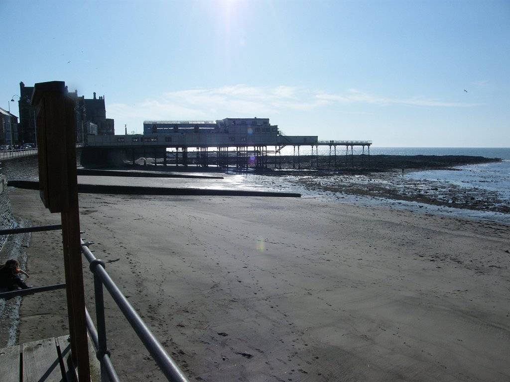
Piers: None.
Kissing gates: Nos.789 to 815 (27 in all). Nos.801 and 813 were so narrow we had to take
our rucksacks off in order to get through!
Pubs: None.
‘Cadw’ properties: None.
Ferris wheels: None.
Diversions: None.
How
we got there and back: We were staying
in our caravan near Aberaeron. This
morning we drove into Aberaeron, parked and walked to the bus stop. We caught a bus to Aberystwyth Bus Station,
then walked down to the river bridge.
At
the end we got as far as the village of Llanon when we had to (’had to’ because there were barbed wire
fences everywhere stopping us from going any other way) walk along a shingle
beach. I couldn’t cope with the loose
stones — it put my back out and from then on my knee started to play up. We went inland — we had no choice. It was late, we were tired, and my back and
knee were merry hell! So when I saw a
bus stop I decided the Walk was over. We
waited 20 minutes for a bus to Aberaeron where we got into our car and returned
to our caravan.
We set
up and started today’s Walk by 7.30am — is that a record? It was certainly lovely to be out at this
early hour on such a beautiful day. Passing
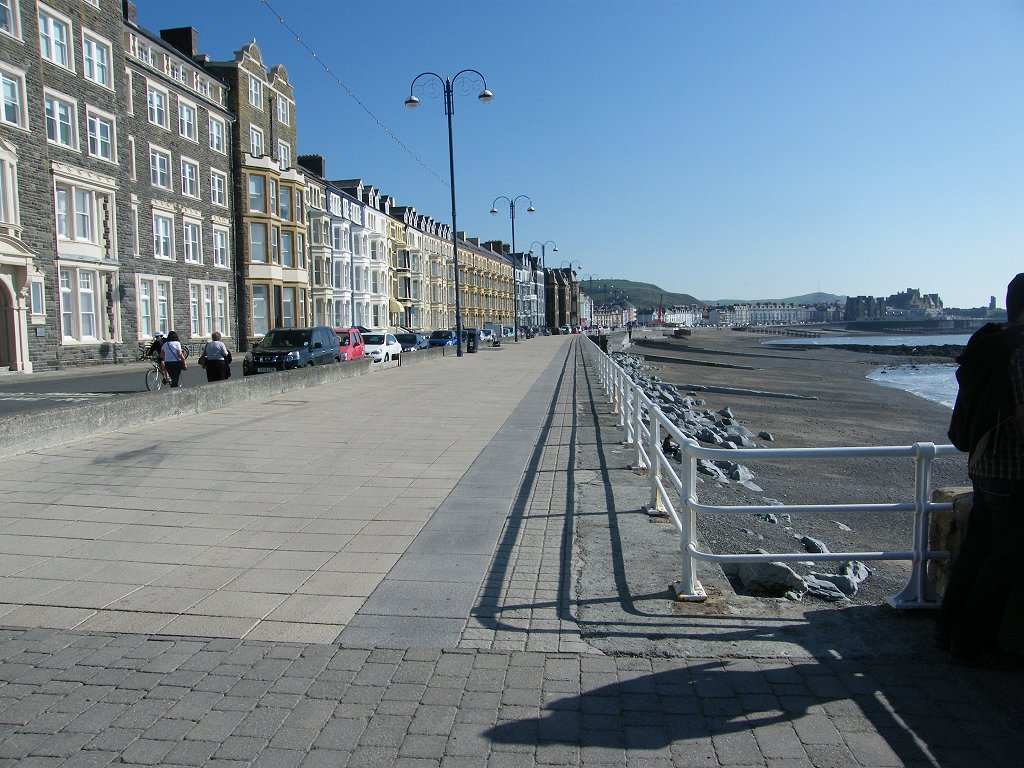
an ornate lamp, we crossed the bridge over the River Rheidol. This seems to be a much more significant
river than the River Ystwyth which comes out into the sea at the same
point. We cannot understand why the town
is called Aberystwyth — surely it should be Aberrheidol?
We made
our way past buildings to the riverside and walked down in front of bijou
riverside residences which overlook the harbour and the marina within it. The bijou residences were new and box-like,
and cynically we wondered if they were tomorrow’s slums.
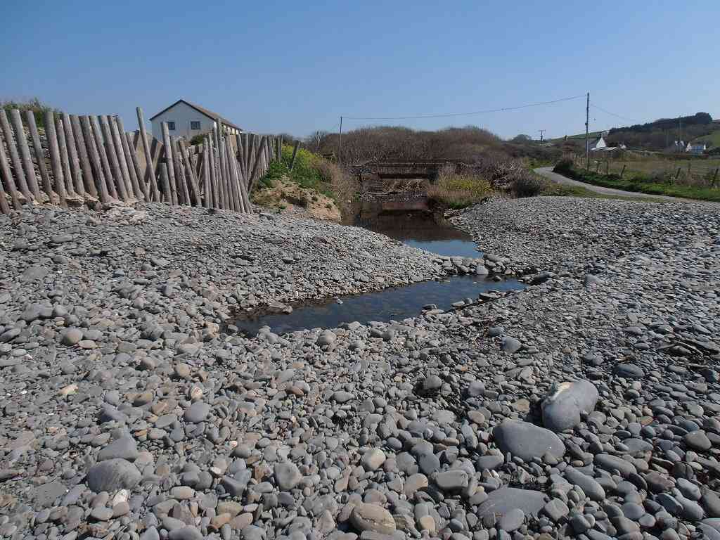
We crossed the River Ystwyth, a mere stream,
which also empties into the harbour. We
noticed there were no railings on the south arm of the harbour, so we decided
not to walk it for safety reasons.The
coast path led south along the back of a shingle bank. The local people had got together to prevent
a development on this site — and they won!
Good on them! The site is now a nature reserve.
At the top of the hill on the east side of
the Ystwyth we could just see a tall column like a factory chimney. A notice told us that this was erected in
1858 as a memorial to the Duke of Wellington.
At the bottom of this notice someone had put a large stone, on it was
written “Litter is pollution, You are the solution”. Colin climbed on to the shingle bank to see if
there was any sand exposed on the beach for us to walk on. There was, so that is what we did.
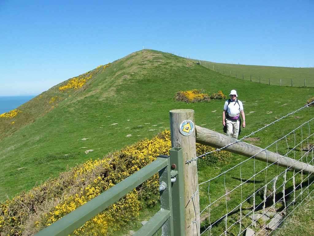
At the
end of the beach we had a big hill to climb — it seemed a long way to the
top. Every time we thought we were just
coming to it, more hill was revealed to us.
We were passed by a girl student who was out for a run. She was very friendly and stopped for a
chat. Then she ran on to the top and
back down — Oh! To be young again!
We did, eventually, reach the top ourselves,
and there we were treated to wonderful views of a blue sky, blue sea, green
hills, interesting geology, yellow gorse and blue violets. We sat on a bank and ate our pasties while we
soaked it all in.
As we
descended we passed the back of a caravan site where a man was strimming the grass,
and it was so noisy! In recent years we’ve spent a lot of time
sitting on caravan sites, and so often our peace has been disturbed by these
loud mowers and strimmers — they ought to
be banned! We exited on to a lane
where, almost opposite, was a gate leading into a field. There we had to climb an almost vertical
hill. My left knee didn’t like it at
all, so I started taking paracetamol and ibuprofen in tandem to ease the
pain. We took a long time getting
up. Two men were following us on the
same path, but they never quite caught us up.
We came
out on to a lane where there were lots of primroses. Round the next corner a track led off to the
right and it was signposted Coast Path.
We seemed to lose the two men there — did they not see the sign and go
the wrong way? We descended slowly,
gently enough not to upset my knee which was twingeing, down a lovely grassy
track for about a mile. This was a
lovely part of the Walk, I really did enjoy it — the views were fantastic and
the walking gentle. The path evened out
to a flat track parallel to the shore, and we still had amazing views on this
lovely sunny day.
We
approached a ruined farm. Just before we
reached it Colin noticed an arrow pointing us up and around behind it. I would have missed it and carried on through
the farm — we wished we had afterwards! We seemed to lose all signage until I noticed
a post lying on the ground. Colin stood
it up, and we worked out we were supposed to go sharply inland up a steep
hill. Oh dear, my poor knee! We
struggled up several contours, then bore right following the footpath
signs. We saw the two men again — they
were down by the derelict farm. They
were dithering about and appeared lost, so Colin waved to them and pointed to
the wooden signpost we were passing.
They either didn’t see us or ignored us, because they carried on in a
straight line.

Then, to our dismay, our
path directed us downhill again to their level!! We couldn’t believe it! And the slope was steep enough to really
upset my knee. We could have stayed on
the level which was a much shorter track, and my knee wouldn’t have been nearly
so painful.

The two
men were ahead of us now despite their hesitation by the derelict farm where
they had made the right decision and we had made the wrong one. The path continued through a gate and down to
the cliff top (all of this was new and
not marked on the OS map). We went
diagonally across the next field — blow
sticking to the footpath, we’d had enough of that! In a field ahead the two men seemed to be
dithering again. Then one went uphill
towards a building, and the other followed.
We heard them talking to some hikers coming the other way. We were a bit lost too, and got out our map —
it was difficult to see where we were because the paths we were on were not
marked on it, and there was no signage within view. Then two ladies appeared from behind bushes,
so we asked them if that was the way — they said it was. Where
was the signage to say we divert up there?
The ladies lived locally, and they agreed that the signage on this part
of the Wales Coastal Path was “fuzzy”. We
told them about our project and gave them blog cards (are you still reading it, ladies?)
They were impressed and said we were “brave” — No! Just mad!
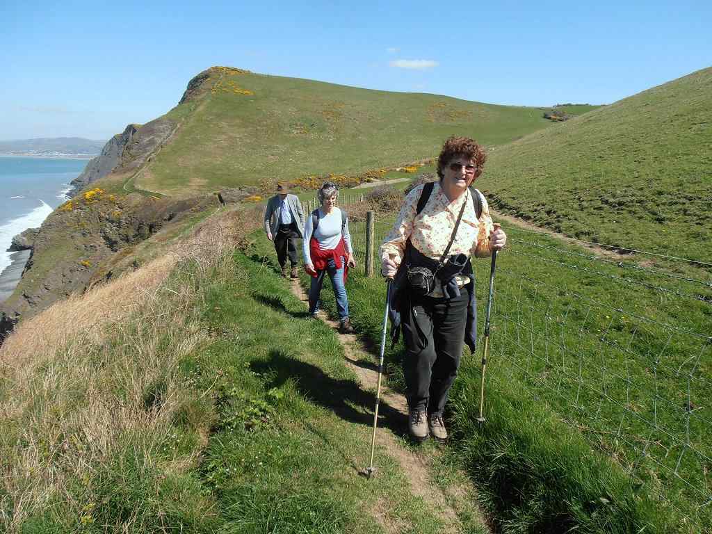
Hidden
behind the bushes was a gate — this led to a track which soon reduced to a
footpath. But at least we were going the right way! It was a bit of a mountain footpath really,
along the side of a hill and not always horizontal. But we had stupendous views! We passed wind-blasted trees and bright
yellow gorse, and were thankful that the weather was calm and sunny — we didn’t
like to think what it would be like on that exposed path if it was wet and
windy.
We
passed interesting rocks and walked up and down steep slopes. We passed a gate leading to a nature reserve,
but that was steeply downhill so we ignored it.
We sat on a bank to eat our sarnies.
The two men were a little ahead of us doing the same, but they soon
moved on and we didn’t see them again. We
caught tantalising glimpses of a caravan site round the hills ahead, it was out
on a spur. But we still had a lot of
ground to cover before we got there.
There seemed to be a lot of uphill, my knees didn’t like it at all.
At last
we were above the caravan site — downhill
all the way now, so we were fooled into thinking! We sat on a wall to eat our apples. Colin saw a bright green lizard, but it had
gone by the time I looked. We continued
down almost to sea level, then had to go a bit uphill in order to get round the
caravan site. I was extremely tired, my
knees were painful especially the left one, the sun was very hot and a man on a
motor mower (Yes! Another one!) nearly drove me mad with
the noise. The path took us round a
field behind the caravan site. We sat on
a bench because it was there. Colin ate
his crisps, but I don’t eat crisps ever since I read in a walking magazine that
their nutritional value is so low they take more energy to consume than they
put back into your body. Junk food! We filled our water bottles at a tap near the
caravan site entrance. We drank a lot of
water because we could replenish it, and immediately felt a lot better.
From
there we had to go up a road, uphill and away from the sea. We were not happy about this — there was a
bridle path going down to the beach, could
we have crossed the river down there where it spreads out and is sometimes
shallower? We could hear the traffic
on the main road getting nearer and nearer, not a sound we had heard since we
left Aberystwyth.
We were almost at the
road when, at last, we could cross the small river. Then we followed a long lane back to the
shore. Halfway along we passed a road
leading off to the right back to the caravan site, so it seemed. Had we been cheated? But we hadn’t — looking at the map later we
saw that it led to a different caravan site on the south side of the river.
The
coast path continued along the beach — shingle! My heart sank! But by now the tide was sufficiently out to
reveal a strip of sand. So we tried that
— it was a little soft but pleasant to walk.
The sand ran out where there was a gate into a field, and the way
continued along the edge of several pastures.
Trouble was, there were stiles instead of gates and I am finding them
increasingly difficult as I get older. (Stop moaning, grumpy old woman!)
We passed a row of old lime kilns, and sat on
a bank in cool shade to eat our chocolate.
There were clumps of primroses everywhere.
We
climbed over a stile and the path turned into a track which took us towards a
church. We didn’t look at the map
properly because we were so hot and tired.
An added difficulty was that we were on the corner of two maps, and we
hadn’t bought the connecting map because it was completely inland, it didn’t show the
coast at all. We crossed a stream and
went straight down to the beach which was shingle again. We couldn’t see a path anywhere, but a woman
in a nearby house told us we were going the right way. The trouble was, the path shown on the OS map
went along the edge of fields at the top of the shore. But that had long since fallen into the sea
and everywhere there were “Private” and “Keep Out” notices. So we retreated to a footpath which went
diagonally across to the beach further down.
We passed an open area with benches and litter bins — their village
green I suppose. It looked a pleasant
spot.
We came
to metal steps which lowered us down to the beach below soft cliffs — shingle
again! It was impossible to walk
on but there was no other way. I found
it particularly difficult because of the state of my knees. (I said
I’d rather walk along a main road, that’s how bad it was!) We came to another set of metal steps and
thankfully climbed them — if only we’d known how near the path up from
the beach was we’d have carried on despite the difficulties, hindsight is a wonderful thing! At the top of the steps we had no choice but
to walk inland for about a mile between two barbed wire fences. (All of
this path was on the inland map which we didn’t have, so we were walking
‘blind’.) We felt very tired and
cross. We came to the main road. Traffic!
No Wales
Coastal Path signs! We felt
abandoned.
We saw
a bus stop, and noted there was a bus to Aberaeron in twenty minutes. Colin wanted to continue, but we didn’t know
if the lane we were turning on to was the right one. There were no signs and we had no map. I said, “No!
I’ve had enough!” We
waited for the bus.
That ended Walk
no.365, we shall pick up Walk no.366 next time on the main road in Llanon. It was half past five, so the Walk had taken
us ten hours. We caught a bus to
Aberaeron where we got into our car and returned to our caravan. We were disappointed that we’d cut short our
planned walk, but perhaps eighteen miles over that sort of terrain was a bit
ambitious. The next day my back went,
and I’m convinced it was triggered by walking along that shingle beach.