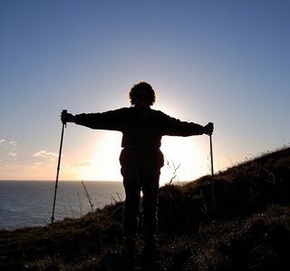
Ages: Colin was 59 years and 44 days. Rosemary was 56 years and 186 days.
Weather: Hot and sunny, but with a little breeze in exposed places.
Location: From Folkestone Warren to Dover Marina.
Distance: 7½ miles.
Total distance: 142 miles.
Terrain: First along a Second World War concrete gun platform between the beach and the cliffs, then we crossed the railway via a footbridge and climbed the chalk cliffs using wooden-barred steps. We walked several miles along the grassy cliff tops before descending to beach level again via a tarmacked path, railway footbridge and concrete steps. The beach was sandy at first but soon turned to leg-shattering loose shingle. After that it was along roads, pavements and a concrete pier.
Tide: In.
Rivers to cross: None.
Ferries: None.
Piers: No.8 at Dover, but it was a concrete one!
Kissing gates: None.
Pubs: ‘The Mogul’ at Dover where we enjoyed Goacher’s Mild and Durham Prior’s Gold (at least, Colin did, I was so thirsty I had a pint of shandy!)
‘English Heritage’ properties: None, though we did try to get to the ‘Western Heights’.
Ferris wheels: None.
Diversions: No.11 up the cliffs and along the top because the tide was in. This meant we missed visiting Samphire Hoe, a new bit of Britain which consists of the rock brought up from digging out the Channel Tunnel!
How we got there and back: We were already camping at Folkestone Warren, so we started our walk directly from the campsite.
At the end, we walked to the bus station in the centre of Dover and caught a bus to eastern Folkestone. We then walked a mile back to the campsite.
 We started our walk fairly early this morning in brilliant sunshine. We could see France quite clearly on the horizon, and could make out Cap-Blanc-Nez and Cap-Gris-Nez.
  On the beach directly below our campsite was a big rectangle of concrete; we can only assume it was a gun platform built to house artillery for our defence during those terrible years of the Second World War when Hitler’s troops were in sight across the narrow strip of water between us and France.
 It was hot walking along the bottom of the cliffs towards Dover, very little breeze down there. We met a smattering of people walking their dogs. We came to another large concrete rectangle where one dogwalker stopped to talk, he didn’t seem very bright especially as he said he thought Butlins in Bognor Regis was a wonderful place! So when he advised us that he thought the tide was too far in for us to get along the bottom of the cliffs to Dover (embellishing his story with tales of helicopter rescues and ‘wouldn’t that be exciting though?’) we really did not know whether to believe him. We thanked him politely and said we would go a little further and take a look. About half a mile further on we were caught up by a man wearing just a pair of underpants(!) who advised us that we were about half an hour too late because the tide was now in far enough to lap the bottom of the cliffs this side of Samphire Hoe. He told us how to get up to the top of the cliff, and he did seem to know what he was talking about. We did wonder whether he just didn’t want us hiking past his nudist beach, but we took his advice and turned back.
 We climbed a track which looked as if it went up the cliffs, but at the top was a locked gate behind which the railway ran into a tunnel. I could see the footbridge further along, so down we went again and retraced our steps to the place where we had met the first chap with the dog—teach us not to listen to the locals! We climbed a very similar track there, and then started climbing steps until we got to the railway, but this time we were at the footbridge over it. On the other side the path divided; it looked as if it went up if we turned left, but Colin looked at the map and declared we must turn right even though it looked as if it went down again that way. At first the path followed the railway, almost to the tunnel, but suddenly we started climbing 393 steps (we didn’t count them, someone at the top told us!) to the very top of the cliff.
It was a hot and thirsty climb, sweat was pouring off us in buckets! Just before we broke cover at the top, I decided I had better go to the loo because the clifftop would be too exposed. We hadn’t met anyone until then, but suddenly a man on his bike appeared and then about a dozen hikers!
 We were feeling a bit dischuffed because we had been walking two hours by then, we were very hot and thirsty, yet we had only progressed one mile and we weren’t even out of Folkestone Warren! Colin was very proud of himself that he didn’t walk across the field to a ‘real ale’ pub which was just there! We continued along a path which came out into a track by a road, the track was the cycleway to Dover and we passed a couple of new sculptures which acted as mileposts on the National Cycle Network. The footpath soon diverted and went along nearer the cliff edge.
We were even allowed to walk through a field of cows, how refreshing not to find our way barred by red notices threatening £5000 fines! The path had obviously become very overgrown in recent months, probably because, like most footpaths in the country, it had been closed for three months due to the ‘foot & mouth’ fiasco. It had been recently mown, but occasionally they had tried to divert it away from the cliff edge because it was becoming dangerous due to erosion. Trouble is, mowing a new path is not enough, it needs ‘walking in’ to smooth out all the bumps. We ignored these ‘diversions, it was easier walking on the old smooth paths and we were never perilously close to the cliff edge.
We made good progress. We passed many derelict concrete constructions which we could only conclude were Second World War defences. This clifftop was the most vulnerable in Britain, and must have been teeming with artillery and all the trappings during those years. One place looked like a derelict barracks and rifle range, another was a huge vertical concrete square with a circular depression in the side facing the sea. We concluded that it once held a radar dish, but we didn’t know. (We later found out it was a ‘sound mirror’, invented after the First World War and a precursor to radar.) We sat on the roof of one of the dozens of ‘pill-boxes’ which are sunk into the clifftop to eat our lunch. From there we had a birds-eye view of Samphire Hoe.
The idea of digging a tunnel under the English Channel was first put forward nearly two hundred years ago. In 1802, a French engineer declared that it was possible to tunnel through the chalk syncline which is the geology of the Channel area. Napoléon was interested, but he was more interested in warmongering so nothing came of it. Again and again, throughout the 19th century, the proposal was put forward by the French, but rebuffed by the British for security reasons. In the 1860s, a Frenchman called Thomé de Gamond and an Englishman called Sir John Hawkshaw, produced practical plans. From these, private companies dedicated to the project were formed on both sides of the Channel. In the 1880s, digging actually started at Sangatte in France and at Folkestone in England. The media of the day, i.e. the newspapers, were dead set against the idea and brought pressure to bear on the Government. Only 2000 yards had been dug on the English side when the whole project was shut down in the interests of national security. The two tunnels were sealed off and became derelict.
It was not until the 1950s, after two World Wars in which the English Channel was of great strategic importance, that the idea was mooted again. By then, it was considered that, in this missile age, worries about security were obsolete. New companies were formed, a Study Group was established, and even the merits of a Channel Bridge were considered. But in 1964 they agreed to build a rail tunnel. The next problem was finance. It took another nine years before a treaty was finalised between the British and French Governments, and they took the decision to proceed. Digging commenced in 1974 at almost the same spots in Folkestone and Sangatte where it had ceased ninety years before. It was estimated that the tunnel would take five to six years to build and cost in the region of a billion pounds.
But they had hopelessly underestimated the whole project. Many people, and I must say I was among them, said that it could never be done, it was too ambitious by far. The estimated completion date was put back and back while the estimated costs rose by millions. In just under a year, when just 1½ miles had been dug out on each side of the Channel, the British Government cancelled the whole project because it said it simply couldn’t afford it any longer. Three years later the idea resurfaced, but again the British Government stipulated that no public money should be put into it. A further three years went by, and suddenly the British and French Governments jointly issued an invitation for privately funded companies to put forward their proposals. Four serious projects were considered, and finally, in 1987, the plan by Eurotunnel (twin rail tunnels for shuttle trains to carry road vehicles with a third service tunnel in between) was ratified. Digging could begin!
It took six years to build. The Tunnel was dug out from each end, and when they met in the middle on the 1st December 1990 they were only a couple of millimetres out! The tunnellers put their arms through the hole and shook hands—the English tunneller claimed he could ‘smell the garlic’! For the first time in twenty thousand years, Britain was joined to France! On the 1st June 1994, the first freight train sped through, and in the following months the high-speed trains were opened up to passengers, cars, lorries and coaches. There was a set-back in 1996 when a lorry caught fire halfway across, filling the train and the Tunnel with smoke. (The people escaped into the service tunnel from where they had to be rescued.) The Tunnel was closed for about six months while damage was repaired and better safety measures implemented. This incident was devastating financially because the Tunnel was losing money hand over fist and, although very popular in the twenty-first century, it has yet to run at a profit. Colin and I have used the Tunnel once, on a day-trip to Calais in 1998. We were very impressed with the speed (25 minutes only underground) and smoothness of the ride, but we never saw the sea and didn’t feel as if we had been abroad at all! We have used the cheaper ferry ever since, at least the view is better!
 An awful lot of chalk was dug out in the building of the Channel Tunnel, and it had to go somewhere. That is what Samphire Hoe is all about, it is an extra bit of England that consists of all the chalk that was extracted from the English end. It was dumped at the bottom of the cliffs between Folkestone and Dover, and the idea is to turn it into a nature reserve. It did look a bit bare from our ‘crow’s-nest’ viewpoint, but several ponds have been created on it and the white chalk was beginning to turn green.
I expect it looks a lot better from down there, but the only way we could get on to it at high tide was by walking through the road tunnel which leads down through the cliffs, and then we would be going back on ourselves. We decided to save it up for a few years when it is more established. We were intrigued by a fenced off area at the eastern end that seemed to have a number of towers with fans in the top. Is it some kind of renewable energy plant?
According to our map, we crossed over the Channel Tunnel at the eastern end of Samphire Hoe. Our path became very ‘undulating’ but was quite spectacular, the land sloping backwards from the cliff edge. The only problem was that we were merging closer and closer to the main road taking the traffic to and from the world’s busiest port—lorries by the hundred, coaches full of elderly holidaymakers and cars - cars - cars - cars - cars! There was the constant drone of traffic which got louder and louder. Eventually we descended a tarmac path until we were right next to this dreadful road.
 We decided to deviate under it and follow the North Downs Way through a housing estate and up to the Western Heights, an ‘English Heritage’ property we planned to visit. But all paths leading up the mound from the estate, including the North Downs Way, were blocked by padlocked gates! We asked a local if he knew why they were padlocked, and he said it was because of the ‘foot & mouth’ restrictions. At this I exploded with anger. This is an ancient monument we were talking about, not a livestock farm. There wasn’t a sign of a grazing animal anywhere, nor had there been for a very long time by the look of the height of the undergrowth. The only case of the disease in Kent had been miles away on the Isle of Sheppey, and that had been five months ago. I asked the man if anyone had complained to the authorities about this little piece of hypocrisy, and he replied that he found it a bit of a nuisance not being able to walk his dog up there anymore, but he wasn’t a protesting kind of person—so they get away with it because of such people’s apathy. (I did complain later that afternoon to the man in the Tourist Information Centre in Dover, but he was very non-committal in his replies.)
We made a new plan—to continue our coastal walk today to the middle of Dover and tomorrow we would come by car to visit all the ‘English Heritage’ properties in the area. So we retraced our steps to the tunnel under the road and continued downhill walking next to it. Not much fun, but then we found a footbridge over the railway which was still on our seaward side (it goes in and out of tunnels all along the cliffs we had walked over) and down a lot of steps to the beach. It was pleasant walking along the sand for a bit, but then it deteriorated into shingle and we were too tired to take it in good temper! There was a high fence behind which there was nothing, it used to be a marshalling yard according to the map. We were relieved to find there was an open gate at the end and we were able to get off the beach just before the high wall of the Western Docks.
The first pier at Western Docks, where the train ferry used to embark and where we once caught a ferry (in 1991, I think) to the ski train, was plastered with notices about fishing permits. We assumed it was the same set-up as Folkestone Pier which we had been asked to leave because we were not fishing, so we didn’t even try this one. We got a bit lost in a lorry park, but eventually realised that we would have to walk over a road bridge leading inland to get to the next pier. It was all very confusing, but we coped!
The second pier was much more user-friendly, and we walked along looking at the old Hoverport which is no longer in use—they use the area as a car park for the Sea-Cat now. In 1998 we booked a weekend in France going out on the Hovercraft. Noisy, smelly things—it may have been quick but neither of us enjoyed the journey. They are unsafe if the sea is at all rough, so we had to come back on a Sea-Cat. I am not easily seasick, but I spent the whole journey lying on the floor! The Hovercraft went out of business sometime last year, and we watched several Sea-Cats come in and out as we walked the length of the pier. They were bouncing up and down even in the harbour, I began to feel queasy just watching them! That is why we now always cross the Channel using the old-fashioned ferry; the ships are quite fast, very comfortable and they are also cheaper. There was a café at the far end of the pier, so we bought a much-needed mug of tea each.
We passed several groups of schoolchildren, both English and French, on our way back and along the marina until we were opposite the Tourist Information Centre. (I was relieved I was not in charge of all the little darlings!) We stopped to look at a sculpture which is a tribute to all the people involved in the rescue of the British Army from the beaches of Dunkirk in 1940.
Weather: Hot and sunny, but with a little breeze in exposed places.
Location: From Folkestone Warren to Dover Marina.
Distance: 7½ miles.
Total distance: 142 miles.
Terrain: First along a Second World War concrete gun platform between the beach and the cliffs, then we crossed the railway via a footbridge and climbed the chalk cliffs using wooden-barred steps. We walked several miles along the grassy cliff tops before descending to beach level again via a tarmacked path, railway footbridge and concrete steps. The beach was sandy at first but soon turned to leg-shattering loose shingle. After that it was along roads, pavements and a concrete pier.
Tide: In.
Rivers to cross: None.
Ferries: None.
Piers: No.8 at Dover, but it was a concrete one!
Kissing gates: None.
Pubs: ‘The Mogul’ at Dover where we enjoyed Goacher’s Mild and Durham Prior’s Gold (at least, Colin did, I was so thirsty I had a pint of shandy!)
‘English Heritage’ properties: None, though we did try to get to the ‘Western Heights’.
Ferris wheels: None.
Diversions: No.11 up the cliffs and along the top because the tide was in. This meant we missed visiting Samphire Hoe, a new bit of Britain which consists of the rock brought up from digging out the Channel Tunnel!
How we got there and back: We were already camping at Folkestone Warren, so we started our walk directly from the campsite.
At the end, we walked to the bus station in the centre of Dover and caught a bus to eastern Folkestone. We then walked a mile back to the campsite.
 We started our walk fairly early this morning in brilliant sunshine. We could see France quite clearly on the horizon, and could make out Cap-Blanc-Nez and Cap-Gris-Nez.
  On the beach directly below our campsite was a big rectangle of concrete; we can only assume it was a gun platform built to house artillery for our defence during those terrible years of the Second World War when Hitler’s troops were in sight across the narrow strip of water between us and France.
 It was hot walking along the bottom of the cliffs towards Dover, very little breeze down there. We met a smattering of people walking their dogs. We came to another large concrete rectangle where one dogwalker stopped to talk, he didn’t seem very bright especially as he said he thought Butlins in Bognor Regis was a wonderful place! So when he advised us that he thought the tide was too far in for us to get along the bottom of the cliffs to Dover (embellishing his story with tales of helicopter rescues and ‘wouldn’t that be exciting though?’) we really did not know whether to believe him. We thanked him politely and said we would go a little further and take a look. About half a mile further on we were caught up by a man wearing just a pair of underpants(!) who advised us that we were about half an hour too late because the tide was now in far enough to lap the bottom of the cliffs this side of Samphire Hoe. He told us how to get up to the top of the cliff, and he did seem to know what he was talking about. We did wonder whether he just didn’t want us hiking past his nudist beach, but we took his advice and turned back.
 We climbed a track which looked as if it went up the cliffs, but at the top was a locked gate behind which the railway ran into a tunnel. I could see the footbridge further along, so down we went again and retraced our steps to the place where we had met the first chap with the dog—teach us not to listen to the locals! We climbed a very similar track there, and then started climbing steps until we got to the railway, but this time we were at the footbridge over it. On the other side the path divided; it looked as if it went up if we turned left, but Colin looked at the map and declared we must turn right even though it looked as if it went down again that way. At first the path followed the railway, almost to the tunnel, but suddenly we started climbing 393 steps (we didn’t count them, someone at the top told us!) to the very top of the cliff.
It was a hot and thirsty climb, sweat was pouring off us in buckets! Just before we broke cover at the top, I decided I had better go to the loo because the clifftop would be too exposed. We hadn’t met anyone until then, but suddenly a man on his bike appeared and then about a dozen hikers!
 We were feeling a bit dischuffed because we had been walking two hours by then, we were very hot and thirsty, yet we had only progressed one mile and we weren’t even out of Folkestone Warren! Colin was very proud of himself that he didn’t walk across the field to a ‘real ale’ pub which was just there! We continued along a path which came out into a track by a road, the track was the cycleway to Dover and we passed a couple of new sculptures which acted as mileposts on the National Cycle Network. The footpath soon diverted and went along nearer the cliff edge.
We were even allowed to walk through a field of cows, how refreshing not to find our way barred by red notices threatening £5000 fines!
 The path had obviously become very overgrown in recent months, probably because, like most footpaths in the country, it had been closed for three months due to the ‘foot & mouth’ fiasco. It had been recently mown, but occasionally they had tried to divert it away from the cliff edge because it was becoming dangerous due to erosion. Trouble is, mowing a new path is not enough, it needs ‘walking in’ to smooth out all the bumps. We ignored these ‘diversions, it was easier walking on the old smooth paths and we were never perilously close to the cliff edge.
We made good progress. We passed many derelict concrete constructions which we could only conclude were Second World War defences. This clifftop was the most vulnerable in Britain, and must have been teeming with artillery and all the trappings during those years. One place looked like a derelict barracks and rifle range, another was a huge vertical concrete square with a circular depression in the side facing the sea. We concluded that it once held a radar dish, but we didn’t know.
 (We later found out it was a ‘sound mirror’, invented after the First World War and a precursor to radar.) We sat on the roof of one of the dozens of ‘pill-boxes’ which are sunk into the clifftop to eat our lunch. From there we had a birds-eye view of Samphire Hoe.
The idea of digging a tunnel under the English Channel was first put forward nearly two hundred years ago. In 1802, a French engineer declared that it was possible to tunnel through the chalk syncline which is the geology of the Channel area. Napoléon was interested, but he was more interested in warmongering so nothing came of it. Again and again, throughout the 19th century, the proposal was put forward by the French, but rebuffed by the British for security reasons. In the 1860s, a Frenchman called Thomé de Gamond and an Englishman called Sir John Hawkshaw, produced practical plans. From these, private companies dedicated to the project were formed on both sides of the Channel. In the 1880s, digging actually started at Sangatte in France and at Folkestone in England. The media of the day, i.e. the newspapers, were dead set against the idea and brought pressure to bear on the Government. Only 2000 yards had been dug on the English side when the whole project was shut down in the interests of national security. The two tunnels were sealed off and became derelict.
It was not until the 1950s, after two World Wars in which the English Channel was of great strategic importance, that the idea was mooted again. By then, it was considered that, in this missile age, worries about security were obsolete. New companies were formed, a Study Group was established, and even the merits of a Channel Bridge were considered. But in 1964 they agreed to build a rail tunnel. The next problem was finance. It took another nine years before a treaty was finalised between the British and French Governments, and they took the decision to proceed. Digging commenced in 1974 at almost the same spots in Folkestone and Sangatte where it had ceased ninety years before. It was estimated that the tunnel would take five to six years to build and cost in the region of a billion pounds.
But they had hopelessly underestimated the whole project. Many people, and I must say I was among them, said that it could never be done, it was too ambitious by far. The estimated completion date was put back and back while the estimated costs rose by millions. In just under a year, when just 1½ miles had been dug out on each side of the Channel, the British Government cancelled the whole project because it said it simply couldn’t afford it any longer. Three years later the idea resurfaced, but again the British Government stipulated that no public money should be put into it. A further three years went by, and suddenly the British and French Governments jointly issued an invitation for privately funded companies to put forward their proposals. Four serious projects were considered, and finally, in 1987, the plan by Eurotunnel (twin rail tunnels for shuttle trains to carry road vehicles with a third service tunnel in between) was ratified. Digging could begin!
It took six years to build. The Tunnel was dug out from each end, and when they met in the middle on the 1st December 1990 they were only a couple of millimetres out! The tunnellers put their arms through the hole and shook hands—the English tunneller claimed he could ‘smell the garlic’! For the first time in twenty thousand years, Britain was joined to France! On the 1st June 1994, the first freight train sped through, and in the following months the high-speed trains were opened up to passengers, cars, lorries and coaches. There was a set-back in 1996 when a lorry caught fire halfway across, filling the train and the Tunnel with smoke. (The people escaped into the service tunnel from where they had to be rescued.) The Tunnel was closed for about six months while damage was repaired and better safety measures implemented. This incident was devastating financially because the Tunnel was losing money hand over fist and, although very popular in the twenty-first century, it has yet to run at a profit. Colin and I have used the Tunnel once, on a day-trip to Calais in 1998. We were very impressed with the speed (25 minutes only underground) and smoothness of the ride, but we never saw the sea and didn’t feel as if we had been abroad at all! We have used the cheaper ferry ever since, at least the view is better!
 An awful lot of chalk was dug out in the building of the Channel Tunnel, and it had to go somewhere. That is what Samphire Hoe is all about, it is an extra bit of England that consists of all the chalk that was extracted from the English end. It was dumped at the bottom of the cliffs between Folkestone and Dover, and the idea is to turn it into a nature reserve. It did look a bit bare from our ‘crow’s-nest’ viewpoint, but several ponds have been created on it and the white chalk was beginning to turn green.
I expect it looks a lot better from down there,
 but the only way we could get on to it at high tide was by walking through the road tunnel which leads down through the cliffs, and then we would be going back on ourselves. We decided to save it up for a few years when it is more established. We were intrigued by a fenced off area at the eastern end that seemed to have a number of towers with fans in the top. Is it some kind of renewable energy plant?
According to our map, we crossed over the Channel Tunnel at the eastern end of Samphire Hoe.
 Our path became very ‘undulating’ but was quite spectacular, the land sloping backwards from the cliff edge. The only problem was that we were merging closer and closer to the main road taking the traffic to and from the world’s busiest port—lorries by the hundred, coaches full of elderly holidaymakers and cars - cars - cars - cars - cars! There was the constant drone of traffic which got louder and louder. Eventually we descended a tarmac path until we were right next to this dreadful road.
 We decided to deviate under it and follow the North Downs Way through a housing estate and up to the Western Heights, an ‘English Heritage’ property we planned to visit. But all paths leading up the mound from the estate, including the North Downs Way, were blocked by padlocked gates! We asked a local if he knew why they were padlocked, and he said it was because of the ‘foot & mouth’ restrictions. At this I exploded with anger. This is an ancient monument we were talking about, not a livestock farm. There wasn’t a sign of a grazing animal anywhere, nor had there been for a very long time by the look of the height of the undergrowth. The only case of the disease in Kent had been miles away on the Isle of Sheppey, and that had been five months ago. I asked the man if anyone had complained to the authorities about this little piece of hypocrisy, and he replied that he found it a bit of a nuisance not being able to walk his dog up there anymore, but he wasn’t a protesting kind of person—so they get away with it because of such people’s apathy. (I did complain later that afternoon to the man in the Tourist Information Centre in Dover, but he was very non-committal in his replies.)
We made a new plan—to continue our coastal walk today to the middle of Dover and tomorrow we would come by car to visit all the ‘English Heritage’ properties in the area. So we retraced our steps to the tunnel under the road and continued downhill walking next to it. Not much fun, but then we found a footbridge over the railway which was still on our seaward side (it goes in and out of tunnels all along the cliffs we had walked over) and down a lot of steps to the beach. It was pleasant walking along the sand for a bit, but then it deteriorated into shingle and we were too tired to take it in good temper! There was a high fence behind which there was nothing, it used to be a marshalling yard according to the map. We were relieved to find there was an open gate at the end and we were able to get off the beach just before the high wall of the Western Docks.
The first pier at Western Docks, where the train ferry used to embark and where we once caught a ferry (in 1991, I think) to the ski train, was plastered with notices about fishing permits. We assumed it was the same set-up as Folkestone Pier which we had been asked to leave because we were not fishing, so we didn’t even try this one. We got a bit lost in a lorry park, but eventually realised that we would have to walk over a road bridge leading inland to get to the next pier. It was all very confusing, but we coped!
The second pier was much more user-friendly, and we walked along looking at the old Hoverport which is no longer in use—they use the area as a car park for the Sea-Cat now. In 1998 we booked a weekend in France going out on the Hovercraft. Noisy, smelly things—it may have been quick but neither of us enjoyed the journey. They are unsafe if the sea is at all rough, so we had to come back on a Sea-Cat. I am not easily seasick, but I spent the whole journey lying on the floor!
 The Hovercraft went out of business sometime last year, and we watched several Sea-Cats come in and out as we walked the length of the pier. They were bouncing up and down even in the harbour, I began to feel queasy just watching them! That is why we now always cross the Channel using the old-fashioned ferry; the ships are quite fast, very comfortable and they are also cheaper. There was a café at the far end of the pier, so we bought a much-needed mug of tea each.
We passed several groups of schoolchildren, both English and French, on our way back and along the marina until we were opposite the Tourist Information Centre. (I was relieved I was not in charge of all the little darlings!) We stopped to look at a sculpture which is a tribute to all the people involved in the rescue of the British Army from the beaches of Dunkirk in 1940.

That ended Walk No.22, we shall visit all the ‘English Heritage sites in Dover for Walk No.23 and pick up Walk No.24 next time at the Dunkirk memorial on Dover Marina. We called at the Tourist Information Centre for directions to the ‘real ale’ pub Colin had picked out of the Guide (and to complain about the padlocked gates on the North Downs Way!) Having refreshed ourselves at the ‘Mogul’, we caught a bus back to Folkestone and returned to our campsite.