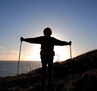
Ages: Colin was 59 years and 106 days. Rosemary was 56 years and 248 days.
Weather: Hot sun, but with a welcome refreshing breeze from the sea. Very clear, but gradually turning hazy.
Location: The Royal St George’s Golf Links to Sandwich Quay via the Stour Valley Walk to Shell Ness and back.
Distance: 6½ miles.
Total distance: 163 miles.
Terrain: A gravel track which deteriorated to sand dunes and finally a boggy marsh! So we retraced our steps to get round a barbed wire fence and tried the top of the beach instead which was soft sand and grass. Returning the same way, we cut across a golf course, then a dusty and very boring farm track and finally a tarmacked path along the river bank.
Tide: In.
Rivers to cross: None—the reason we had to retrace our steps was that there was no way across!
Ferries: None—if there had been it would have saved us miles!
Piers: None.
Kissing gates: Nos.25 & 26 as we entered and left the Nature Reserve at Shell Ness.
Pubs: ‘The George & Dragon’ in Sandwich where we drank two Shepherd Neame beers, ‘Goldings’ and ‘Master Brew’, both of which were bland.
‘English Heritage’ properties: None.
Ferris wheels: None.
Diversions: No.13 near Shell Ness where the path got too boggy to walk. We retraced our steps to get round a barbed wire fence and walked along the beach instead.
How we got there and back: We camped the night before in Sandwich. We walked through the town and across the golf links to the spot on the beach where we had finished the last walk.
At the end, we were in Sandwich, so we looked around some more of this very interesting little town and walked back to the campsite.
Using the same public footpath we had used at the end of our last walk, we strode back across the golf course from Sandwich to get to the coast. We were surprised to find that the public toilet block we had used just four weeks ago was derelict! Both doors were firmly nailed up, and the protective wall in front of the ‘ladies’ entrance had been partially demolished. We supposed that the ‘powers that be’ considered this block to be redundant since there was another more modern block about two hundred yards to the north.
Neither of us were ‘desperate’, so we sat on the shingle beach to eat our lunch. It was a very hot day, and lots of families were piling out of their cars with all the paraphernalia (like folding chairs and windbreaks and cool boxes and rubber boats and picnic hampers and lilos) which the majority of the population thinks is essential for their enjoyment of the seaside. We were more interested in any wildlife we could see, but there wasn’t much. We spied the occasional butterfly, but they were too elusive to photograph, as ever.
 Where the road turned away from the shore, there was a large crane lorry parked up with two burnt-out cars on the back. There was a black patch on the shingle where one of them had obviously been set alight. Abandoned cars have become a big problem in our countryside in recent years, they are everywhere! Many of them are stolen vehicles, driven around late at night by so-called ‘joy-riders’, then abandoned in remote places. Others are ‘old-bangers’ which finally conk out, so the owner takes it miles from home, strips it of all identification and sets it on fire to make really sure he (or she) can’t be traced. Often it is weeks or months before the shell is removed, and its our taxes that have to pay for this service!
 We were using a public footpath marked on the map which leads up to Shell Ness Point—it is prettily named ‘The Stour Valley Walk’—but the path we were on gradually deteriorated the further north we went, and the people thinned out too. It became quite ‘undulating’ underfoot, and we paused to chat to a couple because one had stopped to remove some gravel from her shoe. Later we began to notice that the only people we were meeting were overweight and middle-aged men–and sure enough, we had strayed on to another nudist beach! They were quite blatant about it, posing there in the altogether. All those rolls of fat—it quite put us off our picnic sarnies!!

 Colin was walking along with a long lens on his camera, peering round sand dunes looking for that elusive butterfly! His behaviour could have been misinterpreted…
We had seen surprisingly little wildlife, but then Colin picked up something from the middle of the path which he first thought was a large seed. Then we thought it might be a chrysalis, but it looked absolutely dead. So he started peeling off the outer layer to see what it really was, and to our surprise there was a moth inside which started to move!
We didn’t think its wings had formed properly because they were quite small, but we knew it needed to be somewhere in the shade to dry out if it was to have any chance of life. There was a concrete bin just inside the Nature Reserve, so Colin hung it inside there out of the sun.
We entered the National Trust Nature Reserve, and there we were really on our own—no nature-lovers, no nudists, nothing. Trouble was, there wasn’t any wildlife either! We saw a few birds in the far distance and managed to pick out some egrets and terns, a couple of herons and a kestrel; but where we were—nowt! A large area between us and the beach was fenced off with barbed wire, and our path was getting wetter and boggier by the minute. Colin was wearing trekking sandals, and refused to go on any further because his socks were getting damp! We knew we would have to return by the same route because there is no way across the river north of Sandwich, so we retraced our steps to the Nature Reserve entrance.
I said I wanted to try and get to the river mouth along the beach, and Colin grudgingly agreed. The sand was a little soft, but it wasn’t difficult to walk on. Here we saw a multitude of ringed plovers and back-backed gulls, but nothing extraordinary and it was all a bit of a disappointment. There was so much rubbish washed up along high water mark, it was unbelievable. The majority of the items were made of imperishable plastic, and I expect most of it was thrown off ships. I wish people who sail these vessels would realise that the sea is not a universal dustbin! That beach was disgusting! Near the mouth of the river, we found a wooden pallet, so we sat on it and ate the second half of our picnic. Then we returned, rather disconsolately, to the entrance of the Nature Reserve again where Colin looked up his moth. It was still alive, and its wings seemed to have enlarged a little, so it may have survived.
We were rather puzzled by a big notice there. This area abounds with golf courses, we had passed yet another one as we were walking along the dunes trying not to look at big men’s little willies earlier in the afternoon! This notice was facing the only entrance/exit to the Nature Reserve, and told us that the land we were about to walk over (our only route back to civilisation) belonged to the golf club and that we were forbidden to enter it without permission, but RSBP members could if they showed their pass!
  Who to? Even the nudists had gone home by then! So we ignored it, and walked along the smoother grass behind the dunes for about a mile, then we passed the same notice facing the other way. No one asked to see our pass (which we haven’t got) and no one accused us of trespassing, simply because there was no one there. We didn’t cause any damage, leave any litter nor even any footprints—so no one even knew of our passing through this ‘forbidden’ strip of grassland, and does anybody really care? There are far too many of these PRIVATE notices around our coastline.
We cut across the ‘Prince’s Golf Links’ as the quickest way to get back to Sandwich where we could cross the River Stour. The path seemed to twist and turn about, and bore no relationship to the map! Several times we stopped to check our bearings because we got disorientated. I think, in hindsight, that the golf club had moved the path to suit their layout—and, despite it being a public footpath, a golf ball landed very near us at one point. Then it turned into a lane going past a farm where they were trying to switch on an automatic watering system for their lettuces—it only partly worked. This part of the walk was deadly!
 Eventually we came to the river bank, and walked along a tarmacked path all the way into Sandwich. Even this didn’t seem to give us many river views—too many reeds. I think we were disillusioned about today’s walk because we ended up exactly where we had started in the morning. We didn’t make any progress along the coast because of the impossibility of crossing the river anywhere near its mouth—also, it was a very hot day and the Nature Reserve had been disappointing.
 Sandwich is a very interesting town full of beautiful old buildings which look as if they are about to fall down! About a thousand years ago, when the Isle of Thanet really was an island, it was a flourishing port called Sandwich Haven providing shelter for ships sailing between London and the Continent. It formed an alliance with Dover, Hythe, Romney and Hastings (all of which we have passed through already on this trek), and they became known as the Cinque Ports (pronounced ‘sink’). Rye, Winchelsea, and possibly some others tried to join in at a later date.
  The Cinque Ports became very powerful, second only to the Crown and the Church. They traded in other ports without paying taxes or tolls, they held their own courts, they dealt with their own affairs—in fact they did what they liked and blow everyone else! But their power declined when, like so many other places we have passed through on our route, the port began to silt up. In fact, our whole walk today was on reclaimed land—all those posh golf courses were under the sea until fairly recently! Henry VIII suggested the citizens of Sandwich sell the treasures of the town’s three churches to pay for the dredging, but he did nothing else to help. Elizabeth I was sympathetic too. She was made ‘very merrye’ by the hospitality offered to her by the town when she came to look at the problem for herself, but she didn’t do anything about it either! (I wonder if she enjoyed a game of golf while she was living it up!) So the silt grew, and now Sandwich is some two miles from the sea. The River Stour meanders across this new land with such contorted bends, it almost touches itself in one place.
 We ended our walk by the bridge. Tolls to cross the river have been collected here at Sandwich Quay from the time of King Canute until 1977, when the very last toll was paid by the Mayor. Sandwich now has a bypass, thank goodness, so its ancient and beautiful buildings are protected a little from the constant roar of modern traffic.
  There was the usual list of tolls under the archway of the barbican—built by Henry VIII as part of his coastal defences—but we were more interested in another plaque which commemorated the fact that Sandwich welcomed 5000 refugees from Nazi persecution who had fled across the Channel in 1939/1940. Sixty years later, Sandwich and the whole of East Kent—in fact the whole of Britain—are fed up to the back teeth with the hundreds of thousands of illegal immigrants who are risking life and limb to get across the Channel because we are a ‘soft touch’. We are far from welcoming, because the majority are economic migrants, not fleeing persecution at all, and many of them are criminals.
  They all have their ‘sob’ stories, well rehearsed and convincing, and they all know exactly how to use and abuse the system so they don’t get chucked out if they do manage to land on our soil. One of them was at our campsite the following morning, asking if he could live in a holiday caravan while he looked for work. How times change!
That ended Walk no.27, we shall pick up Walk no.28 next time at the bridge across the river in Sandwich. We walked back through the town to our campsite along the old town walls which were built to rebuff the French in the 14th century. It was a very pleasant route, and we stopped to admire a new and imaginative skateboard ramp where youths were having a wonderful time showing off their skills. A passing lady walking her dog overheard us, and stopped to explain that it had only been open a couple of weeks. Already it had been vandalised, and there were increasing complaints about the play-park’s use late at night by drunken young people and drug taking. There is no local police presence outside of the nine-to-five weekday slot, and if a crime is committed, the perpetrators have long since fled by the time the officers arrive from afar. What sad times we live in!
Weather: Hot sun, but with a welcome refreshing breeze from the sea. Very clear, but gradually turning hazy.

Location: The Royal St George’s Golf Links to Sandwich Quay via the Stour Valley Walk to Shell Ness and back.
Distance: 6½ miles.
Total distance: 163 miles.
Terrain: A gravel track which deteriorated to sand dunes and finally a boggy marsh! So we retraced our steps to get round a barbed wire fence and tried the top of the beach instead which was soft sand and grass. Returning the same way, we cut across a golf course, then a dusty and very boring farm track and finally a tarmacked path along the river bank.
Tide: In.
Rivers to cross: None—the reason we had to retrace our steps was that there was no way across!
Ferries: None—if there had been it would have saved us miles!
Piers: None.
Kissing gates: Nos.25 & 26 as we entered and left the Nature Reserve at Shell Ness.
Pubs: ‘The George & Dragon’ in Sandwich where we drank two Shepherd Neame beers, ‘Goldings’ and ‘Master Brew’, both of which were bland.
‘English Heritage’ properties: None.
Ferris wheels: None.
Diversions: No.13 near Shell Ness where the path got too boggy to walk. We retraced our steps to get round a barbed wire fence and walked along the beach instead.
How we got there and back: We camped the night before in Sandwich. We walked through the town and across the golf links to the spot on the beach where we had finished the last walk.
At the end, we were in Sandwich, so we looked around some more of this very interesting little town and walked back to the campsite.
Using the same public footpath we had used at the end of our last walk, we strode back across the golf course from Sandwich to get to the coast. We were surprised to find that the public toilet block we had used just four weeks ago was derelict! Both doors were firmly nailed up, and the protective wall in front of the ‘ladies’ entrance had been partially demolished. We supposed that the ‘powers that be’ considered this block to be redundant since there was another more modern block about two hundred yards to the north.
Neither of us were ‘desperate’, so we sat on the shingle beach to eat our lunch. It was a very hot day, and lots of families were piling out of their cars with all the paraphernalia (like folding chairs and windbreaks and cool boxes and rubber boats and picnic hampers and lilos) which the majority of the population thinks is essential for their enjoyment of the seaside. We were more interested in any wildlife we could see, but there wasn’t much. We spied the occasional butterfly, but they were too elusive to photograph, as ever.
 Where the road turned away from the shore, there was a large crane lorry parked up with two burnt-out cars on the back. There was a black patch on the shingle where one of them had obviously been set alight. Abandoned cars have become a big problem in our countryside in recent years, they are everywhere! Many of them are stolen vehicles, driven around late at night by so-called ‘joy-riders’, then abandoned in remote places. Others are ‘old-bangers’ which finally conk out, so the owner takes it miles from home, strips it of all identification and sets it on fire to make really sure he (or she) can’t be traced. Often it is weeks or months before the shell is removed, and its our taxes that have to pay for this service!
 We were using a public footpath marked on the map which leads up to Shell Ness Point—it is prettily named ‘The Stour Valley Walk’—but the path we were on gradually deteriorated the further north we went, and the people thinned out too. It became quite ‘undulating’ underfoot, and we paused to chat to a couple because one had stopped to remove some gravel from her shoe. Later we began to notice that the only people we were meeting were overweight and middle-aged men–and sure enough, we had strayed on to another nudist beach! They were quite blatant about it, posing there in the altogether. All those rolls of fat—it quite put us off our picnic sarnies!!
 Colin was walking along with a long lens on his camera, peering round sand dunes looking for that elusive butterfly! His behaviour could have been misinterpreted…
We had seen surprisingly little wildlife, but then Colin picked up something from the middle of the path which he first thought was a large seed. Then we thought it might be a chrysalis, but it looked absolutely dead. So he started peeling off the outer layer to see what it really was, and to our surprise there was a moth inside which started to move!

We didn’t think its wings had formed properly because they were quite small, but we knew it needed to be somewhere in the shade to dry out if it was to have any chance of life. There was a concrete bin just inside the Nature Reserve, so Colin hung it inside there out of the sun.
We entered the National Trust Nature Reserve, and there we were really on our own—no nature-lovers, no nudists, nothing. Trouble was, there wasn’t any wildlife either! We saw a few birds in the far distance and managed to pick out some egrets and terns, a couple of herons and a kestrel; but where we were—nowt! A large area between us and the beach was fenced off with barbed wire, and our path was getting wetter and boggier by the minute. Colin was wearing trekking sandals, and refused to go on any further because his socks were getting damp! We knew we would have to return by the same route because there is no way across the river north of Sandwich, so we retraced our steps to the Nature Reserve entrance.

I said I wanted to try and get to the river mouth along the beach, and Colin grudgingly agreed. The sand was a little soft, but it wasn’t difficult to walk on. Here we saw a multitude of ringed plovers and back-backed gulls, but nothing extraordinary and it was all a bit of a disappointment. There was so much rubbish washed up along high water mark, it was unbelievable. The majority of the items were made of imperishable plastic, and I expect most of it was thrown off ships.
 I wish people who sail these vessels would realise that the sea is not a universal dustbin! That beach was disgusting! Near the mouth of the river, we found a wooden pallet, so we sat on it and ate the second half of our picnic. Then we returned, rather disconsolately, to the entrance of the Nature Reserve again where Colin looked up his moth. It was still alive, and its wings seemed to have enlarged a little, so it may have survived.
We were rather puzzled by a big notice there.
 This area abounds with golf courses, we had passed yet another one as we were walking along the dunes trying not to look at big men’s little willies earlier in the afternoon! This notice was facing the only entrance/exit to the Nature Reserve, and told us that the land we were about to walk over (our only route back to civilisation) belonged to the golf club and that we were forbidden to enter it without permission, but RSBP members could if they showed their pass!
  Who to? Even the nudists had gone home by then! So we ignored it, and walked along the smoother grass behind the dunes for about a mile, then we passed the same notice facing the other way. No one asked to see our pass (which we haven’t got) and no one accused us of trespassing, simply because there was no one there. We didn’t cause any damage, leave any litter nor even any footprints—so no one even knew of our passing through this ‘forbidden’ strip of grassland, and does anybody really care? There are far too many of these PRIVATE notices around our coastline.
We cut across the ‘Prince’s Golf Links’ as the quickest way to get back to Sandwich where we could cross the River Stour. The path seemed to twist and turn about, and bore no relationship to the map! Several times we stopped to check our bearings because we got disorientated. I think, in hindsight, that the golf club had moved the path to suit their layout—and, despite it being a public footpath, a golf ball landed very near us at one point. Then it turned into a lane going past a farm where they were trying to switch on an automatic watering system for their lettuces—it only partly worked. This part of the walk was deadly!
 Eventually we came to the river bank, and walked along a tarmacked path all the way into Sandwich. Even this didn’t seem to give us many river views—too many reeds. I think we were disillusioned about today’s walk because we ended up exactly where we had started in the morning. We didn’t make any progress along the coast because of the impossibility of crossing the river anywhere near its mouth—also, it was a very hot day and the Nature Reserve had been disappointing.
 Sandwich is a very interesting town full of beautiful old buildings which look as if they are about to fall down! About a thousand years ago, when the Isle of Thanet really was an island, it was a flourishing port called Sandwich Haven providing shelter for ships sailing between London and the Continent. It formed an alliance with Dover, Hythe, Romney and Hastings (all of which we have passed through already on this trek), and they became known as the Cinque Ports (pronounced ‘sink’). Rye, Winchelsea, and possibly some others tried to join in at a later date.
  The Cinque Ports became very powerful, second only to the Crown and the Church. They traded in other ports without paying taxes or tolls, they held their own courts, they dealt with their own affairs—in fact they did what they liked and blow everyone else! But their power declined when, like so many other places we have passed through on our route, the port began to silt up. In fact, our whole walk today was on reclaimed land—all those posh golf courses were under the sea until fairly recently! Henry VIII suggested the citizens of Sandwich sell the treasures of the town’s three churches to pay for the dredging, but he did nothing else to help. Elizabeth I was sympathetic too. She was made ‘very merrye’ by the hospitality offered to her by the town when she came to look at the problem for herself, but she didn’t do anything about it either! (I wonder if she enjoyed a game of golf while she was living it up!) So the silt grew, and now Sandwich is some two miles from the sea. The River Stour meanders across this new land with such contorted bends, it almost touches itself in one place.
 We ended our walk by the bridge. Tolls to cross the river have been collected here at Sandwich Quay from the time of King Canute until 1977, when the very last toll was paid by the Mayor. Sandwich now has a bypass, thank goodness, so its ancient and beautiful buildings are protected a little from the constant roar of modern traffic.
  There was the usual list of tolls under the archway of the barbican—built by Henry VIII as part of his coastal defences—but we were more interested in another plaque which commemorated the fact that Sandwich welcomed 5000 refugees from Nazi persecution who had fled across the Channel in 1939/1940. Sixty years later, Sandwich and the whole of East Kent—in fact the whole of Britain—are fed up to the back teeth with the hundreds of thousands of illegal immigrants who are risking life and limb to get across the Channel because we are a ‘soft touch’. We are far from welcoming, because the majority are economic migrants, not fleeing persecution at all, and many of them are criminals.
  They all have their ‘sob’ stories, well rehearsed and convincing, and they all know exactly how to use and abuse the system so they don’t get chucked out if they do manage to land on our soil. One of them was at our campsite the following morning, asking if he could live in a holiday caravan while he looked for work. How times change!
That ended Walk no.27, we shall pick up Walk no.28 next time at the bridge across the river in Sandwich. We walked back through the town to our campsite along the old town walls which were built to rebuff the French in the 14th century. It was a very pleasant route, and we stopped to admire a new and imaginative skateboard ramp where youths were having a wonderful time showing off their skills. A passing lady walking her dog overheard us, and stopped to explain that it had only been open a couple of weeks. Already it had been vandalised, and there were increasing complaints about the play-park’s use late at night by drunken young people and drug taking. There is no local police presence outside of the nine-to-five weekday slot, and if a crime is committed, the perpetrators have long since fled by the time the officers arrive from afar. What sad times we live in!