Ages: Colin was 66 years and 129 days. Rosemary was 63 years and 272 days.
Weather: Light clouds but only one short shower of rain. Warm.
Location: Ardersier to Kessock Bridge (Inverness).
Distance: 12½ miles.
Total distance: 1692½ miles.
Terrain: A couple of fields, tracks, a couple of barbed wire fences, and far too much road!
Tide: Coming in, then going out.
Rivers: No.140, the Moray Firth at the impressive Kessock Bridge.
Ferries: None.
Piers: None.
Kissing gates: Nos.158 & 159 as we crossed a railway to get off the busy A road we had been walking along.
Pubs: None.
‘Historic Scotland’ properties: None.
Ferris wheels: None.
Diversions: None.
How we got there and back: We were staying in a holiday cottage in the countryside about three miles from Dingwall. We had taken two days to drive up from Malvern, stopping overnight at a B&B near Lockerbie. This morning we got up very early and drove to Kessock Bridge where we parked at the northern end, having found our way round to a space behind the Armco barrier. We then walked over the Bridge, two miles into the centre of Inverness. At the bus station we waited at the correct bus stop at the correct time for the bus to Ardersier. No bus! After half an hour we went into the office to complain. The young man seemed particularly disinterested, tried to ring ‘Stagecoach’ but got cut off because they were "too busy" to talk, and couldn’t make any other suggestions. So we returned to the bus stop for the bus an hour later, and this one turned up. The driver had ‘no idea’ why the earlier bus failed to arrive. We alighted in Ardersier and walked to where we had parked the car at the end of the last Walk.
At the end, we finished at the car. We had our tea and tasty caramel squares, and then returned to our cottage near Dingwall.
We were not very happy about the missing bus. To be let down by ‘Stagecoach’ bus company yet again! All our efforts to get to the right bus stop early in the morning of the first day because we had a long Walk ahead of us and a long two weeks of walking planned out with military precision – we could just see the whole thing going down the pan! A young German chap was waiting for the first bus. He was not impressed at all. He had planned to spend the day at Fort George, and eventually wandered off to catch another bus to somewhere else. When we returned to the bus stop, an Italian couple with luggage were waiting for the second bus. The Ardersier bus goes via Inverness Airport and they were due to catch a plane. They were quite upset when we told them the previous bus hadn’t turned up, and very relieved, as we were, when the second bus came round the corner. What’s the good of encouraging people to leave their cars at home and use public transport when it is so unreliable?

However, an hour later than planned, we started the Walk. I waited by the public conveniences in Ardersier (which were open!) while Colin marched back about a hundred yards to where we had parked the car for the last Walk. This was because I had done that hundred yards last time and Colin hadn’t! When he caught me up, we sat on a bench overlooking the Moray Firth and ate our pasties.

A little further on we passed a house, and I noticed it was called Fag End. Also, it had another sign over the front door saying, “Woodbine”! We stopped to have a look and an overweight woman, with pink hair and wearing so much make-up she looked as if she was about to go on the stage, came out and crossed the road to us. She was very jolly, and cheerfully told us that the house originally belonged to a woman who had about fifteen children. It is a modest-sized house, so she was a bit like the old woman who lived in a shoe! Presumably she also smoked, hence the names on the house. As we left, this larger-than-life lady wished us well and hoped we would enjoy our Walk.
We didn’t! The beach was far too stony and uneven to walk on, so we had to trudge for miles along a straight and busy B-road with no footpath. We were forever leaping into the bank at the side to save our lives. Most cars were going too fast, very few slowed down as they passed us.
Some moved across the road to give us a little room, but many didn’t. One car even honked at me! No wonder there were flowers hung on the fence at one point, though they had been there a long time and it was mostly cellophane left looking very tattered and ugly.
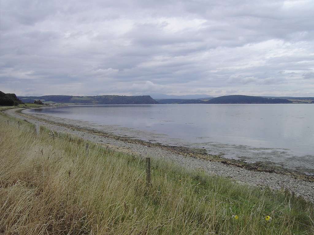
After a couple of miles, the road diverged from the shore so we weren’t even walking by the water, and the view was hidden behind hedges. We were not enjoying it at all.
On the other side of the road we could see a few aeroplanes at Inverness Airport, and occasionally one took off or landed. Further on we could see a chimney belting out steam. We had seen it from Kessock Bridge this morning when we were walking into Inverness.
It looked as if it was in the middle of a field, and we never did find out what it was. We tried to be positive by admiring some harebells on the wayside, and a cabbage white butterfly. But walking along roads is not really our ‘thing’. It is tedious and dangerous.
We passed Castle Stuart, which is a 17th century ruin restored recently by a couple who have turned it into a spooky sort of country house hotel. Shortly after that we turned on to a track leading to Lonnie Farm. We were chancing our arm a bit because there is no path marked on the map leading along the shore from this farm, but we dreaded the thought of having to walk alongside an A-road which was our only alternative. Besides, we didn’t want to miss out Alturlie Point. It was so quiet now we were away from traffic, we couldn’t believe the difference after that busy B-road! And we didn’t have to leap into the bank every few minutes. We passed the farmhouse where dogs were barking, then crossed a cut grass field to the top of the beach which was still too stony to walk. So we stayed in the fields.
The sea looked more like a lake here as a bay curved away in front of Castle Stuart. We could still see that smoky chimney (well, it looked like smoke though it was probably steam) but that was way behind us by now. Black Isle was not far away, for we were at the top end of the estuary.
We climbed (with difficulty on my part) a barbed wire fence and a wall to get into a stubble field. Then we climbed over a rusty gate (that was a bit easier) to get into a field of uncut clover. We were able to walk along the edge of this until we reached another house with barking dogs, then a track took us along to the settlement at Alturlie Point.
Houses are built right to the Point, so we had to squeeze between two of them to get to the beach beyond. We sat on granite stones and ate our sandwiches. We were facing west, and could just about make out Kessock Bridge in the distance. There was a sharp shower of rain just as we left, but it was only short so it didn’t really matter.
We walked for about a mile along a quiet road next to the shore. That was nice. But then we had to turn out on to the A-road and that was HORRIBLE! There was no footway, and we had to use the grass verge because the traffic was constant. This was uneven, so we had to watch our step very carefully so as not to pull an ankle, or worse!
Fortunately after half a mile we were able to cross the road on to the shore side, go over a footway level crossing and follow the old road which went along the shore. This was most pleasant because for most of its length we were down from the railway embankment and couldn’t even hear the road, let alone see it. It is used as a cycle track, and was lovely and quiet. At last we were beginning to enjoy this Walk!
We could see how muddy and slimey the ‘sand’ was on the ‘beach’, and were glad we had a nice firm surface to walk along. It would have been impossible to walk on that mud, we would have sunk up to our armpits. Colin was musing on this, and moaned for the umpteenth time about having to walk on tarmac. He hates it, even when it’s old tarmac like this cycle track where there’s no traffic.
He commented that when we get to ‘that green area’ up ahead we’ll be able to walk on nice soft green grass. We passed a derelict building, and found a stone to sit on and eat our chocolate. Soon we reached ‘that green area’ and found it to be a landfill site which was out of bounds and distinctly smelly! I did laugh!
We hardly noticed that gradually the ‘road’ we were on had narrowed, the white lines which had been down the centre were no longer there, the other walkers had disappeared and so had their dogs.
We crossed over the railway we had been alongside on a bridge, and came to a big green tank labelled ‘Temporary Sewage Works’. No wonder it was smelly around here! Almost immediately we came to another railway high on an embankment above us. We went underneath it and came to a stop — for that was the end of our road. Just like that!
We looked about for a way to go, for we were reluctant to retrace our steps. We saw that people before us had pulled at a fence making it was easier to climb over. So we climbed over it too, and through a gap in the fence beyond. Then we scrambled up a steep, almost vertical bank through bushes to emerge inside the Armco of a major road. We felt like felons fleeing from the authorities! Nonchalantly we stepped over the Armco and walked towards Kessock Bridge. It was nearly a mile to the next roundabout, the traffic was very heavy, and there was no footway. We had to balance along a narrow grass verge, and it was quite HORRIBLE!
After the roundabout there was a pavement at last, so we felt a lot safer. We passed Inverness football stadium, then we crossed the impressive Kessock Bridge. That was the best bit of the whole Walk! It isn’t as long as the Tay Bridge, or as high as the Humber or Forth Road Bridges.
But it is a spectacular bridge nonetheless.
We had views of Inverness to the south of us, and we could see the route of our next Walk snaking away on the north-west side of the Moray Firth underneath us.
On reaching the other side, we went through a gap in the Armco near the bus stop to the car park where we had left our car this morning.
That ended Walk no.193, we shall pick up Walk no.194 next time on the northern side of Kessock Bridge. It was five o’clock, so the Walk had taken six hours. We had tea from our flask and tasty caramel squares, and were delighted to find a workman’s ‘Portaloo’ tucked out of sight under the bridge! Since it was Sunday, there were no workmen about. But it wasn’t locked so we made use of it! We then returned to our cottage near Dingwall, which isn’t really a cottage at all. It is a flat in the roof of our landlord’s house.