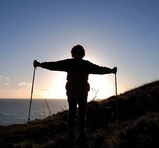
Weather: Hazy sun.
No wind. Very warm.
Location: Prestatyn, via Rhyl, to Colwyn Bay.
Distance: 15 miles.
Total distance: 3420 miles.
Terrain: Concrete proms and cycleways. Firm sandy beaches. Mostly flat.
Tide: In, going out.
Rivers: No.404, Afon Clwyd. No.405, Afon Dulas.
Ferries: None.
Piers: None.
Kissing gates: Nos.436 just after we had crossed the river in Rhyl.
Pubs: None.
‘Cadw’ properties: No.3, Rhuddlan Castle which was a little bit inland so we visited it on a different day.
Ferris wheels: None.
Diversions: No.72 after crossing the river in Rhyl where they were still landscaping the seafront whilst building a new footbridge over the river. (Footbridge not open yet, unfortunately.)
How we got there and back: We were staying in our caravan which was on a small farm site near St Asaph. This morning we drove to Colwyn Bay where we parked on the seafront — free all along! We walked to the station which was just up above us. There we caught a train to Prestatyn (fare: £7.40 each again!) where we walked to the residential road where we had parked our car last time.
At the end we came to our car which was parked very near a toilet block — and the toilets were still open! We had our tea and chocolate biscuits, then drove back to the caravan near St Asaph.
 We walked up the road from where we had parked the car last time, past an
attractive mosaic mural, to the public conveniences in the expensive car park
by the beach. Then we were able to start
the Walk feeling comfortable! From there
we could walk all the way to Rhyl and beyond along the prom. A notice about Pontins was on the corner as
we descended to the prom. The tide was in,
so there was no beach to start with. We
decided to walk on the lower prom because there were too many bikes on the
upper one.
We walked up the road from where we had parked the car last time, past an
attractive mosaic mural, to the public conveniences in the expensive car park
by the beach. Then we were able to start
the Walk feeling comfortable! From there
we could walk all the way to Rhyl and beyond along the prom. A notice about Pontins was on the corner as
we descended to the prom. The tide was in,
so there was no beach to start with. We
decided to walk on the lower prom because there were too many bikes on the
upper one.
 It was a lovely warm day with wall-to-wall blue sky, and we felt
good. It was easy walking so we covered
a lot of distance quite quickly.
It was a lovely warm day with wall-to-wall blue sky, and we felt
good. It was easy walking so we covered
a lot of distance quite quickly.

 We
noted the ubiquitous modern windmills gracing the horizon, and small ships
approaching the Conwy river behind us.
There was the occasional stretch of beautiful beach sand which the
occasional family were enjoying this glorious summer’s day, but then it is a weekday during school term time so
I suppose that’s why there were so few. (It’s great being retired, and able to do
what we want when we want!)
We
noted the ubiquitous modern windmills gracing the horizon, and small ships
approaching the Conwy river behind us.
There was the occasional stretch of beautiful beach sand which the
occasional family were enjoying this glorious summer’s day, but then it is a weekday during school term time so
I suppose that’s why there were so few. (It’s great being retired, and able to do
what we want when we want!)
 A
stretch of beach had shingle along the top, and we passed a digger taking sand
from the dunes behind the prom and dumping it on top of the shingle! Isn’t that cheating?
A
stretch of beach had shingle along the top, and we passed a digger taking sand
from the dunes behind the prom and dumping it on top of the shingle! Isn’t that cheating?

 A couple of miles inland from Rhyl
lies Rhuddlan Castle, another of Edward I’s “Iron Ring” of castles he built in
the 13th century to subdue the Welsh. (We visited it on a different day because we
didn’t want to interrupt the Walk.) During
the construction of the castle, the River Clwyd was straightened and dredged
between Rhuddlan and the sea to allow provisions and troops to reach the
fortification quickly and easily. This
was a terrific feat of engineering even by today’s standards, in fact it was one
of the earliest canals to be dug out in this country.
A couple of miles inland from Rhyl
lies Rhuddlan Castle, another of Edward I’s “Iron Ring” of castles he built in
the 13th century to subdue the Welsh. (We visited it on a different day because we
didn’t want to interrupt the Walk.) During
the construction of the castle, the River Clwyd was straightened and dredged
between Rhuddlan and the sea to allow provisions and troops to reach the
fortification quickly and easily. This
was a terrific feat of engineering even by today’s standards, in fact it was one
of the earliest canals to be dug out in this country.
 The castle withheld several sieges,
even the one by Owain Glyndŵr in 1400 when the town of Rhuddlan was laid waste. In the 15th and 16th
centuries the building became less and less important, so it was neglected and
began to fall down. It was used by
Royalist troops in the English Civil War, but fell to Parliamentary troops
after a siege in 1646. They partially
demolished the castle in 1648, and after that it was left to go to ruin.
The castle withheld several sieges,
even the one by Owain Glyndŵr in 1400 when the town of Rhuddlan was laid waste. In the 15th and 16th
centuries the building became less and less important, so it was neglected and
began to fall down. It was used by
Royalist troops in the English Civil War, but fell to Parliamentary troops
after a siege in 1646. They partially
demolished the castle in 1648, and after that it was left to go to ruin.

The tide was slowly going out revealing a nice sandy beach. We tried to walk on it but the sand was too soft. We retreated to the steps which were wide enough to walk along. Some were corroded, and workmen were mending them.
 By now Colin was desperate to change his pad again. (Don’t
these medics understand what a devastating effect these so-called ‘minor’
medical conditions have on people’s lives when they keep cancelling his
appointments?) We went up to the
upper prom to look for a loo, and there across a piece of wasteland was a
workman’s “Portaloo” — he was saved!
By now Colin was desperate to change his pad again. (Don’t
these medics understand what a devastating effect these so-called ‘minor’
medical conditions have on people’s lives when they keep cancelling his
appointments?) We went up to the
upper prom to look for a loo, and there across a piece of wasteland was a
workman’s “Portaloo” — he was saved!
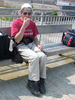 I
waited on a bench, and when he came back we ate our first snack of the day — a
pie for him and a slice of quiche for me.
Two nursery workers passed us with ‘triplet’ push chairs — three babies
each!
I
waited on a bench, and when he came back we ate our first snack of the day — a
pie for him and a slice of quiche for me.
Two nursery workers passed us with ‘triplet’ push chairs — three babies
each!
We continued on the lower prom where we passed fishermen looking very busy — I don’t think! Later we had to go up to the upper prom, and walked along by their newly painted railings.

 We passed a mosaic mural, then came to a stone circle outside a public
convenience. (When Colin was so
desperately searching for facilities, I hadn’t seen the letters PC on the map
because of my eye defect.) Don’t know
what the stone circle was about. We
passed “Waterworld” with an external water slide (a bit like Bognor Butlins)
and bought ourselves an ice cream each.
We passed a mosaic mural, then came to a stone circle outside a public
convenience. (When Colin was so
desperately searching for facilities, I hadn’t seen the letters PC on the map
because of my eye defect.) Don’t know
what the stone circle was about. We
passed “Waterworld” with an external water slide (a bit like Bognor Butlins)
and bought ourselves an ice cream each.

 We were well into Rhyl by now. We
passed a party of school children who were up on a platform. They shouted and waved, obviously having the
time of their lives, so we waved back.
Further on we passed a kiddies’ water park with several Mums standing in
the fountains alongside their children.
We were well into Rhyl by now. We
passed a party of school children who were up on a platform. They shouted and waved, obviously having the
time of their lives, so we waved back.
Further on we passed a kiddies’ water park with several Mums standing in
the fountains alongside their children.
 We
passed a building that was wood effect concrete, a children’s playground that
included a climbing wall, noted numerous gulls on the beach (why no humans?)
and a run-down entertainments centre which was closed even though it said it
was open. We felt that Rhyl was a bit of
a run-down resort — like Bognor, only nicer!
We
passed a building that was wood effect concrete, a children’s playground that
included a climbing wall, noted numerous gulls on the beach (why no humans?)
and a run-down entertainments centre which was closed even though it said it
was open. We felt that Rhyl was a bit of
a run-down resort — like Bognor, only nicer!
 As we approached the river we could see fishing boats taking tourists out
for a sail along the coast. Bet they
make more money doing that than fishing — and a lot safer too. A brand new footbridge was being constructed
across the river, part of the Wales Coast Path initiative. We couldn’t make out whether it was going to
be a swing or a sliding bridge.
As we approached the river we could see fishing boats taking tourists out
for a sail along the coast. Bet they
make more money doing that than fishing — and a lot safer too. A brand new footbridge was being constructed
across the river, part of the Wales Coast Path initiative. We couldn’t make out whether it was going to
be a swing or a sliding bridge.
 However,
it was not yet open so we had to go a little further along the river to cross
on a blue road bridge with lots of other pedestrians and cyclists.
However,
it was not yet open so we had to go a little further along the river to cross
on a blue road bridge with lots of other pedestrians and cyclists.

 On the other side of the river the wild flowers on the waste ground were gorgeous! We tried the first road we came to in order
to get back to the beach, but the ground looked as if it was still being
landscaped and we couldn’t get through. So
we retreated and went along the next road.
We passed a notice advertising a “Roast Dinner £3.99” which reminded us of when we took up
such an offer way back in St Andrews,
Scotland. The meal was horrible! The meat was
tough, and we couldn’t understand how any cook could make a roast dinner so
tasteless. You get what you pay
for…
On the other side of the river the wild flowers on the waste ground were gorgeous! We tried the first road we came to in order
to get back to the beach, but the ground looked as if it was still being
landscaped and we couldn’t get through. So
we retreated and went along the next road.
We passed a notice advertising a “Roast Dinner £3.99” which reminded us of when we took up
such an offer way back in St Andrews,
Scotland. The meal was horrible! The meat was
tough, and we couldn’t understand how any cook could make a roast dinner so
tasteless. You get what you pay
for…
 We passed a man with a strimmer at
a kissing gate (noisy!) and walked
along the cycleway behind the dunes. We
sat on spiky grass to eat our sarnies.
We passed a man with a strimmer at
a kissing gate (noisy!) and walked
along the cycleway behind the dunes. We
sat on spiky grass to eat our sarnies.
The tide was now well out so we were able to walk on the sand for miles — great! We had this beautiful and vast beach practically to ourselves! We passed the occasional family having fun.
 We passed
the occasional seagull. But mostly we
were on our own.
We passed
the occasional seagull. But mostly we
were on our own.

 Colin got desperate for
a loo again. We didn’t know how far we
had walked along the beach, so we couldn’t work out from the map how far it was
to the nearest one. He looked up and
thought he saw the roof of a public convenience above the sea wall. I thought it would be wishful thinking because
he was getting desperate, but he was right!
We had walked further than we thought, and were at Abergele.
Colin got desperate for
a loo again. We didn’t know how far we
had walked along the beach, so we couldn’t work out from the map how far it was
to the nearest one. He looked up and
thought he saw the roof of a public convenience above the sea wall. I thought it would be wishful thinking because
he was getting desperate, but he was right!
We had walked further than we thought, and were at Abergele.

 More comfortable now, we sat on a bench to eat our apples. We walked along the cycleway for a bit. Colin stopped and talked to all the dog owners,
of which there were many. He loves dogs
(I’m indifferent to them) but he doesn’t want the responsibility of owning one
— they are expensive, and a tie. So he
enjoys other people’s dogs without the disadvantages. Trouble is, it makes for slow-going and I
keep having to wait for him.
More comfortable now, we sat on a bench to eat our apples. We walked along the cycleway for a bit. Colin stopped and talked to all the dog owners,
of which there were many. He loves dogs
(I’m indifferent to them) but he doesn’t want the responsibility of owning one
— they are expensive, and a tie. So he
enjoys other people’s dogs without the disadvantages. Trouble is, it makes for slow-going and I
keep having to wait for him.

 We went back on to the beach. The
expanse of sand was now vast! Again we passed occasional families having
fun. The beach began to get rocky, so we
went up on to the cycleway again. We
passed an interesting playground with a spider’s web climbing frame (how I
would have loved that kind of thing
as a child!) and then we came to a giant crab made of recycled glass. Very clever!
We went back on to the beach. The
expanse of sand was now vast! Again we passed occasional families having
fun. The beach began to get rocky, so we
went up on to the cycleway again. We
passed an interesting playground with a spider’s web climbing frame (how I
would have loved that kind of thing
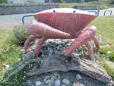
as a child!) and then we came to a giant crab made of recycled glass. Very clever!
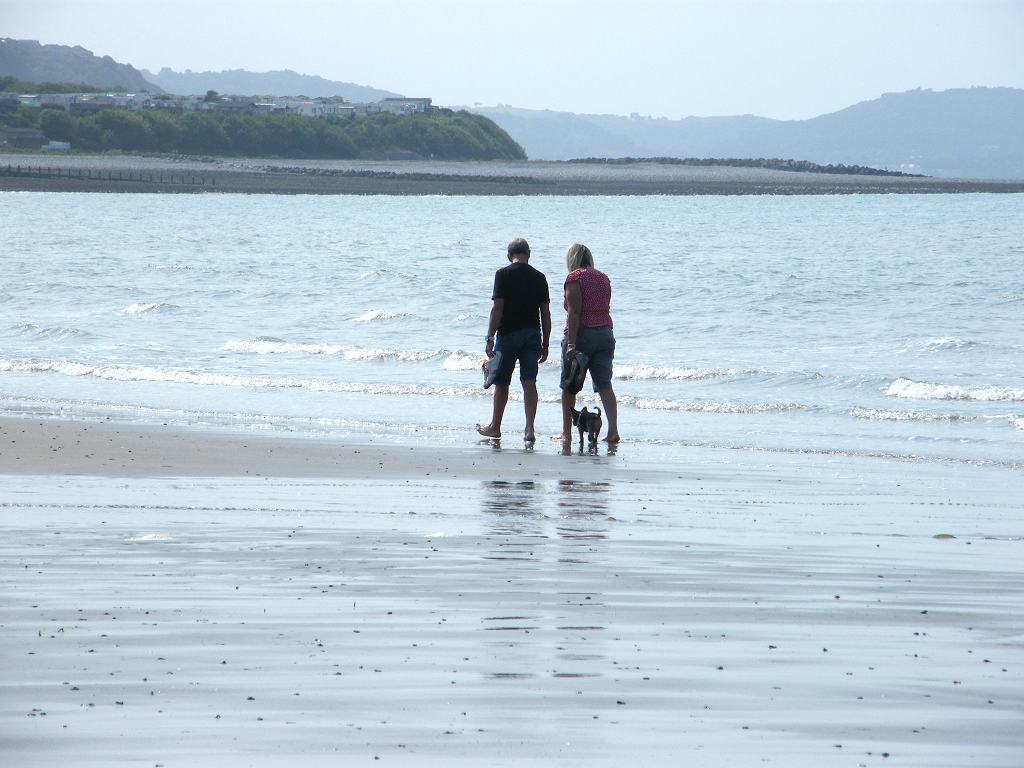
 The beach looked good again, so we went back down. Once more we had this vast area virtually to
ourselves, though we did pass the occasional bait-digger, fisherman and couple
walking their dog through the shallow waves.
It was idyllic!
The beach looked good again, so we went back down. Once more we had this vast area virtually to
ourselves, though we did pass the occasional bait-digger, fisherman and couple
walking their dog through the shallow waves.
It was idyllic!

 We also saw a lot
of jellyfish washed up on the shore.
We also saw a lot
of jellyfish washed up on the shore.
The beach got rocky again. When it got impossible we clambered over what we thought were barnacle-clad rocks to get to the cycleway. It wasn’t until we read a notice board up there that we realised this was the unique (well, unique in Wales as they usually occur in warmer climes further south) Honeycomb Worm Reef we had heard about recently on a ‘Countryfile’ programme on TV.


The worms live in fragile tubes which they build from cement-like mucus that binds sand and shell fragments to form a honeycomb-like reef structure. When the tide covers the reef, the worms poke their heads out of the tubes and use their tentacles to feed on plankton. When the tide recedes they sink back into the far end of the tubes they have made so they don’t dry out. After reading this we went back on to the reef to find them. We were not absolutely sure that we photographed the right things, but they looked like honeycombs to us!
 We continued along a cycleway and came to a small river where children
and dogs were happily playing. We crossed on a footbridge where a notice
ordered “Cyclists Dismount” but none of them did. (I’m not sure that I would have dismounted
either, had I been on a bike. It’s
“Elfin Safety” gone mad!) We passed a public
convenience which Colin gratefully used while I sat on a bench and ate my
chocolate. Colin ate his whilst walking
along, but I can’t successfully eat and walk at the same time — it gives me
indigestion.
We continued along a cycleway and came to a small river where children
and dogs were happily playing. We crossed on a footbridge where a notice
ordered “Cyclists Dismount” but none of them did. (I’m not sure that I would have dismounted
either, had I been on a bike. It’s
“Elfin Safety” gone mad!) We passed a public
convenience which Colin gratefully used while I sat on a bench and ate my
chocolate. Colin ate his whilst walking
along, but I can’t successfully eat and walk at the same time — it gives me
indigestion.
 The road (A55), railway and cycleway were now all squashed together to
get by along the bottom of the cliff. There
was no question of a beach now, we were all shored up with huge rocks and
concrete three-cornered things.
The road (A55), railway and cycleway were now all squashed together to
get by along the bottom of the cliff. There
was no question of a beach now, we were all shored up with huge rocks and
concrete three-cornered things.
 There
were loads of wild flowers through the fence to our left, especially orchids —
tall and beautiful. The cycleway took us
up high to get over a quarry entrance (limestone, we thought) and then down the
other side with cyclists whizzing past us.
We approached the quarry jetty and went up and over that — it was a bit
of a roller-coaster. When we were up
high we could hear the traffic on the A55 very noisily above our heads. The
traffic was constant, and we heard the occasional train on the line which was
also very near.
There
were loads of wild flowers through the fence to our left, especially orchids —
tall and beautiful. The cycleway took us
up high to get over a quarry entrance (limestone, we thought) and then down the
other side with cyclists whizzing past us.
We approached the quarry jetty and went up and over that — it was a bit
of a roller-coaster. When we were up
high we could hear the traffic on the A55 very noisily above our heads. The
traffic was constant, and we heard the occasional train on the line which was
also very near.
 We came down towards Colwyn
Bay. There were wild flowers in profusion — nature
beautifies an ugly landscape. We got
down to the beach again but we were too tired to walk on it, we only wanted to
route-march until we reached the car. We
had both finished our supplies of water even though we had brought extra — it
had been a hot walk.
We came down towards Colwyn
Bay. There were wild flowers in profusion — nature
beautifies an ugly landscape. We got
down to the beach again but we were too tired to walk on it, we only wanted to
route-march until we reached the car. We
had both finished our supplies of water even though we had brought extra — it
had been a hot walk.
 We passed a parked car, and sitting on the pavement next to it was a man working
on his laptop. Down on the beach another
man was conducting business on his mobile phone. Is this the shape of modern life?
We passed a parked car, and sitting on the pavement next to it was a man working
on his laptop. Down on the beach another
man was conducting business on his mobile phone. Is this the shape of modern life?
 The prom widened out to accommodate a large building with a flat top and
wind socks flapping in the breeze. We
concluded it was a helicopter landing pad, but why there?
The prom widened out to accommodate a large building with a flat top and
wind socks flapping in the breeze. We
concluded it was a helicopter landing pad, but why there?
 We passed a couple sitting on the beach in a windbreak-tent. We could only see their silhouettes with the
sun shining through from the other side.
It reminded us of Eric Morecambe’s camping sketch which he did years
ago, and we both started to laugh. That
man has the power to make us see the funny side of life even twenty-nine years
after his death!
We passed a couple sitting on the beach in a windbreak-tent. We could only see their silhouettes with the
sun shining through from the other side.
It reminded us of Eric Morecambe’s camping sketch which he did years
ago, and we both started to laugh. That
man has the power to make us see the funny side of life even twenty-nine years
after his death!

 As we approached Colwyn Bay Pier we thought it looked a bit dead. Sure enough, it is completely derelict with
warning notices not to enter. A sad
sight. Our car was parked a little
further along the road.
As we approached Colwyn Bay Pier we thought it looked a bit dead. Sure enough, it is completely derelict with
warning notices not to enter. A sad
sight. Our car was parked a little
further along the road.
That ended Walk no.331, we shall pick up Walk no.332 in Colwyn Bay just past the pier. It was twenty-five to seven, so the Walk had taken us exactly nine hours. Our car was parked very near a toilet block — and the toilets were still open, much to our relief and comfort! We had our tea and chocolate biscuits, then drove back to our caravan near St Asaph.
Location: Prestatyn, via Rhyl, to Colwyn Bay.
Distance: 15 miles.
Total distance: 3420 miles.
Terrain: Concrete proms and cycleways. Firm sandy beaches. Mostly flat.
Tide: In, going out.
Rivers: No.404, Afon Clwyd. No.405, Afon Dulas.
Ferries: None.
Piers: None.
Kissing gates: Nos.436 just after we had crossed the river in Rhyl.
Pubs: None.
‘Cadw’ properties: No.3, Rhuddlan Castle which was a little bit inland so we visited it on a different day.
Ferris wheels: None.
Diversions: No.72 after crossing the river in Rhyl where they were still landscaping the seafront whilst building a new footbridge over the river. (Footbridge not open yet, unfortunately.)
How we got there and back: We were staying in our caravan which was on a small farm site near St Asaph. This morning we drove to Colwyn Bay where we parked on the seafront — free all along! We walked to the station which was just up above us. There we caught a train to Prestatyn (fare: £7.40 each again!) where we walked to the residential road where we had parked our car last time.
At the end we came to our car which was parked very near a toilet block — and the toilets were still open! We had our tea and chocolate biscuits, then drove back to the caravan near St Asaph.


Rhuddlan Castle


The tide was slowly going out revealing a nice sandy beach. We tried to walk on it but the sand was too soft. We retreated to the steps which were wide enough to walk along. Some were corroded, and workmen were mending them.


We continued on the lower prom where we passed fishermen looking very busy — I don’t think! Later we had to go up to the upper prom, and walked along by their newly painted railings.


The tide was now well out so we were able to walk on the sand for miles — great! We had this beautiful and vast beach practically to ourselves! We passed the occasional family having fun.



The beach got rocky again. When it got impossible we clambered over what we thought were barnacle-clad rocks to get to the cycleway. It wasn’t until we read a notice board up there that we realised this was the unique (well, unique in Wales as they usually occur in warmer climes further south) Honeycomb Worm Reef we had heard about recently on a ‘Countryfile’ programme on TV.


The worms live in fragile tubes which they build from cement-like mucus that binds sand and shell fragments to form a honeycomb-like reef structure. When the tide covers the reef, the worms poke their heads out of the tubes and use their tentacles to feed on plankton. When the tide recedes they sink back into the far end of the tubes they have made so they don’t dry out. After reading this we went back on to the reef to find them. We were not absolutely sure that we photographed the right things, but they looked like honeycombs to us!


That ended Walk no.331, we shall pick up Walk no.332 in Colwyn Bay just past the pier. It was twenty-five to seven, so the Walk had taken us exactly nine hours. Our car was parked very near a toilet block — and the toilets were still open, much to our relief and comfort! We had our tea and chocolate biscuits, then drove back to our caravan near St Asaph.