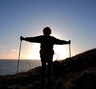
Ages: Colin was 71 years and 78 days. Rosemary was 68 years and 220 days.
Weather: Warm with a lovely cooling breeze. Occasional threatening clouds but they never
came to anything.
Location: Llanfairfechan to Menai Bridge.
Distance: 14 miles.
Total distance: 3458 miles.
Terrain: Concrete / gravel / grassy paths at the top of the beach. Two difficult sections of rocky beaches where the path had disappeared. Some roads / pavements / cycleways. Some footpaths through fields. A lovely well-looked-after wooden pier. A difficult section of a new but badly constructed path through woods — there were too many steps and the signage was poor so we got lost. Ended the Walk crossing the spectacular Menai Bridge. First half of the Walk was flat, second half, when we were tired, was quite undulating.
Tide: Coming in, then going out.
Rivers: No.407, Afon Dulas. No.408, Afon Aber. No.409, Afon Ogwen. No.410, Afon Cegin. No.411, Afon Menai (Menai Strait).
Ferries: None.
Piers: No.34 Bangor — which is ½Km long!
Kissing gates: Nos.443 to 451 spread out along the route.
Pubs: The ‘Tap & Spile’ in Bangor which we visited the next day for a pub lunch. Colin drank Purple Moose ‘Glaslyn Ale’ and Caledonian ‘Flying Scotsman’. I drank Weston’s ‘Old Rosy’ cider.
‘Cadw’ properties: None.
Ferris wheels: None.
Diversions: None.
How we got there and back: Yesterday we towed our caravan from Malvern to a small site on a remote farm in the middle of Anglesey. This morning we drove to Menai Bridge and found a parking space in a residential street. We caught a bus to Bangor which crossed Thomas Telford’s famous bridge, only just fitting between the pillars of the towers. Then we caught another bus to Llanfairfechan where we walked from the village down to the seafront.
At the end we came to our car parked below the famous Menai Bridge. We drove out of town to a layby overlooking the Menai Strait before having our tea and chocolate biscuits. Then we drove back to our caravan at Bodnolwyn Wen.
 The visibility was very clear today — down on the beach at Llanfairfechan
we could see far further than when we were last there a few weeks ago. The views in both directions were
spectacular.
The visibility was very clear today — down on the beach at Llanfairfechan
we could see far further than when we were last there a few weeks ago. The views in both directions were
spectacular.
 We followed the seafront prom westwards.
We crossed a stream into a nature reserve, the first of many. We passed a boating pool and a row of pretty
houses We had excellent views of
Anglesey and Puffin
Island which seemed to
get ever closer. We sat on a bench to
take in these vistas, and to eat our pasty/sausage roll which were still warm
despite being bought in Menai
Bridge, before the bus
ride, more than two hours ago.
We followed the seafront prom westwards.
We crossed a stream into a nature reserve, the first of many. We passed a boating pool and a row of pretty
houses We had excellent views of
Anglesey and Puffin
Island which seemed to
get ever closer. We sat on a bench to
take in these vistas, and to eat our pasty/sausage roll which were still warm
despite being bought in Menai
Bridge, before the bus
ride, more than two hours ago.
 A sand-spit on the beach was out of bounds from March to July, so a
notice on a padlocked gate told us, because of nesting birds. From August to February the beach is
accessible, but only at low tide because the birds roost on the spit at high
tide. We could see and hear them on a
soon-to-be-covered spit further out — they were making a heck of a row! We discussed this with several local
dog-walkers that we met.
A sand-spit on the beach was out of bounds from March to July, so a
notice on a padlocked gate told us, because of nesting birds. From August to February the beach is
accessible, but only at low tide because the birds roost on the spit at high
tide. We could see and hear them on a
soon-to-be-covered spit further out — they were making a heck of a row! We discussed this with several local
dog-walkers that we met.

 The sun came out and it got hot, but there was a blissful breeze. We came to a post telling us how far away the
nearest benches were and in which direction.
What a good idea! At the moment
we didn’t need a bench, but many’s the time when we’ve needed one and can’t
find one. That is what I call useful information. We passed many pools to our left and to our
right. The sea wall has been breached in
places to allow salt-marsh to reform, a habitat which is in short supply since
many salt-marshes have been drained for farming.
The sun came out and it got hot, but there was a blissful breeze. We came to a post telling us how far away the
nearest benches were and in which direction.
What a good idea! At the moment
we didn’t need a bench, but many’s the time when we’ve needed one and can’t
find one. That is what I call useful information. We passed many pools to our left and to our
right. The sea wall has been breached in
places to allow salt-marsh to reform, a habitat which is in short supply since
many salt-marshes have been drained for farming.

 We were on a good track along the top of the beach, on our own as
usual. We saw a castle in the distance,
and Colin remarked that it looked too modern to be real. And it was.
It was Penrhyn
Castle, built nearly two
hundred years ago by George Hay Dawkins to show off his wealth. He went against the fashion of the time for
Gothic architecture, and built his ‘castle’ in his idea of a Norman style. Shortly after it was finished, he died. It was passed down through various members of
his scattered family until, in the early 1950s, it was taken over by the
National Trust. (In lieu of death
duties, as was Hardwick Hall in Derbyshire where Colin was born?)
We were on a good track along the top of the beach, on our own as
usual. We saw a castle in the distance,
and Colin remarked that it looked too modern to be real. And it was.
It was Penrhyn
Castle, built nearly two
hundred years ago by George Hay Dawkins to show off his wealth. He went against the fashion of the time for
Gothic architecture, and built his ‘castle’ in his idea of a Norman style. Shortly after it was finished, he died. It was passed down through various members of
his scattered family until, in the early 1950s, it was taken over by the
National Trust. (In lieu of death
duties, as was Hardwick Hall in Derbyshire where Colin was born?)

 We passed slate fences — we saw them all along and came across them time
and time again in this north-west part of Wales. We also came across a row of concrete blocks
and stones along the beach. We thought
they dated from the Second World War and wondered if they were once part of a
building.
We passed slate fences — we saw them all along and came across them time
and time again in this north-west part of Wales. We also came across a row of concrete blocks
and stones along the beach. We thought
they dated from the Second World War and wondered if they were once part of a
building.
 We came to a wooded area with a pretty wooden footbridge across a
stream. There were more dog-walkers now
because we were near a car park, and Colin was in his element!
We came to a wooded area with a pretty wooden footbridge across a
stream. There were more dog-walkers now
because we were near a car park, and Colin was in his element!
 There were also loads of gulls flying noisily
over — I wonder where they were going? We then crossed over a gas pipeline, according to a notice, and saw a
small tortoiseshell butterfly resting on the track. Colin had forgotten his camera, so I took the
photos and was quite pleased with the results.
There were also loads of gulls flying noisily
over — I wonder where they were going? We then crossed over a gas pipeline, according to a notice, and saw a
small tortoiseshell butterfly resting on the track. Colin had forgotten his camera, so I took the
photos and was quite pleased with the results.
 We were on a good track which suddenly came to an end. This was puzzling because we had been
following the Wales Coast Path signs and were definitely on the right
path. We wondered if the sea had had
anything to do with the lack of trail?
The tide was right in so the rocky beach was narrow.
We were on a good track which suddenly came to an end. This was puzzling because we had been
following the Wales Coast Path signs and were definitely on the right
path. We wondered if the sea had had
anything to do with the lack of trail?
The tide was right in so the rocky beach was narrow.
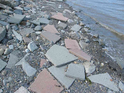 It was covered in broken paving slabs which
only added to the mystery — but they were a great help in negotiating this
uneven terrain. We went right down to
the water’s edge because the beach was flatter there. But then the slabs ran out and walking became
more problematic. It was only for a
short way, soon we were able to get up on to a grass bank and found ourselves
on an established path once more.
It was covered in broken paving slabs which
only added to the mystery — but they were a great help in negotiating this
uneven terrain. We went right down to
the water’s edge because the beach was flatter there. But then the slabs ran out and walking became
more problematic. It was only for a
short way, soon we were able to get up on to a grass bank and found ourselves
on an established path once more.
 We sat on some rocks to eat our sarnies.
We were completely by ourselves on this pleasant beach with fantastic
views in wonderful weather — and it’s the height of the holiday season! (All schools are now on holiday.) We couldn’t get over the fact that we had
successfully escaped the crowds. While
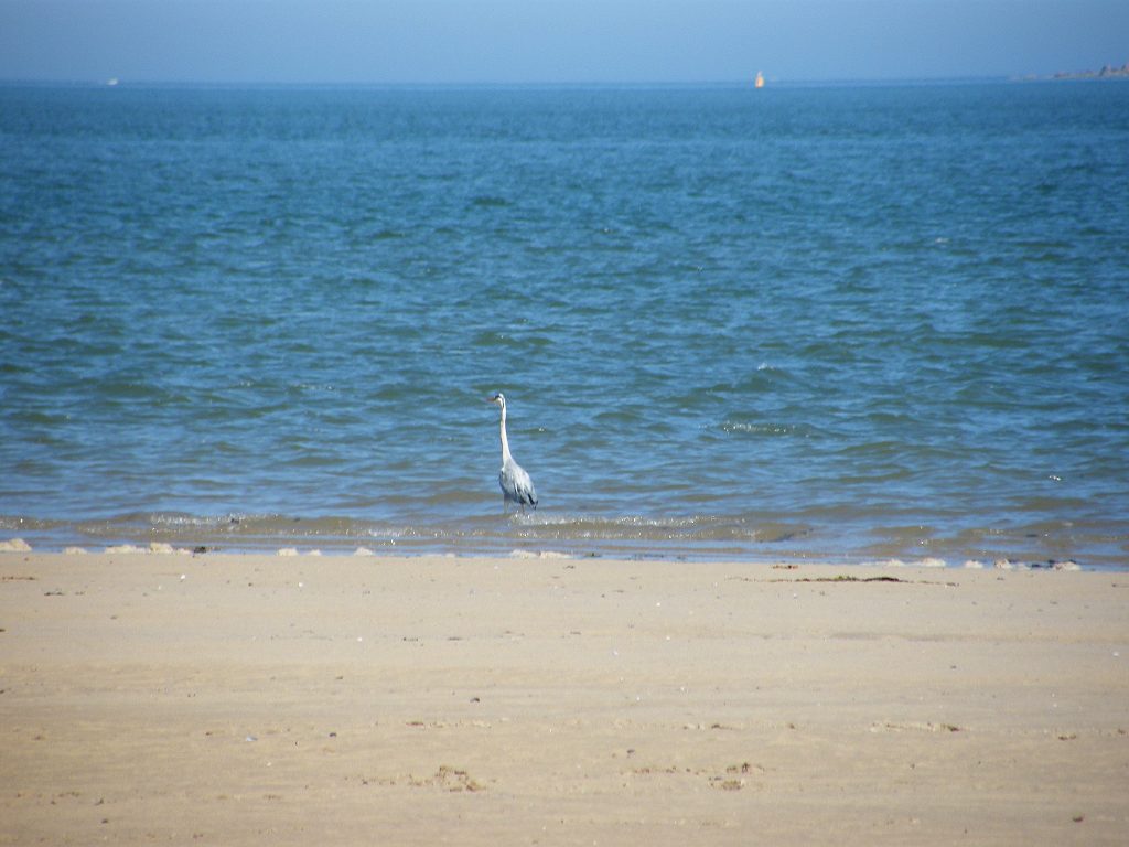
eating, we idly watched an oystercatcher and some plover chicks darting about
looking for food.
We sat on some rocks to eat our sarnies.
We were completely by ourselves on this pleasant beach with fantastic
views in wonderful weather — and it’s the height of the holiday season! (All schools are now on holiday.) We couldn’t get over the fact that we had
successfully escaped the crowds. While
eating, we idly watched an oystercatcher and some plover chicks darting about
looking for food.
We carried on. The path continually improved until we got to a car park. There was a Wales Coast Path sign pointing back the way we had come, there were no notices about a break which had looked pretty permanent to us when we were back there. We chatted to an old man with several dogs in the car park.
 A Wales Coast Path sign pointed us inland up a lane, but we preferred to
follow a public footpath on the beach round a nature reserve. There had been lots of erosion, there was a
fence hanging halfway down a small cliff.
We could just about get past this sand cliff because the tide had
started to recede.
A Wales Coast Path sign pointed us inland up a lane, but we preferred to
follow a public footpath on the beach round a nature reserve. There had been lots of erosion, there was a
fence hanging halfway down a small cliff.
We could just about get past this sand cliff because the tide had
started to recede.
 Studying the map earlier, we had been hopeful of taking a short cut
through the Penrhyn estate (it would have saved us several miles of walking)
particularly as the castle and grounds have belonged to the National Trust for
the past sixty years. We could see an
ornate bridge across the river, but found it to be completely
inaccessible. We wandered through a
bramble wood looking for a way up to it, but only came to a high wall and
impenetrable undergrowth. I sat on a
bench in the shade while Colin found a bush to hide behind so he could change
his pad. I took a close and careful look
at the map, and realised we hadn’t a hope of taking our planned short cut. You would think that the National Trust would
have co-operated with the Wales Coast Path authorities when the Path was being
established to open up a footpath next to that bit of coast, wouldn’t you? But no, we were expected to walk round three
sides of the estate adding several miles to the route.
Studying the map earlier, we had been hopeful of taking a short cut
through the Penrhyn estate (it would have saved us several miles of walking)
particularly as the castle and grounds have belonged to the National Trust for
the past sixty years. We could see an
ornate bridge across the river, but found it to be completely
inaccessible. We wandered through a
bramble wood looking for a way up to it, but only came to a high wall and
impenetrable undergrowth. I sat on a
bench in the shade while Colin found a bush to hide behind so he could change
his pad. I took a close and careful look
at the map, and realised we hadn’t a hope of taking our planned short cut. You would think that the National Trust would
have co-operated with the Wales Coast Path authorities when the Path was being
established to open up a footpath next to that bit of coast, wouldn’t you? But no, we were expected to walk round three
sides of the estate adding several miles to the route.
We came out into the lane, then we had to walk inland and uphill — in this heat. Not nice! We came to a mainer road, and discovered that the Wales Coast Path was signposted to turn off it and go even further inland. We decided that was too far and continued down the main road.
 Very soon we ran out
of pavement and had to do a bit of traffic-dodging for a while. We realised that was why the official path
went even further inland. But it wasn’t
far — we passed a redundant drinking fountain in the wall, crossed a river and
turned off almost immediately along a road we were mildly amused to find was
called “Tre Felin”. (No trees were being
felled, thank goodness.)
Very soon we ran out
of pavement and had to do a bit of traffic-dodging for a while. We realised that was why the official path
went even further inland. But it wasn’t
far — we passed a redundant drinking fountain in the wall, crossed a river and
turned off almost immediately along a road we were mildly amused to find was
called “Tre Felin”. (No trees were being
felled, thank goodness.)
 This led us under a railway viaduct (the railway had been with us ever
since Conwy) and then alongside it through what looked like a small industrial
estate. We continued up a steep gravel
track where we came across an unusual and very pretty flowering plant.
This led us under a railway viaduct (the railway had been with us ever
since Conwy) and then alongside it through what looked like a small industrial
estate. We continued up a steep gravel
track where we came across an unusual and very pretty flowering plant.

 Then we had to cross the A5 — not easy but we
managed it without mishap. We took a
footpath across a field which had a stone air-vent in it, so we knew where the
railway was — under our feet! We crossed
a lane which was even more tricky than the A5 because of speeding traffic and
high hedges.
Then we had to cross the A5 — not easy but we
managed it without mishap. We took a
footpath across a field which had a stone air-vent in it, so we knew where the
railway was — under our feet! We crossed
a lane which was even more tricky than the A5 because of speeding traffic and
high hedges.
We crossed another field, and at the end of it we found a dumped armchair. We were looking for somewhere to sit and eat our apples, but this upholstery was soaked because of recent rain. Far too wet to use as a seat, so we sat on a large stone nearby to consume our fruit. We had forgotten all about the railway, and hadn’t realised we were sitting almost next to the tunnel exit because it was hidden behind bushes and brambles. All of a sudden a train came out with a great Whoosh! and made us both jump!
 The footpath continued round the back of a much larger industrial estate
between two menacing fences through which brambles were growing like
fangs. We wished we had a machete with
us, but it would probably have been classed as an offensive weapon if we
had. So it was just as well — we managed
to get through without too much trouble.
It was very noisy, but not from the factories. There was a cacophony of squawks from the local
gulls who seemed to object to us walking through. I expect they had young nearby, and we know
from our days living in Bognor that gulls can be very aggressive when
protecting them.
The footpath continued round the back of a much larger industrial estate
between two menacing fences through which brambles were growing like
fangs. We wished we had a machete with
us, but it would probably have been classed as an offensive weapon if we
had. So it was just as well — we managed
to get through without too much trouble.
It was very noisy, but not from the factories. There was a cacophony of squawks from the local
gulls who seemed to object to us walking through. I expect they had young nearby, and we know
from our days living in Bognor that gulls can be very aggressive when
protecting them.
We came out from behind the industrial estate, and I immediately got disorientated — I can’t see the map properly when I’m tired. So Colin took over the navigation. He led us down a hill to a footbridge in a pretty glade on a cycleway which was a disused railway leading to Penrhyn Harbour. It was the loveliest section of the whole Walk, and we both felt calm and happy under the trees.
 We met a man on his bike who stopped to chat. He asked us where we were going, as many
people do, and then explained in great detail our route to the Menai Bridge. We hadn’t asked him to, and it wasn’t the
route we intended taking anyway!
Sometimes people are just too helpful.
We met a man on his bike who stopped to chat. He asked us where we were going, as many
people do, and then explained in great detail our route to the Menai Bridge. We hadn’t asked him to, and it wasn’t the
route we intended taking anyway!
Sometimes people are just too helpful.
 There was a short tunnel under the A5 which we had to cross again. This was much better than trying to cross the
actual road, especially as there was quite good official graffiti art painted
on the tunnel sides.
There was a short tunnel under the A5 which we had to cross again. This was much better than trying to cross the
actual road, especially as there was quite good official graffiti art painted
on the tunnel sides.
 Then we crossed the river on what we could see was a converted railway
bridge. There was an ornate bridge at
the end of the cycleway leading into the Penrhyn estate. That is where we would have emerged if we had
been able to take a short cut across the National Trust property. We were at Penrhyn Harbour,
a pretty place now only used by leisure craft.
Then we crossed the river on what we could see was a converted railway
bridge. There was an ornate bridge at
the end of the cycleway leading into the Penrhyn estate. That is where we would have emerged if we had
been able to take a short cut across the National Trust property. We were at Penrhyn Harbour,
a pretty place now only used by leisure craft.
 We had to walk along the road into Bangor,
but this was by the water so it was quite pleasant. We bought ice creams and sat on a wall to eat
them. We continued through an estate of
new houses, some of them still for sale, until we came to Bangor Pier. Bangor has a
lovely pier — 20p only for OAPs — when you walk along it looks as if it will
take you all the way to Anglesey, but of
course it doesn’t. It is half a kilometre
long!
We had to walk along the road into Bangor,
but this was by the water so it was quite pleasant. We bought ice creams and sat on a wall to eat
them. We continued through an estate of
new houses, some of them still for sale, until we came to Bangor Pier. Bangor has a
lovely pier — 20p only for OAPs — when you walk along it looks as if it will
take you all the way to Anglesey, but of
course it doesn’t. It is half a kilometre
long!

 It was built in 1896 and restored
in 1988 after being closed for about fifteen years. We loved the ornate onion domes on the
entrance kiosks. We are so pleased it
was saved from demolition back in the 1970s.
Part of the fund-raising, as at Southwold in Essex,
included putting up memorial plaques. We
chose one to photograph which amused us and wasn’t about death.
It was built in 1896 and restored
in 1988 after being closed for about fifteen years. We loved the ornate onion domes on the
entrance kiosks. We are so pleased it
was saved from demolition back in the 1970s.
Part of the fund-raising, as at Southwold in Essex,
included putting up memorial plaques. We
chose one to photograph which amused us and wasn’t about death.

 It was quite breezy on there this July day, but not cold. All the kiosks were occupied by businesses,
but not all of them were open including the tea room which closed at 4pm. In July?
We were disappointed because we would have loved a cup of tea. There were a lot of people about, so they
must have lost quite a bit of business through shutting so early in the height
of the season. There were children all
along catching crabs, it seems to be the latest seaside craze. (Poor
crabs!)
It was quite breezy on there this July day, but not cold. All the kiosks were occupied by businesses,
but not all of them were open including the tea room which closed at 4pm. In July?
We were disappointed because we would have loved a cup of tea. There were a lot of people about, so they
must have lost quite a bit of business through shutting so early in the height
of the season. There were children all
along catching crabs, it seems to be the latest seaside craze. (Poor
crabs!)
 Coming off the pier, having walked the length of it and back, we could
see no Wales Coast Path notices. So we
climbed quite steeply through some gardens to a road which continued
uphill. The road was narrow and steep, and
it was one-way with cycling allowed both ways.
It also had a footpath alongside so we were not bothered by
traffic. We came to steps leading up to
a viewing bench, but the bench had a WET
PAINT notice on it. We tentatively touched it, and the paint was
dry so we sat on it to eat our chocolate.
We had a lovely view across the Menai Strait,
but young oak trees were beginning to obscure the vista. I hope something is done about them soon.
Coming off the pier, having walked the length of it and back, we could
see no Wales Coast Path notices. So we
climbed quite steeply through some gardens to a road which continued
uphill. The road was narrow and steep, and
it was one-way with cycling allowed both ways.
It also had a footpath alongside so we were not bothered by
traffic. We came to steps leading up to
a viewing bench, but the bench had a WET
PAINT notice on it. We tentatively touched it, and the paint was
dry so we sat on it to eat our chocolate.
We had a lovely view across the Menai Strait,
but young oak trees were beginning to obscure the vista. I hope something is done about them soon.
 Back on the road we climbed still further, passing an open space with a
ring of standing stones. Were they
genuinely ancient or a modern copy? We
rather thought the latter. We walked
along the top of this field instead of the road, though the Wales Coast Path
signage didn’t tell us to until we got to the other end and found a sign pointing
back the way we had come. (It was for
people going the other way.)
Back on the road we climbed still further, passing an open space with a
ring of standing stones. Were they
genuinely ancient or a modern copy? We
rather thought the latter. We walked
along the top of this field instead of the road, though the Wales Coast Path
signage didn’t tell us to until we got to the other end and found a sign pointing
back the way we had come. (It was for
people going the other way.)
The road led into some houses and we seemed to be a long way from the sea. We came to a Wales Coast Path sign pointing us into an estate, which was a surprise because on our map that road came to a dead end when it reached the beach. We thought we would trust the signs this time, not wishing to continue through a suburban-type area and knowing we would soon join up with the main A5 again. It led us down and down and down until we got to the beach.
 And there stood
a sign which really angered us — with the Wales Coast Path logo it said “Low
Tide Route”
and pointed back along a flat beach to Bangor!
Why didn’t they tell us at the other end? We had just climbed an enormous hill
unnecessarily! It was really
aggravating.
And there stood
a sign which really angered us — with the Wales Coast Path logo it said “Low
Tide Route”
and pointed back along a flat beach to Bangor!
Why didn’t they tell us at the other end? We had just climbed an enormous hill
unnecessarily! It was really
aggravating.
 Fortunately we weren’t at a dead end, for on the same post pointing the
other way was another Wales Coast Path sign.
This was not a flat path, it led us up the steep hill again facing
directly into the setting sun so it was difficult to see where we were
going. After crossing two fields, the
path led into a wood which was on the steep slope above the beach. A “new” path had been hacked out, but it was
not good. There were too many wooden
steps which must have cost a bomb to put in — we went up & down, up &
down, up & down — surely it would have been better to flatten the ground a
little? The path was too narrow to walk
comfortably, even in single file. It was
overgrown with weeds, and slippery roots & the stumps of young trees had
not been dealt with. Trip hazards were everywhere
— was it made by amateurs? We couldn’t
see it lasting, one more season and it will disappear completely. We were not enjoying ourselves at all, the
going was much too challenging.
Fortunately we weren’t at a dead end, for on the same post pointing the
other way was another Wales Coast Path sign.
This was not a flat path, it led us up the steep hill again facing
directly into the setting sun so it was difficult to see where we were
going. After crossing two fields, the
path led into a wood which was on the steep slope above the beach. A “new” path had been hacked out, but it was
not good. There were too many wooden
steps which must have cost a bomb to put in — we went up & down, up &
down, up & down — surely it would have been better to flatten the ground a
little? The path was too narrow to walk
comfortably, even in single file. It was
overgrown with weeds, and slippery roots & the stumps of young trees had
not been dealt with. Trip hazards were everywhere
— was it made by amateurs? We couldn’t
see it lasting, one more season and it will disappear completely. We were not enjoying ourselves at all, the
going was much too challenging.
 We came to a parting of the ways with no signage. To our left a flight of wooden steps led up
and up, disappearing amongst the trees.
We’d had enough of hills, so chose the older, more established path
which led more or less straight on. Mistake! This path was just as difficult, and when we
came to a single lamppost in the middle of the wood we wondered whether we were
in Narnia! Further on we came to a dead
stop at a locked gate! It was very
tall with ugly spikes sticking out of the top — it really meant business. So we tried a lower path we had seen further
back which led towards the beach. But
there we came to another similar locked gate!
We had no choice but to return past the lamppost to the flight of wooden
steps. We climbed up & up & up
to a kissing gate which, to our relief, was not locked. We followed the continuation of the path
round several fields until we emerged on to the road not much further on than
we were before!
We came to a parting of the ways with no signage. To our left a flight of wooden steps led up
and up, disappearing amongst the trees.
We’d had enough of hills, so chose the older, more established path
which led more or less straight on. Mistake! This path was just as difficult, and when we
came to a single lamppost in the middle of the wood we wondered whether we were
in Narnia! Further on we came to a dead
stop at a locked gate! It was very
tall with ugly spikes sticking out of the top — it really meant business. So we tried a lower path we had seen further
back which led towards the beach. But
there we came to another similar locked gate!
We had no choice but to return past the lamppost to the flight of wooden
steps. We climbed up & up & up
to a kissing gate which, to our relief, was not locked. We followed the continuation of the path
round several fields until we emerged on to the road not much further on than
we were before!
We were really fed up, that detour must have cost us at least an hour in time alongside a lot of wasted energy and frustration. We had really lost faith in the Wales Coastal Path, it had let us down TWICE today!
We marched off down the side of the A5, fortunately on a pavement. We had put the map away by then, so we missed another path which led down, then up again. There was no signage, so perhaps it was just as well.
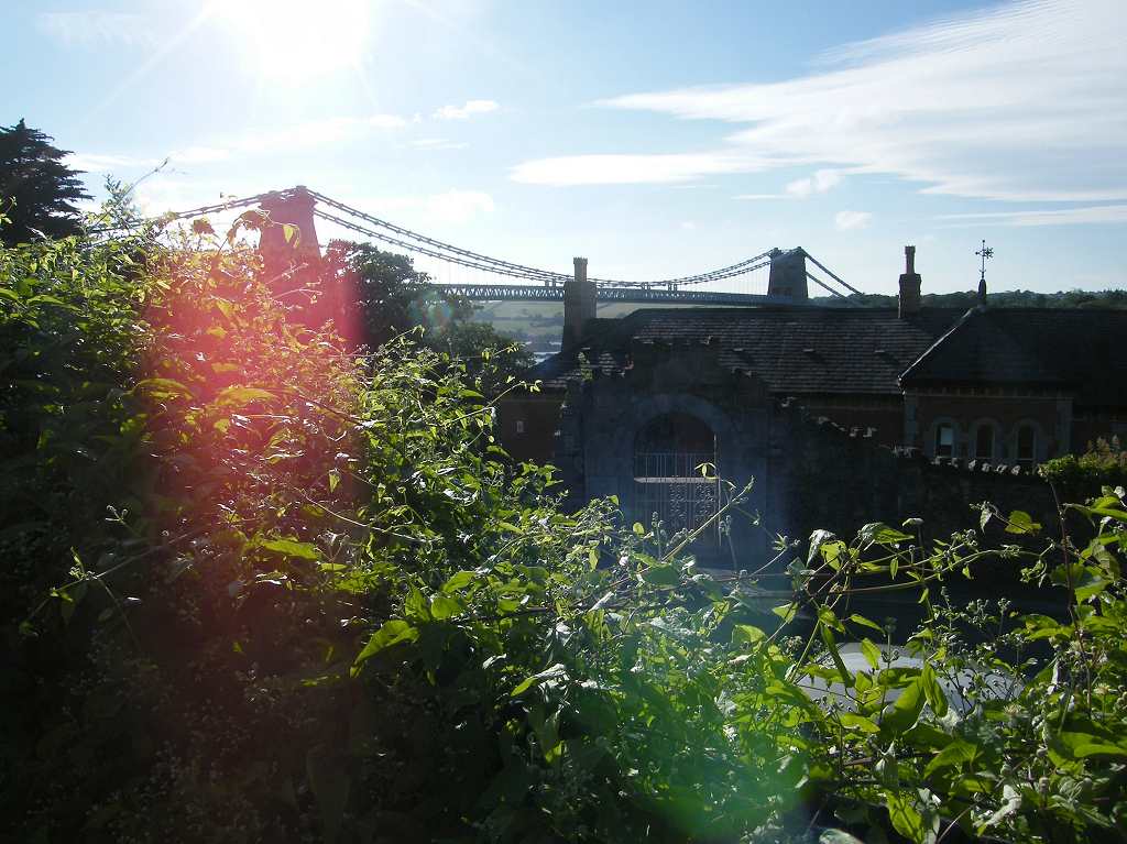
 Suddenly, so it seemed, we came upon Thomas Telford’s AMAZING
BRIDGE! It was built in 1826 as
the first fixed connection between the island
of Anglesey and mainland Wales. It replaced a ferry which had run across the Menai Strait
at that spot since the 13th century.
Telford designed a suspension bridge,
the first of it’s kind, because it had to be high enough for the tall ships of
the day to pass underneath. Also, the
local geology made it impossible to build piers to support a conventional
bridge.
Suddenly, so it seemed, we came upon Thomas Telford’s AMAZING
BRIDGE! It was built in 1826 as
the first fixed connection between the island
of Anglesey and mainland Wales. It replaced a ferry which had run across the Menai Strait
at that spot since the 13th century.
Telford designed a suspension bridge,
the first of it’s kind, because it had to be high enough for the tall ships of
the day to pass underneath. Also, the
local geology made it impossible to build piers to support a conventional
bridge.
 As we crossed over to Anglesey, we
marvelled at the beauty and engineering of the bridge. We know it has been modified several times.
But it is still basically the same bridge — built long before the invention of
the internal combustion engine but safely carrying today’s heavy traffic over
the Menai Strait day and night. This morning we had crossed over it in a bus!
As we crossed over to Anglesey, we
marvelled at the beauty and engineering of the bridge. We know it has been modified several times.
But it is still basically the same bridge — built long before the invention of
the internal combustion engine but safely carrying today’s heavy traffic over
the Menai Strait day and night. This morning we had crossed over it in a bus!
 We continued down steep roads and alleys to the water’s edge, then along
past a bowling green
to where we had parked our car this morning.
We continued down steep roads and alleys to the water’s edge, then along
past a bowling green
to where we had parked our car this morning.
That ended Walk no.335, we shall pick up Walk no.336 in Menai Bridge near the bowling green. It was five past seven, so the Walk had taken us nine hours five minutes. We drove out of town to a layby overlooking the Menai Strait before having our tea and chocolate biscuits. Then we drove back to our caravan at Bodnolwyn Wen.
Location: Llanfairfechan to Menai Bridge.
Distance: 14 miles.
Total distance: 3458 miles.
Terrain: Concrete / gravel / grassy paths at the top of the beach. Two difficult sections of rocky beaches where the path had disappeared. Some roads / pavements / cycleways. Some footpaths through fields. A lovely well-looked-after wooden pier. A difficult section of a new but badly constructed path through woods — there were too many steps and the signage was poor so we got lost. Ended the Walk crossing the spectacular Menai Bridge. First half of the Walk was flat, second half, when we were tired, was quite undulating.
Tide: Coming in, then going out.
Rivers: No.407, Afon Dulas. No.408, Afon Aber. No.409, Afon Ogwen. No.410, Afon Cegin. No.411, Afon Menai (Menai Strait).
Ferries: None.
Piers: No.34 Bangor — which is ½Km long!
Kissing gates: Nos.443 to 451 spread out along the route.
Pubs: The ‘Tap & Spile’ in Bangor which we visited the next day for a pub lunch. Colin drank Purple Moose ‘Glaslyn Ale’ and Caledonian ‘Flying Scotsman’. I drank Weston’s ‘Old Rosy’ cider.
‘Cadw’ properties: None.
Ferris wheels: None.
Diversions: None.
How we got there and back: Yesterday we towed our caravan from Malvern to a small site on a remote farm in the middle of Anglesey. This morning we drove to Menai Bridge and found a parking space in a residential street. We caught a bus to Bangor which crossed Thomas Telford’s famous bridge, only just fitting between the pillars of the towers. Then we caught another bus to Llanfairfechan where we walked from the village down to the seafront.
At the end we came to our car parked below the famous Menai Bridge. We drove out of town to a layby overlooking the Menai Strait before having our tea and chocolate biscuits. Then we drove back to our caravan at Bodnolwyn Wen.


We carried on. The path continually improved until we got to a car park. There was a Wales Coast Path sign pointing back the way we had come, there were no notices about a break which had looked pretty permanent to us when we were back there. We chatted to an old man with several dogs in the car park.


We came out into the lane, then we had to walk inland and uphill — in this heat. Not nice! We came to a mainer road, and discovered that the Wales Coast Path was signposted to turn off it and go even further inland. We decided that was too far and continued down the main road.


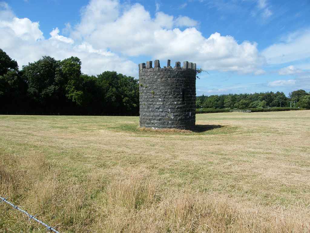
We crossed another field, and at the end of it we found a dumped armchair. We were looking for somewhere to sit and eat our apples, but this upholstery was soaked because of recent rain. Far too wet to use as a seat, so we sat on a large stone nearby to consume our fruit. We had forgotten all about the railway, and hadn’t realised we were sitting almost next to the tunnel exit because it was hidden behind bushes and brambles. All of a sudden a train came out with a great Whoosh! and made us both jump!

We came out from behind the industrial estate, and I immediately got disorientated — I can’t see the map properly when I’m tired. So Colin took over the navigation. He led us down a hill to a footbridge in a pretty glade on a cycleway which was a disused railway leading to Penrhyn Harbour. It was the loveliest section of the whole Walk, and we both felt calm and happy under the trees.


The road led into some houses and we seemed to be a long way from the sea. We came to a Wales Coast Path sign pointing us into an estate, which was a surprise because on our map that road came to a dead end when it reached the beach. We thought we would trust the signs this time, not wishing to continue through a suburban-type area and knowing we would soon join up with the main A5 again. It led us down and down and down until we got to the beach.


We were really fed up, that detour must have cost us at least an hour in time alongside a lot of wasted energy and frustration. We had really lost faith in the Wales Coastal Path, it had let us down TWICE today!
We marched off down the side of the A5, fortunately on a pavement. We had put the map away by then, so we missed another path which led down, then up again. There was no signage, so perhaps it was just as well.


That ended Walk no.335, we shall pick up Walk no.336 in Menai Bridge near the bowling green. It was five past seven, so the Walk had taken us nine hours five minutes. We drove out of town to a layby overlooking the Menai Strait before having our tea and chocolate biscuits. Then we drove back to our caravan at Bodnolwyn Wen.