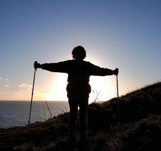
Saturday, March 23, 2002

Walk 41 -- Leysdown-on-Sea to Warden Point, Isle of Sheppey

Ages: Colin was 59 years and 319 days. Rosemary was 57 years and 96 days.
Weather: Sunny and exceptionally clear. Mild with a light wind.
Location: Leysdown-on-Sea to Warden Point, Isle of Sheppey.
Distance: 3 miles.
Total distance: 253 miles.
Terrain: Tarmacked car park next to the sea wall, hard sand on the beach with scrunchy shells, and unmade-up roads with very muddy patches.
Tide: Way out.
Rivers to cross: None.
Ferries: None.
Piers: None.
Kissing gates: None.
Pubs: None.
‘English Heritage’ properties: None.
Ferris wheels: None.
Diversions: None.
How we got there and back: We drove – with bikes on the back of the car – from the Medway Youth Hostel to Warden Point where we parked next to a monastery! We donned our walking boots, locked the bike rack inside the car, then cycled back to Leysdown-on-Sea. We sat on the sea wall where we had parked yesterday and ate the hot pasties which we had just bought. There was no suitable post to chain the bikes to, so we walked – pushing them – for half a mile until we found one.
At the end, we had a cup of tea from our flask in the car. Then we drove to Leysdown-on -Sea to pick up the bikes. From there we drove back home to Bognor.

The weather was brilliant today, warm and sunny! That helped our mood, especially me because I am pretty miserable without my proper glasses. I am getting used to my plastic-framed distance glasses and didn’t take them off so often today. Also, we had slept well again in our comfortable oast-houses hostel at Medway with only quiet fellow guests. It is so pleasant there, modern, light and airy.
We sat on the seawall, where we had parked yesterday, to eat hot pasties which we had just bought. It was so clear we could see not only the towers of Reculver, but all the way to Margate! We couldn’t see a suitable post to chain our bikes to, so Colin suggested we push them along for a while because we had to walk along the edge of the road anyway. About a quarter of a mile further on, where the road turned inland at an angle, we found a post and so left them there.
The tide was way out, so we went down on to the beach. That saved all the zigzagging round caravan parks for the next couple of miles. The sand was hard-packed and crunchy underfoot because of shells. Thousands of beautiful shells are pressed into the sand on that beach. I stopped to take a close-up photo of them, and as I stood up a passing stranger made some sarky remark. I countered with, “When I’m famous….!” and he laughed.
Colin remarked on all the caravan parks right up to the seawall with barbed wire along the top so that access is impossible when the tide is in. Who pays for the upkeep and repair of the seawall? Bet it isn’t the caravan park owners – and if it comes out of the local Council tax, then why are the general public barred from walking along what they have paid for? Hypocrisy reigns supreme at all levels of government! However, we didn’t let it spoil our mood of the day because we really did enjoy that walk along the beach in the sunshine.As we approached Warden we could see an abandoned car which had been driven on to the beach and left below high tide level, so it was a wreck. Some children were playing nearby – it’s nice to see children playing on the beach but not to the backdrop of stolen cars.
There we left the beach and climbed up the loose sandy cliffs which are unstable and falling away all over the place. I wouldn’t like to live within a mile of them! At one place, our path completely disappeared, and we could see where it continued on the other side of the landslide. We took an unmade-up road inland, and turned into a track leading past yet more caravan sites. It descended into a muddy hollow which we couldn’t avoid, but since we had cycled through it a couple of hours earlier we knew it wasn’t very deep. With our boots and gaiters, it was no problem – unlike a family coming the other way who were wearing sandals and trainers!
We passed our parked car and took a short cul-de-sac to Warden Point – at fifty metres above sea level it is supposed to be the best viewpoint on Sheppey. Well..! at least we had a very clear day and could see quite a bit of the Essex coast. Not much else to say about it, really. We returned to our car which we had parked next to a building that looked a bit like an old barn, and was marked as a chapel on the map. A board on the wall claimed it was a ‘Monastery of the Sorrowful and Immaculate Heart of Mary’ – that sounded very Catholic to us. While we were drinking our tea, we heard what sounded like a convent bell calling people to prayers, but there was no apparent bell tower and no sign of movement within the building nor the garden behind it. Curious!

That ended Walk no.41, we shall pick up Walk no.42 next time by the ‘monastery’ at Warden Point on the Isle of Sheppey. We drove back to Leysdown to pick up our bikes, then we drove home to Bognor where we arrived before dark.

Friday, March 22, 2002

Walk 40 -- Eastchurch to Leysdown-on-Sea, Isle of Sheppey

Ages: Colin was 59 years and 318 days. Rosemary was 57 years and 95 days.
Weather: Dull, but remaining dry except for one five-minute shower late in the afternoon. There was a light wind and it was quite mild.
Location: Eastchurch to Leysdown-on-Sea, Isle of Sheppey.
Distance: 10 miles.
Total distance: 250 miles.
Terrain: A busy road with no footway where we had to leap into the hedge every few seconds, then a quieter road. Several miles across farmland where there was no vestige of the footpath, but we managed not to have to wade through any drainage ditches. An unofficial path around a hill, an official path across a very bumpy field, hard-packed tracks, a grassy bank through a nature reserve, and finally a pleasant grassy bank along the top of the sea wall. Quite a variety, and not easy walking!
Tide: Out, coming in.
Rivers to cross: None.
Ferries: None, though we passed the other end of the long disused Harty ferry which would have saved us twenty-nine miles had it still been functional.
Piers: None.
Kissing gates: Nos.39 & 40 at the beginning of the Shell Ness Nature Reserve, and no.41 at the end of it. (No.39 had sharp bits of wire and I pierced my thumb!)
Pubs: None, because the Ferry Inn was closed for major refurbishment!
‘English Heritage’ properties: None.
Ferris wheels: None.
Diversions: None.
How we got there and back: We drove – with bikes on the back of the car – from the Medway Youth Hostel to Leysdown-on-Sea where we parked by the sea wall. We donned our walking boots, locked the bike rack inside the car, then cycled back to Eastchurch where we left the bikes chained to a post on the patch of grass where we had parked the day before.
At the end, we had two cups of tea from our flasks in the car. Then we drove to Eastchurch to pick up the bikes. From there we drove back to the Medway Youth Hostel.

Last night was very comfortable in our converted oast-houses hostel, there was only one other guest. The warden told us that he had been “all day” clearing up after a school party who had stayed two nights and were “completely out of control”! We had originally planned to come a day earlier, but put it off because the weather was so foul. Had we stuck to our original plan, we would have spent our first night caught up with those dreadful kids! God is good to me!!
However, today did not start very well – last night I broke my glasses. I have been wearing spectacles since I was two years old as I was born with a complex eye defect. For the past ten years or so I have been wearing light-sensitive vari-focals and have become absolutely dependent on them. Without my glasses everything is out of focus no matter how near or far it is. The difference between my near-vision and my distance-vision has gradually increased and is now vast. Colin attempted to mend the glasses with sticky tape and then with ‘super-glue’, but to no avail. The nose piece sheered off one side and there seems to be no way the two pieces can be stuck together. I had an old pair of distance-vision specs in the car which I sometimes use for driving, so I put those on today and used a magnifying glass for map-reading. But it was all very uncomfortable and I have no middle-vision. The plastic frames kept slipping off my nose and made my ears sore, so I spent a good bit of today’s walk with them in my hand looking out on a fuzzy world! My head felt odd and I got quite depressed.

Before we started today's Walk, we had a quick look round Eastchurch. The village claims to be the "First Home of British Aviation, 1909" and there is a memorial to some of the earliest pilots, many of whom were killed whilst experimenting with their flying machines. We were disappointed to find there was no mention of Farnborough, nor of 'Colonel' Samuel Cody who flew the first fixed wing aircraft in this country on the 16th October 1908 on Laffan's Plain, now the two-mile runway at Farnborough. Surely Farnborough is the "Home of British Aviation"?

The first part of today’s walk was dreadful! For over a mile we had to walk along the side of a very busy B-road where there was no footway, not even a grass verge. The traffic was constant and speedy, and every few yards we had to leap into the hedge in order to stay alive! Colin wanted to cycle it, said it was “stupid” to walk such an unpleasant road. It probably was, but I was insistent that I want to always be able to say we have walked every inch of the way from Bognor. I told him that he could cycle it if he liked, but I was going to walk – so he did too, just declared at the end, “I hope you enjoyed that, because I didn’t!” No, I didn’t either, but we haven’t given in yet and missed out walking any of ‘the nearest path to the coast’!
With relief we turned south into a lane which we had to walk down for a further mile, and we were only passed by one fairly slow car. At the start of this lane was a big notice telling us that the Ferry Inn at Harty was closed due to major refurbishment! Is there a conspiracy to stop us getting any ‘real ale’ on our ‘Round-Britain-Walk’? Should we turn teetotal now? That was the only ‘real ale’ pub we were due to pass in three days of walking, and I had planned to get there just after lunch to wash down our sarnies before it closed. I must congratulate Colin on the lack of fuss he made – I think he has given up and gone into a decline!
At the bend in the lane, according to the map, the public footpath leads off across the marshes for about two miles to the Harty Ferry – but in reality we could see no vestige of it. There was no signpost, no stile, and no sign that anyone had walked that way before us! We climbed over a gate into a field, and started navigating by orientating the map and then looking for a landmark to make for on the horizon. Being marshland, all the field boundaries were deep drainage ditches and we were concerned that we would not be able to cross them where we wanted to. We were hungry by then, so we sat on the sloping bank of a ditch out of the wind to eat our lunch.
Then we carried on, navigating by looking at landmarks, and found we could cross most of the ditches at animal gateways. (Colin reckoned he saw a hare in the distance, but I couldn’t see it with my ‘wrong’ glasses on.) Eventually we ‘lost it’ completely, couldn’t get across a ditch where we were convinced the ‘footpath’ was supposed to go, and so made towards a flock of sheep being shepherded by three blokes who didn’t seem to like each other much. The one who fancied himself as ‘boss’ obviously thought the other two were incompetent, and they were taking very little notice of what he was saying. We got the impression they were ‘townies’ playing at farming. They had one dead sheep in the back of a truck, and when Colin told them where we had passed another one they didn’t seem much interested. By then we had seen the end of the ditch, so we refrained from asking them the way and they treated us as if we were invisible which is not usually our experience with country people.
Further on, the ‘path’ was so soggy and uneven we kept leaping across a narrow ditch to walk on the driest patches. We could then see where we were ‘supposed’ to go – up a hill alongside an arable field. But we knew we would immediately have to walk down again to the old ferry, so decided to take an unofficial path round the edge of the hill and stay on the level. We crossed over a fence where it was broken, and this path was much more clearly marked than the so-called public footpath we had tried to follow for the last couple of miles.
Colin found a plastic decoy duck and tried to kid me it was a real one which was tame enough to let him pick it up. We also found a large number of shot ‘clay pigeons’ and spent cartridge cases with the name of the Ferry Inn printed on them – no wonder the path was well marked!
The grass seawall bank, which came in from the west where we climbed over the fence, looked as if it had a firm dry path along the top. Studying the map later, we reckoned we could have walked straight along it from the nature reserves where we were yesterday, keeping nearer to the coast and saving us several miles, walking through a prison, along a main road and other such nasties. It is easy to see these things in hindsight, but if we had parked our car at the Ferry Inn yesterday and then not been able to get through because of deep drainage ditches and marsh, we would have been right up it! It is not marked as a public footpath, but that seems to be irrelevant on the Isle of Sheppey.
We walked down the ferry road as far as we could, which was quite a distance because the tide was way out. We had to be careful not to slip on the seaweed. Oare Creek seemed to be little more than an armslength away, yet we have had to walk twenty-nine miles extra because the ferry is redundant. We could have been here last October on Walk 36 instead of five months later on Walk 40! We sat on a rusty boat trailer and ate the sticky buns we had bought earlier in the morning in Leysdown.
As we walked past the Ferry Inn, there still seemed a lot of work to be done to the car park and gardens, and they haven’t much time if they hope to get the place open for Easter which is only next week (I hate it when Easter is in March). A group of men were laying turf, but it was very yellow and had obviously been rolled up too long. They spoke to each other in a foreign language except the one in charge who seemed frustrated that the others weren’t working hard enough and doing it wrong. We wondered if they were illegal immigrants being exploited as cheap labour.
We were discussing this as we walked up the road when we realised we had passed the spot where the footpath supposedly led off into a field (Colin was in charge of the map because I had given up frabbing about with my magnifying glass!) We walked back, and again there was no sign of the footpath where it is so clearly marked on the map. We crossed a dry ditch and a string of barbed wire, then set off across the bumpy lumpy field through the long grass. It was very hard walking, thank goodness it wasn’t far. I wished we had gone round by the road after all, but Colin was delighted because he kept seeing a hare, or maybe several different hares. At last I saw it too, but by the time I had got my telescope to my eye it had disappeared into the grass again. Colin was over the moon because he reckoned he had had seven or eight sightings of hares today – I wish I could see!
We regained a solid track, passed a derelict house, and eventually walked down to a Nature Reserve which goes all the way along to Shell Ness, the most south-easterly corner of Sheppey. Two kissing gates lead into the Reserve, the first had bits of broken wire netting on it and I jabbed my thumb making it bleed. The public footpath was well signposted, for a change, along the top of the grass covered sea wall – so much for our silhouettes supposedly upsetting the nesting birds here! It was the best part of today – easy walking along a grass path with excellent views of the birds. We saw oyster-catchers, shelducks, partridges, pheasants, greylag geese, Canada geese, widgeons, eider (a drake with four ducks), coots, peewits, a heron flew over, ringed plovers, a white goose and some wrens. The downside was that we got caught in a shower of rain when we were right out in the open! Rain was not forecast for today, but we could see this shower edging towards us and it didn’t miss – oh dear!
By the time we got to Shell Ness it was fine again. There is a row of houses there plastered with PRIVATE KEEP OUT type of notices of which we have seen so many on the trek so far, and probably will see a lot more of. We walked down the back of them to the Point, and sat down for a while to look at the sea. We could see Whitstable clearly, and Herne Bay in the distance. Through my little telescope I could see the twin towers of Reculver on the horizon – it seems a long time since we were there.
It was a couple of miles to our car along the seawall, which was quite pleasant walking. We passed an official nudist beach! We had permission to take all our clothes off and gambol about in the waves, but we resisted the temptation because of the stiff breeze that was blowing across on this March day! In fact, there didn’t seem to be any takers at all, I wonder why! It was nice to be by the real sea again – occasionally we seem to have lost sight of the fact we are doing a coastal trek when we have to take so many detours inland to avoid marshland, stomp through industrial areas which could be anywhere, and there has been too much river-bank walking since we got in the region of Sheppey. Our car was parked by the seawall at the southern end of Leysdown-on-Sea.

That ended Walk no.40, we shall pick up Walk no.41 next time on the seawall at Leysdown-on-Sea. We had tea and biscuits, then we drove back to Eastchurch where we parked momentarily on the newly tarmacked PRIVATE PROPERTY NO PUBLIC RIGHT OF WAY track to load up our bikes. Then we returned to the Medway Youth Hostel, near Gillingham, for the night.

Thursday, March 21, 2002

Walk 39 -- the Kingsferry Bridge to Eastchurch, Isle of Sheppey

Ages: Colin was 59 years and 317 days. Rosemary was 57 years and 94 days.
Weather: Dull, but remaining dry. It brightened up later and we saw the sun for the first time in ages! There was a light wind and it was quite mild.
Location: The Kingsferry Bridge to Eastchurch, Isle of Sheppey.
Distance: 9½ miles.
Total distance: 240 miles.
Terrain: Grassy banks and across marshes where it wasn’t nearly as muddy as we had expected. We ended up walking through a prison!
Tide: Out, coming in.
Rivers to cross: No.11, the Swale – though it is not really a river because it is the strait between the Isle of Sheppey and mainland Kent.
Ferries: None, though we passed the other end of the long disused Elmley ferry which would have saved us twelve miles had it still been functional.
Piers: None.
Kissing gates: None.
Pubs: None.
‘English Heritage’ properties: None.
Ferris wheels: None.
Diversions: No.16 from a farm called ‘Great Bell’ where a worker told us the public footpath ahead was closed and the only way we could get to Eastchurch was through the nearby prison!
How we got there and back: We drove – with bikes on the back of the car – from Bognor to Eastchurch on the Isle of Sheppey where we parked on a patch of grass at the very edge of the village. We donned our walking boots, locked the bike rack inside the car, then cycled back to the Kingsferry Bridge where we crossed over it and left the bikes chained to a fence almost under it.
At the end, we had two cups of tea from our flasks in the car. Then we drove to the Kingsferry Bridge to pick up the bikes. From there we drove to the Medway Youth Hostel near Gillingham where we spent the night.

The first day of Spring! How my mother used to long for this day when she was coping with eight children and their chilblains, coughs, colds, sickness and diarrhoea through the dark winter days in that tiny bungalow without central heating in which we all lived until 1959. She seemed to turn a corner on March 21st each year – so it is a fitting day to restart our ‘Round-Britain-Walk’ half a century later!
We chained our bikes to a fence just inside a boatyard almost under the Kingsferry Bridge, then we climbed a steep bank and stepped over an ‘Armco’ barrier on to the bridge. It carries a very busy road and a railway across the Swale, and fortunately there is also a footway/cycleway alongside the road. The problem that had been worrying me all the time I was planning this walk was – how do we get across the railway to continue along the southern shore of the Isle of Sheppey? On all the maps I have been using, the public footpath seems to stop when it reaches the road/railway coming off the bridge and restarts the other side. And that is just what it did! We had a choice – either walk a mile up the road and back another mile along a track, or sneak under the bridge alongside the river. Since the tide was out, we chose the latter and found the mud under the bridge was not as gooey as we had feared.
So we embarked on the Walk ‘proper’. We were looking at oyster-catchers and avocets on the tidal mud through my little telescope, and I walked a little ahead of Colin. I looked down, and there was a snake lying on the path! It was a young grass snake, not very big. At first I thought it was dead because it didn’t move for ages, but then I noticed it’s little black tongue keep flicking in and out! Colin came up and said it was probably only playing dead, and as he got his camera out it started to wriggle. He took several photos, then picked it up. It’s skin was quite dry and smooth to touch, it was a magic moment! Eventually we let it slither away down the side of the grass bank.We were quite hungry by then, it seemed a long time since breakfast. We walked on a bit so that the sound of the traffic over the bridge was dulled, and sat on the slope of the grass bank out of the wind to eat our sandwiches. We had our backs to Ridham Dock (which is a bit of an eyesore, so that didn’t matter) and were facing the marshes. The sun began to come out and it looked much brighter which cheered us no end – we have had far too much dark grey and damp weather in recent weeks. As we walked on past all the industrial complexes on the other side of the Swale – the ones we had passed on Walk 38 – the smell of factory waste and burning wafted over to us. It was horrible! We would hate to live in Sittingbourne, or anywhere in this area, because we would be sniffing in these toxic substances all the time without realising it.
We turned inland by a little inlet and followed the official footpath across the marshes – not much of a footpath, we had to orientate the map then look for a landmark in the distance in order to work out the correct route. It turned out to be not nearly so muddy as we had feared – perhaps they haven’t had the torrential rain that we have had in West Sussex earlier this week when both the villages of Findon and Angmering were washed out! We were tempted to continue following the coastline as there seemed to be a grassy bank most of the way along, but we didn't know if we would suddenly come across a drainage ditch that was too deep to wade and/or too wide to jump (there were plenty of them about) so we decided not to risk it.
Where we regained the coast we came across the other end of the long disused Elmley Ferry which would have saved us twelve miles of walking, and we could have missed out all the yucky industrial section of Sittingbourne, had it still been in operation! We walked out as far as we could on what remained of the road, but we had to retrace our steps quickly because, even as we watched, waves were covering the ground where we had just stood.
Shortly after that, we entered a Nature Reserve where there was a hard-packed track leading off into the distance – in fact the occasional vehicle was using it. However, we could see that a continuous high grassy bank hugged the coastline, so we opted to walk along that. The sun came out, and we had marvellous views of shelducks, avocets, widgeons, oyster-catchers, the ubiquitous gulls, a heron, mallards, coots, redshanks, Canada geese and so on. It was wonderful! It was only when we came back on to the track at the other end that we read a notice requesting us not to walk along the bank because our high profile might disturb nesting birds! Oh well, you can’t win all the time!
We then did continue along the track through another Nature Reserve, and by now we were so far away from everything that the only sounds we could hear were the calls of birds. We heard, rather than saw, peewits and it was lovely to listen to their constant calls – pee-ee-ee-wit! pee-ee-ee-wit! We saw lots of rabbits bounding along, they really run fast! Colin saw a robin, then we both saw an owl – beautiful sight! We think it was a tawny, it was very big and a lovely colour of pale mottled brown. Unfortunately it was downwind from us, so it kept flying on away as we approached. We had several good sightings of it through my little telescope, but didn’t succeed with photography.
The track deteriorated, and turned inland. There is a lot of marshland along this southern coast of Sheppey which is inaccessible unless you know what you are doing. We had resigned ourselves to having to walk a couple of miles inland in order to get round.
As we passed a farm, a man with a tractor asked where we were going. We showed him on our recently bought map – and on the internet map which I had downloaded only the previous evening – the green line of the public footpath leading across fields to a track which is not marked in green because tracks rarely are. A last mile up the track leads to Eastchurch where our car was parked. “Oh, you can’t go along there!” he said, “that’s private property, there’s no right of way along the track! There’s a big green notice put up by the Council, been like that for a couple of years!” “Does that mean the public footpath comes to a dead end in the middle of nowhere?” I asked, incredulously. “Must do,” he replied, “you’ll find you can’t get through if you go on that way!” “Well,” I said, “how are we going to get to Eastchurch? We can’t go back the way we came because we must have walked about eight miles and we are rather tired!” He hesitated, then conceded, “You could go along my farm track to the prison and walk out through there!” “Is that all right, I mean can we just walk through a prison like that?” I asked. “Yes, it’s fine, there’s nobody there!” This we found just a little difficult to believe because on our way to placing car and bikes this morning we had seen prison ‘buses’ both going in and coming out of the complex and it had all looked very functional to us.
So we trudged off up said track and emerged into a road passing a notice which declared ‘NO ENTRY TO UNAUTHORISED PERSONS’ or some such, and displaying another notice, road-sign type, of walkers with a red diagonal line through the middle – we got the distinct impression we weren’t supposed to be there! We were, in fact, inside the prison complex and there was a lot of traffic about – it must have been the end of a shift or something. No one stopped us to ask who we were or what we were doing there as we marched along between high walled compounds, past a notice requesting all visitors to leave the area quickly once their visit was over, and through red & white striped STOP gates which were open. We escaped!
We had been walking steadily uphill for over a mile, the sun came out, we were away from the coastal breeze, and this was the tail-end of a near-ten mile walk which had been preceded by a seven mile cycle ride against the wind – in other words we were knackered! We came on to the Eastchurch bypass, and walked along the grass verge (which was very uneven and squidgy underfoot) to the corner of the village where our car was parked. Opposite was the track we should have come out of, and sure enough there was a big green notice, signed by the Council, saying that it was not a public footpath and there was no right of way down it – we hadn’t noticed that earlier in the day. (Wonder what position on the Council the owner of the land holds – no! stop it! mustn’t be cynical!)

That ended Walk no.39, we shall pick up Walk no.40 next time at the south-east corner of Eastchurch village on the Isle of Sheppey. We were so hot and tired, we had to have two cups of tea plus chocolate biscuits before we could even think straight! Then we drove back over the Kingsferry Bridge to pick up our bikes, then on to the Medway Youth Hostel, near Gillingham, where we spent the night.

Wednesday, October 31, 2001

Walk 38 -- Sittingbourne to the Kingsferry Bridge

Ages: Colin was 59 years and 176 days. Rosemary was 56 years and 318 days.
Weather: Mostly sunny, but a biting wind in exposed places.
Location: Sittingbourne to the Kingsferry Bridge.
Distance: 5½ miles.
Total distance: 230½ miles.
Terrain: Grassy banks, occasionally topped with gravel. A short section of road where we had to play ‘dodge-the-lorries’!
Tide: Going out.
Rivers to cross: None.
Ferries: None.
Piers: None.
Kissing gates: None.
Pubs: The ‘Old Oak’ in Sittingbourne where we enjoyed Hampshire Brewery’s ‘Gold Reserve’.
‘English Heritage’ properties: None.
Ferris wheels: None.
Diversions: None.
How we got there and back: We drove from Medway Youth Hostel to the Kingsferry Bridge where we parked almost underneath it in a lorry lay-by. We donned our walking gear, then cycled in a freezing wind to the ASDA supermarket car park in Sittingbourne. We chained our bikes to their bike stand as if we were going to use the store. (Actually, we did buy a few oddments in there, both yesterday and today, if only to justify using their loo several times!)
At the end, we drove back to ASDA before partaking of tea from our flasks because it was too cold to stop by the Kingsferry Bridge. We picked up the bikes, and drove all the way home to Bognor in the dark. I hate these early nights – I watched the sun set as we drove back to ASDA, and it was only 4.25pm!

Medway Youth Hostel is wonderful! We couldn’t believe the difference between it and Canterbury. Medway is a pair of oast houses which were converted into a hostel only five years ago. We felt comfortable, safe, it was really quiet, and all our fellow-guests were bona-fide holidaymakers. As a result, we both slept well and were in much better moods for our walk today.
As we left the Kingsferry Bridge on our bikes, we wondered what we were in for because the wind we were riding against was bitter! However, as we approached the shelter of the town, we found it much easier and less cold to cycle. We rode past ASDA and into Sittingbourne, parking our bikes next to the public conveniences; then we walked down the High Street and bought our lunch. There were two ‘real ale’ pubs to choose from, both due to open at eleven o’clock according to the ‘beer bible’. At a few minutes after eleven, we tried to enter the ‘Red Lion’ (the favoured one because it usually has more beers on) only to find the door was locked – not again! A notice informed us that, just for today, they weren’t going to open until midday because of a rewiring job. Is there a conspiracy to stop us getting at our beer? So we had to walk half a mile down the road to the ‘Old Oak’ where they had just one ale which was to our liking – but at least they were open! Then we had to walk the half mile back to retrieve our bikes, before cycling back to ASDA car park. Having deposited the wheels, we ‘dodged-the-lorries’ on the narrow lane to get to the stile on the Saxon Shore Way and start the Walk ‘proper’.
Today could be classed as the smelliest walk so far! We had to pass a sewage works, which was vile, and a number of industrial complexes. It was not exactly a country walk, and did not feel much like a coastal one either. It is on days like this that we have to ask ourselves, “Why are we doing this?” It’s a good thing we weren’t in yesterday’s foul mood, or the ‘Round-Britain-Walk’ may have ended there and then!
The path was quite muddy for the first half mile, though we couldn’t blame cattle today. Colin went shooting ahead, but I found it difficult to walk safely on the slime and was lagging behind. The reason for his rush was the noise of go-karts on the opposite bank of Milton Creek. We couldn’t see them because the circuit was over a bank, and he was haring on hoping to get to a rise before they stopped. Eventually, he climbed a steep bank on our side in order to watch them. He said he would love to do go-kart racing again, but I think it is tedious to drive round and round the same track – I like to get somewhere.
We stopped there to sit and consume our lunch. We were hungry, and didn’t want a repeat of yesterday’s fiasco when we didn’t get to eat until the middle of the afternoon. Also, we knew the sewage works was coming up next – and the least said about that, the better! Suffice it to say that we both put on a pace for the next mile or so, but now the track was no longer narrow or muddy so walking was easier. In fact, the whole of today’s hike was a lot greener than we had expected after looking at the map. It might skirt several industrial ‘works’, but it is The Saxon Shore Way and is well signposted and maintained. We tried to concentrate on the birds over the river. We saw a lot of my favourite oyster-catchers, and a huge curlew quite close with its very long beak. We also saw a beautiful bird with a white collar and a rusty red breast perched on a post very near us. We couldn’t identify it, and when Colin started to get his camera out it flew away.
We passed the end station on the Sittingbourne & Kemsley Light Railway (the track is only a mile and a half long) and found the gate was open leading into the station yard. We went through to look at one of the steam engines on display there, and Colin then wandered further in to look at some more of them. An elderly gentleman wearing an enthusiasts T-shirt approached me, so I greeted him and explained that we were just passing on the river bank and had come in out of curiosity. He seemed a bit vague, so I asked him when the railway opened again next season. He wandered off to a bungalow-type mobile home, then a younger man came out with a bunch of leaflets about it all. He was very talkative and friendly, and told us we were free to look around.
By that time Colin had rejoined us, and started talking to the older man about some of the engines. I didn’t find it all that fascinating, but listened politely to the old gent as he bumbled on rather hesitantly. He was very courteous, but I couldn’t help feeling that he viewed us with suspicion – two eccentrics with a highly implausible story about walking along a stinky river bank on a weekday at this time of year. Likely story! What are they really up to? I was also very conscious of the time because I did not want to be walking in the dark, and eventually I managed to hassle Colin away. One piece of interesting information we did glean from this gentleman was that the railway originally led up to Ridham Dock, almost the extent of today’s walk. It was constructed to accommodate the paper mill – that same mill which blocked our access to the footpath yesterday causing us to change plans and lose time.
We regained the river bank, and soon walked over an overgrown concrete platform which was originally a wharf for the station, so we had just been told. Next we reached the mouth of Milton Creek, and turned along The Swale again. It didn’t look any different because the channel is as narrow as a river at this point. Up ahead we could see a long jetty with a ship at the far end being loaded with containers. The jetty was plastered with DANGER notices, so we decided it was not a safe path and kept to the river bank.
We were passing a number of industrial complexes, some smellier than others! One which fascinated me consisted of an enormous pool of water which was being aerated in small fountains. Whether it was a cooling plant or a sewage works I don’t know, but it looked pretty! Far ahead we could see thick black smoke billowing across our green path and the channel.
We could have turned off before the smoke if we were to follow the Saxon Shore Way, but there was a path up to Ridham Dock which was a public footpath – so we went up there.
We were walking on top of an attractive green bank, but when we got to the smoke it filled our lungs with acrid ash and got in our eyes too. It was most unpleasant, but fortunately short-lived. We soon got to the very end at Ridham Dock. We couldn’t see anything as there was a building and a hedge in the way, so we walked back along the bottom of the green bank to keep out of the smoke.
We rejoined the Saxon Shore Way which led us across some green fields to the entrance to Ridham Dock. This was very busy, mostly with ‘Eddie Stobart’ lorries rushing hither and thither. I’m not sure what kind of shipping uses the dock, but I think the lorries pick up and drop off containers there. Unfortunately, the next part of the Way was along a road which had no pavements, so it was a game of ‘dodge-the-Eddie-Stobarts’ for the next couple of hundred yards – not much fun!
As we turned the corner, the footpath went over a stile and led between two hedges adjacent to the road. That was infinitely better! When we reached The Swale once more, on the other side of Ridham Dock, we climbed up on to the bank and immediately we were in the cold wind which we had left at the bridge earlier that morning. It made us shiver, yet all day we had been almost too hot in the brilliant sunshine.
Whether it is always windy and cold along that part of the channel, or it was just because it was near the end of the day I don’t know. I took a photo of the Kingsferry Bridge in the fading sunlight, and then put my camera away. We walked the last stretch quickly to the Bridge and regained our car because it was not the kind of weather to hang about!
That ended Walk no.38, we shall pick up Walk no.39 next time at the Kingsferry Bridge and walk on to the Isle of Sheppey. It was so cold and breezy by the bridge that we drove swiftly to the ASDA car park in Sittingbourne before we had our cups of tea from the flasks. We picked up the bikes, and drove home to Bognor in the dark.

Tuesday, October 30, 2001

Walk 37 -- Conyer to Sittingbourne

Ages: Colin was 59 years and 175 days. Rosemary was 56 years and 317 days.
Weather: Even sunnier and warmer than yesterday, but a very sharp wind in the open.
Location: Conyer to Sittingbourne.
Distance: 7 miles.
Total distance: 225 miles.
Terrain: Grass banks, between marshes and mudflats. The last bit was through an industrial estate, along hard pavements with lorries thundering past – it was dreadful!
Tide: Going out.
Rivers to cross: None, though we did have to walk round the ends of Conyer Creek and Milton Creek.
Ferries: None, though we passed another disused one to the Isle of Sheppey which would have saved us 12 miles!
Piers: None.
Kissing gates: None. (What a let down after yesterday!)
Pubs: None, because we didn’t get to Sittingbourne until they had all closed.
‘English Heritage’ properties: None.
Ferris wheels: None.
Diversions: None.
How we got there and back: We drove from the Youth Hostel in Canterbury to Sittingbourne with our bikes as yesterday. We had planned to leave the car somewhere near the paper mill at Kemsley Down, but (a) there was nowhere to park, and (b) we couldn’t see any way we could get across to the Saxon Shore Way from the road. We drove back about a mile and a half to an ASDA supermarket because I wanted to go to the loo. We realised that parking was going to be a real headache, so we made the decision to discreetly use the superstore car park where we were! We backed the car into a space at the nether end by a tall hedge and quietly removed the bikes. Then we donned our walking gear and cycled to Conyer where we chained our bikes to a tree next to an electricity sub-station.
At the end, we had couple of very welcome cups of tea from our flasks in the car before driving back to Conyer to pick up the bikes. We then drove to the outskirts of Gillingham where we were booked in at the Medway Youth Hostel for the night.

Despite getting up at half past six we did not make a very good start this morning, nor were either of us in a relaxed mood. There were two reasons for this. One was Canterbury Youth Hostel which seemed to have a number of guests who were out of work and very vague about their permanent addresses. Both of us were mildly uncomfortable at sharing dormitories with such people who are inevitably depressed, have a chip on their shoulder, and two of them were ill with chest complaints. Some of our fellow guests from abroad (Fiji) were definitely not tourists, were noisy, and ‘took over’ the Members’ Kitchen which was far too small anyway. On top of that, the power tripped out in the night and was not fixed until the warden came in at half past seven. We were really rather glad to leave this morning, and relieved to be going somewhere else tonight.
The other reason was that we were unable to park our car anywhere near the point on the coastal path where we had intended to finish today’s walk, and we had to concoct ‘Plan B’. That meant shortening the distance – we couldn’t lengthen it because it would have meant too much walking – and the whole fiasco made us very late. Time is of the essence when it gets dark so early!
We found a tree in a pebbled courtyard in front of an electricity substation in Conyer which looked an ideal place to chain our bikes for the day. The trouble was, it was about fifty yards further down the road from where we parked our car, and hence finished our Walk, yesterday. We couldn’t leave that fifty yards out because, so far, we have walked every inch of the way from Bognor. I cycled to the spot where we parked yesterday, then walked back to the tree pushing my bike – Colin chained up the bikes, then marched up the road and marched back again. That bit of nonsense over, we started our Walk!
We took the footpath round the back of the boatyard where one of the masts was emitting a loud shrieking noise due to the wind blowing through it. We were amazed that a natural sound could be so ear-splitting! We viewed the half-built houses from the other side of the creek. They looked very pleasant there in the sun with the creek still full of water; but what about the view when the tide is out? and how much are they selling for?
Further down the creek, out of sight from the houses and the boatyard, was a small boat with a single cabin. It was stationary in the middle of the water, and as we got nearer we could see a light flashing on deck and a man standing there waving his arm from side to side. Our path was well back from the riverside because of the marshes, and we were a long way out of earshot. We didn’t know if he was signalling to us or not – it looked like semaphore and morse all rolled into one. It is too long since our Scouting/Guiding days – we can’t remember either code! He looked as if he had got himself stuck in the mud as the tide receded.
We had no intention of wading through the sludge to find out if he wanted to communicate with us. What could we do anyway? No way were we going to turn round and walk a mile back to tell anyone in Conyer (who?) that he was there. We surmised that if he really was stuck with a packed up engine, no outboard motor, no radio and no mobile phone then he must be an idiot and deserved all he got! It wasn’t as if he was in any danger, stuck in the mud in the sunshine. He could always swim to shore – it wasn’t far! Or he could wait for the tide to come in again. So we waved cheerily and walked on. Two helicopters then appeared from inland, looped over him and flew off again. Perhaps it was some sort of exercise, but we can’t think what.
Colin said it reminded him of the Scout camp at Burridge in 1978 (was it really twenty-three years ago?) when the boys pushed him over the mud in his kayak – it was thigh deep – so that he didn’t have to get himself dirty; and Jack sat in his canoe in the middle of the River Hamble for an hour smoking his pipe whilst waiting for the incoming tide to float him off again! Happy days! Poor old Jack’s been dead for ten and a half years now, but those Scout camps seem like only yesterday.
Then all was forgotten in the excitement – Colin saw a seal!! We were nearing the entrance to the creek and, frustratingly, had not yet got out our telescope/binoculars because we hadn’t seen any birds worth viewing. It dived. Had he imagined it? But no! It resurfaced a long way further out, it must be an animal swimming. It dived and came up once more – it certainly was alive and definitely wasn’t a bird, so we concluded it was a seal because that is what it looked like. Then it dived again with its nose pointing out to sea, and we didn’t see it again.
We came to the Point where Conyer Creek came out into The Swale – which isn’t a river, but a channel between the Isle of Sheppey and the mainland. Looking east we could see all the way back to Whitstable, and the end of Herne Bay Pier stuck out in the sea. We turned west, but the Isle of Sheppey is so near to the shore at this point it seemed as if we were still walking along a river bank. We had the ‘river’ to our right and marshes to our left all the way to Sittingbourne. The wind was quite sharp and we didn’t fancy stopping to eat our lunch because it was too cold. There was nowhere to shelter from it, so after looking at the map and seeing ‘Church: remains of’ I suggested that we might find a stone or two there to hide behind out of the wind. Trouble was, that was two and a half miles ahead and we were already hungry because we were running so late. This did not enhance our mood in any way!
We tried to look at the birds through our telescope/binoculars as we did yesterday, but even my lovely oyster-catchers did not hold the same magic when I was cross and hungry. We saw a big curlew walking on the mud with its very long beak – a beautiful sight! Groups of small birds were flying around in formation, and I followed them with my telescope as they twisted and turned in the sunshine. In fact, we saw a bigger variety of birds today than ever, many we couldn’t identify, and we did begin to feel a lot better.
Marching along in the wind we did not feel so cold, but knew that we would do so as soon as we stopped to eat. I was also very conscious that if we didn’t get to either of the two ‘real ale’ pubs in Sittingbourne before they closed at three o’clock, then Colin would be in such a foul mood I wouldn’t be able to cope. Eventually I voiced this concern, and he replied, “Oh, I’d given up ages ago thinking we would get there in time because it’s impossible now with us being so late!” If only he had said! If only people would communicate more, it would save so many misunderstandings! I slowed down a little then, was less tense and was able to enjoy the birds more.
We passed a number of burnt-out cars each side of the bank. How the vandals got them up there in the first place is a mystery because we were nowhere near any road. I expect they were all stolen vehicles which had been driven round at speed for a few hours before being dumped and torched. It seems to be what young people do for fun these days – what a sad reflection on present-day society! One was half submerged in the mud next to the remains of a jetty which used to be part of a ferry to the Isle of Sheppey. If it was still in operation, it would have saved us twelve miles walking – I wonder how long ago that one closed!
As we neared Milton Creek the marsh to the left turned into ponds, so it seemed we were ‘walking on water’, or at least a grassy bank through the middle of a lake. The map described them as disused oyster ponds, but we found out the next day that they were more recently used to make bricks which used to be a big industry in the area. Ahead of us, on the other side of the creek, tall chimneys and other marks of heavy industry loomed – it all seemed vaguely depressing. We haven’t passed through a ‘real’ seaside town for yonks – nor are we going to for a good many Walks yet.
As we turned south to walk down Milton Creek, the wind dropped making us suddenly a lot warmer. I suggested we stopped to eat our lunch sitting on the river bank before we got too near all the ‘works’ which we knew were ahead of us, but Colin marched on determined to get to ‘Church: remains of’ because I had said so a couple of hours back! (Like most men, the concept of changing your mind to suit the circumstances is completely alien to him.) Even as we approached a very noisy factory, lined with poplar trees on our side, he still carried on. We passed loads of suitable places to sit on the river bank, and even when it became patently obvious that ‘Church: remains of’ no longer existed because it had been buried by tons of rusty cars (a scrapyard was on the spot) he was still looking round for it! (He gets his bloodymindedness from his father who was just the same – once he had got an idea into his head, you could not shift it!) It was half past two and I was ravenous! I told him I was going back to the river bank because I did not want to eat my lunch in the middle of an industrial estate, and he could do what he liked. I stomped back about two hundred yards, sorted out my waterproof overtrousers to sit on and got out my filled baguette which we had bought that morning – Colin appeared and sat down quietly beside me. I’m afraid that when a morning starts badly, as today did, it puts us both out for the rest of the day.
The sun was already low in the sky, but we both felt a lot better for a short rest and something to eat. I reapplied my ‘Powergel’ (which relieves the pain in my arthritic toe like magic!) and we got going on the horrid part of today’s walk – through an industrial estate. We looked along the river bank where an unofficial path seemed to go the way we wanted, but we couldn’t make out, either from squinting along there or from the map, whether we would be able to get out the other end. We were too tired to take the risk, so we took the official path along the side of a road. We were surprised to see a notice in four languages reminding us to drive on the left! I suppose they get a lot of foreign lorries visiting the factories – it’s crazy how British industry is folding up everywhere and we live on cheap imports. We were passed by a number of lorries travelling at breakneck speed (‘time is money’) and several times by a street cleaner driven at about forty miles an hour by two young lads in what sounded like first gear! The vehicle was so new it still had trade plates on it, and we did wonder if they were so-called ‘joy riders’.
We turned on to one of the main roads through Sittingbourne, and had to put up with constant traffic by the side of us. We decided to turn into the industrial estate there to follow a footpath which was clearly marked on the map leading to ‘Crown Quay’, but like the ‘Church: remains of’ it had been completely obliterated. Crown Quay turned out to be some very ordinary warehouses, and we could not see any way out of the estate except the route we had come in, so we had to retrace our steps. We were both very cross!
We followed the cycle track we had ridden that morning which took us past MacDonald’s, skirted the first station on the Sittingbourne & Kemsley Light Railway (closed for the season) and turned round the end of Milton Creek which seemed to disappear under buildings at that point never to be seen again. It wasn’t very exciting. Some schoolchildren cycled across the main road at a crossing and disappeared in front of us through a bridge under the light railway. We followed, and found it to be a much quieter road. Further up, the Saxon Shore Way turned sharp right over a stile to lead back to the western bank of Milton Creek.

That ended Walk no.37, we shall pick up Walk no.38 next time at the stile. We continued about a hundred yards along the road which turned out not to be quite so quiet as we thought – it was fairly narrow and led into an industrial complex, so several times we had to leap into the hedge to let lorries pass! Eventually we turned into a footpath which took us over the railway by a tiny Halt, and down into the ASDA car park almost next to our car. It was already getting dark, and it was only 4pm!
We had a couple of cups of tea – and some cakes and biscuits which we had stashed away there – then we drove back to Conyer to pick up our bikes. After that, we drove to the outskirts of Gillingham (which took ages because the traffic was awful) and I successfully navigated us to Medway Youth Hostel which is a couple of converted oast houses in a quiet rural retreat. Suddenly we both felt very calm.

Our experience at Canterbury Youth Hostel which put us both in such a foul mood for this Walk, and a similar experience at Dover Youth Hostel a few weeks later (which we were using to hop over the Channel for a day-trip) put us off hostelling for life! We let our membership lapse. We do not expect to share a dormitory with people who are homeless and cough all night, suffer from various kinds of mental illness, cadge food in the member's kitchen or spend the evening blaming the local job centre staff for all their misfortunes. We do not expect to socialise with people who are depressed, looking for work, have no permanent address, whose immigrant status is doubtful, and who wake us up at 5am by playing a radio until they stand outside (noisily) to await their transport to a local farm.
We were on holiday for goodness sake, and we thought the hostelling association was budget accommodation for people who are taking a break. On both occasions we felt as if we had ended up in a hostel for the homeless!

Monday, October 29, 2001

Walk 36 -- Oare to Conyer

Ages: Colin was 59 years and 174 days. Rosemary was 56 years and 316 days.
Weather: Sunny and warm with a light breeze, then it got very dull, but no rain.
Location: Oare to Conyer.
Distance: 6 miles.
Total distance: 218 miles.
Terrain: Grass banks, occasionally topped with gravel. Muddy in places.
Tide: Out.
Rivers to cross: None.
Ferries: None, though we passed a disused one to the Isle of Sheppey which would have saved us 29 miles!!
Piers: None.
Kissing gates: Nos. 31, 32, 33, 34, 35, 36, 37 and 38 along Oare Creek and around the Nature Reserve. (This is the record so far for kissing gates in one day – smoo-ooch!)
Pubs: None.
‘English Heritage’ properties: No.11, a ‘Maison Dieu’ at Ospringe. No.12, a stone chapel in a ploughed field about half a mile further west.
Ferris wheels: None.
Diversions: None.
How we got there and back: We drove from home to the hamlet of Conyer with our bikes on the back of the car. We donned our walking gear, then cycled to Oare where we chained our bikes to a fence by the bridge. (It did feel funny cycling in walking boots – but we coped.)
At the end, we had a cup of tea from our flasks in the car, then we drove back to Oare to pick up the bikes. We had a quick look at the two ‘English Heritage’ properties before driving to Canterbury where we were booked in at the Youth Hostel for the night.

Today’s Walk started very well – with a kissing gate, one of eight! The first half mile or so of river bank was quite muddy because there were cows in the field and a lot of rain fell in this area a week ago – in fact a whole month’s-worth fell in one day causing localised flooding. Good job we hadn’t planned to walk last week! After the second kissing gate, conditions improved because the cattle hadn’t been allowed along there to mess up the path and turn it into a quagmire. I am terrified of slipping over because I know how easy it is to break a leg.
While we were cycling along to get to the beginning of today’s walk, Colin had seen no less than three woodpeckers. He was sure that two of them were Green and the third a Lesser Spotted. I have to look where I am going when I am cycling (I don’t know how he manages to see all this wildlife without running into things when he is driving or cycling) and by the time I had stopped and looked around, they had all gone.
The same went for a kingfisher which he was convinced he saw as we cycled over a little stream.
After the second kissing gate, we had to cross a small drainage ditch. Colin was first, and saw the blue streak of another kingfisher as it flew away from under the little bridge. I just saw the back of it as it disappeared behind some bushes. Excitement! Excitement! But we didn’t see any more even though we approached all further ditches cautiously and quietly. We did see a pair of swans with cygnets, and no less than five herons standing on the far side of a field where we think there must have been a drainage ditch.
We had walked about half a mile when I realised that I had left the map in the saddle-bag of my bike! We reasoned that we couldn’t possibly go wrong – we follow the river bank until we hit the sea, then we follow the shore until we get to Conyer where our car (with flasks of hot tea and chocolate biscuits!) awaits us. We decided it wasn’t worth going back for it, so this was the first of our Walks we did without a map! (Even on the first Walk which we knew so well, from Bognor to Littlehampton, we took the map along although we didn’t need to refer to it.) So we carried on mapless!
All the human activity seemed to be on the other side of the river – loads of yachts and boats. Then we saw the pub where they refused to serve us on our last Walk, so we blew a raspberry across the water! We passed under the buzzing electricity wires, and tried to make out the tree where Colin had ‘scrumped’ all those delicious apples two Walks ago. We couldn’t see it, we think it was too far down the other side of the bank. We entered the Nature Reserve (through another kissing gate) and walked right to the point. We could see all the way back to Whitstable and the end of Herne Bay’s pier. At last we were walking along the seashore again, although the Isle of Sheppey was so near it looked like yet another river bank.
The bird life was amazing! Colin had his binoculars and I had my little telescope which has opened up a whole new world to me. Instead of just seeing blurry blobs, I can now bring the birds into sharp focus and they are fantastic! We saw ducks of all sorts, curlews, peewits, skylarks, kestrels, an egret, but my favourite was the oyster-catchers. These beautiful black and white birds were walking along the mudflats on their stumpy legs poking into the sand every so often with their long beaks – I could have watched them for hours. We could hear them as well, which really was wonderful. We were so far away from civilisation (only the occasional hoot from a train in the distance spoilt it) that we could actually listen to natural sounds. The pee-ee-wit was the most musical – magic!
We reached the visitor centre where there was a small car park with one car in it, but no one about at all. The building was locked and shuttered, but by the entrance was a bench out of the wind. That is where we sat to eat our lunch. Then, arm in arm because I didn’t want to slip, we walked carefully down to the end of the disused jetty which was there. Once upon a time there was a ferry across to the island at this point, which would have saved us no less than twenty-nine miles of walking had it still been in operation! I wonder how long ago it closed.
So we carried on westwards towards the bridge, which we won’t reach until the day after tomorrow! We met just ONE person on the whole walk – a girl out with her dog. We continually stopped to look at the birds which was the main interest today. As we got more tired, it seemed an really long way to Conyer – but we had no map to glance at and see how far we had progressed. We kept thinking, ‘It must be the next dent in the bank – No! Then it is definitely the next one!’ and so on. Well, we had been up since five o’clock in order to get there and complete the walk before dark, and we were beginning to feel it. At last! we reached Conyer Creek, but then it seemed to be an awful long way down it to the hamlet. We had just forgotten how far it was on the map.

We couldn’t make out whether the ‘shooting’ noises we kept hearing were bird-scarers or a clay pigeon shoot, it just didn’t sound right for either. As we approached the village, the noise stopped and some youths emerged from the bushes walking ahead of us. We don’t know what they were shooting at, but reckoned they must have run out of ammunition. We passed a row of pukka houses which were only half built. They overlook the creek (pure mud, except at high tide) and there is a boatyard a few yards further down. We wondered how much they were selling these ‘waterfront residences’ for. We passed the pub and the door was open, but Colin wouldn’t even look in to see what ales they sold because it wasn’t in his ‘Good Beer Guide’! There was our car, parked by the side of the road we were walking down, actually on ‘the nearest safe path to the coast’.


That ended Walk no.36, we shall pick up Walk no.37 next time about fifty yards south of the pub in Conyer. We had some tea from our flasks, then drove back to Oare to pick up our bikes. Next we drove down to the A2 to look at two ‘English Heritage’ properties which we had passed within a mile of on our walk (rule no.10).

The first is described as ‘the remains of a small medieval church incorporating part of a 4th-century Romano-British pagan mausoleum’. What they didn’t tell us was that it was in the middle of a ploughed field! We stopped the car in the field gateway, looked across the mud at a few bits of stone sticking up under a tree, shook our heads and drove on!
The second is described as ‘part of a medieval complex of royal lodge, almshouses and hospital, this is much as it was 400 years ago’. We parked a little down the road and walked back to look at it. Certainly a very old building, but it closed yesterday for the 2001 season! It won’t open again until next Easter. We tried to look in the windows, but couldn’t see much.

It was getting quite dark by then – how I hate this time of year when the sun sets in the middle of the afternoon! We drove on to Canterbury Youth Hostel in the gathering gloom.