Ages: Colin was 73 years and 5 days. Rosemary was 70 years and 147 days.
Weather: Very sunny and quite warm. A lovely day!
Location: Llangrannog to Mwnt.
Distance: 11 miles.
Total
distance: 3804 miles.
Terrain:
Mostly cliff paths. Some roads at
Aberporth, then fields before returning to the cliffs.
Tide: Coming
in.
Rivers: None.
Ferries: None.
Piers: None.
Kissing gates: Nos.847 to 864 (eighteen in all).
Pubs: None.
'Cadw’ properties: None.
Ferris wheels: None.
Diversions: No.83, a slight diversion in Aberporth
because a JCB was blocking the path while putting in a new ship sculpture!
How
we got there and back: We were staying
in our caravan on a site at Oakford, near Aberaeron. This morning we drove to Mwnt and parked just
outside the car park to save paying £3!
(That’s National Trust for you!)
From there we caught the ‘Cardi-Bach’ bus to Llangrannog.
At
the end we came to the car parked in Mwnt.
We had our tea and biscuits, then returned to our caravan.
In
the bus shelter in Llangrannog we found a lovely mosaic depicting
the arrival of St Carannog by sea. He
came in the 6th century to this tiny fishing village to meditate and
spread the word of Christ. He built a
church in the village, which is dedicated to him.
There
was a market in ‘The Ship’ car park this morning, where Colin was delighted to
buy two CDs of 60s hits for £1 each. So
we tarried a little before climbing the steep hill past an old lime kiln and a
house built from a railway carriage, until we reached a statue of St Carannog
overlooking Llangrannog.
Then it was a
steep climb which seemed to go on and on to the top of the cliffs. But it was worth the effort because there
were swathes of bluebells all over the place, also other wild flowers of many
colours. There were interesting rocks to
look at too, and fantastic views.
There
was no wind and it felt quite hot in the sun — beautiful late Spring
weather. We sat on a bank to eat our
pasties before continuing. We came to a
gully, the first of many. I found the
steps going down difficult because of my gammy knee. My walking poles helped — in fact I couldn’t
have done today’s Walk without them — but they didn’t stop the constant nagging
pain in my left knee. There was a
secluded beach at the end of the gully, we didn’t go down there. For a change, there didn’t seem to be so many
steps going up out of this gully as there were going down, but I still found
them knackering.
Colin
forgot to pick up his camera before we left the caravan this morning, so he
kept borrowing mine and filling it up with bug pictures. (He put those on his computer when we got home, I didn’t want them.)
We could see Penbryn beach ahead, but then
the path turned inland past a hill with masts on it and down a track to a
stream. Penbryn itself is little more
than a loo block and a café about a quarter of a mile inland from the
shore. We bought delicious ice creams
there and sat outside in the shade to eat them.
As we were doing so, the Cardi-Bach bus passed through on its way back
to Cardigan.

We
crossed the stream behind the café and started to climb steps back up to the
cliffs. Fortunately we were in woods so
it was not too hot for the climb. BUT — each step was big and there were
lots of them. I found it really
difficult, and tiring. Part way up I
turned round to find Colin had been inattentive to my chatter because he was
doing Sudoku as he slowly mounted the steps behind me! I was furious! Why couldn’t he help and encourage me when I
was finding it so difficult? He said he
was “bored” because I was taking so long!!
Really! I think he’s
going potty! I refused to move until he
had put it away.

When we
did eventually get to the top, we looked back and could see Penbryn sands. It looked a nice beach, but we never got down
there — the coast path didn’t touch it. We
climbed and climbed, the path always seemed to be upwards. We met lots of other walkers who were mostly
going the other way. Any walkers going
our way passed us because I was so slow.
It was hot in the sun, but we found a nice shady tree to sit under to
eat our sandwiches.
We came
next to Tresaith. We went steeply
downhill once again, there were lots of steps and my gammy knee made it self
known again. I had dosed myself up with
paracetamol and ibuprofen in tandem, but they have little effect on my left
knee which is now seriously arthritic.
My right one is beginning to go the same way too, I can feel it.
We passed some volunteers mending the steps,
they were very cheery and accommodating.
Well done them — and everyone who gives their time for free to help
others. We descended lots of brick steps
all the way to the sands. It was a
lovely smooth sandy beach, and quite a few people were enjoying it. We saw a lifeboat whizzing across in front of
the sands. Since it was such a lovely
calm day, we wondered if it was on a training exercise rather than a callout?
We
walked across the back of the beach, then it was up on to the cliffs
again. At the top we came to a
wheelchair-friendly path which led all the way into Aberporth. The path overlooked a number of fantastic
rock formations.
We passed more houses
built from railway carriages — they reminded us of Pagham, near Bognor, where a
whole estate is built from them. (When we get there we’ll be within spitting
distance of the end of this Trek — I wonder how old we’ll be then?)
We
walked down into Aberporth and sat on a bench overlooking a beautiful sandy
beach to eat our apples. It looked a
fabulous place, but we couldn’t get to the sands because there was a river in
our way. Aberporth used to be a major
herring fishing port. During the 19th
century it also used to import limestone, coal, coal dust, chimney pots and
lots more besides. (The coal dust was
mixed with clay and used to heat homes in the village.) Nowadays it is first and foremost a holiday
resort — and a very pretty one at that.

We
slithered down a steep grass bank (ouch! m’knees!) to cut off a wide loop of the
official footpath. Then we found the
path was blocked by a JCB putting a sculpture of a ship in place on the
waterfront. We had to divert up through
a wood and down some steps — but it wasn’t very far. We spoke to a lady who was out walking her
dog. She told us that the ship sculpture
is a community project and will be celebrated with a mass picnic in a couple of
weeks. Sounds like fun! We
walked up to a bridge where we crossed the river, then proceeded along a busy
road at the top of the beach for a few yards.
We turned off on to a side road which led uphill out of Aberporth, so we
never got to the beach after all. We
just had to look at it from the car park where there was a wooden sculpture of
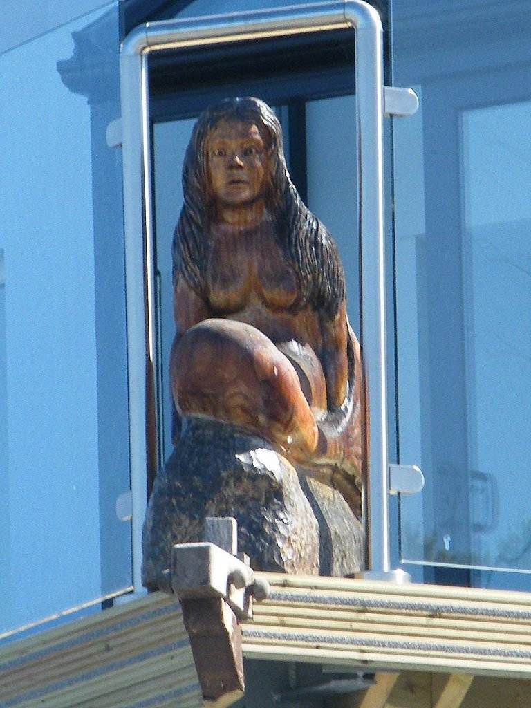
a dolphin. We also noticed a mermaid
sculpture on the corner of a building.
The
road was steep and kept going up and up — it was knackering! We passed a strange plant which was three
times the height of Colin, and I loved the little white flowers by the
roadside. The reason we had to go inland
and uphill was to avoid a Qinetiq site, formerly an outpost of the RAE in
Farnborough. Colin knew about Aberporth
when he worked at the RAE all those years ago, but I didn’t. Why are these government places situated on
the best bits of coast around our country, blocking the view and making us walk
round them?

The notices on the gates and
fences saying “Government Property”
reminded me of the time I worked in the RAE for a year when I first left
school. Every single sheet of the
“bullet-proof” toilet paper in all the toilets had the words “Government Property” written on
it! I used to take reams of it home and
write letters to my friend, Linda, on it.
It amused our teenage minds at the time — but I never dared let my Dad
know, he would have blown a gasket! We
were also warned, at Aberporth, that “images
of trespassers may be recorded”. So
we smiled at the cameras and passed on.
We came
to the end of the Qinetiq fences, and found the coast path at last led off the
road. It went down the side of the fence
for a short distance, then veered off to the left across fields. That’s better! (We hate walking on roads.) We came to a meadow where ladysmocks were
growing — beautiful! Love ladysmocks!
We
walked over to a wood where we crossed a stream on a wooden footbridge with a
rotten panel. It reminded us of Bolivia where
we went trekking in the early 90s, before we started on the
Round-Britain-Walk. Many’s the time when
we took our lives in our hands by crossing a raging torrent in a deep gully on
a rotten wooden bridge! This one wasn’t
exactly life-threatening, but we could have sprained an ankle if we hadn’t seen
it.
It only seemed a little stream where
we crossed it in the woods, but it plunged down an enormous gully a little
further on. We were so glad we were now
on the western side of it — if Qinetiq hadn’t been there and we had been able
to walk along the top of the cliffs from Aberporth, we would have had to come
inland to these woods anyhow in order to cross this stream. The gully was far too deep and steep to cross
otherwise. So perhaps Qinetiq is
forgiven!
We met
two girls with a dog coming the other way.
They were the only people we met between Aberporth and Mwnt, though we
had met loads of hikers between Llangrannog and Aberporth.
We
emerged on to the clifftop path at last.
The geology was fascinating all along, and there was fantastic lighting
in the evening sun. The sun shone
through the wild flowers too — they were prolific and very beautiful in that
light. We sat on a bank to eat our
chocolate.
The
path to Mwnt seemed very long, but perhaps it was just because we were
tired. There were far too many
gullies. We didn’t have to go down too
far into most of them, but we did wish they weren’t there. We came to a seat — the first one we had come
across on all the cliff paths today. So
we had to sit on it even though we
had no more snacks left and very little water.
We didn’t tarry long because we still had nearly two miles to go. The path was sometimes very good allowing us
to walk side by side, but more often than not it was narrow and uneven.
At last
we crossed a gully and went up to the chapel at Mwnt. Mwnt is little more than a chapel, a car park
and a beach. We didn’t go down to the
beach — too many steps in our tired state.
But it looked a lovely place — we must come back sometime.
That ended Walk
no.369, we shall pick up Walk no.370 next time on the clifftop above Mwnt
beach. It was ten to eight, so the Walk
had taken us nine and a half hours. (We
get slower and slower.) We had our tea
and biscuits, then returned to our caravan.


No comments:
Post a Comment