Thursday, July 31, 2008

Walk 187 -- Findochty, via Buckie & Spey Bay, to Kingston on Spey

Ages: Colin was 66 years and 84 days. Rosemary was 63 years and 227 days.
Weather: Cloudy turning sunny. Very warm. Later on heavier cloud came over and a cool wind got up, but it remained dry.
Location: Findochty, via Buckie and Spey Bay, to Kingston on Spey.
Distance: 12 miles.
Total distance: 1624½ miles.
Terrain: Grassy path round golf course, then mainly pavement bashing. We went up on to a gravelled cycle path (old railway embankment) and had a pleasant walk through a forest. Flat.
Tide: Going out.
Rivers: No.135, the Spey between Spey Bay and Garmouth.
Ferries: None.
Piers: None.
Kissing gates: None.
Pubs: None.
‘Historic Scotland’ properties: None.
Ferris wheels: None.
Diversions: None.
How we got there and back: We were staying in a holiday cottage in Gardenstown. With Colin’s bike on the back of the car we drove to Findochty where Colin dropped me off to amuse myself for an hour and a half. He continued to Kingston on Spey where he parked overlooking Spey Bay. He then cycled back to Findochty.
At the end, we finished the Walk at the car. After drinking tea from our flask, we drove back to Findochty to pick up the bike, then on to our cottage in Gardenstown.

We walked the western arm of Findochty Harbour, and looked at the sculpture which overlooks it all. It is of a fisherman looking out to sea, and a plaque quotes from Psalm 107, “These see the works of the Lord and His wonders in the deep”. But the statue itself is rather crude. It looks as if it has been fashioned out of Plaster of Paris, and not finished off!
We climbed up to the War Memorial which is on a hill to the West of Findochty. We had a good view from there. We followed a footpath round the seaward edge of the golf course (not another!), right on the edge of the grassy cliff. Trouble was, it was a trifle overgrown with gorse bushes. Colin wouldn’t go through the gorse, and skirted the bushes on the golf club side. I followed the official path (ow!) but it was very tight. 
When we met up we came across a seat, so we sat down to eat our sandwiches. Then we followed the path which led half way down the cliff and along until it was well past the clubhouse perched on top.
We went through a picnic area, and from then on we had to follow the road. We soon entered Buckie, once we had passed ‘Jonathon’s Bothy’ which looked like someone’s garage! We came across two notices telling us about Buckie. One told us about the plight of the schooner ‘Maria’ which was blown ashore in a gale at Sandend Bay in 1903. 
Buckie lifeboat was called, but it couldn’t launch because of exceptionally low water. So the crew dragged it overland two miles to Strathlene (I think they mean the harbour that is now called Findochty) before putting it in the water and rowing it for five hours in snow and increasing storms to reach Sandend Bay. By that time the schooner was wrecked, but fortunately with no loss of life. The lifeboat was trapped at Portsoy for three days before the sea was calm enough for it to return to Buckie.
The other notice told us a bit of the history of Buckie. It is believed there has been a settlement here since Stone Age times, but as late as 1823 there were only three dwellings to make up the hamlet. Most of the houses were built around 1840 from stones collected from the beach. (Was this anything to do with the Highland ‘Clearances’ which occurred about this time? Crofters were forced out of their homes with great brutality, and many of them settled on the sea coast because they had nowhere else to go.) These were low structures of two rooms apiece, with thatched roofs. In 1843 a wooden harbour was built, but this got washed away six years later. We didn’t find out when the present harbour was built.
We found Buckie to be quite run-down — the ‘Craigenroan Bar’ kind of typified it, it didn’t exactly look inviting to entice you in! The whole town looked as if it had gone to seed. However, we had to smile as four children walked towards us wearing wet-suits with shorts over the top! I asked them if it was the latest fashion, and they smiled shyly and said, “Well, sort of!” I had to take a photograph of them — with their permission, of course.
We didn’t come across any food shops. We were hoping to buy some pies as we had none with us. Colin was hoping for a chippy — he was feeling rather peckish and had set his heart on a bag of chips. His hopes were raised as he thought he saw a chip shop ahead, then dashed when he discovered it was a fresh fish outlet! So we sat on a wall and ate the cinnamon buns I had bought that morning in Findochty (I couldn’t find a pie shop there either).
We decided Buckie was ‘industrial’, and that let us out of walking the harbour walls which would have been long and tedious. But really we couldn’t be bothered — it was muggy and hot, and we were flagging. 
Further on we approached what must have been the original stone fishing harbour, with a gap between high walls. No use now, though, as the harbour area was full of beach stones. 
On top of the high walls were numerous wet-suited children jumping into the old harbour entrance below. It was a terrific height they were jumping from, and they were landing in water only a few yards from the beach. The water seemed to be deep enough for them to do this safely, but I don’t like this new hobby of theirs. It is so dangerous! It is the more nervous children I worry about most, and there were plenty of them about. We could see by their body-language they didn’t really want to be there doing this, but felt they had to so as not to be left out or called a ‘wimp’ or ‘cissy’. What was more frightening was that the few adults about were egging them on! We didn’t feel we could say anything as we would only be rebuffed, so we moved on quickly. I didn’t want to witness the inevitable tragedy!
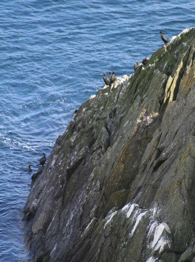
As we walked away from there we saw a curlew fly up with its beautiful curved beak. I think it is one of my favourite birds!
Past Buckie we got fed up with walking along the busy road. So we remembered additional rule no.10 and moved on to the parallel disused railway embankment for the next mile or so. It is a designated cycleway now, and much nicer than the road! We passed through one bridge, then looked over towards the sea as there seemed to be a lot of ‘fuss’ going on over there. Sure enough, there was a colony of seals on the rocks just offshore. We counted them — fifteen! They must be used to people because they didn’t seem at all fazed by all the folk standing close to them, talking excitedly, pointing and taking photographs.
There were lots of wild flowers along the embankment, it really was a treat! As we approached Portgordon we found we were on a level with the rooftops of this village. Then we passed a wooden ‘train’ sculpture full of flowers, and also a ‘well’ sculpture. The embankment then stopped at a road and didn’t continue the other side, so we returned to the shore. On our way we passed a shop selling ice cream — and we were hot — so we bought some, of course. Very nice it was too, we felt a lot better after that.
We continued for about a quarter of a mile along the road next to the shore. We passed a house with sandbags piled in front of the door. I don’t know if they were expecting floods, none of the other houses had them.
The road then turned away from the coast, so we returned to the disused railway-cum-cycle track which is the official coast path. We met a lot of people walking their dogs. I suppose we could have got through to Spey Bay by continuing along the beach, in fact a man we stopped and chatted to told us it was possible. But we were hot and I wanted to walk in the forest which was about a mile away. So we made excuses (like the beach wasn’t actually a path) to stay on the railway line. We watched a young couple, who had overtaken us because they were walking much more quickly, march off down the beach. We stopped feeling guilty about our decision when we saw them marching back!
We strutted merrily along, passing under another bridge. Then we squeezed through a springy stile, the like of which we have only seen before on the partly-restored Wey & Arun Canal near Wisborough Green in Sussex. Once again we were treated to glorious displays of wild flowers, especially rosebay willowherb. We were also observed disdainfully by some pigs!
We came to a bridge which the path didn’t go under, instead it turned to the right. The continuation of the railway line at this point was completely overgrown. Looking on the map we noted that a large gravel pit had been dug just beyond, so to try and continue that way would be impossible. The path led into a small forest where it was very pleasant in the shade. We came across a hay bale, so we sat on it to eat our apples. We followed a lovely path through the trees, and we met nobody. It is also the official cycle route, but Colin (who had cycled it the other way this morning) opined that it was a bit twisty cycling over the roots and missing the trees. Challenging perhaps, but it kept him alert!
We emerged from the forest at Spey Bay, and walked down the road to the end. The Visitor Centre was closed by then, but there were still a few people about. Clouds had come over and a slight wind had got up. It was a bit cooler, and we felt better for it despite our tiredness.
We looked across the wetlands which make up Spey Bay Nature Reserve, and we could see our car parked half a mile away (as the crow flies) across the river. We sat on a seat and ate our chocolate. The River Spey is famous for its salmon fishing — didn’t the Queen Mother used to go fishing in it until she was quite old? There was a fisherman standing in the middle of the river in his waders.
We looked at the pebble pictures and the sculpture, then we started southwards along the river bank, the first mile of the Speyside Way. For the only way we could cross the River Spey was via the railway viaduct, the railway we had previously been walking on which was now a mile inland. The railway used to cross on a spectacular bridge, now restored for the use of cyclists and walkers only. We were very grateful for it — the first road bridge is a further three miles upstream!
As we were crossing we were reminded of the Red Deer River in Sundre, Alberta, Canada where our friends, Anton and Margaret live. 
That river, which passes their house, meanders through pebble beds in much the same way. 
Over the other side of the river we had to walk another half mile before we could get off the railway line on to a road into the village of Garmouth. There is a lane going over the top on a bridge, but we couldn’t see a way to climb up to it. So we had to go the long way.
Finally we walked through Garmouth village, then about a mile along the road to the car which was parked at Kingston on Spey. We were very tired by then. From the car park we could see the Visitor Centre just half a mile across the river, but we’d had to walk three miles to get to our car from there. I suppose we were grateful we could get across the old railway bridge, otherwise it would have been nine miles!

That ended Walk no.187, we shall pick up Walk no.188 next time at Kingston on Spey. It was a quarter to seven, so the Walk had taken us seven and a quarter hours.
Whilst drinking tea from our flask, Colin was playing with a collarless dog, a golden labrador puppy that didn’t seem to be with anybody. It looked very soulful as we drove away, leaving it behind. We drove back to Findochty to pick up the bike, then on to our cottage in Gardenstown.

Wednesday, July 30, 2008

Walk 186 -- Portsoy, via Cullen & Portknockie, to Findochty

Ages: Colin was 66 years and 83 days. Rosemary was 63 years and 226 days.
Weather: Mostly sunny and warm. A pleasant breeze.
Location: Portsoy, via Cullen and Portknockie, to Findochty.
Distance: 12½ miles.
Total distance: 1612½ miles.
Terrain: Some tarmac/concrete, gravel tracks, some pleasant firm sandy beaches with a few rocks to negotiate, but mostly rough paths and easier grass paths. Undulating.
Tide: Going out.
Rivers: No.134, the ‘Burn at Cullen’ in Cullen.
Ferries: None.
Piers: None.
Kissing gates: No.154 as we descended into Sandend.
Pubs: None.
‘Historic Scotland’ properties: None.
Ferris wheels: None.
Diversions: None.
How we got there and back: We were staying in a holiday cottage in Gardenstown. We drove to Findochty where we parked by the harbour. We walked up the hill and caught a bus to Portsoy, where we walked down to the toilet block next to the harbour
At the end, we finished the Walk at the car which was parked half way along the harbour. After drinking tea from our flask, we drove back to Gardenstown.

We started today’s Walk by asking an elderly gentleman to take our photo in front of Portsoy Harbour. We have reached the 1600 mile point, that is we have walked sixteen hundred miles along the coast from Bognor! We tried pictures of us flopped full-length on a bench, but in the end we opted for the one of us sitting together cosy-like — that pose was the old man’s suggestion!
We wandered around the ‘arms’ of the harbour — no children jumping in today — past ‘Portsoy Marble’ and up to the Old Harbour on the western side. There we had to descend using ‘Granny’s teeth’ which was fun. (I’m a granny, but I haven’t got teeth like that!)
         We spoke to a couple of blokes sitting on the headland. They said they had been watching dolphins out at sea, they were leaping out of the water! So we got out our binoculars and little telescope to scour the water far out. Colin reckoned he saw them too, but later he wasn’t so sure. All I saw was a vague splash which could have been anything. I wonder how much of it was wishful thinking? I’m sure there were dolphins out there somewhere, but it’s easy to imagine each white top is a cetacean when you’re desperate to see one!
We left Portsoy on a good path. This took us along the clifftop past lots of fascinating rock formations, birds and flowers. It was very pleasant walking, especially as the sun was shining and the visibility was excellent. We were really enjoying ourselves. 
A notice on a post declared, “We need your help”. It talked about the “Aberdeenshire Core Paths Plan” which can be viewed at the local library, but we didn’t have time to visit that establishment. So I looked it up on the internet, and found the statement, “New path required between Boyne Bay and Whitehills. Agreement in place with landowner.” That is the section where we battled through stinging nettles, thistles, gorse, barbed wire fences and barley fields! So the Council are going to put in a path in order that anyone can enjoy that beautiful stretch of coast. Hooray! Well done Aberdeenshire Council!
 Hope it will be as good as today’s path which we found to be very pleasant to walk. Behind us on the hill were a number of giant modern windmills which had been the backdrop to our struggles across those barley fields. Not doing that again! 
Colin managed to photograph a yellowhammer on a bush, and another brown bird which he couldn’t identify. That is besides all the cormorants and shags hanging on the cliffs.
After a couple of miles we reached a point where we were overlooking Sandend Bay, so we sat down to eat our elevenses — Colin had a ‘stovie’ and I had an apple turnover.
Then we descended to the beach and walked it’s full length along the firm sand. 
It was great to see so many people out enjoying themselves! 
Some children were trying to ‘belly-board’ but the waves were too small for them to succeed. 
I’d rather they did that than jump in the harbour though, much safer.
At Sandend we ascended the cliffs up a narrow rough path with stinging nettles all around us. Colin was having difficulty — now you know why I never wear shorts! But at least there was a path up there, and it didn’t peter out. More flowers, more amazing rocks and another yellowhammer — or perhaps it was the same one following us, who knows? 
We saw a lifeboat come in from the sea and enter an inlet round the next headland. Almost immediately it came out again and buzzed off, so we concluded it was on some kind of exercise. Nothing looked urgent about it.
We came to Findlater Castle where we sat down to eat our sandwiches. There is not much of the castle left, just one or two bits of stone wall built into the original rock. A notice told us it was built in 1455 by Sir Walter Ogilvy, and describes it as “a castle so fortified by the nature of its situation as to seem impregnable”. 
Maybe, but I bet it was draughty too! There were the usual battles over its ownership, family feuds etc, but it ended up back in the hands of the Ogilvy family. In the mid 1600s they abandoned it in favour of a new residence in Cullen. (Perhaps that was less draughty — bet the women of the family had their say in the matter!)
The path was better from thereon, and Colin’s legs had survived the stinging nettles! About half a mile further on it descended to Sunnyside Beach. This is a remote sandy beach with quite a few people enjoying the waves on this warm Summer’s day. 
We were nearing the bottom when we came upon the remains of a fire and a pile of lager cans. Now, it’s fine for people to enjoy themselves, but why can’t they take their rubbish home with them when they go? We met several families coming up, and a couple stopped to chat. The man had a foreign (German?) accent and he was with a young girl who could have been his daughter. 
He was disgusted at the mess and reluctant to leave it there. He fished out a plastic bag and said he would take the cans to a rubbish bin, so Colin helped him clear them up. He would have had to carry them at least a mile to the nearest car park, and then take them on to a town where he could dispose of them properly — what a good-hearted citizen!
Then we descended the last bit of the dunes to the beach. There are rocks alongside this end of the beach, and what amazing rocks they are! They are all twisted this way and that — a lot has happened to them over the millenniums. 
A glance at my Geology map dates them as Dalradian metamorphic rocks, complicated rocks which are difficult to assign to a definite position in the stratigraphical sequence. Beautiful though, even if we don’t know how they got like that!
Further along the sand disappeared, and we entered a ‘forest’ of ferns. They were so tall they almost swallowed up the footpath sign, but the S sign of the ‘North Sea Trail’ was still there, so we knew we were going the right way! (That was the last time we saw that sign.) Even the rocks seemed to be struggling with ferns and gorse, but Colin held his umbrella aloft so I could see my way through!
To my Geologist’s eye, I was convinced we were walking on a raised beach. During the last Ice Age, Scotland and the north of England was covered in ice whereas the south of England was not. This ice was very heavy, and during the thousands of years it was there it weighed down the northern part of the British Isles like a heavy person on one end of a seesaw. After the ice melted, Scotland began to rise up whereas England began to sink in order to restore equilibrium. And it is still doing it! Very slowly, of course. That is why places on the Isle of Wight are sinking into the sea (Blackgang Chine comes to mind) but you will find a lot of raised beaches round northern coasts.
I was sure we were walking on just such a feature. 
There were sea stacks no longer in the sea, and we seemed to be on a kind of platform at the bottom of the cliff which the tide no longer reaches. 
We successfully ‘conquered’ the ferns and left them behind. 
And we couldn’t think of enough superlatives to describe the rocks we were seeing. 
There were climbers all over one rock, and a girl sitting on top of another as if she had just dropped on there from a height. 
I bet our son, Paul, would have climbed them, but that sort of climbing is not for me. I don’t mind a bit of rock-scrambling if it is absolutely necessary, but would rather avoid even that if I can go an easier way.
There used to be no way out to Cullen except by rock-scrambling. Then in 1987, a local young man called Tony Hetherington single-handedly built stone steps into the cliff at the easiest point to get over. Tragically he was killed in a canoeing accident in 1993, shortly after completing this mammoth task. A memorial plaque is set into a cairn at the bottom of the steps, but his real legacy is the staircase itself. Thank you very much, Tony!
We climbed the steps, then the path is very narrow and undulating as it snakes its way round the end of the cliffs.
Both of us remarked that it reminded us of Madeira where we have done a bit of hiking high in the mountains. 
The views were stupendous! 
Eventually we descended to beach level, but we still had another headland to get round before we reached Cullen. 
However the path remained at sea level, and improved as we walked on. As we crossed from Aberdeenshire to Moray, it turned into a track.
And now we had a problem — for our card ‘blob’ maps had run out! They had been produced by Aberdeenshire Council, you see, and only referred to the North Sea Trail in their county. I had tried the ‘Nortrail’ website, but the maps on it were worse than useless. (Might as well draw a wiggly line on a road atlas!) We had tried a Tourist Information Office in the library in Buckie, the first one we could find in Moray. There two ladies tried to be very helpful, but they had never heard of the North Sea Trail! I showed them the ‘blob’ maps we had for Aberdeenshire, and they remarked that Moray Council is “not as rich, and probably can’t afford such things”! They tried to look up maps for us, but they were nowhere near as detailed as the OS maps which we already have and found to be unreliable when it comes to Scottish footpaths. So we are on our own again — planning becomes a guessing game once more!
As we approached Cullen we came across a pet cemetery! I had heard of such places in America, but was very surprised to come across one in northern Scotland. 
It was neat, and nicely set out in beach stones with little memorials to ‘Smudge’, ‘Bruce’, ‘Darkie’ and ‘Milo’ etc. Twee!
We walked into Cullen and arrived at the harbour. There were crowds of people there, all having a wonderful time! There was a real Summer seaside atmosphere about the place on this warm sunny afternoon. 
A group of children, mostly girls, were jumping into the harbour entrance from high walls. That I didn’t like — how can they be sure the water is deep enough where they are jumping? But nobody was telling them not to, in fact the adults around seemed to be encouraging this dangerous sport. 
Nearer the shore, golden sand shelved gently into the water. This is where most of the families were paddling, picnicking, digging holes and building sandcastles. 
It brought back happy childhood memories of seaside holidays! We sat on a bench and ate our apples whilst watching this lovely scene.
We walked all the arms of the harbour, then left Cullen by crossing the river on a footbridge alongside the viaduct of the old railway which used to run aloft from hill to hill across Cullen Bay. 
The railway closed in the 1960s, but the impressive viaduct remains and now has a cycleway running along it. 
But we didn’t walk up there, we walked along the top of another long sandy beach watching the remnants of holidaymakers still enjoying themselves as evening approached.
When the beach came to an end, we had to clamber over a few rocks to find the path which at first stayed low at the bottom of the cliffs. 
Colin was delighted to find a cave, and went off to explore! He came out a little further on next to a rock on which someone had painted the words St DUANE’S DEN !  Next we came across a spring with the water coming out of a spout in a stone wall. Someone had set pebbles into the cement which read JENNY’S WELL
It put me in mind of my friend, Jenny, who died last year from Alzheimer’s. I went on many a hike with her before the illness took hold, and several walking holidays too. I so miss her!
The path took us on, and up a set of concrete steps on to the cliff top.
We passed some of the most spectacular rocks we have seen on this trek — they just seemed to get better and better!
There were several arches.
We watched some kayaks down below, weaving between these amazing rock features. 
Colin wanted to be down there!
We seemed to be slowing up, but eventually we rounded the headland and descended to Portknockie Harbour. Totally a marina, this, there were no fishing boats. A group of children were playing in the evening sun. They were being quite silly, as children often are towards the end of the day, but at least they were being silly in safety. A shallow tidal swimming pool had been constructed inside the harbour, and that is where the majority of the children were playing. 
I was relieved that none of them were jumping off the harbour walls here. 
We sat on a bench and ate our chocolate.
We had to climb up a steep hill to the road to get out of Portknockie as there was no low path leading westwards. We were both tired, but Colin was particularly flagging — I think it was the heat. So we ‘route-marched’ the last 1½ miles along a gravel cycle track with the low sun shining directly in our eyes. We didn’t enjoy this last bit of the Walk, but at least we got there.
As we entered Findochty, we mistook the coastal trail through lack of signposts. Our friendly S sign denoting the ‘Nortrail’ had disappeared as soon as we left Aberdeenshire. However, we found our way through the streets to the harbour. This one did have fishing boats in it, and was a much larger harbour than any of the others we had passed through today. We walked the eastern arms until we came to our car which was parked pretty centrally.

That ended Walk no.186, we shall pick up Walk no.187 at Findochty Harbour. It was a quarter to seven, so the Walk had taken us nine and a quarter hours. After drinking tea from our flask, we drove back to Gardenstown.
This has been a very enjoyable Walk — one of the best!