Wednesday, April 17, 2013

Walk 320 -- Fleetwood to Blackpool

Ages:  Colin was 70 years and 344 days.  Rosemary was 68 years and 121 days.
Weather:  Dull grey.  Strong winds straight in our faces.
Location:  Fleetwood to Blackpool.
Distance:  6 miles.
Total distance:  3279 miles.
Terrain:  Mostly concrete.  Bit of sandy beach.  Flat.
Tide:  Coming in.
Rivers: None.
Ferries:  None.
Piers:  None.
Kissing gates:  None.
Pubs:  None.
‘English Heritage’ properties:  None.
Ferris wheels:  None.
Diversions:  None.
How we got there and back:  We were staying in our caravan in Blackpool.  This morning we drove to Starr Gate on Blackpool South Shore, parked and caught a tram to Fleetwood.
At the end we gave up at Norbreck because of the wind.  We caught a tram back to Starr Gate and drove back to our caravan.  That evening our awning blew down in the wind, and we completely lost heart.  So the next day we drove home to Malvern.

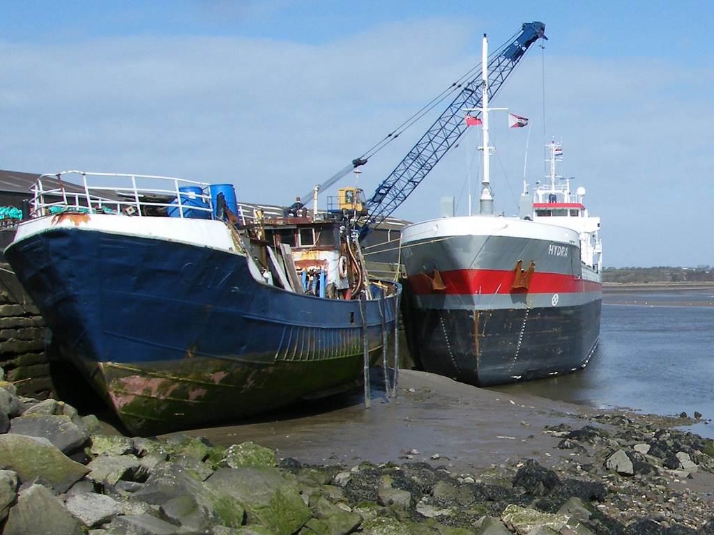
After we got off the tram we walked to the ferry and took photos of it.  It was unbelievably windy, so we quickly repaired to a nearby café where we tucked into beef & onion barms — delicious!  It took quite a bit of courage to go outside again and continue our Walk.  We were glad of our ‘Radar’ keys, all the toilets in the area were 20p a go.
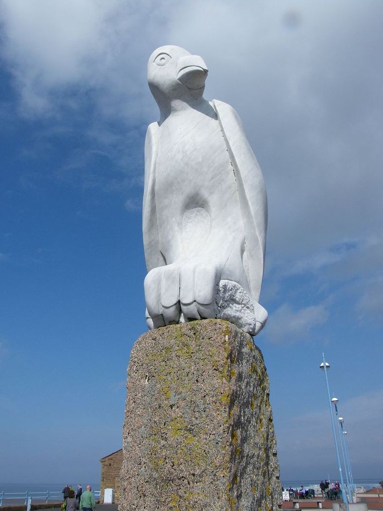
Our entire Walk today was along a concrete prom, southwards towards Blackpool.  There 
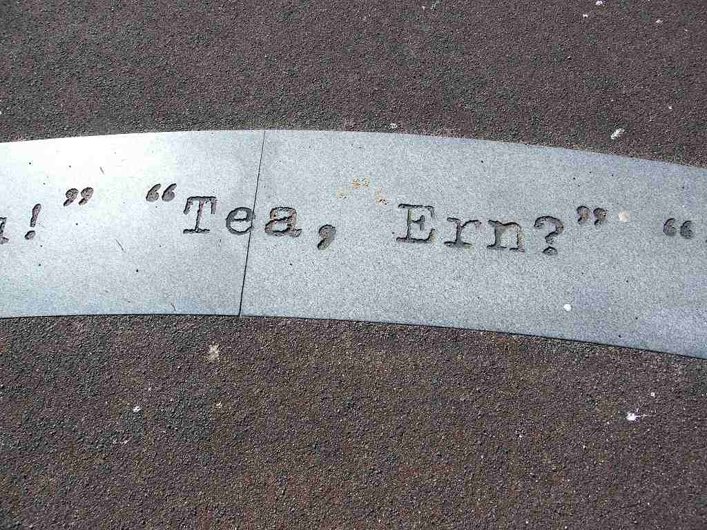
were lots of sculptures on the prom in Fleetwood, some of them memorials.
There was a column with a tiny balcony at the top — was it an old lighthouse?
There was a memorial to the seven men who died in a helicopter accident in Morecambe Bay just after Christmas 2006.
There was a memorial to forty-two ships which didn’t come back from fishing trips over the last hundred years.  All are named and dated, the places where they were fishing when they got into trouble, and the number of hands lost in each case.  This memorial depicts equipment from a trawler, and has fish pictures in the ground in front of it.
And there was a beautiful sculpture of a mother with two children and the family dog welcoming the father of the family home from a fishing trip.
Further on there was an old Victorian water fountain, a memorial bench with bunches of flowers on it, and a look-out tower.
The beach was sandy and looked as if it had been combed.  We went down on to it because sand is kinder to the feet than concrete.  It was firm underfoot to start with, but we had to go back on to the prom when we began to round the corner because the beach got too stony.
We were walking into the wind which was very strong and causing us difficulties.  We think it is often like that on this coast because the children’s playground is tucked away behind a sheltering hedge, not exposed on the seafront.  There were lots of inland ponds — this coast is very flat and probably prone to flooding.  We watched a large ferry, called Steampacket.com, pass just out from the beach — was it going to Ireland?
We were at the southern end of Morecambe Bay.  There were warning signs about the dangers of swimming off this beach because, for people coming the other way, it was the beginning of the dangerous sands.  We were only 12 miles from Barrow-in-Furness as the crow flies, but we had walked more than 70 miles to skirt around the edge of Morecambe Bay.
As we continued we could see how the beach was different, no longer sands to infinity at low tide.
The wind was intense, it seemed even more so now that we had rounded the corner and were walking due south.  Colin tried walking backwards a few yards, and reckoned he could walk three times faster with the wind on his back!  It was just concrete, concrete, concrete — no shelter from the incessant wind.  We even passed warning signs advising us not to walk along the prom in stormy conditions at high tide, so they must be used to such conditions around here.  At last we found some concrete blocks, and sat behind one on a concrete wall where it wasn’t quite so windy, to eat our sarnies.
We carried on, but we were not enjoying it because of the wind.  The sea looked angry, singularly uninviting.  We thought it a horrible bit of coastline!
We came to Cleveleys where there were even more concrete wonders — curly steps and extraordinary lampposts.  I much prefer a natural world with trees and greenery.
We passed another memorial in memory of ships wrecked along the Flyde coast — all were named, and we could see the sea through a porthole.  I liked it, different to most memorials.
We were both finding it very hard going.  Further on we sat on some steps which were partially sheltered, and reassessed.  Whilst tramping along, I had been planning in my head how to readjust the Walks because I was done in and didn’t want to continue in these conditions.  The wind had sapped all my energy, and Colin was finding it difficult too.  So we walked on to the nearest tram stop, which was Norbreck, and called a halt.

That ended Walk no.320, we shall pick up Walk no.321 at Norbreck tram stop, Blackpool.   It was twenty past three, so the Walk had taken us four hours, twenty minutes.  We caught a tram back to Starr Gate and drove back to our caravan.
In the evening the wind got even worse.  Our awning was strengthened with 'storm guys' — huge chunky pegs holding down strong thick straps which were fastened with cheap plastic buckles....one of which snapped!  Pegs all along the front quickly became unpegged, but when the centre pole detached itself I was standing by it, fortunately.  I was able to grab it before it did any damage.  So we had to get the whole awning down in a hurry in a force 10 gale!  (It was 10 o'clock at night, by the way, and pitch dark!)  We worked as a team and did it very calmly even though it was a bit frantic at times.  Another fortunate thing was that it didn't rain during the whole procedure because we didn't have time to 'rescue' things like the toaster and microwave, which we keep on a table in the awning, until after the whole extremely heavy canvas had been bundled unceremoniously into the car.  The caravan shook most of the night, even though we were on a sheltered site more than two miles from the seafront!  No damage to the awning, thank goodness, except for that stupid plastic buckle which will be replaced with something much more appropriate for a 'storm' guy!  The awning cost us over £300 just a year ago and is just out of guarantee, of course.  One other caravanner on the site wasn't so lucky — his awning ripped before he could get it down.
The next day we didn’t feel like putting the awning up again, especially as the wind was still very strong.  In fact we didn’t feel like doing anything at all.  I was completely drained of energy, I think I was in a state of shock.  So we folded the awning — with difficulty because it was still very windy.  Then we packed everything up and drove home to Malvern.

Monday, April 15, 2013

Walk 319 -- Glasson to Fleetwood

Ages:  Colin was 70 years and 342 days.  Rosemary was 68 years and 119 days.
Weather:  Sunny and warm, but a strong wind which made us feel cold.
Location:  Glasson to Fleetwood.
Distance:  14 miles.
Total distance:  3273 miles.
Terrain:  Lots of concrete.  Lots of tracks (but none muddy!)  Lovely sea-bank.  One barbed wire fence.  Nearly all flat.
Tide:  Out, coming in.
Rivers: No.395, River Wyre.
Ferries:  No.23 across the Wyre from Knott End-on-Sea to Fleetwood.  Fare £1.50 each.
Piers:  None.
Kissing gates:  Nos. 404, 405 & 406 between Glasson and Cockerham.
Pubs:  None.
‘English Heritage’ properties:  None.
Ferris wheels:  None.
Diversions:  None.
How we got there and back:  We were staying in our caravan in Blackpool.  This morning we drove to Knott End-on-Sea, parked near the ferry terminal and caught a bus to Glasson.
At the end we finished the Walk at Knott-End-on-Sea at the ferry terminal — we pretended the ferry over to Fleetwood.  Our car was parked nearby.  After partaking of tea and chocolate biscuits, we drove back to our caravan in Blackpool.

We were lucky enough to do this entire Walk in sunshine, though we could have done with less wind which was so strong it was difficult to stand upright in exposed places!  We began in Glasson — still a busy port these days, though small.  We were not allowed into the docks, and we couldn’t see Bazil Point or Ferry Cottage on the other side of the River Lune because there was a ship in the way.  We bought delicious pasties at the village shop, and managed to find a bench in a relatively sheltered place on which to sit and eat them while they were still hot.
We started the Walk on the bridge over the Lancaster Canal.  We climbed a short hill, the only hill on today’s Walk, from the top of which there were far-reaching views.  To the north we could see Bazil Point and Ferry Cottage where we were in the rain at the end of the last Walk.
To the east we could see Lancaster University where our son, Paul, did his first degree — he got a ‘First’ in Chemistry when he was only 20.  (Four years later he gained a PhD at Leeds.)  Help!  It is 22 years since Paul was in his last term at Lancaster — can we really be that old?  At the beginning of that final year, he and his caving/climbing friends abseiled down the tower block in the middle of the university complex to show off to the ‘Freshers’.  (Sssh!  They also went sewer-lunking underneath the University buildings, but don’t tell anyone because they were not supposed to be there!) 
We passed some celandines on a bank as we descended — we always look out for these bright cheery flowers as a harbinger of Spring, which is very late this year.  We crossed several fields to a farm on the coast where there was a ram’s head on the wall above the door.
One footpath signpost had an extra notice warning us there were free range children and animals about, so please drive slowly.  Another footpath signpost was sited next to what looked like a bomb from the Second World War.
The coast path was well signposted and mostly tarmac.  Visibility was very good — we could clearly see Sunderland Point, where Sambo’s grave is sited, and Heysham nuclear power station behind us.  A notice on the edge of the marsh told us of local concern about plans to leave the sea defences to the mercies of the ocean, eventually abandoning the whole area — including houses, caravan sites, agricultural land and the ruins of Cockersands Abbey — to the waves.  The notice was dated 2010 — three years ago!  Yet it didn’t look as if the sea had encroached even the marshland in front of us, let alone the fields behind.  Another notice warned us that “armed trespassers will be prosecuted” and informed us that shooting is prohibited in Lancs on Christmas Day.  It’s useful to know these things.
In the background to all our views stood Plover Scar Lighthouse, a small lighthouse at the mouth of the River Lune placed there in 1847 to guide ships safely into the river channel.  It is automatic now, of course, as they all are.  The path turned into grass but it was solid, even and quite pleasant to walk on.
Round a bend we came across the sparse remains of Cockersands Abbey.  This began as a hermitage in the 12th century by Hugh Garth a ‘hermit of great perfection’.  Within a few years it was taken over by monks of the Premonstratension Order (never heard of them) who built the abbey.  From what we could work out from the plan on the door of the one remaining building, most of the area on which the abbey was built is now in the sea.  It was surrendered to the King’s Commissioners at the Reformation and left to go to ruin.  Only the semi-octagonal chapter house remains because it was used by the Dalton family of Thurnham Hall as a burial place.  We couldn’t get inside it.
It was very windy there, and cold despite the sun.  So we moved on quickly round the next bend.  There we found an old barn where we could sit on the windowsill out of the wind and eat our sarnies.  We carried on past several caravan sites and a lot of marshes.  There were loads of sheep about, and occasionally we found we were unintentionally ‘herding’ them.  It reminded us of when we walked round the seemingly endless Essex marshes near the beginning of this Trek — Golly!  that was ten years ago! 
We were feeling tired by then, the wind didn’t help with our walking.  We wore our kags just to keep warm, they made good windshields.  Eventually the path took us along the bottom of a bank to the road.  There we sat on some wood to rest, drink some water and don our high-viz waistcoats.  We had three miles of road-walking to do, and it was deadly!  We stopped on a bridge about halfway for another rest.  Colin went off at a tangent to change his pad, but it was difficult to find somewhere out of sight because the whole area was open.  In the end he crouched behind a wall — keeping his dignity is very difficult for him at the moment.
At last we were able to turn off on to a minor road, and after a few yards we came to a car park.  A path led us through trees to a lovely picnic area sheltered from the wind and decorated with daffodils all round.  Some colourful chickens wandered past, pecking at the ground, while we sat there and ate our chocolate.  It was lovely to relax a bit in such a pleasant spot, well away from the traffic after that dreadful three-mile road stomp.
Our map told us that the Coastal Way took us for the next couple of miles along the minor road through the village of Pilling.  But we noticed that there was a stile up on the sea bank by the picnic site.  A notice attached to the stile told us that there was no public access between 26th December and Good Friday.  It didn’t explain why, so I looked it up on the internet — apparently it is to protect over-wintering birds and livestock during the nesting and lambing season.  I also found out that the embankment was built in 1981 to protect the village of Pilling which had been prone to flooding up until then.
Well, Easter was early this year, and Good Friday had long since past.  It was lovely walking up there — a wide, firm, grassy path, and it was a short cut, off the road missing out Pilling altogether.  On the second stile we passed were Coastal Way stickers — now they tell us, for there had been none on the first.  We passed several gates along the length of the sea bank, all of which we could walk round — we didn’t even have to open them.
We had an excellent view of Lancaster University from there, better than the view we had further back.  As we by-passed the village we could see Pilling church, and an old fashioned windmill which was minus its sails.
I was ahead of Colin, and didn’t notice that at one of the gates the Coastal Way path was signposted to go down the landward side of the bank and across some fields to the road.  I carried on along the top of the bank, lost in my own dream world.
Colin caught me up just as I reached a barbed wire fence barring my way, and explained where I had gone wrong.  We were both reluctant to go back, we couldn’t see why we were not permitted to go the last quarter of a mile on the bank.  What possible harm could we do walking along there?  It looked as though people before us had gone down the seaward side on to the marsh — they had worn a bit of a path.  But the barbed wire fence continued across the marsh all the way to a deep ditch.  Looking more closely, we realised that our predecessors had stepped through the fence at a point where the wires were loose.  So we did the same, holding the strands apart for each other.  I was a little apprehensive about not being able to get through at the further end of the sea bank, but when we saw people out playing with their children and walking their dogs on the marsh next to us we realised that the barbed wire fence had been put there to stop people walking towards Glasson, not away from it like we were.  Why?  Why not open it all up and make life simpler?  So there was no ‘other end’ to cause a problem.
The marsh gradually became sandier.  We sat on a rock to eat our apples.  Nearby was the remains of a fire on which someone had tried unsuccessfully to burn a painting easel and a Christmas tree.  We came to a car park, and since the beach was getting rockier by the minute we went up there to walk on the official coastal path which was tarmacked from that point all the way to the end of the Walk.  The trouble was — we were walking due west into the setting sun which was very bright.  We could barely see where we were going, and it was terrible light for photography.
To our right was a rocky marshy beach, not good for walking, further out it looked as if it could be muddy.
People’s back gardens were down on our left, protected from stormy seas by the sea bank on which we were walking.  We passed a garden where chickens were kept, and among them was an ostrich-type bird, we think it was a cassowary.  It looked quite superior, as if it was ruling the chickens.
Another garden was festooned with forsythia bushes in brilliant flower — Spring is here at last!
Out on the sands we saw horses running, perhaps it wasn’t that muddy after all.  We also passed some children playing on the marsh — not much of a beach for them, but they seemed to be enjoying themselves as children do.
We walked through Knott End-on –Sea, where our car was parked, and eventually came to the ferry slipway.  The last ferry of the day across the River Wyre had already left, we could see it approaching Fleet wood on the other side.  But we had no intention of catching it because the logistics of using the ferry were too great.  As usual, we pretended instead.  We walked out to the end of the slipway, and the ferry seemed to turn round as if it was coming back for us.  So we turned round and exited the slipway as fast as we could so that they didn’t have a wasted journey.

That ended Walk no.319, we shall pick up Walk no.320 in Fleetwood over the River Wyre.   It was six o’clock, so the Walk had taken us seven hours, five minutes.    Our car was parked nearby.  After partaking of tea and chocolate biscuits, we drove back to our caravan in Blackpool.

Saturday, April 13, 2013

Walk 318 -- Morecambe to Glasson

Ages:  Colin was 70 years and 340 days.  Rosemary was 68 years and 117 days.
Weather:  Sunny at first.  Clouding over, and eventually it rained.  Cold wind.
Location:  Morecambe to Glasson.
Distance:  12 miles.
Total distance:  3259 miles.
Terrain:  A lot of concrete.  Muddy tracks.  A causeway.  A little beach.  Nearly all flat.
Tide:  Out.  Then coming in.
Rivers: No.394, River Lune.
Ferries:  There was once a ferry across the Lune to Glasson from Bazil Point, so we pretended.
Piers:  None.
Kissing gates:  No. 403 near Heysham.
Pubs:  None.
‘English Heritage’ properties:  None.
Ferris wheels:  None.
Diversions:  None.
How we got there and back:  We were staying in our caravan in Blackpool.  This morning we drove to the village of Overton where we parked by the village hall.  From there we caught a bus to Morecambe where we walked from the bus station to the point on the seafront where we finished the last Walk.
At the end we finished the Walk at Bazil Point, by ‘Ferry House’ which is opposite the little port of Glasson.  From there we walked three quarters of a mile to Overton where our car was parked.  After partaking of tea and chocolate biscuits, we drove back to our caravan in Blackpool.

We started today’s Walk in brilliant sunshine, which made a nice change.  But it was not to last, so we made good use of it while we could.  On our way from Morecambe Station to the starting point, we bought freshly cooked pasties and stopped in a seafront garden to eat them while they were still warm.  The pasties were delicious, and we watched a beautiful small tortoiseshell butterfly fluttering on some newly planted flowers nearby.
We started the Walk at the exact point on Morecambe seafront where we had parked the car last time.  It was a lovely sunny morning, but the breeze was a tad cold.  We walked southwards along the prom.  We passed a harbour area with boats stranded on the sand because the tide was out.
The beach was sandier and much more pleasant than the mudflats we had passed further back.  We passed a sculpture of the Lake District — the mountains we could see in the distance with all their names.  We were disgusted to find that the clock tower public toilets were not free, and did not have a disabled toilet which we could open with our ‘Radar’ keys.  Going to the toilet is such a basic need, and it is very difficult in towns with no handy bushes available.  It should be the law that all towns provide public toilets which are clean, open and free!.......(but don’t get me started!)  Fortunately neither of us needed to go at this point.

There were decorations all over the prom — sand ripples, shells, starfish, etc.  There were people feeding white bread to seagulls — are they so ignorant?  I wish they wouldn’t, the birds become such a nuisance and the junk food they are fed is not very nutritious so they get out of condition, and lazy too.  They were certainly making a lot of noise and mess on the prom just there.  These birds need to look for their own wild food if they are to remain healthy.  They are intelligent opportunists, I cannot see them ever going hungry.
It seems that Morecambe is trying to pull itself out of its reputation for being a ‘has-been’ resort, and I commend them for that.  (Wish Bognor would take note…….)  But be warned, Morecambe, people won’t come if they can’t go to the toilet conveniently and without having to pay!
But then Morecambe has the accolade given to it by Eric Morecambe, the popular comedian who died onstage in 1984.  He is best remembered for his ‘Morecambe & Wise’ TV shows which became an unmissable Christmas tradition in the late seventies and early eighties.  He only had to walk on stage and everybody started laughing, there was just something ridiculous and lovable about the man.  Born Eric Bartholomew, he took the stage name Eric Morecambe because he liked the resort so much.  After his death, a metal statue of him doing the little dance with which he always ended his shows was erected on Morecambe seafront.
When we came upon this tribute, we immediately burst into laughter at his memory.  We asked a passerby to take a picture of us doing his little dance each side of the statue.  Then we took a photo of this same gentleman on his phone doing the dance so he could show his friends.  He said he had never thought of doing this before, but he was giggling away too.  As was everybody all about — and complete strangers talking and joking with each other.  It seems the magic of Eric Morecambe lives on, even more than a quarter of a century after his untimely death.
Some of the infamous Morecambe & Wise jokes were printed on the steps leading up to the memorial, jokes like: “Tea, Ern?”  “The one with the short fat hairy legs!” and the words of their signature song “Bring me sunshine….”  We got talking to a lady in a wheelchair and her daughter, and ended up taking a photo on their phone of them doing the dance.  Everyone about was talking and laughing, there was a great feeling of friendship and well-being.  We were reluctant to leave.
But leave we had to, we still had a good many miles to cover.  We passed lots of wire bird sculptures which we really liked, and bird silhouettes all along the fences.  We noted that the beach had turned into unfriendly mud again with deep channels, and wondered whether the sand we had seen further back had been imported from somewhere else.
We walked on to a stone pier, at the end of which were lots of rocks which had been put in place to keep the beach and the pier in place.  There is a lighthouse on this pier, a bit inconspicuous at the end of the café building.
We passed a statue of a grumpy bird, and a rather nice sculpture of cormorants on a rock was nearby.  There was a hopscotch pitch (how I loved to play that game as a child!) which was surrounded by eggs, at least we think they were eggs but couldn’t think why they were there.  A complete stranger came up to me and said, “Oh!  I saw you back at the Eric Morecambe statue!” and we both burst out laughing for no reason.  I’m convinced that memorial has magical properties — perhaps the world’s leaders ought to hold their conferences there!
We continued along the prom, passing the magnificent old station building which is now a pub.  (The present station building is just a row of huts.)  We passed a ‘Polo’ tower, a spinnaker sculpture, and a memorial to a champion swimmer.  We also passed the ‘Clifton Hotel’ — Clifton is my maiden name, but I don’t have any connections with this establishment apart from sharing the name.  And an innovative children’s playground which was being much enjoyed by several families.  (How I would have loved such a playground as a child!  But then my playground was the fields, hedgerows and woods near where I lived, and I was allowed to roam freely making my own fun with my brothers and friends — so perhaps I was the lucky one after all.)
The visibility was improving all the time — we could now see Grange-over-Sands much more clearly over the bay, and also the Lake District mountains which we could just about make out on the horizon behind us.  The beach got sandier again, so we decided to walk down on to it amongst the playing children.  The sand ripples we ended up walking over were like a trellis, a lovely piece of art worked by nature!
Ahead we could see a ferry in Heysham Port — ferries run from the Isle of Man and Belfast to there.  After passing a man with a metal detector, we found a bench out of the wind to sit on and eat our sarnies.  The trouble was, we were joined by several dogs who wanted a share — but they didn’t get any ’cos we’re mean!  The views from our lunchstop were magnificent, but we did note it was beginning to cloud over.
We walked on to Heysham where the long concrete prom finally came to an end.  We couldn’t find the continuation of the coast path, it turned out it went behind the church, not in front of it as marked on the map.  But our only option seemed to be to climb a little hill on a road.  Two people in disabled buggies were lining up at the bottom of this road ready for the “off” because it was quite steep.  We joked with them and asked them to tow us up!  They just about made it to the top (without us tagging on behind).
There we found Heysham Church, a lovely old church which was very interesting.  The chancel dates back to the 14th century, but this sandstone rubble church was built on the site of a much older Saxon church.  Inside is a Viking stone, and in the churchyard stands the remains of a Saxon Cross.
It was ages since we had passed a toilet, and Colin was desperate to change his pad.  There was nowhere here, so he said he would go and seek a private place “in the woods somewhere”.  I stayed in the church, partially listening to a man who was showing a group of people round and seemed to know a lot about it.  After a few minutes they dispersed, and the group leader said he wished to lock up now.  So I had to wait for Colin out in the churchyard (I’d no idea where he’d gone) and he missed out on viewing inside the church.  He was a bit put out by that when he eventually came back, but at least he was comfortable now.
We walked uphill to the ruins of a much older church, the chapel of St Patrick dates back to the 8th century.  There was the same group listening intently to their leader who was explaining the history of the rock-cut graves which are believed to be even older than the ruined chapel.  Their origin, and the reason why they are there on the clifftop, is lost in the mists of time.  We were all diverted by a young boy who had climbed up on to the ruined wall to show off.  He was told by the group leader to get down before he did any damage, but then found he couldn’t.  He tried several ways, but he was too high and he began to get scared.  Eventually he was helped down, a little shocked, and hopefully he had learned a lesson or two about climbing and anti-social behaviour.  I think he got his comeuppance!
We walked out to the Head, then down to the nuclear power station which we bypassed on dull roads.  We turned into a vast caravan site, it seemed the only way we could go at the end of a long lane.  On the map the path through there was vague, and there was no sign of it whatsoever on the ground.  We traipsed past caravan after caravan hoping we would be able to get out at the other end, but there seemed to be a fence surrounding the whole park.  We were dreading having to retrace our steps to the entrance — and then what?  But two youths on bikes unintentionally showed us the way out.  They passed us, then turned to cycle between two of the caravans.  We followed them and found, hidden away behind one of the vans, that the fence had been broken down at the corner.  The youths had long since gone, and we were able to step out on to the public footpath once again.  We had no idea where we had lost it, but we were very relieved that it was now found!
Ahead of us was supposed to be a holiday park with rows of chalets, according to the map.  When we looked more closely at the undergrowth we discovered that such an establishment had been there but was completely demolished, obviously yonks ago.  We followed the path out to a road, but not before Colin felt an urgent need to adjust his pad.  So I emerged on to the road by myself to wait for him.  A man came down the road and told me helpfully, “There’s a pub just round the corner!”  So there was, but it was not our kind of place — no real ale, no character, too much disco music and football.
About a mile down the road it started to rain — oh dear!  We were passed by two kids on bikes who yelled cheekily, “Look at those two!  Would you like a bike?”  Colin replied, “Yes, I’ll have yours!” and made towards them.  They sped off!
We came to a car park, and then we were out in the open of the marshes.  The rain intensified — it was miserable!  We used the hedge of a private caravan park for shelter from the wind so we could eat our apples and don our full wet-weather gear.  A couple came out of the gate with their dog while we were there and passed the time of day.  We strode out across the marsh paying no attention to the horrible weather.  The path was good at first, but inevitably it deteriorated.  But we got to our destination — a place marked “Sambo’s Grave” on the map.  This is Sambo’s story:—
He is believed to have arrived in the hamlet of Sunderland around 1736 on a ship from the West Indies — at that time Sunderland was used as a port for ships too large to sail up the River Lune to the port of Lancaster.  It is not known how old Sambo was, but he was probably still a child.  He was the captain’s servant, and he was placed in the inn with his board paid until his ship was ready to sail again.  His master went off on his own business, and Sambo was unable to speak or understand English.  He thought he had been abandoned, I can only imagine how lonely and frightened he must have felt being left in this cold, damp and murky place far from any kind of life or climate he had known before.  He pined for his master and refused to eat even though the local people tried to be kind to the terrified boy.  Soon he grew weak, and inevitably died.  (Another theory is that he caught the flu, having no immunity to the disease, and that was the cause of his death.)  The other sailors, who were around the village, felt sorry for the boy and wanted to give him a decent burial.  But Sambo was not a Christian so he couldn’t be buried in consecrated ground.  And the sailors had no money to buy a coffin.  So they dug a grave in a rabbit warren nearby, and buried poor Sambo in just the clothes he was wearing.
Forward about sixty years — Glasson Dock had opened, and Sunderland ceased to be a port.  It became a bit of a holiday destination instead.  A certain James Watson heard the story of Sambo, and raised money for a memorial which took the form of a plaque placed on the hitherto unmarked grave.  Despite being the brother of a prominent slave trader, James Watson wrote the following epitaph on the plaque (the spelling is 18th century!)
Here lies
Poor Samboo
A faithfull Negro
Who
(Attending his Maſter from the Weſt Indies)
Died on his Arrival at Sunderland
Full sixty Years the angry Winter's Wave
  Has thundering daſhd this bleak & barren Shore
Since Sambo's Head laid in this lonely Grave
  Lies still & ne'er will hear their turmoil more.

Full many a Sandbird chirps upon the Sod
  And many a Moonlight Elfin round him trips
Full many a Summer's Sunbeam warms the Clod
  And many a teeming Cloud upon him drips.

But still he sleeps  till the awakening Sounds
  Of the Archangel's Trump new Life impart
Then the Great Judge his Approbation founds
  Not on Man's Color but his Worth of Heart

James Watſon Scr.               H.Bell del. 1796

When we arrived at this bleak and godforsaken place, it was raining hard from a slate-grey sky.  The plaque had been there so long it was illegible — I got the text off the internet.  But we were intrigued by the story, and struck by how well cared for the grave and its surroundings were.  For over two hundred years, the local people, especially the children, have kept the area tidy, turned it into a garden and decorated the grave with painted beach stones. They have written prayers and venerated the area as if it was holy.  I think everybody empathises with the dreadful loneliness Sambo must have felt, and ever since have been trying to say they are sorry. 
(As for the few people who write on the internet that this story is ‘racist’ I have only this to say — you can’t change history!  The slave trade was at its height in the early 18th century, and at that time all black people were called ‘Sambo’.  What’s wrong with the name anyway?  Little Black Sambo, in the children’s tale, was a hero because he defeated the tiger — and he ate an awful lot of pancakes!  Go and visit Sambo’s grave.  Leave a prayer on a painted stone.  Experience the spirituality of the place and put aside your misplaced prejudices.  It happened.  Be thankful it wasn’t you.) 
Despite the rain, we felt a deep serenity in Sambo’s garden.  May he rest in peace.  We took a couple of photos from under an umbrella, then found a bench which was partly under a bush nearby.  We sat on it to eat our chocolate, but it was a bit wet despite the shelter of the bush.
We decided not to walk round the end of this little peninsula because there wasn’t an official path, and we were wet, tired and cold.  Instead we backtracked a few yards along the beach so we could take a footpath which cut through to the hamlet of Sunderland.  At the other end we met some cyclists who asked us the way to Sambo’s grave.  They looked really wet — people don’t seem to know how to dress for rain these days.
We continued out on to the causeway, the only way the residents of Sunderland can reach their homes by road.  It felt like an adventure!  It was about a mile across the marsh to Overton and it was very bleak in this wet murky weather.  We were relieved the tide wasn’t covering the road which was sandy, and slippery in places.
At the other side we did not walk into the village of Overton (where our car was parked) straight away.  We followed a track along the edge of the marsh to Bazil Point, from where a ferry used to run to Glasson on the other side of the River Lune.  (It was signposted “Bazil Poinit”!)  A car arrived at the end of the causeway about the same time as we did.  The driver got out and took two quad bikes off the trailer he was towing.  We were a little way along the muddy track when these two quad bikes passed us — two adults and three children clutching on for dear life.  That made a mess of the path!  They came back very soon, we got the impression the bumps and mud were a bit too much for the children.
We struggled on through some very boggy patches, but at Bazil Point we came out on to a stony beach.  I felt good, but Colin was tired, irritable and fed up.  (At the end of the last Walk our moods had been the other way round.)  We continued walking on this beach until we came to “Ferry Cottage” — too new to be the original, but it’s very name indicated that there was once a ferry across the River Lune to Glasson which we could just about see in the murk.

That ended Walk no.318, we shall pick up Walk no.319 in the tiny port of Glasson on the River Lune.   It was twenty-five past five, so the Walk had taken us seven and a half hours.  We walked up the rough road leading from the cottage three quarters of a mile into Overton where our car was parked.  After partaking of tea and chocolate biscuits, we drove back to our caravan in Blackpool.