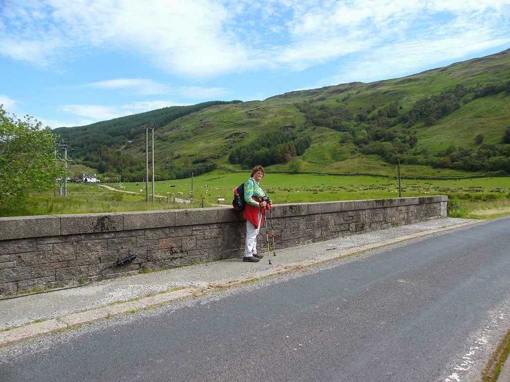
Ages: Colin was 69 years and 59 days. Rosemary was 66 years and 201 days.
Weather: Heavy rain at first. It did dry up, but it remained very grey with
the occasional spitting. Only at the
very end of the Walk did it turn fine.
Location: Dunoon, via McInroy’s Point, to Largs.
Distance: 17 miles, 2½ of which were ferry.
Total
distance: 2700 miles. (Three fifths of the entire journey!)
Terrain: A lot of
road-walking with much car-dodging. Near
the beginning of the Walk we took a nice path which diverted from the road for
a couple of miles. Flat.
Tide: Coming in.
Rivers: No.328,
Firth of Clyde. No.329, Kip Water. No.330, Kelly Burn. No.331, Skelmorlie Water. No. 332, Noddsdale Water.
Ferries: No.22, across the Clyde
from Hunter’s Quay to McInroy’s Point.
Fare £4.00 each.
Piers: None.
Kissing
gates: None.
Pubs: ‘Charley Smith’s’ in Largs where Colin
enjoyed Houston’s
‘Tartan Terror’ (the only real ale they had on) and I had a shandy.
‘Historic Scotland’ properties: None.
Ferris wheels: None.
Diversions: None.
How we got there and
back: We were touring south-west Scotland
with our caravan. Yesterday we moved the
’van from Dunoon to Prestwick, using the ferry
from Hunter’s Quay to McInroy’s Point.
This morning we drove to Largs in sheeting rain, parked near the pier in
pelting rain, caught the 10am bus to McInroy’s Point where we alighted in
driving rain. We must be mad!
At the end it had stopped
raining! We finished the Walk by the
pier and went to the pub which was nearby.
Then we returned to the car and had our tea and biscuits before driving
back to Prestwick.
We didn’t much like our
caravan site at the end of Prestwick
Airport’s runway. We made enquiries at a much nicer site in Ayr, but they were fully booked for the coming
weekend. We then realised just how tired
we were, so we decided to go home the following day. The journey was 130 miles less than the
journey coming up — we’re getting nearer to home!
We crossed the Firth of Clyde on the ferry yesterday,
towing our caravan to Prestwick which is now
our base. So today’s Walk was only
fourteen miles of actual walking, from McInroy’s Point on the outskirts of
Gourock to Largs. It was very wet this
morning, particularly as we began the Walk, so photos are a bit intermittent.
We took the first few pictures through the window of
the ferry terminal building where we had alighted from the bus. Then we braved the elements and walked along
the pavement in a downpour. About a mile
down the road we came to a bus shelter, so we sat in there to eat our
pies. The rain started to ease off, and
eventually stopped — well, more or less.
We turned a corner and passed a small
lighthouse. Approximately half a mile
further on we were able to turn off the road on to a cyclepath — what a
relief! It was lined with trees, and
they made a very pretty frame as we looked out across the Firth of Clyde towards
Dunoon.
We came to a large and pleasant picnic area, but
were shocked to discover that the robust wooden picnic tables had been ruined
by disposable barbecues. This was
despite the fact that each table had a fireproof plate at one end on which to
put such a barbecue. The damage had obviously
been done deliberately. I can never
understand vandalism of this type, what do the perpetrators get out of it?
We were grateful for the portaloos which were
clean and in good order, then we continued along the cyclepath which clung to
the coast around a muddy bay.
We passed a shack nestling on a rock at the top of
the beach. It was enclosed by fencing
and even had a chimney. It didn’t look a
very nice place to live but we strongly suspected someone did, although we
didn’t see anybody there.
Past the bay the path led us through a pleasant wood
— still a bit drippy on such a dreary day but it was a good path all the way
through.
We came out at some brand-new
houses — you know, those three storey ‘town-houses’ they’re fond of building
these days overlooking any place where there is a bit of muddy water. They looked like ‘Legoland’! Neither of us could bear to live in such a
place. That is where the cyclepath went
inland, but we decided to stick to the coast for a bit longer.
We came to a marina, and tried to follow the
beach. We should have looked at the map
more carefully (something I find difficult to do when I’m tired) because there
was no way we could continue further south from there without crossing the
entrance to the marina which is a river called Kip Water. We lost the path and got stuck behind a
bank. We tried to follow an unofficial
path over the bank, but it was very overgrown and extremely wet in the long
undergrowth — fortunately we were both still wearing our overtrousers.
Eventually we came to the concreted edge of
the marina, but we had to walk three-quarters of the way round it before
exiting on to the road through the main gate.
Back at the coast, we came to another picnic area by
the local War Memorial. It was next to a
layby and even had loos — real ones, not portaloos this time. Well done the Local Authority! So
many Councils underestimate the importance of clean and free public toilets in order
to attract visitors, with their spending money, to an area.
We sat at a table to eat our lunch because,
by now, the rain had stopped. We
couldn’t believe it when we were pestered by midges! We thought we had left those little irritants far behind in the
Highlands.
I’m sure these ones lay in wait in a nearby bush until we had just
settled down — then they launched their attack!
So we had to eat up quickly and move on.
We had to walk beside the main road past the old
power station. After that we were able
to turn off through housing estates, and then descend steeply to Wemyss Bay
seafront. It still kept raining off and
on, so we didn’t know where we were with the wet-weather gear, and few
photographs were taken. I managed to
take a quick snap of a weathered red rock on the beach. The quiet seafront road led us back to the
main road, there was no getting away from it.
I went into route-march mode and Colin stopped to
faff, so I was way ahead of him. As we
approached Wemyss
Bay station, I realised
we could turn off the road and walk inside the linear station car park. So I sat on a low fence to wait for Colin to
catch up in case he didn’t see that I had turned in there. He didn’t, and I had to call him back as he
went marching past.
We went inside the station and found a bench to sit
on. We were hot, and had decided to
remove our kags and overtrousers because the rain had sort-of stopped — but not
quite which was annoying. As we were
doing this, we realised that the station building is quite spectacular,
especially the roof. The platforms are
curved and so is the amazing roof.
A
wide curved corridor leads down to the ferry — which crosses to Rothesay on the
Isle of Bute — and the magnificent roof follows the curve. Curves are so much more pleasing to the eye
than straight lines. It all looked
spruced up and fresh. Sure enough we
found a notice which told us this station had been restored in 1994. This magnificent building had been erected in
1903 to replace the original station built in 1865. And it had won a Brunel Award — from Washington DC!
Wemyss Bay Station is easily the most magnificent
station building I have ever seen! I loved it!
We had a look at the ferry, which was loading up,
and later we saw it leave to cross the water.
(The swans we saw didn’t need a ferry, they could make their own way
across if they so wished.)
Now we were
on the main road for a good many miles, all the way to Largs in fact. We weren’t very happy about that. We saw signposts for the ‘Argyll Coastal
Path’ but they pointed uphill and inland, well away from the coast. So we ignored them, we had seen how close the
contours were on the map!
We walked through Skelmorlie where we thankfully
found a seat to rest and eat our apples.
Colin admitted he was flagging, I think he was feeling the mugginess of
the weather. He reckoned the apple
revived him, so we continued. Perhaps he
was a bit dehydrated, he doesn’t drink enough water on these Walks.
Out of Skelmorlie the pavement came to an end, so we
donned our bright yellow vests. We had
to go ‘car-dodging’ for miles and miles, which we didn’t enjoy at all. The road was very busy, constant traffic in
both directions. It was particularly
difficult where there was a fence because we had nowhere to go. The road was fairly narrow so the traffic
couldn’t pull out to pass us, and much of it was loathe to slow down. We dreaded it every time a bus came along.
We came to a layby where there was a caravan parked. No towing car, and by a busy road like
that. It looked in good nick — a better
state than ours and probably younger (ours is now 19 years old). We couldn’t understand why someone would
leave a caravan in such a place. It had
its curtains drawn but it had no hitch-lock nor wheel clamp, so anyone could
have hitched it up and stolen it.
Perhaps it was already stolen and had been dumped, who knows?
The rocks on our right hand side were interesting,
but we didn’t want to keep stopping once we were in ‘march-mode’, nor was it a
good idea to pause and take photos with all that traffic speeding past.
After many miles, we came to a gap in the fence
which was filled with a very old seat facing the sea. We sat on it with relief and ate our
chocolate. An almost illegible plaque
told us that this bench was “the property of ‘Largs Visitors Society’ in
1897”. Thank you! Presumably in your day you didn’t have
constant traffic whizzing past a couple of feet from your backside whilst
sitting on this bench admiring the view.
Nevertheless, we were very grateful for the tiny sanctuary it offered
114 years later! Further on we passed
another such bench, but that one had collapsed — old age!
We resumed
car-dodging, but made slow progress. We
had to stop and press ourselves into the fence every time a vehicle passed,
which was most of the time. We were
heartily relieved to reach Largs where a pavement appeared and we were able to
relax and put our yellow vests away.
We crossed the river, then took a path alongside it
down to the seafront. From there we were
on a nice wide seaside promenade for the rest of the Walk.
Largs is a real seaside town, the first since
we can’t remember when. The rain had
stopped completely, and even the sun was out at intervals. Everything looked bright and jolly, so
different from the dark, grey and wet town we had parked in this morning before
catching the bus to McInroy’s Point.
We watched a ferry go out to Great Cumbrae
Island. This morning ‘The Waverley’ had been moored
in Largs, but we were unable to photograph it in the pelting rain. By this evening it had gone, which was a
disappointment.
There were kiddies’
rides and candy shops open this evening, and a feeling of bonhomie in the
air.
We dumped our rucksacks etc in the
car as we passed, and walked as far as the ferry terminal.
That ended Walk no.278, we shall pick up Walk no.279
next time by the ferry terminal in Largs.
It was six o’clock, so the Walk had taken us seven and a half
hours. We went to the pub which was
nearby, and afterwards we returned to the car for our tea and biscuits. Then we
drove back to Prestwick.
We didn’t much like our caravan site at the end of Prestwick Airport’s runway. Yesterday we made enquiries at a much nicer
site in Ayr, but they were fully booked for
the coming weekend. Today we realised
just how tired we were, so we decided to go home tomorrow. The journey was 130 miles less than the
journey coming up — we’re getting nearer to home!


 Eventually we came to the concreted edge of
the marina, but we had to walk three-quarters of the way round it before
exiting on to the road through the main gate.
Eventually we came to the concreted edge of
the marina, but we had to walk three-quarters of the way round it before
exiting on to the road through the main gate.