Wednesday, September 20, 2017

Walk 385 -- St Ishmael's to Milford Haven

 Ages: Colin was 75 years and 135 days. Rosemary was 72 years and 277 days. 
Weather: Wet and windy, but not cold. 
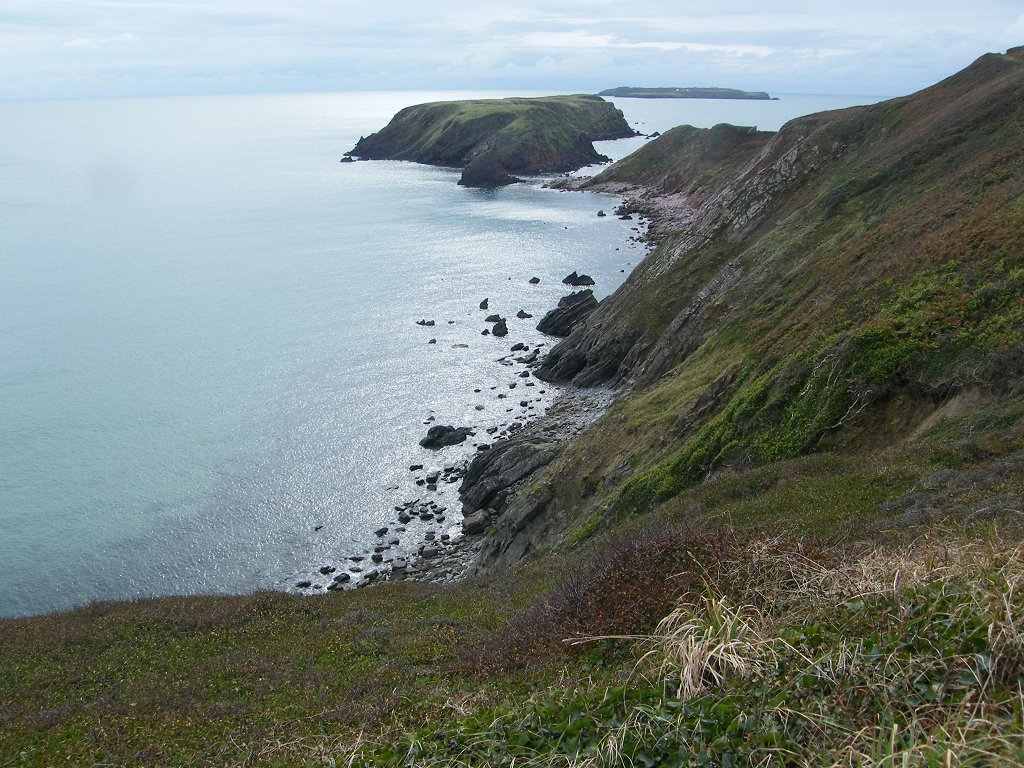
Location: St Ishmael’s to Milford Haven. 
Distance: 7 miles. 
Total distance: 3931 miles. 
Terrain: Gently undulating clifftop paths, tarmacked latterly. Some pavement-bashing in Milford Haven. 
Tide: Out. 
Rivers: No.453, Sandy Haven Pill. 
Ferries: None. 
Piers: None. 
Kissing gates: Nos.940, 941, 942 and 943 near Sandy Haven. 
Pubs: The Taberna Inn at Herbrandston which we visited after we had finished the Walk. Colin drank Purple Moose “Elderflower Ale” and Tomos Watkin “Pecker Wrecker”. I had Thatchers cider, and we both had a very nice meal. 
‘Cadw’ properties: None. 
Ferris wheels: None. 
Diversions: None. 
How we got there and back: We were caravanning near Whitesands Beach. This morning we drove to Milford Haven where we parked in the retail park very near Tesco. From there we caught a bus to St Ishmael’s where we alighted by the toilet block and children’s playground where we finished the Walk two days ago. 
At the end we came to the car which was parked just by the bridge. It was pelting down with rain, so Colin moved the car under the bridge for shelter while he did the teas. I asked, “Where has the river gone?” because I noticed the bridge was over a car park with no sign of the river! We realised that the whole river valley had been culverted to build the retail park which was vast! We drove to Herbrandston where we warmed and dried ourselves for several hours in the very friendly pub. We had a lovely meal, then returned to our caravan at Whitesands. We went home two days later. 
 
There was a children's playground at the beginning of today's Walk which we had to walk through. So we stopped and fooled around in there like a couple of kids.
We walked on alongside a cricket field as it started to rain. We got to the far corner where it was windy and realised this was serious, by no means a passing shower. So we returned to a rusty shelter which we had just passed and there put our cameras away. That is why there are so few pictures taken on this Walk. We donned wet-weather gear and ate our pies. Then we strode bravely out into fine misty rain and a high wind. Fortunately this wind was blowing in from the sea so we didn't get blown off the cliff!
It was most unpleasant, but we plodded along. We came to the seat which we'd originally planned to sit on and eat our pies — we knew it was there because we had seen it on a map in the playground. It was horrible there in that weather, how glad we were that we'd used the shelter in the cricket ground! We plodded on. Our only saving grace was occasional high hedges which shielded us, the path was actually dry behind some of them. We'd stand behind a hedge for a bit of a breather, then we'd stride out towards the next one to get in its shelter as quickly as we could. 
As we approached Great Castle Head the rain eased off, so I got out my camera and took a few pictures.
But before we got to Sandy Haven it started up with a vengeance, so the camera went away again.
The path took us through woods which would have been lovely if the weather had been sunny.
But it wasn't, it was drippy and slippery with lots of ups and downs and roots to trip us up. Tricky!
But we did it without mishap and got safely down to the road at Sandy Haven.
Before the woods we were passed by a couple of blokes with a dog. Then, as we walked down to the 'bridge' at Sandy Haven we were passed by a foreign couple. They were the only hikers we met on this crazy day, apart from a single bloke who caught us up at Gelliswick Bay.
 
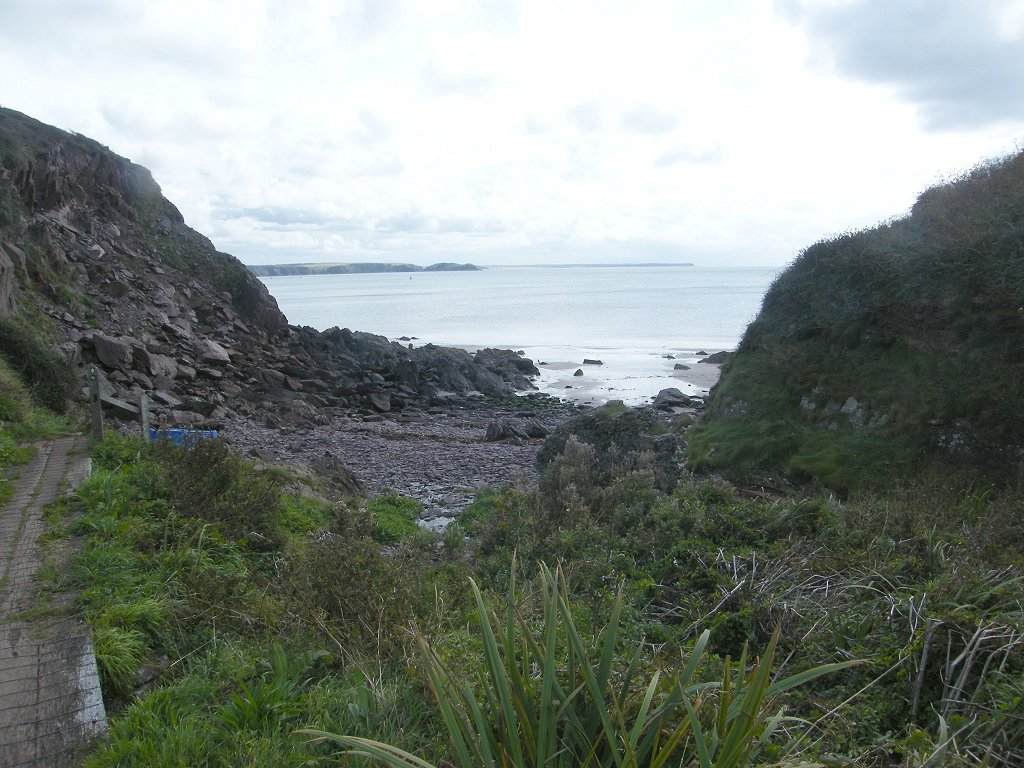
When we arrived at Sandy Haven the tide was right out — we had planned this one, unlike at Dale.  We crossed safely despite the slippery mud on the other side. We breathed a sigh of relief because the high-tide route would have been four miles extra. It was early to be thinking about lunch, but I was concerned that we wouldn't find a sheltered spot to eat our rolls. So we sat on the rocks at the bottom of the eastern ramp where we were completely sheltered from the wind and pretty much from the rain by overhanging trees. From there we could see the rain sweeping in waves across the 'bridge' while we were chomping.
The photos we took when we recced the crossing on a sunny day back in June will have to do.
 
We wondered whether it was safe to carry on because it looked from the map as if the path would be very exposed. We discussed our options, and decided in the end to risk it and continue. We walked through a deserted caravan site (when are these caravans actually used?) and then past a very exposed picnic site where I'd originally planned to stop for lunch. Onwards to the top of the cliffs. It wasn't as bad as we expected because a lot of the path was protected by high hedges on the cliff side. Colin risked his camera to take a picture of a fort on an island, which had intrigued him.
 
We were not aware that we were walking alongside an oil terminal — if we hadn't seen it on the map we wouldn't have known. We caught the occasional glimpse of a high barbed-wire-topped fence. A lot of the terminal was hidden behind brambles, hedges etc. It was very 'Green'.
 
We saw a long jetty ahead, and noticed a vehicle driving down the length of it. As we got nearer we realised the path went down underneath it. We sat on the concrete steps leading down under it. I needed the rest, I had found it hard work walking in all that wind and rain. We were relatively sheltered there, so we ate our chocolate. Under the jetty we were out of the rain, so I got out my camera and took a picture of the underside of the jetty. The only time we were on beach sand today was when we were under that jetty. 
There was a flight of steep steps out of it, and from thereon the path was tarmacked. We suspected it was once a road, and it did turn into a road later on when houses began to appear on the left-hand side. We couldn't see a second jetty which was marked on the map because it was heavily shielded by hedges and a wood on the right-hand side.
 
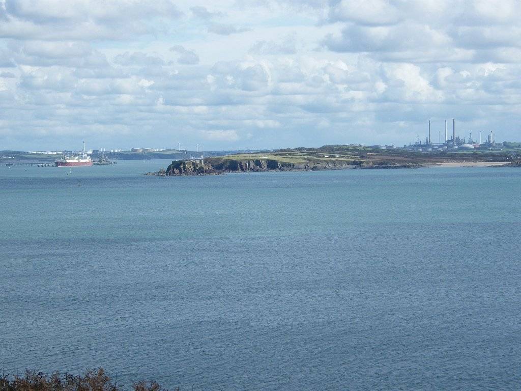
Gelliswick Bay looked nice — at least it would have done if the weather had been good. It looked pretty grim today. The ladies toilet was closed (had it been vandalised?) but the gents was OK and so was the disabled — good job I've got a RADAR key! We went up the steps on the other side of the bay, then through a housing estate and a residential area to the bridge in Milford Haven. 
 
That ended Walk no.385, we shall pick up Walk no.386 next time on the river bridge in Milford Haven. It was quarter past three, so the Walk had taken us five hours and twenty-five minutes. It was pelting down with rain, so Colin moved the car under the bridge for shelter while he did the teas. I asked, “Where has the river gone?” because I noticed the bridge was over a car park with no sign of the river! We realised that the whole river valley had been culverted to build the retail park which was vast! We drove to Herbrandston where we warmed and dried ourselves for several hours in the very friendly pub. We had a lovely meal, then returned to our caravan at Whitesands. 
Two days later we fully intended walking from Milford Haven to Pembroke Dock. But the weather forecast was for rain from mid-afternoon. Colin said, “We really ought to take the awning down now while it is dry, and do the Walk later.” I said, “OK then. The bus we are catching today is an hourly service so we can always catch a later one.” As we took the awning down the rain started — and it was only nine o’clock. So much for weather forecasts! Having folded up the soggy awning, we looked at each other soaking wet in the rain and agreed, “Let’s b****r off home!” And so we did, a day earlier than intended and through monsoon-like rain!

Monday, September 18, 2017

Walk 384 -- West Dale to St Ishmael's

Ages:  Colin was 75 years and 133 days.  Rosemary was 72 years and 275 days. 
Weather:  Fine.  Gentle breeze.  Mostly sunny, getting quite warm later. 
Location:  West Dale to St Ishmael’s. 
Distance:  11 miles. 
Total distance:  3924 miles. 
Terrain:  Cliff top paths, undulating.  Quiet roads, slightly undulating. 
Tide:  Out, coming in.  Too far in when we needed it to be out! 
Rivers:  No.452, Afon Dale (my name for it because it wasn’t named on the map). 
Ferries:  None. 
Piers:  None. 
Kissing gates:  Nos.936, 937, 938 and 939 around St Ann’s Head. 
Pubs:  The Griffin Inn in Dale where Colin drank Evan Evans “Cwrw Haf 40” and I had a shandy. 
‘Cadw’ properties:  None. 
Ferris wheels:  None. 
Diversions:  No.84 near Dale.  We couldn’t get across the river because the tide was too far in, so we had to go round by road which was further and boring! 
How we got there and back:  We were caravanning near Whitesands Beach.  This morning we drove to St Ishmael’s where we parked by a toilet block and children’s playground on the edge of the village.  We caught the bus from there to Dale where we alighted near the church.  From there we walked westwards down through the sugar beet field to the coast path. 
At the end we came to the car having just walked through St Ishmael’s village.  We had our tea and chocolate biscuits, then returned to our caravan at Whitesands. 
 
At the beginning of this Walk we had to climb a lot of steps up a hill, but when we got to the top it remained pretty level all the way through to St Ann’s Head.
We didn’t meet very many people until after we had passed St Ann’s Head.
We were enthralled by the geology in the cliffs, every corner we turned opened a new vista.
We sat on a rock to eat our pies and soak in the wonderful views. 
As we approached St Ann’s Head there were a plethora of notices reminding us that it was private property and “keep to the footpath”—YES SIR! 
We passed the old lighthouse building and followed a not-very-obvious signpost pointing to a viewpoint along a narrow fenced path.  We remembered coming here with the U3A Geology group in 2011.  Our coach parked by the lighthouse building, and we may well have missed the signpost today if we hadn’t remembered coming here back then.
It didn’t look very much from the signpost, but just round the corner we came to view a spectacularly folded cliff face.  I remember it was extremely windy when we came here six years ago, and I didn’t feel safe. I took a quick photo whilst clutching the fence, terrified that I was going to get blown off the cliff.  Then I went back to wait for the others in the coach.  There was no such wind today — we were able to enjoy the full spectacle in sunshine and a gentle breeze.  We didn’t have a professor explaining the outcrop today, but we couldn’t hear him back then anyway because the wind was too noisy!
 
Back on the Coast Path we passed even more notices reminding us that it was private property and “keep to the footpath”.  But we realised the houses here are all holiday cottages, hardly disturbing the local residents! As we left the area we passed a walled-off rectangle that we thought might once have been allotments.  It is all overgrown with brambles now — sad!
 
We passed a notice about Henry Tudor, the father of the infamous Henry VIII.  It said:  HENRY TUDOR Earl of Richmond landed at Mill Bay on 7 August 1485 with 55 ships and 4000 men landing at Dale.  Travelling through West Wales and gathering support, he then struck east.  On 22 August 1485 Henry defeated Richard III at the Battle of Bosworth, and became King Henry VII founder of the Tudor dynasty.”  I never really knew where Henry Tudor came from, nor what his claim to the throne was.  I think it may have been through the female side of his family.
 
We came to a cleft — Oh dear!  My poor knees!  When we had climbed out the other side of it we sat on a bank to eat our rolls.  We carried on, walking to the end of the next headland where there were some radio aerials.  We thought they were probably to do with navigation at the entrance to Milford Haven — we saw a big oil tanker enter later.  We could clearly see West Angle Bay across the water.  It didn’t seem far away, but we knew we will have a lot of walking to do before we reach it.
 
We passed what looked like a fort on a little headland, and wondered whether it was a lookout post from the Second World War.  Milford Haven would have been very vulnerable at that time.  We soon came to another cleft, but this one was gentler and not so deep.  A group of students were on the beach.  They came up to the path just in front of us and marched off ahead much faster because of their youth.  We speculated that they were University Geology students based at Dale Fort Field Centre, but we didn’t know.
 
The next headland had a tall light on it, again we thought it had a connection with Milford Haven.  Two clefts followed, but neither was too deep.  The second one was in a pleasant wooded vale.
Then we walked up to the final headland which was very narrow and ended in an ancient fort.  We didn’t have to go up to the fort because it was a dead end, and when we did try to go up there on one of our ‘rest’ days we found that it is being used as a private field centre and inaccessible.
 
A quiet road took us down from there into Dale village.  As we entered the village I glanced through a gateway and caught sight of the face of Jesus Christ carved in wood.  Intrigued, we stopped and peeped in.  it was a wood workshop but out in the open.  It was very untidy and there was a carved crocodile on top of the gateway.  On the opposite side of the road was an open shed containing lots of faces carved in wood.  Most of them reminded me of that painting “The Scream”!  It was all a bit weird, and there was no one about.
 
We carried on and passed a pub.  Since I was hot and tired I said to Colin, who had walked straight past, “I fancy a shandy!”  He admitted he hadn’t previously looked up any pubs — he used to be meticulous about it.  We went in and found it sold real ales, and subsequently Colin discovered it was in the Beer Guide.  We sat outside in the shade and enjoyed our drinks.
Further on we came across a painted wooden structure for children that was supposed to represent part of a ship.  We put Thomas the Travelling Teddy on there for a photoshoot.  Then we sat on a bench and lazily ate our apples. 
We marched on up the road, which was quite busy, to some lime kilns, dating from the 18th and 19th centuries.  A notice told us that limestone from the quarries by the Cresswell and Carew rivers and coal from Cresswell Quay were transported downstream to Dale.  The boats beached opposite the kilns and offloaded their cargo into carts.  It was then taken to the top of the kilns to feed the furnace.  Activity came to an end over a hundred years ago.
 
We crossed a shingle bank to the river.  There is supposed to be a footbridge there, but it is submerged at high tide.  Water was already covering it.  Colin removed his boots and waded across to see what it was like.
He got to the other side with water up to his ankles, but when he turned round to return he felt the pull of the current on his legs.  He only got back with difficulty.  Meanwhile the water was getting deeper and the current stronger by the minute — we could see it happening.
We were so annoyed that we had seen numerous warnings in tourist literature about the tidal crossing at Sandy Haven, which we will tackle on our next Walk, but none about the crossing here at Dale.  If we had known, we wouldn’t have hung about at the pub, nor sat and lazily ate our apples, nor investigated the lime kilns.  We only just missed getting across in the dry.  (The next morning, a ‘rest’ day, we returned when the tide was low and found the crossing to be well out of the water and easy to cross.)
 
But today we had three options — 1. To wait for the tide to go out again, but that would have taken at least three hours and meant finishing the Walk in the dark.  2. To go back into Dale and wait over an hour for the last bus back to St Ishmael’s, but then we’d still have to do this part of the Walk another day putting our carefully planned schedule out, and wasting our bus fares this morning.  3. To walk the long way round by road.  We decided on option 3.
 
We crossed back over the shingle bank to the kilns where we sat on a seat to eat our chocolate.  Then we set off on a route-march, ‘Power-Walking’.  Trouble was, it got slower and less powerful all along!  We crossed the river at Mullock Bridge, but on the old bridge which was alongside the present road bridge.  We were surprised at how narrow it was.  We didn’t walk down the other side of the river to the point opposite Dale because we were tired and time was getting on.  So we put Additional Rule 15 into action and walked the shortest way by road to St Ishmael’s.  We thought it would be miles further, but it turned out to be only an additional one and a half miles.
 
We were on quieter roads after the bridge, but it was boring!  We don’t get much pleasure through walking along roads.  Partway we were passed by a huge empty bus.  The driver stopped and offered us a lift to the top of the village — his vehicle was too big to drive down into St Ishmael’s.  But it wouldn’t have helped us much, so we thanked him and declined.  We eventually arrived at the car tired, hot and bothered at the same time as the last bus (a smaller vehicle) from Dale.  But we wouldn’t have to repeat any part of the Walk!
 
 
That ended Walk no.384, we shall pick up Walk no.385 next time in St Ishmael’s village by the toilet block.  It was twenty to seven, so the Walk had taken us eight hours and thirty minutes.  We had our tea and chocolate biscuits, then returned to our caravan at Whitesands.

Saturday, September 16, 2017

Walk 383 -- Marloes to West Dale

 Ages:  Colin was 75 years and 131 days.  Rosemary was 72 years and 273 days.
Weather:  Slate-grey sky.  Windy at first but this died down.  Light rain at the end.
Location:  Marloes to West Dale.
Distance:  7½ miles.
Total distance:  3913 miles.
Terrain:  Cliff top paths.  Some steep undulations, but many were level, wide and grassy.
Tide:  Coming in.
Rivers:  None.
Ferries:  None. 
Piers:  None.
Kissing gates:  No.935 as we left Martins Haven.
Pubs:  None.
‘Cadw’ properties:  None.
Ferris wheels:  None.
Diversions:  None.
How we got there and back:  We were caravanning near Whitesands Beach.  This morning we drove to Dale where we managed to park for free near the church.  We walked into the village and had to ask where the bus stop was because it wasn’t obvious.  We caught a bus to Marloes.  After using the loos in the village (couldn’t find the ones in Dale) we walked to the layby we had used yesterday, then down the footpath to Black Cliff.
At the end we turned off the coast path at West Dale and walked through a sugar beet field to our car parked near the church.  After supping our tea and chocolate biscuits, we drove back to our caravan at Whitesands in monsoon-like rain! 
 
We started today’s Walk at Black Cliff, but we didn’t have to descend as low as we did on the last Walk because the junction was halfway up the cliff again.  As we walked along we had good views back towards Black Cliff and a lovely sandy beach.  This is only accessible at low tide, and the water was already too far in.
We met quite a few people on this dull and breezy day, including one couple who passed us backwards and forwards three times!  He said, “We can’t go on meeting like this!”  I replied, “Are you doing some sort of zigzag route?”  She said, No, we’ve staying in a cottage and we’re looking for our bearings!”  To which Colin replied, “Well, I hope you find them!” 
It wasn’t a bad path.  There were a few more steep downhills and uphills than on the last Walk, but it wasn’t nearly so difficult as the path round Solva way.  Some sections were sheltered by a hedge.  There were lovely views all along.  We sat on a bank and ate our pies in a not-very-sheltered position.
We arrived in Martin’s Haven.  The only seat was already taken up by a couple, so we sat on a rock on the beach and ate a sandwich.  Colin thought he saw a seal — and then we both saw it!  The last time we were here was with our local U3A Geology group back in 2011.  We remembered we saw a seal then, and our leaders were not too happy that most of the group stood watching the antics of the seal rather than listen to them going on about rocks!
We chatted about seals to the couple who had walked down from the seat.  Then we walked up to the toilet block where we read a notice about boat trips to Skomer and Skokholm.  When we added up boat fees and landing fees we realised they would be very expensive trips.  We decided we weren’t that interested in birdwatching which is about the only thing you can do when you get there.
There was an inscribed stone in a wall cavity.  A notice told us it was found in 1984 in the foundation course of this Victorian wall.  The markings on the stone indicate it stems from the 7th to 9th century, and about thirty such stones have been found in Pembrokeshire.  It marks either a prayer station or a burial, and is indicative of the high volume of pilgrim traffic between Pembrokeshire and Ireland at that time.
The official coast path misses out the end of the peninsula at Martin’s Haven, but we decided to walk round it anyway if the weather was suitable because we had the time.  How glad we were that we did!  But first we had to climb an almost vertical slope — I was pleased that I coped with this.  Then we continued up gentler slopes to the highest point where there was a coastguard lookout post.
We had magnificent views of the islands of Skomer and Skokholm from there.  We decided they looked very bare — we had seen enough of them for free, neither of us particularly wanted to go there.
We went down to the far side where it was fairly level, and there on the beaches far below were a number of baby seals and their Mums!  (We did wonder if it wasn’t too early for grey seals to be born — we thought the pupping season was November/December) 
It was great to watch them even though they didn’t exactly do very much.  We saw them on all the beaches round to where we met up with the coast path again.
We met lots of people to chat to, especially a couple from Hong Kong where the woman was jumping up and down with excitement! 
We also saw lots of interesting rocks and caves — this really is a magnificent stretch of coast!
We sat on a grass bank and ate a second sandwich.
Then we continued along the coast path eastwards towards Marloes Sands.
We met two women who told us they were “WI walkers”.
They were doing an 18 mile trek from Dale via St Ann’s Head and Martin’s Haven to Little Haven.
They then planned, after dark, to walk round to Broad Haven on the beach when the tide was out — about two of our Walks in one go and in the opposite direction.
We don’t know if they made it, but since we endured torrential rain from about 5pm onwards, I think perhaps not.
Meanwhile, in fine weather we continued towards the corner opposite Gateholm Island where we were treated to wonderful views!
And there, just ahead, was Marloes Sands.  We had thought, when studying the map, that perhaps we’d be able to walk a mile or so along this sandy beach, but it was not so.  The tide was in and only a few disparate sections of shingly beach were exposed, each cut off from the next by a rocky promontory.  Also, there was only one access point down the cliffs to the biggest bit of beach so we would only have been able to scramble down there and come back up the same way.  We didn’t bother.
But the views were superb!  Twisted rocks, vertical layers, rock arches, caves, etc — it was beautiful!  We sat on a bank and ate our apples before walking along the path at the top of the cliffs.  As we approached the access point, we descended steps almost to beach level then climbed steps up to clifftop level again.  The steps made my knees ache, but nothing like the pain I used to experience before my knees were replaced.
At the further end of Marloes sands we came to the remains of a wartime airfield — parts of concrete runways are now all that is left.  We sat on a rock to eat our chocolate.  It started to rain, but it was only light at first.  We put the cameras away and donned kags.  Colin put on his overtrousers but I didn’t bother (they are so hot to wear!)  We went down another cleft, up again, and finally down to the beach at West Dale. 
That ended Walk no.383, we shall pick up Walk no.384 next time on the beach at West Dale Bay.  It was twenty past five, so the Walk had taken us six hours and fifty minutes.  We turned off the coast path and walked inland through a sugar beet field to our car parked near the church.  After supping our tea and chocolate biscuits, we drove back to our caravan at Whitesands in monsoon-like rain!