Sunday, September 11, 2011

Abandoned Walk!

Abandoned  Walk !
We had planned to do Walk 284, from Ballantrae to Stranraer, on Sunday 11th September 2011.  We had prepared our lunch and packed our rucksacks the day before.  We got up early and drove to Stranraer in plenty of time to catch the bus.
But…….the sky was BLACK, the rain was SHEETING and the wind was WICKED!  The weather forecast was that the tail-end of a hurricane was racing across the Atlantic in the gulf stream and due to hit our part of the Scottish coast on Monday afternoon with gusts of wind up to 80mph!  We thought it had already arrived.  We realised we would be walking for 18 miles directly into that wind.
We sat in the car park looking at the rain pelting down and listening to the wind whistling around the car.  I said, “Morrison’s is only round the corner and it opens in ten minutes.  It has a very nice cafĂ© where we can buy a cup of tea and a bun!”  Colin didn’t need much persuading.
Fortunately we are experienced campers, and had parked our caravan in the most sheltered spot at New England Bay which is a beautiful site right on the seashore.  We had grassed over dunes behind us and huge gorse bushes each side of us which took the brunt of the wind.  Our caravan only 'bounced' a little. and we discovered a leak on one of the front corners — but it didn't cause us much grief.  Other caravanners had to move their vans from the prime seafront positions with the views, and quite a few had problems with their awnings (we haven't got one yet).
After skulking in the caravan for several days waiting for conditions to improve, we were bored out of our minds and had lost all momentum to continue the planned Walks.  So we came home once the winds began to die down.  We had no problem with the caravan on the exposed motorway, despite warning signs about strong winds on all the gantries, and no hold-ups.
We were a little disappointed that, once again, we’d had to cut our walking session short.  We really have been unlucky this year — what with blisters, a pulled muscle, a bad back and now atrocious weather.  But it will all be there next year, and we shall return in April to continue.
Months later I read, in the Caravan Club magazine, that at a caravan site at Maybole, situated between Ayr and Stranraer, nine caravans were blown over on their sides that day — some with people inside!!  Fortunately no one was seriously hurt, but they were very shocked and their vans were total right-offs.
We had been very lucky, I had considered using that site.

Friday, September 09, 2011

Walk 283 -- Girvan to Ballantrae

Ages:  Colin was 69 years and 124 days.  Rosemary was 66 years and 266 days.
Weather:  Cloudy, with long bright intervals during which it got quite hot.  There was a strong breeze which was against us.  A tiny shower near the end of the Walk took us by surprise.
Location:  Girvan to Ballantrae.
Distance:  12 miles.
Total distance:  2780 miles.
Terrain:  Snatches of beach.  Lots of road.  Some ‘old’ road.  One big hill, but otherwise flat. 
Tide:  Going out.
Rivers:  None.
Ferries:  None.
Piers:  None.
Kissing gates:  No.235 where the Ayrshire Coastal Path went off uphill, but after following it for a few yards we changed our minds, deciding it wasn’t coastal enough, and returned to the road.  Nos. 236, 237, and 238 on the ‘old’ road — but 236 was nailed up and 238 led sideways into nothing!
Pubs:  None.
‘Historic Scotland’ properties:  None.
Ferris wheels:  None.
Diversions:  None.
How we got there and back:  We had brought our caravan up to south-west Scotland.  Yesterday we moved it from Ayr to New England Bay on the southern Rhins of Galloway.  This morning we drove to Ballantrae and parked in a seafront car park.  We caught a bus to Girvan, and the driver kindly dropped us off near the car park where we had finished the last Walk although there wasn’t an official bus stop there. 
At the end we walked along the seafront to where our car was parked.  After having our tea, we drove back to the caravan at New England Bay, stopping off to shop for supplies in Stranraer on the way.  (Lovely caravan site at New England Bay, but miles from any shops!)

It was a much nicer day than when we last walked two days ago, and there were a lot more cars in the car park.  The snack bar was doing a good trade, it hadn’t been open when we were last there in the wet.  The view was gorgeous, Ailsa Craig seemed very near and had a cloud on its top making it look like an iced bun!  We sat on a seat to eat our pies before we started.
Colin noticed a grass path going behind a building and round a rocky spur (Cow and Horse Rocks).  It was obviously well used, and it kept us off the road for a couple of hundred yards.  But most of today’s Walk was on the road — sometimes with a pavement and sometimes not.  We wore our bright yellow vests from the start.
 The next spur (Black Neuk) had the ‘old’ road running round it so we were able to stay off the road for another couple of hundred yards.  A notice on a trailer was offering ‘freshly dug tatties’ for sale — I wonder what foreigners make of that kind of English!  (My spell-check doesn’t recognise ‘tatties’ as a word!)  After that it was the road for miles and miles, with a lot of unpleasant car-dodging.  There were snatches of beach, but it always got too rocky after a few yards forcing us to return to the road.
Opposite where we came out from the ‘tatties’ layby was a paper and wire sculpture.  Despite the fact it was weather-worn, it was really rather good.  It depicted a running horse with a rider, and another figure, possibly a woman, trying to leap on behind him.  We liked it — it seemed to be full of energy — and thought it a pity that the wind was tearing it apart.
We came to a milestone that said:  Girvan 3 - Ballantrae 10.  We had only walked two miles, but then we did start at the southernmost part of the town.  Oh well, ten miles to go then!  Ailsa Craig had now lost its cream topping.
The Ayrshire Coastal Path led off along a track on the other side of the road.  We hate roads, as is well known, but couldn’t make up our minds whether to follow it or not.  By then we had passed the entrance, so we climbed over a gate to get to it.  Not a nice track, it was muddy and went uphill whereas the road stayed more or less flat and followed the coast.  We decided we preferred the road after all, and went down through a field  to get back to it.  We were glad afterwards because we saw the track went up really steeply to high places.  A milestone told us:  Girvan 4 – Ballantrae 9.  Going down!
We hiked up Kennedy’s Pass.  It wasn’t very high but it was a bit dodgy with the traffic where the road went round a sharpish bend.  We could see the village of Lendalfoot ahead.  Eventually we emerged on a beach where we sat on a rock to eat our lunch.  I tried to video seagulls taking off from the beach on their hundreds, but ended up with a lot of very shaky film, most of which I deleted at a later date!
The rocks we were passing looked very interesting, a variety of igneous I see from the geology map.  With the volcanic plug of Ailsa Craig in the background, they made a wonderful scene.
There must have been a lot of volcanic activity in this area, I wonder what it looked like then — and what it sounded and smelt like!  A lot of sulphur, I should imagine.  Much more peaceful today.
The seabirds seemed to like the rocks, we saw gulls everywhere, and cormorants drying out their wings.
Seals as well — one was doggedly sitting on her rock even though the tide was rising up and covering it.  She did look funny, as if she was floating on the water.
Further on another seal had found a higher rock, she looked majestic — queen of all she surveyed!  (I was convinced the seals we saw were female, they looked too calm and even-tempered to be males.)
We came to a memorial — it was to a ship that came to grief on this shore in September 1711, exactly three hundred years ago.  The stone is sandstone — pity they didn’t use a nice piece of the local granite because the lettering had eroded a little and was difficult to read.  I think this is what it says:  Created to the memory of / Archibald Hamilton and crew / natives of King’s Cross, Arran / who were drowned near this place September 11th  1711  /  Ye passengers whoe’er ye are / As ye pass on this way / Disturb ye not this small respect / That’s paid to sailor’s clay.
Through Lendalfoot we passed a number of wild rose bushes.  At this time of year it is mainly hips hanging on the branches, but there was the occasional flower in all its glory.  They smelt gorgeous, but Colin was unable to detect any of their scent as he seems to have lost his sense of smell in recent months.  Must be getting old!
About half a mile out of Lendalfoot we came to a picnic site on which there was a much newer memorial to a Russian ship which was involved in the Japanese wars circa 1904.  This ugly (well, we thought so!) stone with Russian writing on it was erected in 2006 for a ship that had nothing to do with Scotland, nor the British nation for that matter.  Eh?  I eventually found out that when it was being scrapped in the 1920s, it was being towed from the Firth of Clyde to Germany and it came to grief on the very rocks we had been admiring just offshore from Lendalfoot.  A sorry end to a great ship, but we did wonder whose feelings were being appeased when the authorities went to the expense of erecting such a memorial nearly a hundred years later on this spot, where nobody died.
We climbed a hill after that, and found it hot in the sun which was shining right in our eyes.  Colin complained that he had forgotten his peak, so he wasn’t very happy.  We came to a milestone which told us Ballantrae was only four miles away — not far to go now.
The road then went inland for about a mile, but it used to hug the coast and we wanted to walk along the ‘old’ road away from the traffic.  You would have thought the Ayrshire Coastal Path would have done the same, but it didn’t.  We found the spot where the ‘old’ road branched off, but there were a number of gates which were either tied up impossibly or padlocked.  It wasn’t very friendly.
We saw an Ayrshire Coastal Path sign ahead of us on the road, so we walked up there.  But it was pointing back the way we had come, and there was no sign pointing on our way.  Colin opined that it was looping us round and through a tunnel under the road — we were still convinced the Ayrshire Coastal Path was routed along the ‘old’ road.  But we were wrong!  We found out later that it went inland too, like the new road.
To avoid the loop we walked down a steep bank and climbed over a fence.  All the gates were tied in impossible knots, and even a kissing gate was nailed up.  But the fence next to it was broken — obviously other hikers had been there before us!  We stepped through without causing any further damage, and at last we were on the ‘old’ road.  The tarmac was still there, and so were most of the ‘cat’s-eyes’, so we didn’t think it was too long ago that traffic had been speeding past our way.
The tarmac was coated in animal dung making it difficult to keep it off our boots.  But as we progressed this problem became less and less until there was none at all.  We went gently downhill, and at one point we walked for about a hundred yards on an ‘old old’ road where a bend had been straightened out a long time in the past.
We were well away from the traffic, and it was very quiet.  We agreed that this was the most pleasant part of the Walk.
We descended along what seemed to be an ancient raised beach alongside cliffs where avalanche barriers were still in place — probably the reason the main road had been rerouted further inland.  We also passed a cave-house in the bottom of the cliff.  Colin went to look inside, but couldn’t see anything because it was dark in there!
After a good mile of easy walking we came to a gate, again tied up with twine to such an extent we couldn’t undo it.  There was a kissing gate in the side fence, but this only led to a rough grass bank and an even rougher beach — so rough we couldn’t walk on it.  We thought this very odd.  There was a lot of barbed wire about, but not on the top bar of the gate.  So we climbed over.  Further down we came to another gate which did have barbed wire wrapped round the top bar, but there was a gap in it so we were able to climb over.  We then came out on to the real road again.  An Ayrshire Coastal Path sign pointed a different way than we had come, though ours was the more obvious route.
We felt the whole place was most unfriendly.  We concluded that the land was owned by a b****y-minded farmer who was determined walkers were not going to turn the old road into a footpath.  (He couldn’t really stop us because of the open access laws in Scotland.)  Well, he didn’t beat us!  What harm did we do, walking along a tarmac road?
We crossed a stream. Then swept down to the beach where we sat on a rock to eat our chocolate.  We had two miles of lovely sandy beach to walk before we reached Ballantrae Harbour — a nice end to our Walk.  That is, except for the short sharp shower which caught us just before we got there!
The harbour is very small and was practically dry.  There were a few boats tied to the wall but most of them were out of the water.  The sandstone harbour wall was quite attractive, the way it had been eroded.  We walked along the seafront gardens to the car park where our velocipede with tea and biscuits in the boot was waiting for us.

That ended Walk no.283, we shall pick up Walk no.284 next time in the car park at the southern end of Ballantrae.  It was  a quarter to six, so the Walk had taken us seven hours.  We had our tea, then we drove back to the caravan at New England Bay, shopping in Stranraer on the way.

Wednesday, September 07, 2011

Walk 282 -- Maidens to Girvan

Ages:  Colin was 69 years and 122 days.  Rosemary was 66 years and 264 days.
Weather:  Prolonged heavy showers verging on hail.  Blustery and cool.
Location:  Maidens to Girvan.
Distance:  11 miles.
Total distance:  2768 miles.
Terrain:  We negotiated a very posh golf course (one round of golf costing between £175 and £195!!) which used to be an airstrip.  Sandy beach which got increasingly rocky.  So we crossed a field to a busy road, but didn’t like that either in the rain.  Crossed back on a track to a bumpy path along the top of the beach.  Through a farm to a golf club road.  Pavements, then sandy beach again.  Mostly flat.
Tide:  Out, fortunately.
Rivers:  No.341, Water of Girvan.  Also several floodwater streams in spate.
Ferries:  None.
Piers:  None.
Kissing gates:  Nos.233 & 234 in and out of diversion.
Pubs:  None.
‘Historic Scotland’ properties:  None.
Ferris wheels:  None.
Diversions:  No.61, to the road across a field because the beach got too rocky and slippery with seaweed.  In hindsight, we should have gone behind some cottages.
How we got there and back:  We were staying in our caravan on a site in Ayr.  This morning we drove to Girvan in the pouring rain and parked at a seafront car park just beyond the town.  It was so miserable, we really didn’t want to be there!  We didn’t leave ourselves enough time to get to the bus stop, and saw the back end of the bus (only once every two hours) pull away ahead of us.  By some miracle, it’s route looped through a housing estate and we picked it up in another road!  We alighted at Maidens, and walked across the playing field to the harbour.
At the end we came up off the beach to where our car was parked.  After having our tea, we drove back to the caravan in Ayr.  We were soaking wet, and I was quite cold and miserable.

It was terrible weather today — wet and windy — and we did wonder why we were doing this.  (Today was one of the many Walks when we really questioned our sanity!)  Not many photos were taken because we didn’t want the cameras to get wet.  We walked most of the harbour at Maidens, and spent a bit of time watching the waves break over a wall.
Then we tried to get up to the golf course without going out to the main road.  On the map it looked as if this was possible, but we found that in actual fact it wasn’t.
We tried a private road which looked promising, but after climbing a steep bit of hill we discovered there was no way through.  So we retraced our steps.  Next we tried the adjacent housing estate, but every time we chose a road which looked as if it would lead to the golf course we had to retrace our steps because it inevitably turned out to be a dead end.  Eventually we found our way out of that maze on to the hated main road — we had progressed a mere few yards from the harbour and wasted a lot of time!
We noticed an Ayrshire Coastal Path sign pointing along the road — we don’t want ROAD!  So a few yards further on we climbed over a fence where a concrete runway from an old disused airstrip crossed the road.  Aha!  We may have done it this time!  We walked the length of this runway towards a couple of trees, then along a concrete path which curved a little, then along another concrete runway in a slightly different direction.  Yes, we were well and truly walking across the prestigious Turnberry Golf Course, one of the most expensive golf courses in the country!
There were a number of golfers out playing despite the howling wind and torrential rain.  We thought we were crazy enough to be out walking in such conditions, but these people had paid well over £100 each to play on Turnberry’s hallowed greens!  We supposed they had booked and paid for their time in advance so had to play no matter what the conditions.  We hoped they were enjoying themselves at that price — we weren’t!
We came to the end of the concrete, unless we turned away from the coast.  We were making for the lighthouse which we could see on top of the cliffs.  We tried to keep off the greens, but this was not always possible so we crept round the very edges.  We came to a green on the cliff edge, and had to wait for two golfers to tee off before we could proceed.  One lost his ball down towards the beach, he didn’t go down after it.
We came to a cafĂ© on the lighthouse road.  We crossed the road and followed a path which led away on the other side.  This joined up with a track on which there was an Ayrshire Coastal Path sign!  The official path must have turned off the road a bit further down from where we climbed over the fence.  The track took us down to the beach which is where we wanted to be.  We felt a lot more comfortable once we were off the golf course, though Colin said that “comfortable” wasn’t exactly the word which came to mind since it was pouring with rain once more!
When it stopped, momentarily, we sat on a log to eat our pasties — only just in time because as we were finishing it started honking down again.
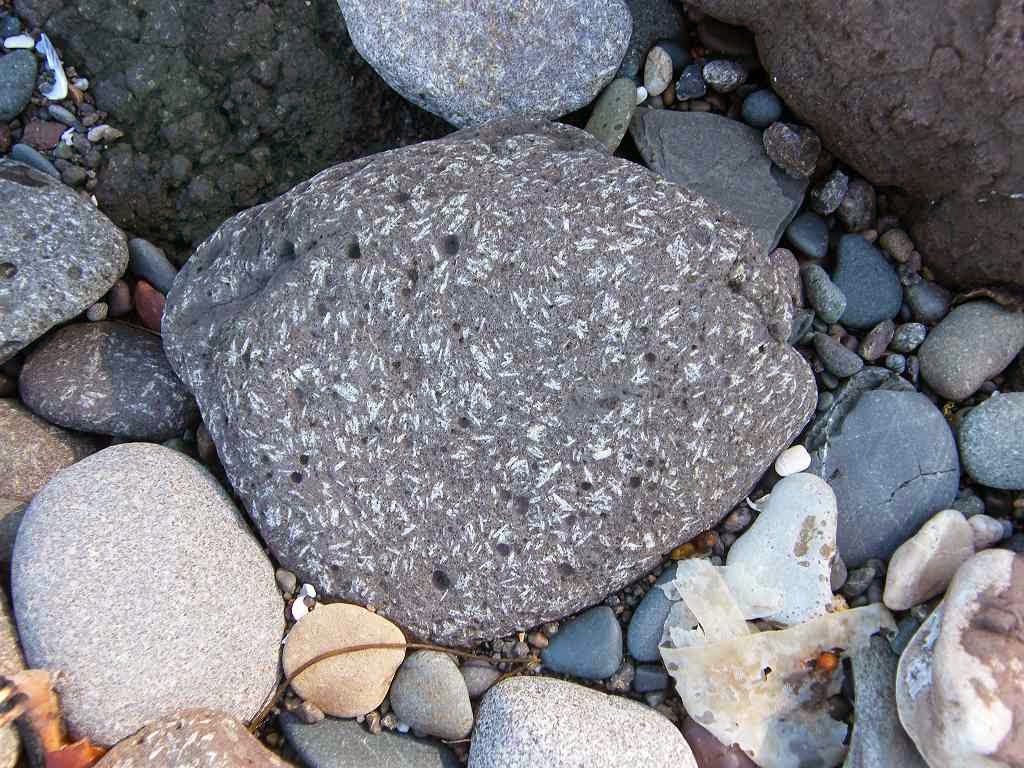
We could see the volcanic plug of Ailsa Craig very clearly out on the horizon.  It is where they quarry curling stones, and we noticed that the boulders on the beach by our feet were a good quality granite.  We reckoned they must have been washed over from Ailsa Craig by the sea.  We looked up and saw a tornado-effect colouring in the sky near Ailsa Craig.  It was quite eerie, and we hoped it wasn’t coming our way.
We carried on for a few miles — a lovely beach, but the weather was so awful we didn’t enjoy it at all.  We crossed a couple of rivers without getting water in our boots.  Fortunately the tide was out, so we crossed right near the waterline where a river spreads out and is therefore shallower.  That worked a treat, until we came to the third river.
We had walked past a ‘works’ with about half a mile of spiky unfriendly fence bordering the beach.    There we came to a river which was bigger than the ones we had crossed before.  On our bank the spiky fence of the ‘works’ ran along the riverside making it impossible for us to walk up to the road bridge which was about two hundred yards inland.  On the opposite bank we could see an Ayrshire Coastal Path sign, but how could we get over there?  We reckoned this was normally a shallow stream but it was swollen by the rain.  We were reluctant to go back half a mile and access the road on the other side of the ‘works’.  So we went right down to the edge of the waves where rivers are normally a lot shallower, and just ran for it hand in hand.
We both got water in our boots!  We sat on a rock to empty them out, but that didn’t achieve much.  (We learned later that the Ayrshire Coastal Path goes up to the road before the ‘works’, but we didn’t see the sign.)  We carried on with wet feet.  We were both a bit miserable, neither of us were enjoying the Walk.
The beach got soft, rocky and slippery with seaweed.  I wanted to go out to the road — surely it can’t be worse than this?  Colin went up the bank to look but all he saw were barbed wire fences, so we had to stay on that uggy beach.  A bit further on we came to a kissing gate with an Ayrshire Coastal Path ‘diversion’ sign which, so a notice told us, “the path behind the cottages is only to be used when high tide covered the rocks”.  Well, it didn’t — but we were so fed up with that awful beach which we now considered to be dangerously slippery, that we went through the gate.  Not wishing to be spat out on the beach again just the other side of the cottages, we continued up the field and through a gate to the road.
We donned our bright yellow vests.  The road was horrible!  It was busy, the traffic was fast and there was no footpath.  Further on a narrow footpath appeared on the opposite side, so we crossed over.  Marginally better, but we were both hating it.  Our feet were uncomfortable and the rain was pouring down relentlessly.
Then Colin saw a good track on the other side of the road, leading down towards the sea.  What’s more, there was a signpost at the beginning of it saying “Girvan”!  (“Come back, dreadful beach, all is forgiven!”)  By now we had realised that the beach was preferable to the road, so we crossed over and went down the track.  We also told ourselves that we should have walked behind the cottages as we weren’t very much further on.
We were led on to a path along the top of the beach.  This was good in parts, but a bit bumpy, neglected and overgrown.  There was a lull in the rain, so we sat on a rock intending to eat our chocolate.  (We hadn’t had an opportunity to eat our sandwiches yet.)  We assessed the state we were in.  Our feet were wet and uncomfortable.  One of my arms was soaked, and also one of Colin’s legs.  (Our waterproofs were not as waterproof as they used to be.)  After two bites the rain started up again, so we ate the rest of the chocolate walking along.
Before Girvan the path veered away from the beach and up through a farm.  We almost reached the main road, but just before we did so we were able to turn right on to a golf course road.  This led us back down towards the sea at Girvan Harbour.  On the way we passed several cottages, one of which was derelict and vandalised.
Girvan Harbour was bigger than we thought it would be after looking at the map.  It seemed to take a long time to walk round it, so we didn’t walk the harbour pier — rain, and Colin complained that his knee was hurting.  We crossed the river on a bridge, then had to walk into town in order to reach the other side of the harbour.  Colin took the opportunity to buy his favourite motorcycle paper.
We went down on to the beach as soon as we reached it.  This was a nice sandy beach which we walked for the last mile, in front of Girvan, until we reached our car parked at the far end.

That ended Walk no.282, we shall pick up Walk no.283 next time at the southern end of Girvan Beach.  It was twenty-five to four, so the Walk had taken us five hours and twenty-five minutes.  We ate our sandwiches in the warm and dry of the car, had a cup of tea from our flask, and then drove back to our caravan in Ayr.  We were both soaking wet, and I was quite cold and miserable.  In hindsight we probably should have cancelled today’s Walk, but at least it was done now.  Girvan is probably quite a nice place, but we were too miserable to notice.
The next day we moved our caravan to New England Bay, a beautiful site in the sand dunes on The Rhins.

Monday, September 05, 2011

Walk 281 -- Ayr to Maidens

Ages:  Colin was 69 years and 120 days.  Rosemary was 66 years and 262 days.
Weather:  The rain stopped 10 minutes into the Walk.  It turned sunny, then there were more clouds but no more rain.  A cool breeze.
Location:  Ayr to Maidens.
Distance:  16 miles.
Total distance:  2757 miles.
Terrain:  Long sandy beaches.  A rocky beach which was tricky and slowed us down.  Paths around fields and through woods.  Through the formal gardens of a castle!  And a little road-walking.  Much of the Walk was flat, but some was undulating.
Tide:  Out, then it came in.
Rivers:  No.339, River Ayr.  No. 340, River Doon.
Ferries:  None.
Piers:  None.
Kissing gates:  No.230, no.231 and no.232 on the path through fields just out of Dunure.
Pubs:  “West Kirk” (Weatherspoons) in Ayr — it is an old church, and the toilets are up behind the pulpit!  We had lunch there on one of our ‘rest’ days.  Colin drank Moorhouse’s “Old Boss”, and I had Erdinger Weissbier.  “Glen Park Hotel” in Ayr.  (Colin went by himself on a ‘rest’ day.)  He drank “Leezie Lundie”, “Jolly Beggars” and “Towzie Tyke” — all Ayr brewery beers.  “Wellington’s Bar” in Ayr where there is a large wellington boot outside on the pavement which we walked right by and didn’t see!  We had a pub lunch there on another of our ‘rest’ days — Colin drank Strathaven “Old Mortality 80/-” and I drank Magner’s cider.
‘Historic Scotland’ properties:  No.30. Crossraguel Abbey which we visited on another day.
Ferris wheels:  None.
Diversions:  None.
How we got there and back:  We were staying in our caravan on a site in Ayr.  This morning Colin drove to Maidens where he parked the car and caught a bus back to Ayr.  Meanwhile I walked along the river to meet him at the bridge where we finished the last Walk.
At the end we walked across a playing field to the layby where the car was parked.  After having our tea, we drove back to the caravan in Ayr.

We crossed the bridge and walked down the south side of the river to the sea.  By the time we got there the rain had stopped, and it remained fine for the rest of the day.  On the way we passed a section of the old town wall — a ruined look-out tower looked pretty precarious to me!  There were new flats built on the waterside with “private gardens and walkways” so we had to walk a good bit along the pavement in front of them with no views.  When we did catch a glimpse of the river we could see the “Port of Ayr” across the other side.  There were some modern windmill blades piled up on the quay — they were huge!
As we neared the shore, we found there was a set of steps next to a shop leading down to a footbridge over a channel.  From there we were able to access South Pier which we walked along to the harbour entrance.  A small ship in the dock looked as if it was preparing to leave, perhaps waiting for the tide to get a bit higher.
We walked back along the pier, and about halfway we were able to climb down to a vast sandy beach.  Pity about the weather being so dull and cool, it should have been packed with people at this time of year!  But then I suppose it was a Monday morning, and Scottish schools have long since gone back for the new academic year.  We had it to ourselves — except for the ubiquitous gulls, the curlews, the swans….and the odd stranded jellyfish.
There was probably a nice esplanade over the wall to our left, but we could only see a kids’ play building from the beach.  We wanted to stay down there away from the crowds because it was so lovely walking along the waterline.
After a couple of miles we came to a river flowing across the sand, too deep to paddle through.  So we went up to the shoreline cycleway in order to cross it on a bridge.  There we sat on a low wall to eat our pies.  We looked back towards the port, and noticed that the ship we had seen preparing was now leaving the harbour.
We thought we would have to follow the cycleway from thereon out to the main road, but we spied an Ayrshire Coastal Path notice which directed us across a car park.  Further on it led us through grassy dunes and out on to the beach beneath a ruined castle teetering on the edge of the cliff.  None of this path was marked on our OS map so it was all a bit of an adventure!
We picked our way round two rocky headlands, relieved that the tide was still quite far out but anxious because it was coming in fast.  The next headland seemed to be stuck even further out, but a grassy path took us inland a little to get past it, then spat us out on the beach again.  Looking at the map, we couldn’t see where the path was going to take us next, the coastline ahead looked even rockier and the tide was approaching at a lick!  It was a bit worrying.
Colin said, “There is a caravan site ahead, surely they’ll take us out there!”  But a tall and long spiky fence stopped us from entering.  It was a bit like a prison camp — it reminded us of the Butlin’s site in Bognor which is fenced off from the sea in a similar manner.
A large amount of smelly seaweed had accumulated along the beach and it was getting difficult to walk on, apart from the fact it was quite slippery.  So we climbed up on to a greensward between the beach and the spiky fence which was mown — how civilised!  We came to a gate in the fence, no “Ayrshire Coastal Path” sign and the caravan site didn’t look very welcoming.  So we continued outside the fence along a track which had now appeared.  A track?  Well, surely it must go somewhere? 
It did, it led us to a sewage works!  But we were able to skirt round it and found ourselves on a golf course.  I wanted to go back because we seemed to have completely lost the Ayrshire Coastal Path, but Colin was a bit further on than me, picking our way round their precious greens, and he spied a post over the top of a bush.  This post was on the beach, and had arrows pointing in both directions with the Ayrshire Coastal Path logo.  So we should have stayed on that slippery beach all the time!  We stepped over a low fence, scrabbled down a little bank, and we were on a sandy beach once again.
The going was OK at first but it soon got rocky, especially round headlands.  And the tide was still approaching.  We looked up at the cliffs — there was no way we could have scaled them.  We met no one, but we knew people had been there before us because we came across a driftwood sculpture on the sand.
We came to a beautiful beach called Bracken Bay where there were hundreds of limpets and barnacles in the sand.  We sat on a rock to eat half our lunch — we knew we had a lot more miles to cover and wanted to eke it out.  Surely there was a way out here?  Looking at the map, we could see the way ahead was all rocks and cliffs…...and the tide was getting nearer and nearer.  But no, there was absolutely no path up from that lovely beach.
We had no choice but to carry on below the cliffs.  The map was right — we were now struggling along a very rocky shore.  The going was difficult and slow, and we were both in fear that either one of us would slip and break an ankle.
The swans were keeping up with us — it was all right for them, they could just swim along!  Again we looked up at the cliffs we were passing, but it was no-go even though they were no longer vertical and seemed to have clefts every so often.  It was all volcanic rocks we were floundering over and quite beautiful, though we did puzzle about some stones which seemed to contain fossils.
Each time we rounded a headland we saw another headland, it was never-ending.  The going got more and more difficult — possible (just) for we had no choice — but tiring and our legs ached.  It was slippery on the seaweed, and we had to be so alert in order to avoid an accident.  It was costing us a lot of time, and we were well aware that Maidens was still a long way off.
We came to a wall built of beach rocks, significant only because it was a field boundary.  We thought, when we first saw it in the distance, it might be the wall of Danure Harbour, but a quick look at the map made us realise that even that goal was another two miles further on.  We had to make decisions, we couldn’t go on like this.  Colin reccied a grass mound behind a big rock and reckoned, though dodgy, it was easier than the beach.  We were both fed up with rock-jumping, so we climbed up there to give it a go.  Some curious cows came near to stare, then suddenly they all ran away.
The going wasn’t too bad, until we came to a stream.  This was tricky to cross, but we both managed it in the end.  We thought about looking for a gate to the road up the hill to our left, but then we decided that the animal track we were on might actually be a proper path because it had improved considerably.  It was really quite good for a while — until it led down to the beach again.  But Danure Harbour was now in sight! 
The last bit of that path down to the beach was perhaps the most difficult part of the whole Walk.  It was steep, slippery and involved quite a bit of limbo-dancing!!  But we OAPs come from a tough generation, and we coped.  It was obviously an unofficial path.  We had to walk a bit of beach before we reached the harbour, but after all that we had been through that was quite easy.
We looked back along the beach and were surprised to see a notice which told us the official Ayrshire Coastal Path was all along that difficult beach.  Bet the people who devised the path have never actually walked it!
We were relieved to get to the harbour.  We sat at a picnic table to eat the second half of our lunch, but had to change tables because the seats were so low we couldn’t sit with any degree of comfort.
We walked the harbour walls, and looked at the old lighthouse with sandstone eroded walls.  And there was another ruined castle a bit further along the shore — we didn’t go over to it.
We came across a notice which said: 
Ayrshire Coastal Path
TIDAL WARNING
FOR WALKERS
For tidal areas 1 hour
north & south of Danure
check Harbour Ladder
in SW corner. 
On a rising tide, if rung 10 is covered
there is a 3-4 hour delay.
At high water, if rung 6 is covered
there is a 2 hour delay.
Route best walked on a falling tide. 
You couldn’t make it up!  Could you?  I said, “No!  No more rocky beach walking!”  Colin didn’t need any persuading, so we went to a nearby cafĂ© to revive ourselves with a pot of tea.
We left the village on the road, climbing up past a pretty wall mosaic and an appropriate weather vane.  We passed the entrance to a play-park which, it appeared, you had to pay for!  We were quite shocked about that, it didn’t look anything special and it was completely devoid of people — perhaps they felt the same way about it as we did.  Grassy paths leading out of the other end of the play-park seemed to go along the coast above the low cliffs, and we did wonder if we were missing out.  But as we walked higher and further they disappeared, and of course none of them were marked on the map.  Did they go back down to the beach?  Were they dead ends?  We never found out.
When we got to a bend in the road, we came across a field gate with an “Ayrshire Coastal Footpath” sign pointing us downhill across the fields — again there was no clue on the OS map.  We were surprised because we thought we had left that path behind on the beach.  Should we risk it?  The tide was now right in, and we didn’t want any more beach walking anyhow.  But we hadn’t been looking forward to walking alongside the main road which we were soon going to come to, a route which was inland and several miles further.  So we risked it!
We followed the edges of several fields, and one was freshly ploughed and rolled which was a little tricky.  We climbed over a difficult stile with a huge step, then a little bridge over a ditch.  All were overgrown with nettles etc — we didn’t think the path was much used.  On the clifftop we could see a rock which looked like an Easter Island statue, and another with cormorants roosting on it.  Ailsa Craig was very clear in the distance, we had been seeing it for miles.
The path eventually led down in a big zigzag to Culzean Bay.  The tide was now well in, but there was still room for us to walk round a small rocky promontory without getting our feet wet.  A flock of oystercatchers flew off in a hurry.
We now had two miles of sandy beach to walk, it was glorious!  We could see Culzean Castle at the far end of the bay, and with Ailsa Craig very clear on the horizon it was just about perfect.  Even the weather brightened up.  We sat on a log when we were near the far end and ate our chocolate.


As we neared the castle the beach began to get stony, though not difficult to walk.  We rounded one rocky promontory, then came across a hidden bungalow with grass in front of it.  We noticed a path over a small bridge just past the building, so we climbed up and found there was a lovely path through the woods at the bottom of the cliff.  This path was much better than the beach which had become quite rocky and seaweedy.  It took us behind the next little promontory, then down to the beach momentarily.
We were standing before the grand gates of Culzean Castle with a Rotary Club badge telling us that the Ayrshire Coastal Path went through them.  When we were in that Norman church which wasn’t Norman the other day, we got talking to someone who had been one of the team setting up the Ayrshire Coastal Path.  He told us the tale of a party of walkers who were hiking, quite legally, through the grounds of Culzean Castle when they were stopped by a numpty, of American origin, who was at a business conference in the castle.  He told them, in no uncertain terms, that they were trespassing.  He forced them to march straight towards the main gate and out on to the road!  They were furious, and complained bitterly to Ayrshire Coastal Path authorities, ie the chap who was telling us the tale.  So we knew we were within our rights to walk through the grounds, but when we did so it didn’t feel right.
What didn’t help was that, once we were past the grand gates, there were absolutely no footpath signs telling us the way through.  We zigzagged up through some woods until we came out on to a formal drive.  No one was about, and we just had to guess which way to go next.  We climbed some steps to the castle entrance, but felt very uncomfortable in such an exposed position.  The castle teeters on the edge of the cliff, so we knew we had to walk behind it.  We decided to walk along a sunken formal garden, but we couldn’t see a way down to it.  In the end we resorted to slipping down a grassy bank.
The gardens were very neat and formal, and we tried to keep a low profile away from the castle building up on high.  All the time we felt we shouldn’t really be there.  Past the castle we went through a door in a wall to get nearer to the clifftop.  We were on a beautiful neat lawn with fantastic views across to the Isle of Arran — yes, we could still see that magical island!
Still we met no one.  Still we felt that at any moment we were going to be accosted for trespassing in these private grounds.  We veered off towards the woods, and began to feel more comfortable once we were in amongst the trees.  Using our OS map we made our way to “Swan Pool”, being careful not to be diverted down paths to the beach too soon.  The pool is very big, but unfortunately it was full of blanket weed.  We did see a pair of swans with cygnets down at the far end.  We met one or two people, locals out walking their dogs, but they didn’t bother us at all.
We were relieved that the woodland paths were good and easy walking.  We were both feeling quite tired by then and not up to dealing with difficult terrain.  Eventually we came to the end of the woods where we found sturdy wooden steps leading down to Maidenhead Bay.
We could see Maidens ahead, along a mile of sandy beach.  It was easy walking, and it made a pleasant end to our Walk.  A girl on a horse passed us, but we didn’t mind because we were about to complete our Walk and we weren’t feeling rushed or stressed.  On reaching the harbour, we walked a few yards inland to find our car parked in a layby.
That ended Walk no.281, we shall pick up Walk no.282 next time at Maidens Harbour.   I forgot to write down the time we finished, but it was near to getting dark so it must have been a good many hours.  It had been a lovely Walk, much better than we thought it would be because many of the paths we walked are not marked on the OS map.  We had our tea, then returned to our caravan in Ayr.
Crossraguel  Abbey 
Crossraguel Abbey is about four miles inland from Maidens, so we visited it on another day.  It was founded in the thirteenth century by the Earl of Carrick for the Order of Cluny, a branch of the Benedictines who wore black robes.  Their mission was to encourage pilgrimage, and this abbey is situated half-way between Paisley and Whithorn on the Ayrshire pilgrims' trail to the shrine of St Ninian in The Machars of Galloway.
The abbey was sacked in 1307 by the English army of Edward I, and subsequently rebuilt on a grander scale. It was the usual story of getter richer and more corrupt as the years went by.  The abbey was dissolved at the Reformation in the 16th century, and some of the stone was removed to build local houses.
However, much of the original building remains, and we certainly found a lot more of interest there than we did at Dundonald Castle the other day.  I was especially pleased that I could have a go at carving stone -- I would love to have trained as a stone mason in my youth, but such opportunities were just not available at the time, especially for girls.