skip to main |
skip to sidebar
Ages: Colin was 71 years and 84 days. Rosemary was 68 years and 226 days.
Weather: Wet at first.
Then dry, warm and muggy. From
lunchtime onwards, wet and windy.
Location: Moelfre to Llaneilian.
Distance: 10 miles.
Total
distance: 3492 miles.
Terrain: Some quiet roads. A little sandy beach. A bit of squidgy estuary. Mostly cliff paths, usually grassy. Very
undulating.
Tide: Out.
Rivers: No.414, Afon Goch.
Ferries: None.
Piers: None.
Kissing gates: Nos.492 to 522 — until we reached the
lighthouse road and decided the weather rendered it unsafe to continue along
the cliff-top path. Thirty-one kissing
gates, an all-time record for a Walk!
Pubs: The ‘Pilot Boat’ at City Dulas, where Colin
drank Robinson’s ‘Curwr Ddraig Aur’ and ‘Unicorn’, and I had Stowford Press
cider.
‘Cadw’ properties: None.
Ferris wheels: None.
Diversions: None.
How
we got there and back: We were staying
in our caravan on a remote farm in the middle of Anglesey. This morning we drove to Amlwch where we
parked in a residential road near the bus stop.
We caught a bus to Moelfre where the bus stop was within a few yards of
the point where we finished the last Walk.
At the end we
finished the Walk near the lighthouse having decided it would be too
unpleasant, and dangerous, to continue along the cliff path to Amlwch in that
weather. We marched two and a half miles
along the road to our car parked in Amlwch, having picked up fish’n’chips on
our way through town. We drove straight
back to our caravan at Bodnolwyn Wen so that we could don some dry clothes
before devouring the fish’n’chips which we kept warm in the caravan oven.
The next day it
had stopped raining, so we took down the awning and drove home to Malvern.
It was pouring with rain when we woke this morning, and the downpour continued
without a break all the while we were travelling and setting up the Walk. So as soon as we got off the bus in Moelfre
we put on our full wet-weather gear.
Almost immediately the rain stopped!
Very soon it turned hot and muggy, so we peeled off the layers one by
one.
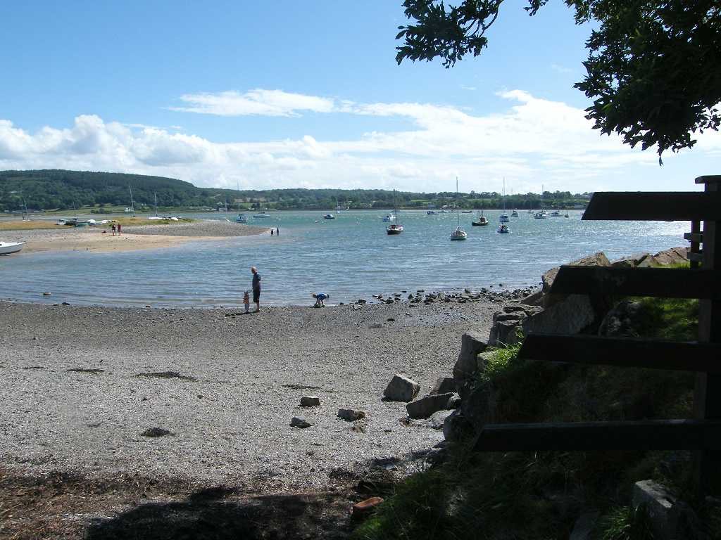
We sat on a bench overlooking the tiny harbour to eat our pasties — we
thought we’d better take the opportunity while it wasn’t raining. There was a good path round the edge of
Moelfre overlooking the sea. We soon reached
the lifeboat Visitor Centre where we came across a lot of memorials. The first one which caught the eye was a kind
of stone chimney pot full of flowers dedicated to Leslie Allison who spent
forty years living in Moelfre — “Best
times of my life” so it said.
Then
there was a rather fine sculpture in remembrance of the ‘Royal Charter’ which
was wrecked on this coast on the 26th October 1859. It is believed about 450 lives were lost. We liked the statue of a fisherman at the
wheel of his ship — it seemed full of energy.
We passed the lifeboat shed and ramp below. Above was a plaque commending the bravery of
the lifeboatmen who rescued the crew of the M/V Hindlea off this headland on
the 28th October 1959. There
was mist on the sea though we could still see Great Orme in the distance. We rounded the little headland where the
rocky island called Ynys Moelfre situated
just offshore came into view. There were
lots of rocks just there and all were covered in gulls and cormorants. What a cacophony of sound greeted our ears!
We could see a large container ship out in the distance. It blew out a cloud of smoke, but it didn’t
move from it’s position for the whole of our Walk. It just sat there. I thought time was money with these things —
if so, this ship was losing an awful lot of it.
We walked round to the next bay passing people fishing with rods from the
rocks below. A fisherman buzzed up in a
small boat to check his lobster pots.
There was just one lobster big enough to keep, he threw three smaller
ones and a number of crabs back into the water.
Not a very good catch.
The rocks we passed looked interesting — though it’s now twenty-five
years since I did that Open University degree and I have forgotten most of it in
the meantime. The wild flowers looked
spectacular, especially with drops of water on the petals.
We climbed the cliffs to yet another memorial stone. This one also remembered the night the Royal
Charter came to grief just offshore with the loss of so many lives. There were spectacular views from the
memorial stone.
We came down to the next bay, Traeth Lligwy. We passed very close to a house where the dog
barked and the owner told it to shut up.
We wondered if this happened every time someone walked past on the Wales
Coast Path. A notice on a fence was a
protest against large modern windmills — we could see why the locals don’t want
them there spoiling the view.
Traeth Lligwy Bay
is lovely, with nice sand, a café and toilets which we were pleased to
use. We continued across the car park,
into the dunes and out on to the beach where there was a slight breeze. It was, by then, very warm and muggy, almost
suffocating.
We read a stark warning
about soft sand on the further end of the beach, but that is where the path led
uphill through ferns so we didn’t have to put ourselves in danger. However, we did note a couple of sand castles
had been built on the soft sand where they warn you not to tread. Was this sheer dare-devilism?
We came to no less than four men with strimmers — what a noise! I always joke that “Man with Strimmer”
follows me all over the world, I can’t get away from him. But four! Isn’t that a little too much? At least they were keeping the path clear,
which needed doing on many of the paths we have walked so far. We waited until we were out of earshot before
we thought about lunch. We sat on rocks
eating our sarnies whilst watching a lone fisherman, first with a net in the
water, then from a rock with a line. He
didn’t seem to catch anything!
We could still make out Great Orme in the haze, and as we left we could
see it was raining over there. We came
across lots of tents some in fields and others alongside the path continuing
round the corner. Most had their own
private toilet tent, and we got the impression that it was some kind of
rally. There was no campsite marked on
our map at that spot.
That was when the rain reached us, so it was on with the wet-weather gear
again. It rained relentlessly for the rest of the day, and I only managed to take
one more photo (towards the end of the Walk) for fear of ruining the camera. It was such a pity because the rest of the
Walk, about three-quarters of it, was across the most spectacular scenery we
had seen in a long time.
We didn’t take the dead-end path down to a knoll because it was
raining. Instead we turned back round a
farm and continued along a track through a gate. Three cars came, at intervals, making for the
tented camp. Colin politely held the
gate open for the first one to save the driver getting out. Then he said, “I’m not doing that anymore!”
and walked off leaving the other two drivers to their own devices. The track was narrow, and we were relieved to
turn off it into fields so we didn’t have to dodge cars anymore.
We walked for about a mile across undulating fields with only sheep for
company, until we came to the main road and a PUB! I couldn’t believe it when Colin suggested we didn’t stop “because we’ll have
to take off all this gear and we might make the floors wet!” That’s what pubs are for, isn’t it? To give rest and refreshment to weary
travellers! I ignored him and marched
in, relieved myself of my wet-weather gear and made the floor wet — my boots
were so wet they had been washed perfectly clean, like new. It turned out this pub was in the Good Beer
Guide, one of Colin’s CAMRA pubs, only he hadn’t bothered to look it up before
we came.
We should have called a halt there, in view of the weather, and caught a
bus back to Amlwch. Why didn’t we? Call it determination, stubbornness or
bloody-mindedness — whatever — we just didn’t want to give up on a Walk again!
Surely the rain will stop sometime like it did this morning?
It didn’t.
So, after rest and refreshment, we donned our wet gear and carried
on. Neither of us enjoyed the rest of
the Walk at all. We had to go a short
distance along the main road before we could turn off down a track towards the
river. We were relieved to find that a
ford marked on the map turned out to be a footbridge — and a spanking brand new
one at that! It was a bit squidgy along the marshes for
nearly a mile after that, but we coped. We
then turned inland up a lane, one kilometre uphill. It seemed to go on and on — we both hated
that. The footpath cut across the corner
of a field, then we had more lane, this time undulating, for another kilometre.
The lane took a left-hand bend but we went straight on following a
track. We came to an open barn, so we
sheltered in there to eat our apples.
There was nowhere to sit down, nothing we could perch on and the floor
was far too muddy. But at least we were
out of the rain momentarily. We soon
carried on, this time through open fields downhill towards the coast. Even the cows were sheltering under hedges
and trees, looking at us lugubriously as we passed. We met a small walking group coming the other
way — they were as wet as we were. They
had started at Cemaes
Bay this morning and were
making for Moelfre. We chatted about the
insanity of walking in such weather!
We came to the clifftop and turned left.
It was an excellent path, but challenging to walk in the rain. It was very undulating, there were gullies
with little wooden bridges at the bottom, and the stones and rocks were
slippery. There should have been
spectacular views, but they were shrouded in mist.
We should have taken loads of pictures of
this picturesque coastline, but we didn’t want to ruin our cameras. I tried just one of the lighthouse on the
headland when the rain abated for a fraction, but it wasn’t a very good picture
at all. We didn’t feel safe on that
cliff path by ourselves in the mist, and with the stones under our feet being
so slippery. By the time we reached the
lighthouse road we were wet through and totally exhausted. So we decided to end the Walk there.
That ended Walk no.338, we shall pick up Walk no.339 where the Wales
Coastal Path crosses the lighthouse road at Llaneilian. It was quarter to seven, so the Walk had
taken us eight and a quarter hours. We
route-marched miserably two miles along the road to Amlwch. At one point we decided to take a short cut
along a footpath, but it was so unused and overgrown we nearly got lost, and
ended up taking longer than if we’d gone the long way round by road. This didn’t help our mood. As we approached Amlwch we passed a fish’n’chip
shop, so we called in and bought our supper. As we drove back to our caravan, there were
rivers of water flowing down many of the roads!
The next day the rain had stopped and it turned into a very hot day. We took down the awning, packed up our
caravan, and headed for home.
Ages: Colin was 71 years and 82 days. Rosemary was 68 years and 224 days.
Weather: Quite a strong wind. Very warm in the sun. Cooler when cloudy. Dry.
Location: Glan-yr-afon to Moelfre.
Distance: 12 miles.
Total
distance: 3482 miles.
Terrain: A lot of grassy paths across farmland, and
ferny paths along cliff tops. Beach
walking — some sandy and some stony. A
few quiet lanes. Squidgy paths along the
top of beach / marsh. Undulating at the
beginning and end of the Walk, the middle bit was flat.
Tide: Coming in.
Rivers: No.413, Afon Nodwydd.
Ferries: None.
Piers: None.
Kissing gates: Nos.476 to 491. These were concentrated at the beginning and
end of the Walk, none in the middle.
Pubs: The ‘Ship Inn’ at Red Wharf Bay.
Colin drank Derby Brewing ‘Piggy in the Middle’ and Conway ‘Keneally’s Ale’ whereas I had a
shandy again as it was a hot day.
‘Cadw’ properties: None.
Ferris wheels: None.
Diversions: No.74 which we ignored because a local had
told us we could ‘get through’, which we did.
(Most of the track had disappeared in a landslide three months
ago.) No.75 which we were unable to
ignore because security fences had been put up.
Work was being carried out in an adjacent holiday park, and the official
coastal public footpath had been fenced off with no notice of a diversionary
route. Fortunately we had just met a
couple of employees at the Camp, and they told us how to get round the
blockage, through the Park and via the beach.
How
we got there and back: We were staying
in our caravan on a remote farm in the middle of Anglesey. This morning we drove to Moelfre where we
parked in a large free car park near the bus stop. We caught a bus to Menai Bridge,
then a second bus out to Glan-yr-afon.
This second bus was a real white-knuckle ride as we tore along
impossibly narrow lanes, twisting and turning up and down hills. Great fun!
At the end we
finished the Walk in Moelfre very near the car park. We partook of tea and chocolate biscuits,
then drove back to our caravan at Bodnolwyn Wen.
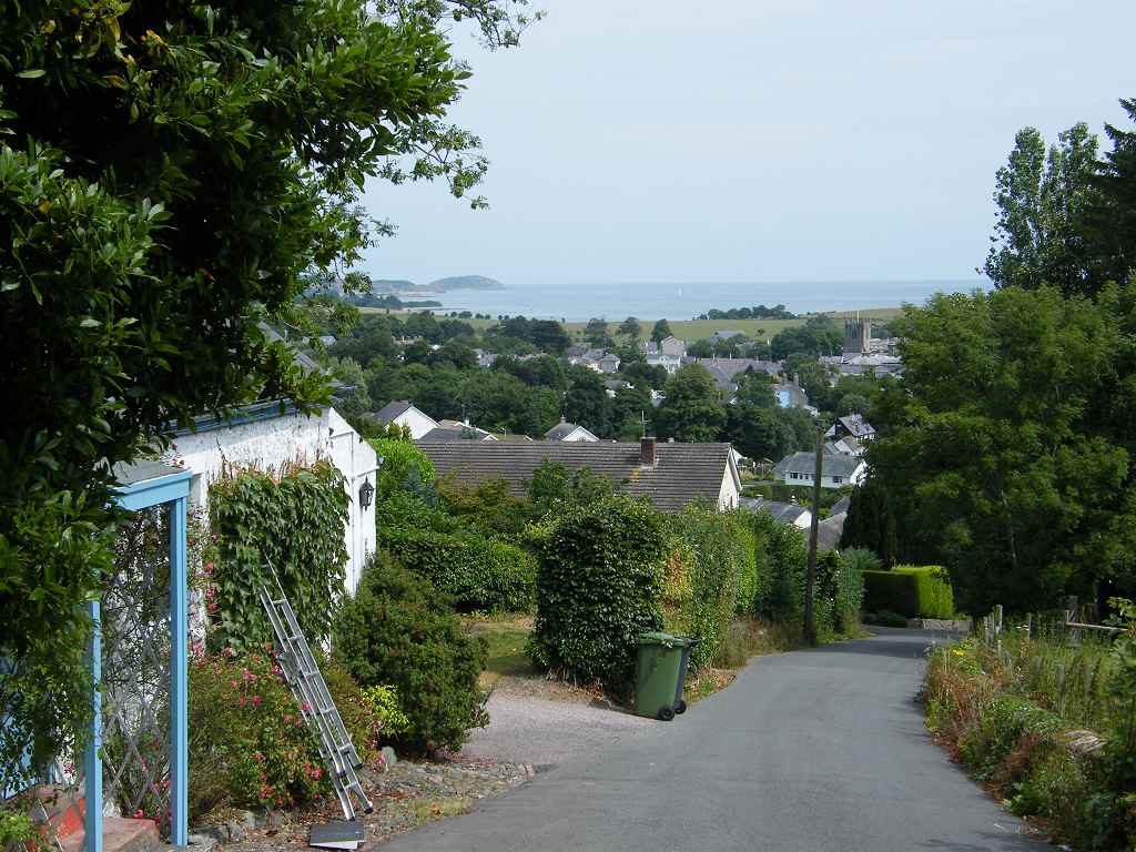
We started today’s Walk at the road junction in the hamlet of
Glan-yr-Afon which is just a handful of houses.
Further along the lane we passed a Methodist chapel which seemed to be
in the middle of nowhere, yet it was still functional. Opposite the chapel was an old quarry site
which had obviously been cleared out recently — we wondered if it was a
potential building site. The wild
flowers were gorgeous — honeysuckle, orchids and suchlike — big showy flowers.


After about half a mile we turned off the lane to walk paths and tracks
across fields. We stopped to talk to a
man who was hanging bird feeders outside his isolated house. He was saying how once common birds are now
much in decline due to habitat loss, he had noticed the reduction in customers
for his feeders over the years. He also
told us that there was a land slippage a bit further on and the footpath was
closed. The diversion was back to the
road, but the notice telling walkers about it had been blown away. He advised us to ignore it because, “Anyone who
is agile can get past easily!” We
thanked him for the information, and walked on.
We skirted a farmyard, then saw the post from which the notice had
disappeared. We ignored it and carried
on. Further on we sat on a bank and ate
our sandwiches — we had no pies today because there wasn’t enough time, when we
were in Menai Bridge between buses, to go to the pie
shop. Colin complained that he was cold,
but he hadn’t brought his coat because the sun was shining when we left the
caravan this morning — he’s always doing things like that. I told him to put his kag on, which he did.
We crossed more fields, then turned into a gully between ferns. There we came across a sheltered seat with a
magnificent view, it would have been an ideal place to have stopped and eaten
our sandwiches. How we wished there had
been a prior notice warning us that this was coming up!
Colin disappeared into the bushes to change
his pad, so I sat on the bench admiring the view and the colourful wild flowers
which were all around.
The track took us steeply downhill from there, and we soon came to a gate
with “Footpath Closed” notices and “Danger Keep Out”. The security fencing had been laid aside, so
we ignored them all and carried on.
Before
long we came to the landslip. Half the
width of the track had disappeared leaving a gaping hole — but it was fenced
off and there was plenty of room to get round behind it. We didn’t feel there was any danger for
walkers at all. Honestly, we are more in
danger on the average cliff path! We
looked over the edge, from the safe position behind the fence, and saw dead
vegetation all the way down where a torrent of water must have whooshed past
taking a big lump out of the track. It
would have been impossible to get a vehicle past the hole, and we did wonder if
there were any cars stuck at the cottage behind us. Perhaps the “Danger” notices were for them.
Looking back from a zigzag in the track further
down we could see a digger working on the lower end of the landslip. According to the man with the bird feeders,
it had all happened some months back. It
will be a lot of work to restore the track so it can take cars again.
We came steeply down and emerged at the eastern end of Red Wharf Bay.
The beach was rocky at first, so we went up on to the narrow road.
At a passing place in this lane we past a “No
Shooting” notice, and there were more of them further along the bay. I don’t know what wildlife these ‘hunters’
take pot shots at, but I’m glad they’re not allowed to do it — for the
wildlife’s sake as well as our own safety.
We met a couple from Liverpool and
stopped to chat. Then we went down on to
the now sandy beach and walked two kilometres along the high tide strand
line. We had to cross several little
rivers which were not on the map, but they were all shallow enough for us to
paddle through in our boots. We realised
that we were too far out on the wide expanse of beach — the tide was beginning
to come in by then — so we crossed some marshy ground to get back to the shore.
We were hailed by a couple who had emerged from a lane. They wanted to look at our OS map because
they were thinking of cutting across the sand directly to the pub. Looking ahead, it did look as if this was
possible. We told them that we had
originally thought of doing just that, but there was a river in the way which
we couldn’t see from beach level. They
obviously didn’t quite believe us though we showed them the river clearly
marked on the map. They said they’d go
away and have another think!
We sat on rocks near a collapsed building to eat our apples. Far in the distance we could see another
couple way out on the beach who had obviously thought they could cut across to
the pub. But they had reached the river
and were walking up and down looking for a crossing point. In the end they had to come inland to cross
the river on the road bridge, like the rest of us!
There were lots of marshes now, it was a bit like Grange-over-Sands. We were glad we were on the clearly marked beach
track even though this was a bit squidgy in places. We came to the river at last, and had to go
on to the road to cross it — but at least this was no major diversion from our
path.
The tide was only half in, so we decided to continue on the marsh path. This was especially squidgy as we rounded a
corner to head northwards. We came to
where the official path went slightly inland through woods, but we decided to
remain on the top of the beach until we reached the pub because it was still a
good path. (Whilst sitting in the pub
garden supping our drinks, this path got covered by the tide.)

The pub was very crowded and we found the beer to be good but
expensive. We sat on a seat outside in
the shade where we had a lovely view across the beach and the bay. Trouble was, we also had ‘lovely’ views of
too many “builder’s bums” in the vicinity!
It seems to be the fashion these days to hang your trousers below your
hips showing off your bum crease. Some
of the obese young men (this fashion is especially prevalent amongst such gross
creatures) were almost ‘mooning’ when they bent over! I don’t know how some of them manage to keep
their trousers from falling down — and they look horrible!! Yuk!
There were loads of FAT people on that beach — No! Don’t go down that road again! — but it is
sad to see so many fat children about.
They are all overloading the NHS who are finding it difficult to cope.

When we visited Red
Wharf Bay
on a Geology field course two years later (yes, it has taken me more than that
long to write up this Walk!) we were taken further up the beach from that point
to look at some geological wonders. But
we didn’t know about them today, and the tide was right in so we had to follow
the official path which led part-way up the low cliffs. We moved on towards caravan sites — the path
went behind them because they were Strictly
Private. We came to a fork in the
path where there was just a bare post, no signage. I thought we went uphill, and Colin was
convinced we went down. Just as we were
deliberating, a couple came along wearing the uniform of one of the Strictly Private caravan sites. They said, “Don’t go up there, it’s only a
field!” (So Colin had been right, I do
concede!) They led us along the lower
path saying, “This is the Coastal Path!”
But we quickly came to a barrier with a “Public Footpath Closed”
notice. Some workmen were lopping trees
adjacent to the path, and they had blocked it off without showing any diversion
route. But our uniformed guides were
very helpful. They took us into their Strictly Private holiday camp where they
showed us a path leading to a beach.
They told us that there was a sign further along the beach directing us
back into the woods on to the continuation of the path. Thank you to our helpful guides!


It was a small sheltered beach, and lovely and sandy. It was being enjoyed by hundreds of
holidaymakers, a good half of them morbidly obese — No! Don’t keep going on about
it! But I can’t help it when they
unashamedly display acres of flesh for all to see!
We followed a pleasant path through woods which took us to Benllech,
where we persuaded ourselves we deserved an ice cream each. I fancied Thornton’s chocolate caramel, but Colin went
over the road where he bought a double cornet with free topping. We sat on a bench in the shade to consume
these delicacies.
Benllech has a small
but sandy beach. We sat there and
watched most of the crowds packing up for the day, taking their tired and
whining children with them. Too many of
them were obese — see! There I go again! But I’m proud that I have managed to lose one
and a half stone, that’s 12% of my body weight, since Christmas through careful
eating and exercise. I feel fantastic
because of it! And I still eat all the
foods I like, just not so much of them.
We continued northwards, and were soon on the coast path again. But this section was very narrow and
overgrown. We met several groups of
walkers to start with, but as we got further away from Benllech we were once
more on our own.
It was very up-and-down,
lots of steps and boardwalks. We passed
a number of seats, but there was no view from any of them because of bushes and
trees which needed cutting back. We felt
this section of the Coast Path was in need of urgent TLC!
We battled our way through until we came to a headland where the grass
was mown! There was a ruined building in the middle of
the headland, and notices insisting we kept to the footpath round the edge and
not take a short cut through an estate of ghastly holiday homes. We came to a seat on the north-west side of
the headland where we could see our way ahead, so we sat on it to eat our
chocolate.
We continued down to the beach, then up over fields to a car park where
there was a toilet block still open — bliss! I found someone’s handbag on the back of one
of the basins. I left it there because I
didn’t know what to do with it otherwise.
I didn’t even look inside to see if there was a name. There were hardly any cars left in the car
park. I just hoped the owner would
remember where she had left it and come back for it.
Leaving the car park, we couldn’t see any sign for the continuation of
the Coast Path. We deduced it was
through an unmarked rusty gate, and this proved to be correct. We had a few more fields to cross and then we
reached Moelfre, finding ourselves very near the car park where we had left the
car this morning.
That ended Walk no.337, we shall pick up Walk no.338 in Moelfre, near the
car park. It was quarter past seven, so
the Walk had taken us eight hours fifty-five minutes. We partook of tea and chocolate biscuits,
then drove back to our caravan at Bodnolwyn Wen.
Ages: Colin was 71 years and 80 days. Rosemary was 68 years and 222 days.
Weather: Warm with a lovely cooling breeze in exposed
places. (The rain stayed over in
Snowdonia!)
Location: Menai
Bridge to Glan-yr-afon.
Distance: 12 miles.
Total
distance: 3470 miles.
Terrain: Some road-walking, but quiet roads. Mostly grassy paths through fields, and paths
through woods. A little rocky beach. Undulating.
Tide: In when we wanted it to be out.
Rivers: No.412, Afon Cadant.
Ferries: None.
Piers: No.35 Beaumaris — with Lifeboats Open Day.
Kissing gates: Nos.452 to 475 — these were especially
concentrated in the last section of the Walk.
(Twenty-four total equals our record for a Walk!)
Pubs: The ‘White Lion Hotel’ in Beaumaris, which we
visited the next day. Colin drank Jennings ‘Cocky Blonde’
whereas I had a shandy as it was a hot day.
‘Cadw’ properties: No.6, Beaumaris Castle,
which we visited the next day. Also the
local church.
Ferris wheels: None.
Diversions: No.73 about a mile after Beaumaris. The official footpath led along the beach,
but the tide was in and so it was impossible.
We had to go round by road which was much further.
How
we got there and back: We were staying
in our caravan on a remote farm in the middle of Anglesey. This morning we drove to Glan-yr-afon where
we were amazed to find, in such a remote hamlet, a large car park opposite a
bus stop! The bus turned up on time,
too, and conveyed us to Menai
Bridge, a most enjoyable
ride.
At the end we finished
the Walk at the only road junction in Glan-yr-afon. We walked a couple of hundred yards downhill
to our car, where we partook of tea and chocolate biscuits. Then we drove back to our caravan at
Bodnolwyn Wen.
We sat in a shelter near the bowling
green to eat freshly bought pasties which were still
warm. We had magnificent views across
the Menai Strait,
the iconic Menai Bridge
behind us and Bangor’s
pier in the distance ahead. We chatted
to a local man whose entertainment was sitting at that vantage point watching
people making a mess of launching their boats below.
We walked on towards St George’s
Pier (private), followed by a residential road which proved to be a dead
end. There had been no signs telling us
where to go up to the main road, but we backtracked a little and found our
way.
We had to continue alongside a busy
road then, but we did have a pavement walk on.
We passed a private bridge over to an island in the Strait. Colin admired some bright yellow flowers which
we passed, and also a tree which looked like the sculpture of an iguana!
We crossed a ‘new’ bridge over a tidal inlet
which had been built in the 1970s to replace a much older and more awkward
bridge — very nice for the owners of the house tucked away down there next to the
old bridge.
The official Coast Path signposted us on to a parallel back road because
the main road continued between walls with no pavement. We decided to follow the signs, even though
it was slightly further from the sea, in the interests of safety. Trouble was, as soon as we left the
waterfront we lost the breeze and it got very hot.
We passed a flock of sheep sleeping in the
shade under trees — it was too hot out in the field even for them! There were thick clouds over Snowdonia on the
other side of the Strait. Apparently it
rained most of the day over the rest of the country, so we were in the right
place.
We could see Bangor Pier down below in the Strait. Even from there it looked as if it almost
touched Anglesey — but it was an optical
illusion. We could also see the derelict
bathing station in the grounds of Penryn
Castle where hadn’t been
allowed to go.
We came to a bend in the road where the Coast Path went straight on
through woods and fields — the sign was a bit obscure and I would have missed
it if Colin hadn’t noticed it. There was
immediate confusion as to where the correct path actually went. The first, and most obvious, path we tried
didn’t seem to be right after a few yards.
So we returned to base and tried another leading off at a slightly
different angle. We weren’t sure about
this one either until, after climbing a hillock through ferns and brambles, we
came across another arrow with the Wales Coast Path logo. Next we came to a field where our OS map said
we should cut a corner. We cut it too
much, and realised when we couldn’t get out of the field. Colin looked in the woods to our right and
found another sign. We had missed a
kissing gate — so we had a kiss anyway!
There followed a good clear path through woods — and cool because we were in the shade! When we exited, I was in the lead. We came to a Wales Coast Path sign which
definitely pointed us to the right. I
was puzzled about this because our OS map indicated we went straight on at this
point. However, we followed the sign,
battled through ferns and brambles up a hillock until the path came to a
complete stop at the top. We could see
cottages down there on our left, but they
should have been on our right! We
battled back through brambles and ferns to the sign and confirmed we had
followed it correctly as indicated. So
we ignored it and went straight on along a slightly better path. We came out into a lane by the cottages, as
we had been expecting.

We passed lots of rose bay willowherb (fireweed) blooming in all its
glory, and a profusion of other showy wild flowers. We descended quite steeply down a lane and
under a bridge. We thought, at the time,
that it might be a disused railway bridge, but looking at the map we decided it
wasn’t — more likely a track on a private estate. We descended into the picturesque town of Beaumaris — called “Beautiful Sea”
by the French-speaking aristocracy in the 13th century.
Down at the waterfront we sat in the shade in a little park to eat our
sarnies. Then we walked along the seafront,
passing families playing on the beach and a ghastly pink house which was part
of a terrace. It was the first Saturday
of the school summer holidays, the weather was warm and sunny, and there were a
lot of people out enjoying themselves.
We visited Beaumaris
Church on a different
day, but I mention it here because it is very interesting. Originally built in the 13th
century as a part-fort, and much embellished since, it has fancy stonework on
the outside all round its castle-like roof.
Inside there is a set of medieval misericords — always a fascination for
Colin — where Solomon and the Queen of Sheba mingle with local people carrying
flagons and sheaves of corn. On the
north wall is a brass triptych which is, apparently, very rare.
The centre panel shows God the Father and his
crucified son. Beside them is a figure
of St John
holding a poisoned chalice! The piece is
pre-Reformation, and I have no idea of the significance of the poisoned
chalice.
In Beaumaris itself we saw lots of FAT people — no! I mustn’t go on about
that again — and passed a kiddies'
paddling pool which was not green like the one in Llandudno. We walked on the little wooden pier where
many families were engaged in catching crabs — this seems to be the latest
craze at seaside resorts.
There was lots
of sailing and canoeing going on, and good to see so many children involved in
these activities. The local lifeboatmen
were holding an open day with stalls, etc, and children were throwing wet
sponges at men in the ‘stocks’. Everybody
seemed to be having a good time, there was a very jolly atmosphere.
We saw Beaumaris
Castle across the car
park, but we visited it on a different day.
Beaumaris Castle
The castle is part of Edward I’s ‘Iron
Ring’ of castles he built to subdue the Welsh.
It was built in the 13th century in its strategic position at
the mouth of the Menai
Strait. Edward I regarded it as his ‘perfect castle’
because of its symmetrical concentric planning.
But it was never finished because he ran out of money!
It doesn’t actually have much of a
history, though taken once by Owen Glyndŵr, and was never much damaged in
warfare. It escaped ‘slighting’ after
the Civil War, and fell into gentle ruin through neglect in the 17th
century. It retains its moat to this
day, which gives a peaceful feel about the building.
We continued along the waterfront, and came across a notice saying “DANGER GUNS
KEEP CLEAR” There was another
such notice facing the other way about twenty yards further along the prom. This was quite puzzling because it was such a
peaceful afternoon by the seaside in
the sunshine. We looked around, but
couldn’t see nor hear any guns. So we
legged it across the gap, and got away with it!

We began to climb a grassy path over sandy cliffs. Looking back we could see a derelict tidal
pool which must have given much pleasure on days like this in the past. Colin remarked that it was a long time since
we had walked over cliffs, but he had to make the most of it because, within
half a mile, we were back at sea level.
There we thought there was a lower prom to walk on, but it was too
sloping so we went back to the pavement.
This was full of potholes and collapsed tarmac. When we got to the other end we passed a
“Footpath Closed” notice which had fallen over.
So where were we supposed to walk?
On the road?
Shortly after that the road turned inland, but the Wales Coast Path was
signed to continue along the beach. All
very well at low tide, but the tide was in and there was no beach! So we had to go inland on the road, traipsing
round two sides of a triangle which wasn’t much fun. At least for the very last bit we were able
to walk on a parallel path above a stream, which was quite pleasant.
The road met the shore, but after only a few yards it swung away
again. We’d had enough of this! The top of the beach was held together by
strong wire netting, so we walked along the top of it. I didn’t like it, but I did it because I
didn’t want to walk on any more roads.
There were a couple of big steps at the other end, but we got
through. There we chatted to a woman
with a dog who had watched us negotiate the netting. Then we were stopped by a couple walking the
other way who wanted to know if they could get through if they walked along the
top of the netting. We reassured them it
was possible.
We walked along a stony beach to the next bit of roadway. Looking over towards Snowdonia, one of the
mountains sported a cloud formation which made it look like a volcano!
The Wales Coast Path followed the road inland
round the next loop, but we decided to follow the beach top because it was only
a short way. It was a bit rocky round
that tiny headland, but we have negotiated worse in the past.
We were along the waterfront again.
In the distance we could see lime kilns and a chimney at an ancient
derelict ‘works’. We sat on a wall to
eat our apples.
Then Colin continued
walking along the top of the wall, but I didn’t feel like balancing so I stayed
on the pavement. We stayed on the road
then, uphill and uphill, because there was no beach anymore.
We came to the ancient Penmon Priory.
There was a toll, £2.50 for cars but free for pedestrians, which we
thought was for driving down to Penmon Point which is private land. But the next day, when we drove up there and
parked by the priory to look at the church behind it we were asked for £2.50
just to park for twenty minutes. So we
moved the car fifty yards back down the road and walked up! There are four ancient monuments within a few
yards of that car park — we visited two on our Walk, but due to time pressure
we came back the following day in the car to visit the other two.
Penmon
Priory
There has been a priory on this
site since the 6th century, established by St Seiriol, a Celtic
hermit. But the present ruins date from
the 13th century when the original Celtic priory was reorganised as
an Augustinian Priory. The refectory was
on the first floor with cellars below and dormitories above. At the east end of the building, the remains
of the kitchen and warming house date from the 16th century. Only the bare walls remain today.
Penmon Church
Penmon Church, dedicated to St
Seiriol, dates from the 12th century, but the chancel was added in
the 14th. The Victorians also
restored the building, adding a porch over a new entrance from what was once
the cloister of the original priory.
The most interesting artefact in
the church is a 10th century cross with Viking markings on it. This would have originally stood outside, of
course, but it is now housed inside the church for its protection. We noticed the font had similar markings on
it, and we later found out that it could have been the original base of the old
cross.
Holy
Well
A footpath leads past fish ponds,
established by the Augustinian monks, to an ancient Holy Well. It is said that St Seiriol lived in a cell
next to the well, but the present building dates only from the 18th
century. The healing powers of such
wells are believed to date back to pre-Christian times.
The
Dovecot
After the Reformation the estate
was given to the Bulkeley family. They
built the dovecot at the beginning of the 17th century to house
pigeons for eggs and meat. It is well
preserved, and we could go inside.
So much history in one place! We
walked on down the road for about half a mile to Penmon Point. It was only half a mile but it seemed to be a
long way. We were tired! It was a busy road too — the toll collector
must have been making a fortune today. It
was a narrow road, and we had to keep dodging the traffic. There was a café at the bottom which we
didn’t want to patronise, but the only toilet was for “café users only”. I didn’t need to go, and Colin went off and
found a bush!


Just off shore at Penmon Point lies Puffin Island, but I don’t think
there have been any puffins out there in many a long year. There were lots of people on the beach, many
of them fishing so it must have been a good place. There was lots of boating activity too. We got chatting to a canoeist who told us
there were seals on the other side of Puffin Island.
There was a small lighthouse just offshore which tolled a bell every thirty
seconds. This began to get annoying, so
when we felt we could stand it no longer we decided to move on.
The coast now went north-westwards, but there was no beach and the path
was inland. We didn’t see the sea again
this Walk. We started up and over mounds
covered in ferns, but it was a good path well-signed — and it had recently been
strimmed. We met a walking group coming
the other way.
We entered a wood and the
path was crazy paving! It looked like we
were walking up someone’s garden path.
The path continued for over two miles up and over fields, then past
houses. There were lots and lots of
signs, we couldn’t possibly miss the path.
Lots of kissing gates too, which helped to pass the time!
We met a woman with children in tow who was obviously a holidaymaker just
arrived. She asked us the way to the
beach and was disappointed when we told her that this part of the coast was
cliffs, the nearest beach being two miles back.
Eventually we climbed over a “Granny’s teeth” type stile on to a road,
which was a quiet country lane. We
finished the Walk at a road junction where we turned south to get back to our
car at Glan-yr-afon.
On our way down to the car, we stopped to chat to a young couple who were
renovating a house. They told us they
had completely rebuilt the cottage using the stone from an old derelict one,
and they were pleased when we admired their stonework. They didn’t know when it would be finished,
it seemed that it had been going on forever!
We wished them good luck. We were
amused by a cartoon picture of a house on a blank wall — they told us it was
for rent “very cheap”!
That ended Walk no.336, we shall pick up Walk no.337 at the road junction
just north of Glan-yr-afon. It was
quarter past six, so the Walk had taken us eight hours twenty minutes. We had our tea and chocolate biscuits, then
we drove back to our caravan at Bodnolwyn Wen.

 We sat on a bench overlooking the tiny harbour to eat our pasties — we
thought we’d better take the opportunity while it wasn’t raining. There was a good path round the edge of
Moelfre overlooking the sea. We soon reached
the lifeboat Visitor Centre where we came across a lot of memorials. The first one which caught the eye was a kind
of stone chimney pot full of flowers dedicated to Leslie Allison who spent
forty years living in Moelfre — “Best
times of my life” so it said.
We sat on a bench overlooking the tiny harbour to eat our pasties — we
thought we’d better take the opportunity while it wasn’t raining. There was a good path round the edge of
Moelfre overlooking the sea. We soon reached
the lifeboat Visitor Centre where we came across a lot of memorials. The first one which caught the eye was a kind
of stone chimney pot full of flowers dedicated to Leslie Allison who spent
forty years living in Moelfre — “Best
times of my life” so it said.
 Then
there was a rather fine sculpture in remembrance of the ‘Royal Charter’ which
was wrecked on this coast on the 26th October 1859. It is believed about 450 lives were lost. We liked the statue of a fisherman at the
wheel of his ship — it seemed full of energy.
Then
there was a rather fine sculpture in remembrance of the ‘Royal Charter’ which
was wrecked on this coast on the 26th October 1859. It is believed about 450 lives were lost. We liked the statue of a fisherman at the
wheel of his ship — it seemed full of energy.
 We could see a large container ship out in the distance. It blew out a cloud of smoke, but it didn’t
move from it’s position for the whole of our Walk. It just sat there. I thought time was money with these things —
if so, this ship was losing an awful lot of it.
We could see a large container ship out in the distance. It blew out a cloud of smoke, but it didn’t
move from it’s position for the whole of our Walk. It just sat there. I thought time was money with these things —
if so, this ship was losing an awful lot of it. We walked round to the next bay passing people fishing with rods from the
rocks below. A fisherman buzzed up in a
small boat to check his lobster pots.
There was just one lobster big enough to keep, he threw three smaller
ones and a number of crabs back into the water.
Not a very good catch.
We walked round to the next bay passing people fishing with rods from the
rocks below. A fisherman buzzed up in a
small boat to check his lobster pots.
There was just one lobster big enough to keep, he threw three smaller
ones and a number of crabs back into the water.
Not a very good catch. The rocks we passed looked interesting — though it’s now twenty-five
years since I did that Open University degree and I have forgotten most of it in
the meantime. The wild flowers looked
spectacular, especially with drops of water on the petals.
The rocks we passed looked interesting — though it’s now twenty-five
years since I did that Open University degree and I have forgotten most of it in
the meantime. The wild flowers looked
spectacular, especially with drops of water on the petals. We climbed the cliffs to yet another memorial stone. This one also remembered the night the Royal
Charter came to grief just offshore with the loss of so many lives. There were spectacular views from the
memorial stone.
We climbed the cliffs to yet another memorial stone. This one also remembered the night the Royal
Charter came to grief just offshore with the loss of so many lives. There were spectacular views from the
memorial stone.
 We came down to the next bay, Traeth Lligwy. We passed very close to a house where the dog
barked and the owner told it to shut up.
We wondered if this happened every time someone walked past on the Wales
Coast Path. A notice on a fence was a
protest against large modern windmills — we could see why the locals don’t want
them there spoiling the view.
We came down to the next bay, Traeth Lligwy. We passed very close to a house where the dog
barked and the owner told it to shut up.
We wondered if this happened every time someone walked past on the Wales
Coast Path. A notice on a fence was a
protest against large modern windmills — we could see why the locals don’t want
them there spoiling the view. Traeth Lligwy Bay
is lovely, with nice sand, a café and toilets which we were pleased to
use. We continued across the car park,
into the dunes and out on to the beach where there was a slight breeze. It was, by then, very warm and muggy, almost
suffocating.
Traeth Lligwy Bay
is lovely, with nice sand, a café and toilets which we were pleased to
use. We continued across the car park,
into the dunes and out on to the beach where there was a slight breeze. It was, by then, very warm and muggy, almost
suffocating. We read a stark warning
about soft sand on the further end of the beach, but that is where the path led
uphill through ferns so we didn’t have to put ourselves in danger. However, we did note a couple of sand castles
had been built on the soft sand where they warn you not to tread. Was this sheer dare-devilism?
We read a stark warning
about soft sand on the further end of the beach, but that is where the path led
uphill through ferns so we didn’t have to put ourselves in danger. However, we did note a couple of sand castles
had been built on the soft sand where they warn you not to tread. Was this sheer dare-devilism? We could still make out Great Orme in the haze, and as we left we could
see it was raining over there. We came
across lots of tents some in fields and others alongside the path continuing
round the corner. Most had their own
private toilet tent, and we got the impression that it was some kind of
rally. There was no campsite marked on
our map at that spot.
We could still make out Great Orme in the haze, and as we left we could
see it was raining over there. We came
across lots of tents some in fields and others alongside the path continuing
round the corner. Most had their own
private toilet tent, and we got the impression that it was some kind of
rally. There was no campsite marked on
our map at that spot. That was when the rain reached us, so it was on with the wet-weather gear
again. It rained relentlessly for the rest of the day, and I only managed to take
one more photo (towards the end of the Walk) for fear of ruining the camera. It was such a pity because the rest of the
Walk, about three-quarters of it, was across the most spectacular scenery we
had seen in a long time.
That was when the rain reached us, so it was on with the wet-weather gear
again. It rained relentlessly for the rest of the day, and I only managed to take
one more photo (towards the end of the Walk) for fear of ruining the camera. It was such a pity because the rest of the
Walk, about three-quarters of it, was across the most spectacular scenery we
had seen in a long time. We should have taken loads of pictures of
this picturesque coastline, but we didn’t want to ruin our cameras. I tried just one of the lighthouse on the
headland when the rain abated for a fraction, but it wasn’t a very good picture
at all. We didn’t feel safe on that
cliff path by ourselves in the mist, and with the stones under our feet being
so slippery. By the time we reached the
lighthouse road we were wet through and totally exhausted. So we decided to end the Walk there.
We should have taken loads of pictures of
this picturesque coastline, but we didn’t want to ruin our cameras. I tried just one of the lighthouse on the
headland when the rain abated for a fraction, but it wasn’t a very good picture
at all. We didn’t feel safe on that
cliff path by ourselves in the mist, and with the stones under our feet being
so slippery. By the time we reached the
lighthouse road we were wet through and totally exhausted. So we decided to end the Walk there.