Wednesday, June 30, 2010

Walk 257 -- Kingairloch to the Corran Ferry

Ages:  Colin was 68 years and 53 days.  Rosemary was 65 years and 195 days.
Weather:  Mostly hot and sunny.  Then cloudy but remaining muggy.
Location:  Kingairloch to the Corran Ferry.
Distance:  14 miles.
Total distance:  2411 miles.
Terrain:  Mostly roads.  A little undulating.
Tide:  Out, coming in.
Rivers:  No.280, Glengalmadale River.  No.281, Allt Challuim.  No.282, Inversanda River.  No.283, River Gour.  No.284, Corran Narrows.
Ferries:  No.19, the Corran Ferry which is FREE for pedestrians!
Piers:  None.
Kissing gates:  None.
Pubs:  None.
‘Historic Scotland’ properties:  None.
Ferris wheels:  None.
Diversions:  None.
How we got there and back:  We were staying in our caravan at Resipole, near Salen.  This morning, with Colin’s bike in the back of the car, we drove to Kingairloch where Colin left me by the river.  I didn’t want to stay there because of the midges, so I did the first mile or so of the Walk by myself.  When I was in a breeze facing the wider loch, I sat on a rock reading my book whilst waiting for Colin.  Meanwhile he had driven to the Corran Ferry and cycled back.  He didn’t stop as he passed me, he cycled on to the river then walked back to me pushing his bike.  In fact he pushed his bike all the way to the road junction which was several miles away so we didn’t have to divert to collect it at the end of the day.
At the end, we came to the car which was parked by the Corran Ferry.  It was quarter past seven, so the Walk had taken us nearly seven hours.  We watched the ferry plying to and fro — it was very busy even that late in the evening — whilst drinking tea and eating caramel shortcake.  Then we returned to the caravan at Resipole, picking up the bike at the road junction on the way.


It is our ‘big’ grand-daughter’s 19th birthday today.  Kelly is a lovely girl but, like most youngsters, she really didn’t know what she wanted to do with her life when she left school.  However she is veering towards training to be a nurse, a midwife in fact.  She has recently applied to start an ‘Access’ course so that she can gain the qualifications needed to study for a nursing degree at University.  She is planning to fund herself by working part-time in a supermarket.  She really is getting her ideas together, and we are very proud of her.

Our Walk today started by the river in Kingairloch.  But I had to wait two hours for Colin to ‘plant’ the car and cycle back, and I didn’t want to hang around alongside a million midges!  It was a lovely warm day with no wind, so they were all hanging about under the trees by the river.   
I crossed on the bridge and walked out of Kingairloch round the end of an enormous rock.  The road runs along the very edge of Loch Linnhe, the southern end of the Great Glen Fault.  There was a gentle breeze, not enough to make me cold but sufficient to blow the midges away.  So I found a comfortable rock on the beach, and settled down in the sun to read my book for a couple of hours.

The day was glorious and the views fantastic!  It was so quiet I could almost hear the silence.  I could see mountains on the other side of the loch, and everywhere I looked it was just beautiful!  Eventually Colin came cycling along.  He passed me and carried on round the big rock to the river where we had finished the last Walk.  Then he walked back to me pushing his bike which he took all the way to the road junction to save us driving this way at the end of today’s Walk.

He sat next to me and we ate our pies.  Until he came it had been very quiet — barely any traffic on the road and none whatsoever on the loch.  But as soon as he arrived, two oystercatchers set upon a third with an ear-splitting cacophony of noise!  Just as suddenly they all flew off and it was quiet again.

The narrow road hugged the bottom of the mountain in a way that reminded us of Madeira — and the weather was a bit like Madeira too!  We wandered along as if we were the only two people in the world.  It was unbelievably wonderful, now we know why we are doing this Trek!

The space at the bottom of the cliff widened, and there was a tinkers’ camp with the most beautiful view in the world.  On a day like today we could almost envy their nomadic way of life, but on a cold wet windy night we like our home comforts — so perhaps not.  
 In amongst the caravans were a number of curly-horned sheep.  They were grazing the wild irises, but somehow I don’t believe they belonged to the tinkers.

When we came to a ‘Corran 11’ milepost we knew we had walked three miles.  But more importantly, we also knew we had walked exactly 2400 miles from Bognor.  We wanted a photograph of ourselves at this significant spot, and fortunately there were two cars nearby with two couples sitting in chairs sunbathing — the first people we had met since leaving Kingairloch.   
The men organised the photo-shoot while the women regaled us with stories of all the seals, otters and eagles they had seen from this spot.  We had seen a butterfly, nothing in or above the water.  Mind you, had they really seen them?   We only had their word for it.  Colin is quite sharp-eyed, and if there had been animals or birds worth seeing he would have spotted them.  But they were happy, so what does it matter?

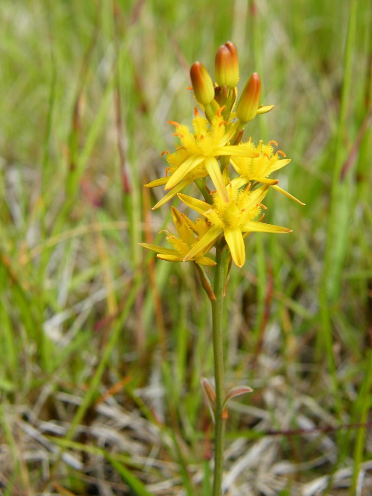
It was a lovely stretch of road we walked in the balmy sunshine.  
There was hardly any traffic, and the wild flowers were exquisite — especially the orchids.  
I can’t get over the variety and beauty of the wild orchids we have encountered all round the coast of Britain, and especially in Scotland.

We came to an Outdoor Centre where we sat on the wall (there didn’t seem to be anyone using it today) and ate our sarnies.  The two cars of sunbathers drove past while we were eating, and the women waved.

 The road then left the coast and went uphill over the moors.  We passed several small lochans.  It seemed a long hard trudge to get up there.  Meanwhile the sky was clouding over and it was turning muggy.  BUT looking ahead we could see Ben Nevis — the highest mountain in Britain — in the distance.  We have climbed it twice in the past, and both times the view from the top was………misty!  It was good to see it today without mist.

Still eight miles to go, according to another milepost.  We passed a herd of cows grazing amongst the lochans and we began to feel tired.  I think it was the mugginess of the atmosphere.   

We got to the top and started to descend, that was better!  Although Colin was tempted, he didn’t get on his bike at all.  He walked all the way.

We crossed a river and came to the road junction, and there Colin left his bike chained to a post because we would be passing this place when we returned to the caravan.  We sat on a rock to eat our apples.  Now we were on the main road leading to Fort William via the Corran Ferry — a popular route.  The traffic was much heavier, but it came in bunches because of the ferry.  Not much room to walk off the road, so it was several miles of ‘traffic-dodging’ which we didn’t enjoy.

The road took us above and along the river until we reached the shore again, and there we more or less followed the coast until the narrow point at Corran.  We were quite tired by then, and the mugginess of the ‘closed-in’ weather was beginning to get to us.  Such a difference to this morning!   
At one point we found a bit of ‘old’ road, but it was so old we ended up having to climb a fence.  (I can’t do it at my age!)   
At another point Colin insisted on walking round a wood because it got him off the road and “it must be shorter”.  Well, it wasn’t!  I was too tired to divert from the conventional route I had worked out from the map, and when I turned round later Colin had come out of the wood and was way behind me!   
We came to a noticeboard with a ‘You Are Here’ arrow on it.  That was most depressing because it looked as if we had made no progress at all after the road junction.  It did turn out to be inaccurate — too much Art and not enough map!  It shouldn’t be allowed, it discourages tired walkers so!  
It was still a long way, I had to force myself to keep going.  The views were wonderful, and so were the flowers and the rocks in the road cutting.  But I was so tired!  At last we got to the ferry where our car was parked.


That ended Walk no.257, we shall pick up Walk no.258 next time on the other side of the Corran Ferry.  It was quarter past seven, so the Walk had taken us nearly seven hours.  While we were drinking tea and eating caramel shortcake, we watched the ferry plying to and fro across this narrow neck of the loch.  It was very busy even this late in the evening.  As foot passengers we could have had a free ride across and then come back, but we couldn’t be bothered.  We also looked at a derelict boat that was definitely not the ferry!

We considered having supper at the nearby pub to save me cooking, but decided in the end it was a bit too expensive for our current finances.  We drove back to our caravan in Resipole, picking up Colin’s bike as we passed the road junction.

The next day we moved our caravan to Barcaldine, near Oban.

Tuesday, June 29, 2010

Walk 256 -- Strontian to Kingairloch

Ages:  Colin was 68 years and 52 days.  Rosemary was 65 years and 194 days.
Weather:  Cloudy, turning to hot sun.  A light breeze.
Location:  Strontian to Kingairloch.
Distance:  15 miles.
Total distance:  2397 miles.
Terrain:  All roads.  The first third of the Walk was flat, then we had a BIG HILL to climb!  The second half of the Walk was gently downhill.  Fantastic scenery!
Tide:  Coming in.
Rivers:  No.275, Carnoch River.  No.276, Allt na Creiche.  No.277, Allt na Cloiche.  No.278, Allt na h-Airigh.  No.279, Abhainn Ghardail.  Plus numerous streams.
Ferries:  None.
Piers:  None.
Kissing gates:  No.216 by the side of the road near Strontian.
Pubs:  None.
‘Historic Scotland’ properties:  None.
Ferris wheels:  None.
Diversions:  None.
How we got there and back:  We were staying in our caravan at Resipole, near Salen.  This morning, with Colin’s bike in the back of the car, we drove to Strontian where Colin left me on the village green.  I sat at a picnic table reading my book, and occasionally playing lazily with an old dog who had a ball but couldn’t really be bothered either.  Later I walked down to the car park where we finished the last Walk, and sat on a log whilst waiting for Colin.  Meanwhile he had driven to Kingairloch by a route which avoids the big hill, and cycled back.
At the end, we came to the car which was parked by the river more or less through Kingairloch which is hardly a village.  It was a twenty-five past seven, so the Walk had taken us seven and a quarter hours.  We moved the car to a breezier spot before partaking of tea and caramel shortcake as we were being bombarded by midges next to the river!  Then we returned to the caravan at Resipole, picking up the bike on our way through Strontian.


While waiting for Colin, I went into the Tourist Information Centre in Strontian to ask about ‘Historic Scotland’ properties, but they had no information whatsoever!  The rather prissy woman in there told me, “We’re only a small place and we haven’t got room for everything!”  So then I asked her if she had a local tide table I could buy.  She replied that there was a tide table pinned up on the wall, but she couldn’t give or sell me a copy because it was copyright!  This tide table was only for the next week.  I said (sarcastically I know!) “Oh, are the times of the tides a State Secret then?”  She just repeated, “I can’t let you have a copy because it’s copyright information!”  Words failed me at that point, and I had to walk out.

I sat on the green to read my book, and played occasionally with a very old dog who had a ball — but most of the time he couldn’t be bothered either.  It is a very pleasant green in Strontian, at least it was until not one, but TWO ‘men-with-strimmers’ got started nearby.  When a third man on a sit’n’ride motor mower got going, I couldn’t stand it any longer!  I walked down to the car park where we had finished the last Walk, and found a log to sit on and read my book.  I had lovely views across the loch and was only a little bothered by midges.

It took Colin two hours to drive to Kingairloch, then cycle back along a route which avoided the big hill we planned to walk over.  He needed a rest when he arrived, so he sat on the log too and we ate our pies.  We then walked alongside the loch towards its end which was about a mile away.  We found a tiny bit of ‘old’ road to walk along, but that didn’t really matter because the road wasn’t exactly busy.

We saw a heron fishing in the shallows, and there were small yachts moored at this end of the loch.  We passed Strontian War Memorial which was located way up high on a rock overlooking the water.  It was a lovely warm day, and the scenery was breathtaking.  We felt lucky to be alive!

At last we came to the end of Loch Sunart — possibly the longest loch we have walked inland for.  It turned into a river which was bridged by a road, and that followed the southern shore westwards for about three miles.
We followed this road, crossing the river and a marsh full of yellow irises.  There were a lot of showy wild flowers in bloom along the shore, especially foxgloves.  When we were opposite Strontian, we sat on a bank to eat our sarnies.

Where the road turns away from the loch, a track leads off which continues to follow the southern shore for miles and miles.  We didn’t take it, partly because of the logistics of organising the next few Walks, and partly because further on it turns into a mountain path.
At one point this path climbs steeply some way up a ridge, then there is a gap of about a mile over the top before another steep path appears on the map to take us down the other side.  After our frightening ‘adventure’ on Walk 245, we made up Additional Rule no.16 which forbade us to take such a path in the interests of our safety and wellbeing.
Besides, our experiences have led us to distrust many of the Scottish footpaths we see on our expensive OS maps, and the forest paths would have been thick with midges at this time of year!  On top of that, we couldn’t see how we would be able to set up the Walks — the only public transport goes to Lochaline which is at least three Walks away, Colin would inevitably have come to grief if he had tried to cycle the forest tracks, and we couldn’t afford to hire another car.
It seems a big ‘chunk’ to miss out most of the Morvern Peninsula, but we felt our Walk to the Point of Ardnamurchan (when we didn’t have to do because it is a dead end) more than compensated for it.

So we stayed on the road which turned south and went up a great big hill!  We passed a farm entrance where the cattle grid intrigued us.  We wondered what use it was because it only stretched partway across the road and there was nothing to stop animals walking round it.
The sun came out as we started to climb, and it got very hot.  The views behind became increasingly spectacular — we kept turning round to look at them.  (That was our excuse, anyway, when we frequently stopped to have a rest.)  We were passed by a cyclist (male) with huge panniers and long hair.  He was followed by his girl-friend with huge panniers and short hair!  They both seemed cool, calm and collected despite the stiff climb, but I was so hot I really began to think I wouldn’t make it.  So I went into ‘march-mode’ and found that helped.  At last we reached the top, and descended a little to the road junction where we stopped to eat our apples.

The road we were on leads downhill through Claggan to Lochaline where there is a ferry to the Isle of Mull.  A road branches off which leads along the southern shore of the Morvern Peninsula through Savary and Killundine to Drimnin.  But it is all a dead end, so we turned left and took the road eastwards towards Kingairloch.  But yesterday, a ‘rest’ day, we drove down to Lochaline to see what it was like down there.  I wrote in my diary:  We went over the mountains and down to Lochaline where the ferry goes off to Mull.  We had lunch from the snack bar there whilst watching the ferry go out and a dive-boat come in.  We then drove all the way along to Drimnin where there was a passenger ferry to Tobermory, according to the map.  But it has long since been defunct.  Very pretty route though, with fine views of Mull.
There is a rock by the side of the road with a big hole in it — quite natural.  Back through Lochaline, we took a side road to look at Loch Arienas.  But there were too many midges, so we didn’t stop.”

Now we were no longer going uphill and I’d had a bit of a rest, I felt a lot better.  The sun didn’t seem so hot anymore.  I was ahead of Colin when a flock of sheep appeared unexpectedly round a corner.  I could almost hear a collective GULP! as they spied me, and the whole flock scarpered in all directions!  At that point we were passing a farm where there were a lot of dogs in cages.  They sensed us, and started baying like the Hound of the Baskervilles — all hell was let loose!  And we’d only been walking along a public road in a very remote place.  
Further down there was a car which stopped when it almost reached us, then it continued and passed us.  It was the shepherd and his dog.  They got out and began to round up the dispersed sheep, the man whistling and shouting while the dog ran hither and thither to gather them together.  The man seemed annoyed at us for causing the disturbance, but we were the innocent party (honest!) so we walked on before there was any altercation.  (Also because I am a coward at heart!)

We descended past a small loch which we thought might be a corrie lake.  There seemed to be a miniature hydro-electric scheme attached to it — at least that’s what we thought it was.  Probably only big enough to provide electricity to the sparse properties nearby.  We kept passing pipeline notices, and there was part of the pipeline exposed.  We assumed it was all part of the same works.  We sat on a granite stone to eat our chocolate.

We got to Kingairloch at last, with wonderful views across the sea-loch which marks the southern end of the Great Glen Fault.  We had passed lots of flowers on the way, especially wild orchids.  We could see down towards Oban — the views were stunning!
We caught glimpses of the little Loch à Choire through the trees at first.  Then it opened out so we could see it properly, and further across the sea-loch — the much bigger Loch Linnhe.

 The road twisted sharply downhill where we caught sight of the chapel at Camasnacroise down on the shore.  We could also see a nice sandy beach and a sand bar shining in the sun.  It looked idyllic — except for the midges!  They weren’t too bad if we kept moving, but we daren’t stop even momentarily.

There were fuchsia hedges all the way down to river level.  This reminded us of a holiday in western Ireland some years back, where fuchsia hedges lined the fields for mile upon lazy mile.  We loved them!  We came to our car, parked between the river and a metal signpost telling us it was fourteen miles to Corran — our next destination.

 That ended Walk no.256, we shall pick up Walk no.257 by the river at Kingairloch.  It was twenty-five past seven, so the Walk had taken us seven and a quarter hours. We had to move the car to a breezier spot before partaking of tea and caramel shortcake as we were being bombarded by midges where we were parked.  So we drove on round the corner, and sat on rocks overlooking the beautiful Loch Linnhe.  Then we returned to the caravan at Resipole, picking up the bike on our way through Strontian.