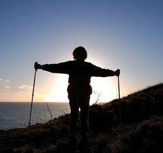
Weather: Torrential showers with a very warm sun
between. Hot and humid. Later turning breezy and cooler.
Location: Dalbeattie to Caulkerbush.
Distance: 14 miles.
Total distance: 2993 miles.
Terrain: Some road-walking, some coastal path. Slippery (mud) in places, uneven ground in others but some pleasant grass paths. Could be very undulating — quite a few steps.
Tide: Out.
Rivers: No.358, Kirkgunzeon Lane in Dalbeattie. No.359, Barnhourie Burn at Sandyhills.
Ferries: None.
Piers: None.
Kissing gates: Nos.313 & 314 as we approached Rockcliffe. Nos.315, 316, 317, 318, 319, 320, 321, 322, 323, 324, 325, 326, 327, 328, 329, 330, & 331 on the coastal path. (19 in all!)
Pubs: None.
‘Historic Scotland’ properties: None.
Ferris wheels: None.
Diversions: None.
How we got there and back: Yesterday we towed our caravan from home to Dalbeattie. This morning Colin drove the car to Caulkerbush where he parked it and caught a bus back to Dalbeattie.
At the end we came to our car parked by the side of the road in Caulkerbush. We drove straight back to Dalbeattie for our tea and biscuits in the caravan.
Nearly six weeks later, and here we are back in Dalbeattie. My foot feels fine and I can walk properly, so we are looking forward to a couple of weeks good walking. But the weather is not co-operating. As we walked through Dalbeattie to the starting point of today’s Walk (at a crossroads by the end of the causeway near the river) the rain poured on to us. We passed people scurrying into a church for a funeral, and felt the weather was quite appropriate for such an occasion!
Despite wearing full wet weather gear, we had to stand under a tree at the crossroads for five minutes or more because it was raining so hard. Hence we were reluctant to take our cameras out, and the photos taken were fewer than we would have liked. And all of them were taken on Colin’s ‘instant’ camera because it was easier to slip it in and out of our pockets.
About a hundred yards down the road a track forked off next to a triangle of grass. Some horses were tethered to a post on this piddly bit of greenery, and they looked very miserable in the pouring rain. From a distance I thought a man in the adjacent bus shelter was their rider, but it turned out he didn’t have anything to do with them, he was just sheltering from the rain. I really felt for those horses, and hoped they hadn’t been abandoned.
We crossed a stream into a yard, then followed a track through a gate and on towards the sewage works. There were lots of horses and ponies in adjacent fields — this seems to be a very ‘horsey’ area. It was muddy underfoot and still pouring with rain. We came to the sewage works, but inevitably it had a locked gate. So we went into the field next to it and walked alongside the perimeter fence. But we were faced with a hedge and a fence at the other end, with trees and dense undergrowth beyond. There was no way we could have got through.
Disappointed (we had hoped to walk, for a bit, by the river) we retraced our steps to the locked gate, then tried to walk the other way round the sewage works. This time we were thwarted by a hedge and a double barbed wire fence. So we had to walk back in a northerly direction which is exactly what we didn’t want to do. We were inside one of the fields with horses — they came right up to us and were very nosey! We walked all round their enclosure but couldn’t find any way out to the road. It was quite muddy and slippery in places, so not easy going. I was glad I had brought my walking poles.
 Then the sun came out — we couldn’t believe the huge
amount of blue sky after all that rain!
But it didn’t last, so we whipped out the camera to take the first
picture of the day — me with some of the ponies. It got very hot, so we started to peel off
layers — they soon had to go back on! We
admitted defeat, went back to the yard where we were able to exit to the
road. We had wasted a lot of time and
made very little progress on our Walk.
We walked down the road to a picnic area where we
stopped to eat our pasties. By then it
was raining again, and that remained the pattern of the day though it did
remain warm.

 We walked down to the village where we admired
shells set in a wall — but it was too wet to get the camera out, so no
photograph. We turned a corner, and a
lovely view of the river opened out before us.
We were at the mouth of the estuary — at last we were back by the sea! The tide was right out, so most of the boats
were stranded on the sand/mud. We could
just make out a cormorant ‘drying’ its wings next to one of the boats — in the
rain? (It was honking down!)

 We passed a Millennium ‘Saxon’ Cross, but again too
wet to risk getting the camera out. We
wanted to stop and eat our sarnies and there were lots of seats with fabulous
views — but all out in the open in the wet.
Frustrating! But right at the
very end was a shelter with dry seats inside facing the sea, it was clean and
freshly painted. Perfect!
 Not only could we have our lunch in comfort,
but we could take photographs of the estuary without getting the camera wet.
And then it stopped raining — things were getting better! It wasn’t clear on the map whether we could get through to the next village, Rockcliffe, at this level down by the shore. We sincerely hoped we could because otherwise it was retrace our steps back to the main road and walk several miles round. We asked a local lady who was out walking her dog. She said she thought we could get through but she believed it was a bit of a steep path. (Don’t mind that, so long as we don’t have to go back to that wretched road!)
 We followed a narrow winding dead-end road almost to
its end, and were surprised to be passed by a police car on the way. Wild roses grew in the hedgerows, they looked
and smelled wonderful. A path led us up
through the woods (it wasn’t very steep) and down into Rockcliffe. We were there!
 And what a wonderful sense of humour the people of
Rockcliffe have! We loved the face made out
of an old log particularly, but also the other faces and animals which adorned
the cottages we passed.


A ‘grotto’ was for the under 5s and over 80s, apparently. We fit into neither category, but we still loved it! Then it started raining again which dampened our mood a little.
 We walked down to the shore and across a bit of
beach.
 Up on to the minor road for about
a hundred yards, then we took a footpath towards Castlehill Point. About a quarter of a mile into it we were at
last told that this was the coast path to Sandyhills. It was with some relief that we learned this
because, up until that point, we hadn’t known if we would be able to get
through.

 The path took us to an
overgrown shore where I was struck by the variety of colourful stones on the
beach. They were mostly granites, I
think, and looked really good glistening in the rain.
Very soon we were directed up through woods, and finally climbed to the top of Castlehill Point. The rain had petered out by then and we were treated to magnificent views.

 I loved the way the tide was
edging into the mouth of the estuary, I thought it was quite artistic. I even videoed it for a minute or two because
I wanted to preserve the gentle movement of the waves. It was soothing to my mood. Then we noticed a heron standing in the
shallows trying to catch a fish. That
just made the picture — pity the light was so flat.
 We continued eastwards on the cliff path. We saw one person in the distance walking his
dogs, but he just did a circular round a field and then disappeared in the
direction of Rockcliffe. We actually MET
NOBODY. The rain held off and it got a
little breezy. Visibility remained poor
but it did improve slightly.

 It was a lovely path, we did enjoy it! The views were magnificent, and they were
occasionally enhanced by bright summer flowers.
We saw the occasional bird, the occasional sandy inlet, we passed a
ruined building and a hedge which demonstrated very clearly the direction of
the prevailing wind!
 Out in the Solway
Firth we could just make out an offshore wind farm, but we couldn’t see the Lake District which we knew was out there somewhere.
 Colin was thrilled to see a long-eared owl,
but didn’t have time to get his camera out before it flew away. I didn’t see it because I was trailing a bit
behind at that point — the path was very up and down.
 The cliffs were beautiful too, a lovely
russet red colour interspersed with grey.
(A Silurian rock called Wenlock, according to my geology map, with lumps
of an intrusive igneous rock called Porphyrite scattered about.)
 Eventually we came down steps to a road and we
thought we were there — at Sandyhills, I mean.
But of course we weren’t. We were
getting a bit tired and this was wishful thinking. A close study of the map told us we had only
got to Port O’Warren Bay and we had at least another mile to go. We walked up the road and turned right, still
following the coast path signs.
A car passed us, then stopped and the driver put out a tiny ‘Yorkie’ dog. Then she continued to drive slowly on with the little dog running as fast as its little legs could carry it to try and catch up! We were open-mouthed! Then we were passed by a van who had put out a labrador to run in the same way. Is this the way the local people walk their dogs in these parts?
 We turned on to the cliff footpath again, and felt
we had had enough of the ‘up & down’ despite the wonderful views. We were really tired by then, and the path
was quite slippery in places because of the earlier rain. We were very slow over this bit.

 But we persevered, and came out in a maze of
paths. There was a distinct lack of
‘Coastal Footpath’ signs, and we kept taking the wrong turning which was
irritating in our state of weariness.
But eventually we found a footbridge over the burn at the edge of Sandyhills Beach.
We had made it!
It was a lovely sandy beach to walk across, but it seemed to be owned by the adjacent caravan park. A prominent notice on the beach warned us of an offshore deep channel which is concealed by the high tide, and of the fast-flowing incoming tide. Don’t get cut off! There was also a signpost pointing back the way we had come giving the mileages to all the places we had passed through since Rockcliffe. We could have done with one of those at the other end — even better, as far back as Kippford!
 We exited to the car park where we found a bench to
sit on and eat our chocolate. There we looked at a ‘history board’ which
told us about stake nets, saltpan rocks, Barnhourie Mill, RAF bombing targets,
etc, etc. We were really too fatigued to
read it all. We could vaguely see the
platform which was the RAF bombing target, but we just wanted to get to the end
of the Walk.
 We put on our bright yellow waistcoats and trudged
the final two and a half miles along the road.
Mostly the sea was out of sight, but occasionally there was a gap in the
trees revealing the water below. On
reaching Caulkerbush we came upon our car parked by the side of the road.
That ended Walk no.296, we shall pick up Walk no.297 next time just short of the road junction in Caulkerbush. It was twenty to eight, so the Walk had taken us nine hours twenty minutes. We drove straight back to Dalbeattie for our tea and biscuits in the caravan.
My left heel was very uncomfortable, and when I removed my boot I discovered a nasty blister had formed. Feeling inside my boot I found there was a hole in the lining at that spot! I shall have to fill it with foam or something. Those boots had cost me a small fortune — they shouldn’t go like that!
Location: Dalbeattie to Caulkerbush.
Distance: 14 miles.
Total distance: 2993 miles.
Terrain: Some road-walking, some coastal path. Slippery (mud) in places, uneven ground in others but some pleasant grass paths. Could be very undulating — quite a few steps.
Tide: Out.
Rivers: No.358, Kirkgunzeon Lane in Dalbeattie. No.359, Barnhourie Burn at Sandyhills.
Ferries: None.
Piers: None.
Kissing gates: Nos.313 & 314 as we approached Rockcliffe. Nos.315, 316, 317, 318, 319, 320, 321, 322, 323, 324, 325, 326, 327, 328, 329, 330, & 331 on the coastal path. (19 in all!)
Pubs: None.
‘Historic Scotland’ properties: None.
Ferris wheels: None.
Diversions: None.
How we got there and back: Yesterday we towed our caravan from home to Dalbeattie. This morning Colin drove the car to Caulkerbush where he parked it and caught a bus back to Dalbeattie.
At the end we came to our car parked by the side of the road in Caulkerbush. We drove straight back to Dalbeattie for our tea and biscuits in the caravan.
Nearly six weeks later, and here we are back in Dalbeattie. My foot feels fine and I can walk properly, so we are looking forward to a couple of weeks good walking. But the weather is not co-operating. As we walked through Dalbeattie to the starting point of today’s Walk (at a crossroads by the end of the causeway near the river) the rain poured on to us. We passed people scurrying into a church for a funeral, and felt the weather was quite appropriate for such an occasion!
Despite wearing full wet weather gear, we had to stand under a tree at the crossroads for five minutes or more because it was raining so hard. Hence we were reluctant to take our cameras out, and the photos taken were fewer than we would have liked. And all of them were taken on Colin’s ‘instant’ camera because it was easier to slip it in and out of our pockets.
About a hundred yards down the road a track forked off next to a triangle of grass. Some horses were tethered to a post on this piddly bit of greenery, and they looked very miserable in the pouring rain. From a distance I thought a man in the adjacent bus shelter was their rider, but it turned out he didn’t have anything to do with them, he was just sheltering from the rain. I really felt for those horses, and hoped they hadn’t been abandoned.
We crossed a stream into a yard, then followed a track through a gate and on towards the sewage works. There were lots of horses and ponies in adjacent fields — this seems to be a very ‘horsey’ area. It was muddy underfoot and still pouring with rain. We came to the sewage works, but inevitably it had a locked gate. So we went into the field next to it and walked alongside the perimeter fence. But we were faced with a hedge and a fence at the other end, with trees and dense undergrowth beyond. There was no way we could have got through.
Disappointed (we had hoped to walk, for a bit, by the river) we retraced our steps to the locked gate, then tried to walk the other way round the sewage works. This time we were thwarted by a hedge and a double barbed wire fence. So we had to walk back in a northerly direction which is exactly what we didn’t want to do. We were inside one of the fields with horses — they came right up to us and were very nosey! We walked all round their enclosure but couldn’t find any way out to the road. It was quite muddy and slippery in places, so not easy going. I was glad I had brought my walking poles.
Then we continued down the
road for about two miles, passing a field with ponies and their very young
foals on the way. It was a relief to get
off the main road when we turned on to a minor road to Kippford. It was still raining.
And then it stopped raining — things were getting better! It wasn’t clear on the map whether we could get through to the next village, Rockcliffe, at this level down by the shore. We sincerely hoped we could because otherwise it was retrace our steps back to the main road and walk several miles round. We asked a local lady who was out walking her dog. She said she thought we could get through but she believed it was a bit of a steep path. (Don’t mind that, so long as we don’t have to go back to that wretched road!)
A ‘grotto’ was for the under 5s and over 80s, apparently. We fit into neither category, but we still loved it! Then it started raining again which dampened our mood a little.
Very soon we were directed up through woods, and finally climbed to the top of Castlehill Point. The rain had petered out by then and we were treated to magnificent views.
A car passed us, then stopped and the driver put out a tiny ‘Yorkie’ dog. Then she continued to drive slowly on with the little dog running as fast as its little legs could carry it to try and catch up! We were open-mouthed! Then we were passed by a van who had put out a labrador to run in the same way. Is this the way the local people walk their dogs in these parts?
It was a lovely sandy beach to walk across, but it seemed to be owned by the adjacent caravan park. A prominent notice on the beach warned us of an offshore deep channel which is concealed by the high tide, and of the fast-flowing incoming tide. Don’t get cut off! There was also a signpost pointing back the way we had come giving the mileages to all the places we had passed through since Rockcliffe. We could have done with one of those at the other end — even better, as far back as Kippford!
That ended Walk no.296, we shall pick up Walk no.297 next time just short of the road junction in Caulkerbush. It was twenty to eight, so the Walk had taken us nine hours twenty minutes. We drove straight back to Dalbeattie for our tea and biscuits in the caravan.
My left heel was very uncomfortable, and when I removed my boot I discovered a nasty blister had formed. Feeling inside my boot I found there was a hole in the lining at that spot! I shall have to fill it with foam or something. Those boots had cost me a small fortune — they shouldn’t go like that!