Ages: Colin was 64 years and 13 days. Rosemary was 61 years and 155 days.
Weather: Sunny at first, then clouding over. From lunchtime onwards it was persistent rain — yuk!
Location: Saltburn-by-the-Sea to Middlesbrough, via Redcar.
Distance: 15½ miles.
Total distance: 1056½ miles.
Terrain: Crumbling clifftop paths, concrete proms, dunes, roads, tracks and a lot of main roads — with pavements thank goodness.
Tide: In, going out.
Rivers: None.
Ferries: None.
Piers: No.26, Saltburn-by-the-Sea.
Kissing gates: None.
Pubs: None. (Unless you count ‘The Cross Keys’ near Guisborough which we visited two days later after we had abandoned Walk no.133 because of the weather. We drank Prior’s Ale, Ruby Ale, Flying Herbert and Dizzy Dick, all by North Yorkshire.)
‘English Heritage’ properties: No.38, Gisborough Priory. We didn’t have to visit it, but we did on a dull and drippy day earlier in the week because we didn’t know what else to do with ourselves.
Ferris wheels: None.
Diversions: No.37 between Redcar and Middlesbrough. The footpath had been closed only six days earlier, and would remain closed for the next six months so that work to prevent flooding could take place. The only alternative was along the main road for several miles — yuk! yuk!
How we got there and back: We were camping in Hinderwell. We didn’t want to park our car in Middlesbrough because of its reputation for vandalism. I had looked at lots of bus timetables, and found there is no direct bus route from Middlesbrough to Saltburn. So I had planned to park in Skelton, catch a bus to Saltburn, and at the end catch a bus back from Middlesbrough to Skelton. Soon after 9am (very early!) we were waiting for the Saltburn bus in Skelton. It didn’t turn up! An elderly lady was waiting for the same bus, and getting very anxious because she was organist at a little Mormon church in Redcar. As time went on she became more and more agitated, so Colin collected the car and we gave her a lift to her church, arriving ten minutes before the service was due to start. She kept saying, “I can’t really believe this!” and practically danced out of the car with a hop, skip and jump when we arrived! We then drove to Saltburn and parked at the top of the cliff lift again.
At the end we caught a train from Middlesbrough to Saltburn. (Colin thought of that, I had forgotten all about the trains — and it was much cheaper, too, because we had our Senior railcards!) Then we drove straight to ‘The Ship’ in Port Mulgrave because the landlady had saved two roast beef dinners for us. Colin drank ‘Spitfire’ and I drank wine — a merlot. After that it was just a short drive back to the campsite.
 An Augustinian Priory founded by the Bruce family, afterwards kings of Scotland. There is not much of it left, just the fourteenth century east end which looked quite dramatic in the murk. In an adjacent field is a dovecot, but we didn’t know how old that was, and we couldn’t get to it.
After the fiasco of the bus not turning up, we actually managed to start the Walk in good time — our only problem being that we were walking away from the car instead of towards it. The cliff lift was working this morning, but we didn’t use it because it was downhill to the beach and we weren’t tired. The toilets at the bottom were closed, which was a bit of an inconvenience as we had to walk a quarter of a mile in the wrong direction to find some that were open. (Some of these Council officers ought to suffer from Colin’s problem, then perhaps they would understand how important it is to have toilets open in built-up areas where there are no convenient bushes or rocks to hide behind!)
 There were crowds of people enjoying the seafront on this bright and sunny Sunday morning. The atmosphere was quite jolly! There were a number of surfers in the sea enjoying the waves. All were wearing wetsuits — I bet the water was perishing!
We walked along the newly refurbished pier — apparently the most northerly in England. If Scotland doesn’t have any piers — and I don’t think the Victorians built them up there — then it is going to be a very long time before we walk another one. We were lucky we were able to walk this one, for it has only recently been reopened after restoration. A notice told us the history:
1869 – PIER COMPLETED, A VICTORIAN MARVEL 1500FT OUT INTO THE SEA
1875 – PIER HEAD WASHED AWAY, REBUILT AT 1280FT
1900 – STORM DAMAGE, PIER SHORTENED
1924 – ‘OVENBEG’ BROKE UP ON PIER AND TORE AWAY CENTRAL SECTION, WHICH WAS REBUILT
1939 – CENTRAL SECTION CUT OUT BY ROYAL ENGINEERS TO FOIL THREAT OF INVASION
 1953 – GALES TWISTED MAIN STRUCTURE, REBUILT 1956-59
1961 – STORM DAMAGE TO 20 PILES REPAIRED
1973 – CORROSION AND DAMAGE FORCED PIER TO BE CLOSED
1974 – OCTOBER STORM WASHED AWAY PIER HEAD BEFORE IT COULD BE REPAIRED
 1975 – PIER TO BE DEMOLISHED
1975 – SAVE THE PIER CAMPAIGN EVENTUALLY SUCCESSFUL
1978 – SHORTENED PIER, 681FT, OPENED TO PUBLIC AGAIN
1996 – PIER ONCE AGAIN IN IMMINENT DANGER OF COLLAPSE
1999 – PIER RESTORATION FUNDING RAISED
 We visited Saltburn in 1994 on our way to Scotland, and we thought it a rather run-down place back then. I don’t remember the pier particularly, but I do remember everything looked tatty,
  gone to seed. This time, however, the seafront looked bright and cheerful as if it had recently been given a fresh coat of paint. Some of the gardens were still fenced off because they are currently being ‘refurbished’ so the work hasn’t finished yet. Well done, Saltburn-by-the-Sea! It is now a very pleasant seaside town.
 At the end of the prom we climbed up on to some low sandy ‘cliffs’ because the beach sand looked soft and the tide was in. Lovely flowers up there, and sweeping views, but it wasn’t easy walking because it was eroded, muddy, and everywhere there were flies! There were clouds of them, we seemed to be breathing them in and out. It was horrible! (If you think I have left spots on any of the photos, think again.
 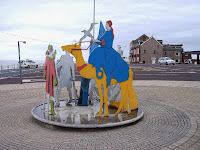 That is the flies!) We soon came to a deep cleft which was difficult to get down. After we had successfully descended, we decided to try the beach again — but it was too soft to walk comfortably. At Marske we climbed up on to very low cliffs and found a hole out of the wind where we stopped to eat our pasties.
 We were soon on tarmac and concrete — the outskirts of Redcar. This is much more of a “Kiss-me-quick” type of resort. There was the familiar smell of greasy fish’n’chips, and obese families sitting out eating same.
  We passed a roundabout sculpture, ‘Las Vegas’, an information point completely devoid of information, and a theatre advertising for ‘females for a horror movie’! There was a funfair (no Ferris wheel!) with a bouncing cradle that seemed to be a safer version of bungy jumping that adolescents could take part in.
 On the plus side, there were some fantastic railings — first of all with silhouettes of Laurel and Hardy, then colourful pictures of nursery rhymes and seaside scenes. I loved them!


 Then we came across a group of penguins on the prom — it was quite like Antarctica (I don’t think)! It was all very jolly, and we thought it was great!

 We got to the end of the prom and it started to rain. We both donned our capes, and before it got too bad we huddled behind a wall to eat our sandwiches. We looked out towards the Gare from which families were returning in their droves because it is rather a nice beach out there, but now the rain was getting heavier by the minute. A notice nearby told us about it:
The mouth of the River Tees was a death trap for ships, and during one violent storm in 1861 over fifty ships were lost on to a sandbank called the Bar. Following this disaster the authorities and local industrialists decided to build the breakwater called the South Gare to provide a safe harbour.
The Gare is 2½ miles long and was constructed from waste, known as slag, from blast furnaces producing iron and steel. The South Gare was completed and opened in 1888. The whole structure is a marvel of engineering skill and to this day it still protects shipping. The construction of the breakwater saved valuable cargos and also many lives.
Whilst the Victorians altered nature, the area is still an important haven for wildlife with the seashore and dunes providing refuge for nationally important habitats and species.
We looked out into the grey that was the Gare, the streams of families returning hurriedly to their cars, felt the rain on our capes and made a decision. Two and a half miles there and back would add five miles to our Walk, the Gare is a dead end we don’t have to walk unless we want to — extra Rule no.2 — and we didn’t. So we turned and started walking alongside the golf course where golfers were still playing despite the fact that the rain was getting quite heavy! It rained relentlessly for the rest of the Walk. (Some of the subsequent photos were taken when we returned to the area at a later date because it was too wet to risk getting out the camera.) It is not a very salubrious golf course with the chimneys of heavy industry belching smoke into the atmosphere in the near distance. The public footpath is supposed to go adjacent to the course for a while, then cut across the middle. We strongly suspect that the golfers had removed the fingerpost for we missed the way across and ended up trudging an extra half mile round the nether end. We then walked across a nature reserve, over a railway and out to the main road. We stood by the gate eating our apples because it was raining cats and dogs by then and there was nowhere to sit down.
The rain was torrential, we got soaked with spray every time a lorry passed, we got waved at by youths in a car, we were constantly passed by ‘boy-racers’ driving at speed and we kept getting derogatory remarks about our capes. (We thought the capes were brilliant! We may have looked like a couple of hunchbacks, but they kept us and our rucksacks dry.) The factories looked gruesome, many with flames coming from their chimneys. We were not enjoying ourselves. On a roundabout further up the road was a colourful sculpture celebrating the steel industry. We rather liked it, but had to return at a later date, when it was not raining, to photograph it.
 Eventually we were able to turn off on to the A66, and found a parallel estate road to walk along where there was little traffic. We passed a row of shops which had been burnt out, but it looked as if the chemist’s shop was still open. The area was so run down, easily the worst area we have walked through on the whole of this Trek. It was worse than anything in the Thames Estuary and worse than any part of Hull. There seems to be an atmosphere of hopelessness about Middlesbrough, perhaps it is something to do with the smoke and steam emanating from so many factory chimneys and breathed in on a daily basis by the local populace. It didn’t do us any good experiencing it on such a grey and wet day. Even when we came back on a sunny day, we didn’t feel any different about it.
 Amongst the houses we came across a tall grey structure with no windows or doors. We were puzzled until we read a small plaque which was affixed to it:
 There Colin said, “What about catching a train back to Saltburn?” We looked on the timetable displayed in the station, and sure enough there was a direct service back to there, and it ran on Sundays! We would have plenty of time to get to the Transporter Bridge — then to the main station in Middlesbrough to catch it. I had been so into buses I had forgotten all about the trains!
We sat on the station platform to eat our chocolate, and then looked for the footpath which ran alongside the railway, according to our map. We hadn’t seen it when we had entered the station, so we looked along the end of the platform first — nothing! We retreated to the station entrance, and at last we spied it hidden behind a large bush and overgrown with eyebrow-high weeds! It was quite an ornamental entrance, a modern work of art which obviously hadn’t been there long. It was a sign that Middlesbrough is perhaps beginning to reinvent itself, but the sad thing was the footpath itself had disappeared under uncontrolled weeds and was ankle-deep in rubbish! Most of it was industrial litter — polythene wrappings and polystyrene wadding, that sort of thing. It had obviously been dumped there, and the wind had blown much of it into adjacent bushes where it hung like flags.
 In that rain, the whole scene was yukky!
We stomped on, the narrow path sandwiched between the railway line and a number of factories from which emanated humming sounds, hissing noises, steam and obnoxious smells. We were very wary of what we were actually treading in — it was difficult to remember that we were walking the coastal path! Further on we came across a safe which had been broken into — it was empty. It was just before a bridge where a dead-end road went over the railway. We surmised that it had been stolen from somewhere, then the thieves managed to break it open and steal the contents, and then threw the safe itself off the bridge in this out-of-the-way place. (When we returned in better weather to photograph it, it wasn’t there.)
We crossed the railway at a level crossing, and from there on we could see the famous Transporter Bridge above the intervening buildings. I hadn’t realised it was so tall! The ‘path’ was now a minor road, so walking was much more pleasant. We traversed several brand new car parks — all empty — and came across a brand new football stadium! This magnificent structure was in such contrast to the surrounding industrial / downtrodden area we had just passed through, it quite took us by surprise. I suppose we were lucky that there wasn’t a match when we passed through — there was hardly a soul about. The stadium was so new there was still work ongoing, but it was obviously open and in use. Perhaps Middlesbrough is pulling itself together after all!
We kept getting tantalising glimpses of the Transporter Bridge, then we rounded a corner and there it was! What a fascinating structure! It reminded me of Tower Bridge in London without the bottom bit. Wires hang down from the top bit to transport cars across the River Tees in a cage! I hadn’t realised it was like that, though Colin knew more about it. It is the first bridging point on the River Tees, and carries the main A178 across the river. It was built in 1911 in that way so that ships could pass underneath it unimpeded. It is the largest working bridge of its kind in the world. We were delighted to find that it is open every day, and carries pedestrians for a small fee.
That ended Walk no.132, we shall pick up Walk no.133 next time at the Transporter Bridge in Middlesbrough. We walked about a hundred yards down the road to the railway station where we caught a train directly back to Saltburn. It was only while we were waiting for the train that we realised how wet — and subsequently how cold — we were. In Saltburn we walked the short distance to our car, then drove straight to Port Mulgrave where two roast dinners were waiting for us at the local pub. Then we felt better, but it was still raining when we returned to our tent.
At a later date I managed to find two pictures of the Transporter Bridge taken in the 1950s.

 It eventually stopped raining at 8pm — after 14 hours!!! Since more of the same was forecast, we packed up our soggy camp the next day and went home. We came back in July when the weather was better.
Weather: Sunny at first, then clouding over. From lunchtime onwards it was persistent rain — yuk!
Location: Saltburn-by-the-Sea to Middlesbrough, via Redcar.
Distance: 15½ miles.
Total distance: 1056½ miles.
Terrain: Crumbling clifftop paths, concrete proms, dunes, roads, tracks and a lot of main roads — with pavements thank goodness.
Tide: In, going out.
Rivers: None.
Ferries: None.
Piers: No.26, Saltburn-by-the-Sea.
Kissing gates: None.
Pubs: None. (Unless you count ‘The Cross Keys’ near Guisborough which we visited two days later after we had abandoned Walk no.133 because of the weather. We drank Prior’s Ale, Ruby Ale, Flying Herbert and Dizzy Dick, all by North Yorkshire.)
‘English Heritage’ properties: No.38, Gisborough Priory. We didn’t have to visit it, but we did on a dull and drippy day earlier in the week because we didn’t know what else to do with ourselves.
Ferris wheels: None.
Diversions: No.37 between Redcar and Middlesbrough. The footpath had been closed only six days earlier, and would remain closed for the next six months so that work to prevent flooding could take place. The only alternative was along the main road for several miles — yuk! yuk!
How we got there and back: We were camping in Hinderwell. We didn’t want to park our car in Middlesbrough because of its reputation for vandalism. I had looked at lots of bus timetables, and found there is no direct bus route from Middlesbrough to Saltburn. So I had planned to park in Skelton, catch a bus to Saltburn, and at the end catch a bus back from Middlesbrough to Skelton. Soon after 9am (very early!) we were waiting for the Saltburn bus in Skelton. It didn’t turn up! An elderly lady was waiting for the same bus, and getting very anxious because she was organist at a little Mormon church in Redcar. As time went on she became more and more agitated, so Colin collected the car and we gave her a lift to her church, arriving ten minutes before the service was due to start. She kept saying, “I can’t really believe this!” and practically danced out of the car with a hop, skip and jump when we arrived! We then drove to Saltburn and parked at the top of the cliff lift again.
At the end we caught a train from Middlesbrough to Saltburn. (Colin thought of that, I had forgotten all about the trains — and it was much cheaper, too, because we had our Senior railcards!) Then we drove straight to ‘The Ship’ in Port Mulgrave because the landlady had saved two roast beef dinners for us. Colin drank ‘Spitfire’ and I drank wine — a merlot. After that it was just a short drive back to the campsite.
Gisborough Priory
 An Augustinian Priory founded by the Bruce family, afterwards kings of Scotland. There is not much of it left, just the fourteenth century east end which looked quite dramatic in the murk. In an adjacent field is a dovecot, but we didn’t know how old that was, and we couldn’t get to it.
After the fiasco of the bus not turning up, we actually managed to start the Walk in good time — our only problem being that we were walking away from the car instead of towards it. The cliff lift was working this morning, but we didn’t use it because it was downhill to the beach and we weren’t tired.
 The toilets at the bottom were closed, which was a bit of an inconvenience as we had to walk a quarter of a mile in the wrong direction to find some that were open. (Some of these Council officers ought to suffer from Colin’s problem, then perhaps they would understand how important it is to have toilets open in built-up areas where there are no convenient bushes or rocks to hide behind!)
 There were crowds of people enjoying the seafront on this bright and sunny Sunday morning. The atmosphere was quite jolly! There were a number of surfers in the sea enjoying the waves. All were wearing wetsuits — I bet the water was perishing!
We walked along the newly refurbished pier — apparently the most northerly in England. If Scotland doesn’t have any piers — and I don’t think the Victorians built them up there —
 then it is going to be a very long time before we walk another one. We were lucky we were able to walk this one, for it has only recently been reopened after restoration. A notice told us the history:
1869 – PIER COMPLETED, A VICTORIAN MARVEL 1500FT OUT INTO THE SEA
1875 – PIER HEAD WASHED AWAY, REBUILT AT 1280FT
1900 – STORM DAMAGE, PIER SHORTENED
1924 – ‘OVENBEG’ BROKE UP ON PIER AND TORE AWAY CENTRAL SECTION, WHICH WAS REBUILT
1939 – CENTRAL SECTION CUT OUT BY ROYAL ENGINEERS TO FOIL THREAT OF INVASION
 1953 – GALES TWISTED MAIN STRUCTURE, REBUILT 1956-59
1961 – STORM DAMAGE TO 20 PILES REPAIRED
1973 – CORROSION AND DAMAGE FORCED PIER TO BE CLOSED
1974 – OCTOBER STORM WASHED AWAY PIER HEAD BEFORE IT COULD BE REPAIRED
 1975 – PIER TO BE DEMOLISHED
1975 – SAVE THE PIER CAMPAIGN EVENTUALLY SUCCESSFUL
1978 – SHORTENED PIER, 681FT, OPENED TO PUBLIC AGAIN
1996 – PIER ONCE AGAIN IN IMMINENT DANGER OF COLLAPSE
1999 – PIER RESTORATION FUNDING RAISED
 We visited Saltburn in 1994 on our way to Scotland, and we thought it a rather run-down place back then. I don’t remember the pier particularly, but I do remember everything looked tatty,
  gone to seed. This time, however, the seafront looked bright and cheerful as if it had recently been given a fresh coat of paint. Some of the gardens were still fenced off because they are currently being ‘refurbished’ so the work hasn’t finished yet. Well done, Saltburn-by-the-Sea! It is now a very pleasant seaside town.
 At the end of the prom we climbed up on to some low sandy ‘cliffs’ because the beach sand looked soft and the tide was in. Lovely flowers up there, and sweeping views, but it wasn’t easy walking because it was eroded, muddy, and everywhere there were flies! There were clouds of them, we seemed to be breathing them in and out. It was horrible! (If you think I have left spots on any of the photos, think again.
  That is the flies!) We soon came to a deep cleft which was difficult to get down. After we had successfully descended, we decided to try the beach again — but it was too soft to walk comfortably. At Marske we climbed up on to very low cliffs and found a hole out of the wind where we stopped to eat our pasties.
 We were soon on tarmac and concrete — the outskirts of Redcar. This is much more of a “Kiss-me-quick” type of resort. There was the familiar smell of greasy fish’n’chips, and obese families sitting out eating same.
  We passed a roundabout sculpture, ‘Las Vegas’, an information point completely devoid of information, and a theatre advertising for ‘females for a horror movie’! There was a funfair (no Ferris wheel!) with a bouncing cradle that seemed to be a safer version of bungy jumping that adolescents could take part in.
 On the plus side, there were some fantastic railings — first of all with silhouettes of Laurel and Hardy, then colourful pictures of nursery rhymes and seaside scenes. I loved them!


 Then we came across a group of penguins on the prom — it was quite like Antarctica (I don’t think)! It was all very jolly, and we thought it was great!
 We got to the end of the prom and it started to rain. We both donned our capes, and before it got too bad we huddled behind a wall to eat our sandwiches. We looked out towards the Gare from which families were returning in their droves because it is rather a nice beach out there, but now the rain was getting heavier by the minute. A notice nearby told us about it:
The mouth of the River Tees was a death trap for ships, and during one violent storm in 1861 over fifty ships were lost on to a sandbank called the Bar. Following this disaster the authorities and local industrialists decided to build the breakwater called the South Gare to provide a safe harbour.
The Gare is 2½ miles long and was constructed from waste, known as slag, from blast furnaces producing iron and steel. The South Gare was completed and opened in 1888. The whole structure is a marvel of engineering skill and to this day it still protects shipping. The construction of the breakwater saved valuable cargos and also many lives.
Whilst the Victorians altered nature, the area is still an important haven for wildlife with the seashore and dunes providing refuge for nationally important habitats and species.
We looked out into the grey that was the Gare, the streams of families returning hurriedly to their cars, felt the rain on our capes and made a decision. Two and a half miles there and back would add five miles to our Walk, the Gare is a dead end we don’t have to walk unless we want to — extra Rule no.2 — and we didn’t. So we turned and started walking alongside the golf course where golfers were still playing despite the fact that the rain was getting quite heavy! It rained relentlessly for the rest of the Walk. (Some of the subsequent photos were taken when we returned to the area at a later date because it was too wet to risk getting out the camera.)
 It is not a very salubrious golf course with the chimneys of heavy industry belching smoke into the atmosphere in the near distance. The public footpath is supposed to go adjacent to the course for a while, then cut across the middle. We strongly suspect that the golfers had removed the fingerpost for we missed the way across and ended up trudging an extra half mile round the nether end. We then walked across a nature reserve, over a railway and out to the main road. We stood by the gate eating our apples because it was raining cats and dogs by then and there was nowhere to sit down.
The rest of the Walk was horrible!
We were supposed to walk only half a mile alongside the trunk road, then turn off to take a path leading alongside a pipeline, over a railway, then adjacent to it with huge heavy industry type factories either side of us. Not very salubrious, but at least it would get us away from the traffic. But we couldn’t find the path which led off the road. We looked more carefully, then found a small notice which informed us the path was closed so work could be done to prevent flooding. It closed only six days previously and would remain closed for the next six months! How’s that for bad timing? Our only alternative was to walk along the side of the dual carriageway for miles and miles and miles!The rain was torrential, we got soaked with spray every time a lorry passed, we got waved at by youths in a car,
 we were constantly passed by ‘boy-racers’ driving at speed and we kept getting derogatory remarks about our capes. (We thought the capes were brilliant! We may have looked like a couple of hunchbacks, but they kept us and our rucksacks dry.) The factories looked gruesome, many with flames coming from their chimneys. We were not enjoying ourselves. On a roundabout further up the road was a colourful sculpture celebrating the steel industry. We rather liked it, but had to return at a later date, when it was not raining, to photograph it.
 Eventually we were able to turn off on to the A66, and found a parallel estate road to walk along where there was little traffic. We passed a row of shops which had been burnt out, but it looked as if the chemist’s shop was still open. The area was so run down, easily the worst area we have walked through on the whole of this Trek. It was worse than anything in the Thames Estuary and worse than any part of Hull. There seems to be an atmosphere of hopelessness about Middlesbrough, perhaps it is something to do with the smoke and steam emanating from so many factory chimneys and breathed in on a daily basis by the local populace. It didn’t do us any good experiencing it on such a grey and wet day. Even when we came back on a sunny day, we didn’t feel any different about it.
 Amongst the houses we came across a tall grey structure with no windows or doors. We were puzzled until we read a small plaque which was affixed to it:
THIS INGOT MOULD WAS
PRESENTED BY BRITISH STEEL
TO THE PEOPLE OF GRANGETOWN
IN RECOGNITION OF THEIR SERVICES
TO THE IRON AND STEEL INDUSTRY
APRIL 1999
We kept to tatty back streets until we came to the railway at an unmanned station. PRESENTED BY BRITISH STEEL
TO THE PEOPLE OF GRANGETOWN
IN RECOGNITION OF THEIR SERVICES
TO THE IRON AND STEEL INDUSTRY
APRIL 1999
 There Colin said, “What about catching a train back to Saltburn?” We looked on the timetable displayed in the station, and sure enough there was a direct service back to there, and it ran on Sundays! We would have plenty of time to get to the Transporter Bridge — then to the main station in Middlesbrough to catch it. I had been so into buses I had forgotten all about the trains!
We sat on the station platform to eat our chocolate, and then looked for the footpath which ran alongside the railway, according to our map.
 We hadn’t seen it when we had entered the station, so we looked along the end of the platform first — nothing! We retreated to the station entrance, and at last we spied it hidden behind a large bush and overgrown with eyebrow-high weeds! It was quite an ornamental entrance, a modern work of art which obviously hadn’t been there long. It was a sign that Middlesbrough is perhaps beginning to reinvent itself, but the sad thing was the footpath itself had disappeared under uncontrolled weeds and was ankle-deep in rubbish! Most of it was industrial litter — polythene wrappings and polystyrene wadding, that sort of thing. It had obviously been dumped there, and the wind had blown much of it into adjacent bushes where it hung like flags.
 In that rain, the whole scene was yukky!
We stomped on, the narrow path sandwiched between the railway line and a number of factories from which emanated humming sounds, hissing noises, steam and obnoxious smells. We were very wary of what we were actually treading in — it was difficult to remember that we were walking the coastal path! Further on we came across a safe which had been broken into — it was empty. It was just before a bridge where a dead-end road went over the railway. We surmised that it had been stolen from somewhere, then the thieves managed to break it open and steal the contents, and then threw the safe itself off the bridge in this out-of-the-way place. (When we returned in better weather to photograph it, it wasn’t there.)
We crossed the railway at a level crossing, and from there on we could see the famous Transporter Bridge above the intervening buildings. I hadn’t realised it was so tall!
 The ‘path’ was now a minor road, so walking was much more pleasant. We traversed several brand new car parks — all empty — and came across a brand new football stadium! This magnificent structure was in such contrast to the surrounding industrial / downtrodden area we had just passed through, it quite took us by surprise. I suppose we were lucky that there wasn’t a match when we passed through — there was hardly a soul about. The stadium was so new there was still work ongoing, but it was obviously open and in use. Perhaps Middlesbrough is pulling itself together after all!
We kept getting tantalising glimpses of the Transporter Bridge, then we rounded a corner and there it was! What a fascinating structure! It reminded me of Tower Bridge in London without the bottom bit. Wires hang down from the top bit to transport cars across the River Tees in a cage! I hadn’t realised it was like that, though Colin knew more about it. It is the first bridging point on the River Tees, and carries the main A178 across the river. It was built in 1911 in that way so that ships could pass underneath it unimpeded. It is the largest working bridge of its kind in the world. We were delighted to find that it is open every day, and carries pedestrians for a small fee.
That ended Walk no.132, we shall pick up Walk no.133 next time at the Transporter Bridge in Middlesbrough. We walked about a hundred yards down the road to the railway station where we caught a train directly back to Saltburn. It was only while we were waiting for the train that we realised how wet — and subsequently how cold — we were. In Saltburn we walked the short distance to our car, then drove straight to Port Mulgrave where two roast dinners were waiting for us at the local pub. Then we felt better, but it was still raining when we returned to our tent.
At a later date I managed to find two pictures of the Transporter Bridge taken in the 1950s.
Abandoned Walk!
We had planned to do Walk no.133 the next day, 22nd May. It had started raining when the alarm went at 6am. Undaunted, we got up and prepared everything for the day’s Walk. Then we drove all the way to Hartlepool, and drove round a bit there to get our bearings about bus stops, car parks, etc. We decided on a free car park just south of the harbour. I put on my cape, got out of the car — and got straight back in again! The cold northerly wind would have been blowing in our faces for the whole of the ten mile Walk, and the rain was teeming down relentlessly. It was just impossible — worse than yesterday and worse than Winter. We went to a pub instead, and another one in the evening for good measure! It eventually stopped raining at 8pm — after 14 hours!!! Since more of the same was forecast, we packed up our soggy camp the next day and went home. We came back in July when the weather was better.
No comments:
Post a Comment