Walk 197.
Date: 18 September 2008.
Ages: Colin was 66 years and 133 days. Rosemary was 63 years and 276 days.
Weather: Persistent drizzle all day. Cold wind.
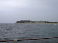
Location: Cromarty, via Nigg Ferry and Balintore, to Hilton of Cadboll.
Distance: 10½ miles.
Total distance: 1733 miles.
Terrain: Up a steep hill, then a grassy path on the cliff top turning into a track. After that it was a lot of road-walking. When we eventually got down to the beach again at Balintore, we read an information board which told us there was a ‘challenging’ path over the clifftop all the way to Nigg Ferry! But it wasn’t marked at all on our map, and we certainly didn’t find the other end of it. We have got into so much trouble trying to follow clifftops where no path is marked (and even sometimes where a path is marked!) that we said we wouldn’t do it again even though we both hate walking along roads. So we were both a bit miffed that there had actually been a path we could have used. It’s time Scotland got it’s act together over footpaths!
Tide: Coming in.
Rivers: No.146, the entrance to Cromarty Bay where we pretended to take the ferry. (It would have been too complex and expensive getting there and back to have actually used it.)
Ferries: No.14 across the entrance to Cromarty Bay. Cost £2.50 each.
Piers: None.
Kissing gates: None.
Pubs: None.
‘Historic Scotland’ properties: None.
Ferris wheels: None.
Diversions: None.
How we got there and back: We were staying in a holiday flat in the countryside about three miles from Dingwall. This morning we got up early, put Colin’s bike on the back of the car, and drove to Nigg Ferry where Colin dropped me off. I waited for an hour and a half in the rain while Colin drove to Hilton of Cadboll and cycled back in the rain – the things we do for the sake of this Round-Britain-Walk!
At the end, we finished at the car. We had our tea and yummy caramel squares, then returned to Nigg Ferry to pick up the bike. We drove back to Dingwall where we went to Tesco for more supplies, then bought fish’n’chips which we ate in the car in the dark. After that we returned to our flat in the roof.
We didn’t escape the rain today, it was miserable! It took Colin an hour and a half to park the car and cycle back. I waited next to a big derelict factory that was previously something to do with the oil industry. It was abandoned and for sale — a dreary sight in the drizzle. I tried to shelter as best I could out of the wind and concentrate on my puzzle book, but I couldn’t get out of the rain and had to keep moving about because I was so cold. There was an hotel nearby, but that was closed so I had to stay outside. What a dump!


So we yomped down a series of roads, albeit quiet ones, for miles and miles and miles. It was deadly! All that time we were nowhere near the coast, we couldn’t even see it.
We came to the hamlet of Nigg — just half a dozen houses and a church. Inside the church is a Pictish stone of great antiquity. A notice told us that it had stood in the graveyard for many centuries, but had recently been brought indoors to protect it from the weather. We were told that the Picts were not invaders nor incomers, but descendants of the Celts who had lived in this country for over a thousand years. They were farmers, sailors, hunters and craftsmen. They were also artists, and during the 6th and 7th centuries they used to carve geometric and animal symbols on to boulders. However, during the 8th century their sculpture underwent a subtle change. They would hack out rectangular stone slabs and then cover both sides with their designs which now included Christian symbols such as crosses. This particular slab displays a decorated cross topped by the crouching figures of St Anthony and St Paul in the desert.


It had stopped raining temporarily, so we made use of the opportunity and sat on a seat nearby to eat our chocolate. We then walked down to the beach at Shandwick.
 There a notice told us that there was a footpath northwards all the way to Tarbat Ness — we were quite relieved about that as it wasn’t obvious from the OS map. But it also told us there was a seven mile “challenging” walk southwards over the cliffs all the way to Nigg Ferry! Well, we didn’t find it, and it’s certainly not marked on our OS ‘Explorer’ map which I recently paid so much for. We were both quite angry about that — we’d spent most of the day walking on roads which we hate, and they led us miles out of our way too.


Then we had a big surprise, for there was a mermaid on a rock!! It was a lovely stone carving (of course!) which was reminiscent of the Little Mermaid in Copenhagen.


That ended Walk no.197, we shall pick up Walk no.198 next time at the northern end of Hilton of Cadboll. It was half past five, so the Walk had taken six hours. We have walked for five consecutive days, and have added 58 miles to our total. We had our tea and caramel squares, and returned to Nigg Ferry to pick up the bike. We ate fish’n’chips in the car on the way back before returning to our flat in the roof of a house way out in the countryside.
Our landlord and his wife have gone on a cruise, leaving their grown-up son in the house below. We haven’t even seen him, let alone spoken to him, and he hasn’t made himself known to us. Electricity is extra, and the meter is eating pound coins! So we are reluctant to put the heating on, and are often quite cold in the evenings. We cannot have a shower because they haven’t fitted one due to there being no head of water upstairs. The bath takes an age to fill. But every evening, at about midnight, the son has a shower downstairs. The tank is in the attic right next to our bed, and takes at least half an hour to fill. No, we don’t like our accommodation at all!

1 comment:
I think you did the right thing on this walk with your route. I took the ferry across from Cromarty. It now costs £4.50 but at least it is running (it did not run at all last year and I understand is only back this year due to a subsidy).
From there I thought I might try to follow the beach as I had done on the coast leading up to Cromarty. But the sandy beach soon became shingle, became pebbles and then rocks. The tide was right up to the cliff face and no way round. So I headed up the "private" road heading up the cliffs. From here there is a footpath signed "Castlecraig Ciruclar Walk 5 miles". There was initially a good path along the cliffs, past some old World War II buildings and a few fields. But then the stiles became harder to find and I was back to climbing over fences. When I assumed I had left the path behind I came across another stile, but the farmer had surrounded it with fences, so it was useless. Then I came to a river valley surrounded by bracken and heather. There was a footpath sign but entirely surrounded by thick bracken. I forced my way down the valley though bracken and heather and found the stream. I could just make it across on rocks and climbed up the very steep bank the other side. Another field and then at the end of that just a load of gorse. I tried to force my way through but got all scratched and had to concede defeat, there was no sign of the supposed path. I made my way up a farm track to Wester Rarichie then followed the roads to Balintore.
So that difficult path you spotted the sign for is not just difficult but impossible! I think in hindsight with the time I wasted the road option you took was probably best.
Post a Comment