Weather: Dull almost to the point of foggy with a cold
wind. Brightening later with a weak sun
and much warmer.
Location: Ardpatrick to Muasdale.
Distance: 15½ miles.
Total
distance: 2560 miles.
Terrain: A muddy
track. A lot of road-walking. Some nice beach-walking, but mostly it was
too shingly to be comfortable.
Tide: Coming in, going out later.
Rivers: No.308, West Loch
Tarbert. No.309, Clachan Burn. No.310, Clachaig Water.
Ferries: No.20 across West Loch Tarbert, though the
ferry had obviously been defunct for very many years. So we pretended again!
Piers: None.
Kissing
gates: None.
Pubs: None.
‘Historic Scotland’
properties: None.
Ferris wheels: None.
Diversions: None.
How we got there and
back: We were touring with our caravan
in Scotland. Yesterday we moved it from Lochgilphead to
Machrihanish. This morning we drove to
Muasdale where we parked the car behind the bus stop. Then we caught a bus to Clachan. From the village we followed a track over a
hill and down to Portachoillan where there is a jetty directly across the water
from the jetty at Ardpatrick which we walked to two days ago. Near each jetty is a house called “Ferry
House”.
At the end, we thankfully
came to the car in the dark! I was all
in, with extremely sore feet as I seemed to have blisters on both heels. We had our tea and shortcake, then drove back
to our caravan in Machrihanish.
We started today’s Walk by the jetty at Portachoillan where there is also a house called ‘Ferry House’. Apparently the ferry across West Loch Tarbert from Ardpatrick had been in operation since the 17th century, and possibly earlier than that. It ceased to run in the early 1950s, so was still going within living memory — for us at least! In the late 1940s it was still being used to bring cargo ashore. The goods were brought from Glasgow to Port Ellen on the Isle of Islay. There they were loaded on to a West Loch Steamer which would anchor off Ardpatrick and hoist a pennant to call the ferry-boat. This would take the cargo, a ton at a time, to whichever side of the loch it was wanted. In 1891 single passengers were charged a shilling to cross from Ardpatrick to Portachoillan, but only sixpence each if there was more than one passenger. I think that was terribly expensive — a shilling was a lot of money at that time.
 We sat by the old jetty and ate our pies. Then we started walking southwards along a
track.
We sat by the old jetty and ate our pies. Then we started walking southwards along a
track.
 We stopped and were chatting to
an elderly couple who were walking the other way, when their whole family — children,
grandchildren and assorted dogs — appeared from behind a gate. Suddenly we were in a crowd! We soon left them behind, and continued in
our more usual state of isolation.
We stopped and were chatting to
an elderly couple who were walking the other way, when their whole family — children,
grandchildren and assorted dogs — appeared from behind a gate. Suddenly we were in a crowd! We soon left them behind, and continued in
our more usual state of isolation.
 Beyond the gate the track turned very muddy. Colin stamped his foot to get some mud off
his boot, and a roe deer leapt out of thick undergrowth nearby, crashing off
into adjacent trees. It gave us quite a
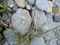
fright! We passed an interesting rock, metamorphic
I’m sure, and managed to negotiate the mud without too much trouble. Beyond the next gate the track was drier —
much more pleasant.
Beyond the gate the track turned very muddy. Colin stamped his foot to get some mud off
his boot, and a roe deer leapt out of thick undergrowth nearby, crashing off
into adjacent trees. It gave us quite a
fright! We passed an interesting rock, metamorphic
I’m sure, and managed to negotiate the mud without too much trouble. Beyond the next gate the track was drier —
much more pleasant.

 The track followed the shore until it came to a
small river, Clachan Burn, where it curved round following the waterway into
the village of Clachan.
We watched a modern-day ferry steam past, going from Kennacraig (further
up the loch) to Port Ellen, we supposed.
Further on, our way was ‘blocked’ by a sheep and her lamb — but they
lost their bottle at the last minute and bolted!
The track followed the shore until it came to a
small river, Clachan Burn, where it curved round following the waterway into
the village of Clachan.
We watched a modern-day ferry steam past, going from Kennacraig (further
up the loch) to Port Ellen, we supposed.
Further on, our way was ‘blocked’ by a sheep and her lamb — but they
lost their bottle at the last minute and bolted!
 We came into Clachan village through a pair of
ornamental gates.
We came into Clachan village through a pair of
ornamental gates.

 This lovely village,
apparently the oldest in the area, is in danger of losing its school because
pupil numbers are low. There was a
campaign going on to ‘Save Our School’, we saw big notices all over the place
about it. I hope they are successful —
closing a little school like this usually tears the heart out of the village in
which it is situated.
This lovely village,
apparently the oldest in the area, is in danger of losing its school because
pupil numbers are low. There was a
campaign going on to ‘Save Our School’, we saw big notices all over the place
about it. I hope they are successful —
closing a little school like this usually tears the heart out of the village in
which it is situated.

 We passed a bicycle with a skull hanging on its
handlebars — a sheep’s skull, not a human’s!
It’s not the kind of everyday thing you find hanging from your
handlebars, or perhaps it is in Scotland.
We passed a bicycle with a skull hanging on its
handlebars — a sheep’s skull, not a human’s!
It’s not the kind of everyday thing you find hanging from your
handlebars, or perhaps it is in Scotland.
 We crossed Clachan Burn on a bridge, and then
we were out on the main road. But there
was a pavement, at least there was for the first mile.
We crossed Clachan Burn on a bridge, and then
we were out on the main road. But there
was a pavement, at least there was for the first mile.
The Kintyre peninsula calls itself ‘The Mainland Island’ because it is almost cut off from the mainland by West Loch Tarbert, but not quite. A fairly new walking trail has been waymarked all the way down from Tarbert to Southend at the southern tip. We intended using a good bit of this trail where it follows the coast, and today we would be on it for most of the Walk. South of Clachan it was on the main road for a good many miles — according to our OS map. So when we passed the entrance to the grounds of a big house, we walked straight past. The pavement disappeared there so we had to do about a mile of traffic-dodging.
 We were a bit annoyed
about that, but not half so annoyed as when we found out that the Kintyre Way
actually went through the grounds of that big house — which is now a hospital —
and not along the road as was marked on the map! There was a Kintyre Way marker post where the drive
came out the other end, but there hadn’t been one where the drive went in a
mile or so back.
We were a bit annoyed
about that, but not half so annoyed as when we found out that the Kintyre Way
actually went through the grounds of that big house — which is now a hospital —
and not along the road as was marked on the map! There was a Kintyre Way marker post where the drive
came out the other end, but there hadn’t been one where the drive went in a
mile or so back.
 We passed a house where some bird ‘sculptures’ had
been cleverly made from party bunting.
They were very colourful and looked great.
We passed a house where some bird ‘sculptures’ had
been cleverly made from party bunting.
They were very colourful and looked great.

The Kintyre Way turned off and ran adjacent to the road. An information board told us that this place is called Ronachan which means ‘place of seals’. It claimed that seals have gathered on the rocks here for ‘a thousand years or more’. Also that otters are frequently seen.

Sure enough, four seals were dozing on a rock just off-shore, but we couldn’t see any otters. We sat on the stripy stones of the beach (metamorphic rocks again!) to eat our sarnies.
 We continued along the path, but I found it too
rough and uneven underfoot so I retreated to the road. Now I hate walking along roads, so you can
tell how bad the path was! Colin
persevered, even when it turned into a shingly beach, but he had difficulty
keeping up with me. We passed a green
caravan, me above it and Colin below.
We continued along the path, but I found it too
rough and uneven underfoot so I retreated to the road. Now I hate walking along roads, so you can
tell how bad the path was! Colin
persevered, even when it turned into a shingly beach, but he had difficulty
keeping up with me. We passed a green
caravan, me above it and Colin below.
 Colin had a nice bit of sandy beach to walk over, but then his path ran
out and he had to climb a little ‘cliff’ in order to join me on the road.
Colin had a nice bit of sandy beach to walk over, but then his path ran
out and he had to climb a little ‘cliff’ in order to join me on the road.
 We had a bit of ‘old road’ to follow along the top,
and when that ran out we thought we’d both continue along the path, giving it
another try. Good job we did! We walked round a bush so that we had a good
view of the rocky shoreline below, and Colin suddenly grabbed my arm. I know that means he’s seen some interesting
wildlife, so I stopped immediately.
We had a bit of ‘old road’ to follow along the top,
and when that ran out we thought we’d both continue along the path, giving it
another try. Good job we did! We walked round a bush so that we had a good
view of the rocky shoreline below, and Colin suddenly grabbed my arm. I know that means he’s seen some interesting
wildlife, so I stopped immediately.
 Colin whispered, “I think that’s an otter swimming into shore!” We both watched in silence as a beautiful
sleek otter beached itself on the stones and proceeded to eat a large fish
which it had in its mouth!! We were
downwind of it, and it hadn’t heard us because of the noise of the waves. We watched it for a good five minutes, and
it had no idea we were there!
What a thrill!!
Colin whispered, “I think that’s an otter swimming into shore!” We both watched in silence as a beautiful
sleek otter beached itself on the stones and proceeded to eat a large fish
which it had in its mouth!! We were
downwind of it, and it hadn’t heard us because of the noise of the waves. We watched it for a good five minutes, and
it had no idea we were there!
What a thrill!!
 Colin had not brought his SLR camera today because
it was raining when we left the caravan this morning. So I carefully got out my ‘bridge’ camera,
set it on full zoom, and proceeded to take a set of photos followed by a little
bit of video. Then Colin grabbed the
camera from me and tried to get a bit closer, but the otter had finished its
meal by then, slipped into the water and was away. So all the otter pictures were taken by me,
and I’m very proud of them!
Colin had not brought his SLR camera today because
it was raining when we left the caravan this morning. So I carefully got out my ‘bridge’ camera,
set it on full zoom, and proceeded to take a set of photos followed by a little
bit of video. Then Colin grabbed the
camera from me and tried to get a bit closer, but the otter had finished its
meal by then, slipped into the water and was away. So all the otter pictures were taken by me,
and I’m very proud of them!
 We were both on a ‘high’ as we continued along the
path — which we both gave up in the end because it was just too difficult to
walk on. And this is supposed to be a
waymarked trail! We passed a white
caravan on the shore, then we came to where the path diverted from the road
along the beach.
We were both on a ‘high’ as we continued along the
path — which we both gave up in the end because it was just too difficult to
walk on. And this is supposed to be a
waymarked trail! We passed a white
caravan on the shore, then we came to where the path diverted from the road
along the beach.
 It was lovely to walk
alongside the plopping waves again, it seems a long time since we have done
this. We were well south of the
Ardpatrick peninsula by now.
It was lovely to walk
alongside the plopping waves again, it seems a long time since we have done
this. We were well south of the
Ardpatrick peninsula by now.

 We passed a few jellyfish washed up on the shore,
some of them were quite big. The beach
gradually got more and more shingly, and we found it quite hard going in
places. When it got too difficult, we
went up to the grassy bank along the top.
We passed a few jellyfish washed up on the shore,
some of them were quite big. The beach
gradually got more and more shingly, and we found it quite hard going in
places. When it got too difficult, we
went up to the grassy bank along the top.
This part of the shore goes out to a point, like a triangle, then cuts back in again. A notice explained that little terns, the UK’s rarest seabird, nest on the beach at the Point — so would we please cut the corner and not walk there. Any excuse to make the Walk shorter, even though the birds hadn’t yet arrived for the season (they are summer visitors). We thought we would take a BIG short cut across the green because it looked as if it was flat and all short grass. But we cut off too soon, and a river we hadn’t seen from a distance sent us back to the beach where it was shallow enough to cross without getting water in our boots. Then we cut off the corner.
 Past the Point, we came back to the beach at a
derelict concrete lookout post. We sat
down to eat our apples. For the past
hour or so, blisters had been forming on both my heels and they were really
quite sore by then. I took off my boots
and put blister-plasters on the backs of the offending appendages. I also took painkillers after lacing up my
boots again.
Past the Point, we came back to the beach at a
derelict concrete lookout post. We sat
down to eat our apples. For the past
hour or so, blisters had been forming on both my heels and they were really
quite sore by then. I took off my boots
and put blister-plasters on the backs of the offending appendages. I also took painkillers after lacing up my
boots again.
 We walked on the grass until we got to a caravan
site, then we walked on a lovely sandy beach all the way to the ferry terminal
at Tayinloan. The sun was getting quite
low in the western sky, and shining brightly through a muggy mist.
We walked on the grass until we got to a caravan
site, then we walked on a lovely sandy beach all the way to the ferry terminal
at Tayinloan. The sun was getting quite
low in the western sky, and shining brightly through a muggy mist.

 The nice thing about ferry terminals in Scotland is
that there is always a loo which is always open and free! We sat in a bus shelter to eat our
chocolate. We still had four miles to
go, and my feet were hurting like hell. I
couldn’t understand why I was getting these blisters. Admittedly my boots were new last summer, but
they were quality boots costing an arm and a leg, they fitted me perfectly in
the shop, and I had well walked them in by clocking up more than 250
miles! So why had they suddenly started
to cause me so much grief?
The nice thing about ferry terminals in Scotland is
that there is always a loo which is always open and free! We sat in a bus shelter to eat our
chocolate. We still had four miles to
go, and my feet were hurting like hell. I
couldn’t understand why I was getting these blisters. Admittedly my boots were new last summer, but
they were quality boots costing an arm and a leg, they fitted me perfectly in
the shop, and I had well walked them in by clocking up more than 250
miles! So why had they suddenly started
to cause me so much grief?

We walked out to the road. I tried to persuade Colin to thumb a lift to Muasdale as I didn’t think I could walk that far. He was reluctant — I don’t think he realised how painful my heels had become.
 He said
we should start walking as there wasn’t much traffic about, and we would try
and thumb a lift when a car appeared.
Over the next half hour not a single vehicle passed us in our
direction!! And this is a main
road, the only road leading to
Campbeltown!
He said
we should start walking as there wasn’t much traffic about, and we would try
and thumb a lift when a car appeared.
Over the next half hour not a single vehicle passed us in our
direction!! And this is a main
road, the only road leading to
Campbeltown!
 So I put my mind into ‘automatic’ mode, and we
route-marched it as the sun slowly sank on our right. Despite the agony of my feet, I still managed
to take the occasional picture of interesting features we passed on the way,
though I didn’t really look at them at all.
So I put my mind into ‘automatic’ mode, and we
route-marched it as the sun slowly sank on our right. Despite the agony of my feet, I still managed
to take the occasional picture of interesting features we passed on the way,
though I didn’t really look at them at all.

We did that four miles in one and a half hours — not bad, eh? I didn’t think I would make it, but I did! It was almost dark when we arrived at our car parked behind the bus stop in Muasdale.

That ended Walk no.269, we shall pick up Walk no.270 next time at the bus stop in Muasdale. It was half past eight, so the Walk had taken us seven and a half hours. I was all in, mainly because of my sore feet. We had our tea and shortcake, then drove back to our caravan in Machrihanish.
Later, when I revealed the blisters — particularly the one on my right heel — even Colin was shocked. It was HUGE and there was absolutely no skin left on it at all. We carefully cleaned it up, and he put gauze over it sealed down with masking tape.
We started today’s Walk by the jetty at Portachoillan where there is also a house called ‘Ferry House’. Apparently the ferry across West Loch Tarbert from Ardpatrick had been in operation since the 17th century, and possibly earlier than that. It ceased to run in the early 1950s, so was still going within living memory — for us at least! In the late 1940s it was still being used to bring cargo ashore. The goods were brought from Glasgow to Port Ellen on the Isle of Islay. There they were loaded on to a West Loch Steamer which would anchor off Ardpatrick and hoist a pennant to call the ferry-boat. This would take the cargo, a ton at a time, to whichever side of the loch it was wanted. In 1891 single passengers were charged a shilling to cross from Ardpatrick to Portachoillan, but only sixpence each if there was more than one passenger. I think that was terribly expensive — a shilling was a lot of money at that time.


The Kintyre peninsula calls itself ‘The Mainland Island’ because it is almost cut off from the mainland by West Loch Tarbert, but not quite. A fairly new walking trail has been waymarked all the way down from Tarbert to Southend at the southern tip. We intended using a good bit of this trail where it follows the coast, and today we would be on it for most of the Walk. South of Clachan it was on the main road for a good many miles — according to our OS map. So when we passed the entrance to the grounds of a big house, we walked straight past. The pavement disappeared there so we had to do about a mile of traffic-dodging.


The Kintyre Way turned off and ran adjacent to the road. An information board told us that this place is called Ronachan which means ‘place of seals’. It claimed that seals have gathered on the rocks here for ‘a thousand years or more’. Also that otters are frequently seen.


Sure enough, four seals were dozing on a rock just off-shore, but we couldn’t see any otters. We sat on the stripy stones of the beach (metamorphic rocks again!) to eat our sarnies.


This part of the shore goes out to a point, like a triangle, then cuts back in again. A notice explained that little terns, the UK’s rarest seabird, nest on the beach at the Point — so would we please cut the corner and not walk there. Any excuse to make the Walk shorter, even though the birds hadn’t yet arrived for the season (they are summer visitors). We thought we would take a BIG short cut across the green because it looked as if it was flat and all short grass. But we cut off too soon, and a river we hadn’t seen from a distance sent us back to the beach where it was shallow enough to cross without getting water in our boots. Then we cut off the corner.


We walked out to the road. I tried to persuade Colin to thumb a lift to Muasdale as I didn’t think I could walk that far. He was reluctant — I don’t think he realised how painful my heels had become.


We did that four miles in one and a half hours — not bad, eh? I didn’t think I would make it, but I did! It was almost dark when we arrived at our car parked behind the bus stop in Muasdale.

That ended Walk no.269, we shall pick up Walk no.270 next time at the bus stop in Muasdale. It was half past eight, so the Walk had taken us seven and a half hours. I was all in, mainly because of my sore feet. We had our tea and shortcake, then drove back to our caravan in Machrihanish.
Later, when I revealed the blisters — particularly the one on my right heel — even Colin was shocked. It was HUGE and there was absolutely no skin left on it at all. We carefully cleaned it up, and he put gauze over it sealed down with masking tape.

No comments:
Post a Comment