Weather: Sunny at first, but becoming cloudy. There was a strong breeze but it was warm out
of it. Light rain for the last two
miles.
Location: Southend to Campbeltown.
Distance: 15 miles.
Total distance: 2606 miles.
Terrain: Beach at first, then across a golf course and along farm tracks. All too soon we spilled out on to a very quiet tarmacked lane which led us on for miles and miles and miles. A bit undulating.
Tide: Coming in.
Rivers: No.315, Conieglen Water. No.316, Balnabraid Water.
Ferries: None.
Piers: None.
Kissing gates: None.
Pubs: None.
‘Historic Scotland’ properties: None.
Ferris wheels: None.
Diversions: None.
How we got there and back: Yesterday we had towed our caravan more than 470 miles from home to Machrihanish. This morning we drove into Campbeltown and parked the car near the bus terminal on the waterfront. Then we caught a bus to Southend, alighting at the exact spot where we had finished the last Walk.
At the end, we arrived at the car. Since we were only about four miles from the caravan site in Machrihanish, we got straight in and drove back to have our tea in comfort.
After that disastrous last Walk, my blisters took about a week to heal, the pulled muscle approximately three. Four weeks later I was walking quite freely without a limp. Walks for our next trip were planned, caravan sites booked and the caravan half-packed. Then my back went — suddenly and dreadfully. I couldn’t walk across the room, let alone round Britain! (Anyone who has suffered back-pain will know what I mean when I say the pain was excruciating!) There didn’t seem to be any reason for this to happen, I had only got out of bed that morning in the normal fashion, not done anything extraordinary. But both Maria (our chiropractic daughter) and the local chiropractor I eventually saw said that it was probably caused by the fall on the mountain and subsequent limping walk because my body would have been uneven at the time. Sometimes these injuries can take weeks to manifest themselves into severe back-pain.
Isn’t the NHS useless when it comes to the treatment of back-pain? We tried the minor injuries unit at our local hospital first, but they wouldn’t touch it because “it wasn’t an injury”. (Oh yes it was, albeit four weeks ago!) All they would do was to make an appointment with my doctor, which I could have done myself. Only it wasn’t my doctor because his list was full for the next week or so. It was the ‘emergency’ doctor whom I had never met before and who didn’t know me or my medical history. He seemed particularly disinterested and didn’t recommend any treatment whatsoever. Without looking at me, he wrote out a prescription for three items. One was valium which I won’t touch with a bargepole. I have had a bad history with valium in times gone past — I tried to tell him but he didn’t listen. (I threw those away.) Another was an anti-inflammatory which gave me chronic stomach cramps and diarrhoea lasting several days. (As if I hadn’t got enough problems to deal with!) It turns out it was a muscle-relaxant, and that includes the muscles in the lower bowel!! The third one was codeine, which I used to be able to buy over the counter when I was a child.
By now I was quite desperate — I felt really let down by the NHS. Two friends, quite separately, recommended a McTimoney chiropractor who practised locally. (Maria lives too far away!) Private, of course, so I had to shell out. But worth every penny! A lovely lady, very gentle. Twenty-four hours after her first treatment I was able to dispense with all painkillers! So eight weeks and several treatments later, the caravan sites were rebooked and we returned to the Mull of Kintyre.
 A couple of days after today’s Walk we drove to
Southend to look at Keil
Caves, and St Columba’s
Well and footprints. (We didn’t have
time to do this at the end of Walk 271 nor at the beginning of Walk 272.) St Columba is supposed to have visited the
area briefly in the 6th century and he was so holy he miraculously
left his footprints in the stone.
A couple of days after today’s Walk we drove to
Southend to look at Keil
Caves, and St Columba’s
Well and footprints. (We didn’t have
time to do this at the end of Walk 271 nor at the beginning of Walk 272.) St Columba is supposed to have visited the
area briefly in the 6th century and he was so holy he miraculously
left his footprints in the stone.
Well, when we saw these supposed footprints we both burst out laughing — they were so obviously fake! It looked as if someone had stood in wet concrete wearing a pair of very modern shoes.
 We could even see the mason’s marks where the prints had been carved
out. Apparently the legend was ‘helped
along’ in the 19th century by a local mason in order to boost the
tourist trade — con merchants are not a modern phenomenon, they’ve been with us
throughout history!
We could even see the mason’s marks where the prints had been carved
out. Apparently the legend was ‘helped
along’ in the 19th century by a local mason in order to boost the
tourist trade — con merchants are not a modern phenomenon, they’ve been with us
throughout history!
 Nearby is ‘St Columba’s Well’, a hollow under the
rock where water gathers from a spring. It was prettied up in the 19th
century, though it was a bit overgrown when we visited. We don’t know if there are any miraculous
cures attributed to this well, we didn’t inquire.
Nearby is ‘St Columba’s Well’, a hollow under the
rock where water gathers from a spring. It was prettied up in the 19th
century, though it was a bit overgrown when we visited. We don’t know if there are any miraculous
cures attributed to this well, we didn’t inquire.

 Keil
Caves, which are nearby,
have been inhabited in centuries past.
The 1881 census lists six people, from two families, living there. It was pouring with rain the day we visited —
I wouldn’t have liked to be so desperately poor that I’d have to resort to
living in a cave. The modern so-called
‘poor’ don’t know what real poverty is.
Keil
Caves, which are nearby,
have been inhabited in centuries past.
The 1881 census lists six people, from two families, living there. It was pouring with rain the day we visited —
I wouldn’t have liked to be so desperately poor that I’d have to resort to
living in a cave. The modern so-called
‘poor’ don’t know what real poverty is.
And so to today’s Walk. We used the loo which was at the start point, and sat at the picnic table to eat our pies. Then we walked along the firm sandy beach for about a quarter of a mile — it was good to be back by the sea!
 We
could see Northern Ireland
(just twelve miles away) very clearly today despite the cloudy skies. On the last Walk the skies had been
brilliantly blue, but there had been a heat-haze which had partly obscured the horizon. We had a much better view of the Irish
mountains today.
We
could see Northern Ireland
(just twelve miles away) very clearly today despite the cloudy skies. On the last Walk the skies had been
brilliantly blue, but there had been a heat-haze which had partly obscured the horizon. We had a much better view of the Irish
mountains today.


There were a number of birds on the beach (we were the only people) and Colin noticed that there were some eider duck chicks with their Mum. Gorgeous little balls of feathers! He stopped to photograph them.
 We left the beach by the old lifeboat station. There is a prominent rock there on which a
castle once stood. A notice told us that
this stronghold was besieged by the King of Dalriada (wherever that is) as far
back as 712AD. Then it was captured by
King Haakon of Norway
in 1263, in 1306 Robert the Bruce sheltered here, in 1494 James IV visited the
castle and in 1558 it was attacked by the Earl of Sussex. But the worst atrocity occurred in 1647. Royalist forces, loyal to the Stewarts, were
defeated in North Kintyre. They withdrew to the relative safety of the
castle on Dunaverty Rock where they were besieged. (Well, they couldn’t go much further, could
they? There is only sea beyond
Southend.) When they finally
surrendered, all 300 of them were murdered by the Covenanting army of General
David Leslie. We were horrified! Three hundred men massacred for the sake of
this little tiny rock! There is no sign
of the castle in this day and age and only a few people live in this beautiful
but outlying place, so what was their sacrifice for? Oh!
The folly of Man!
We left the beach by the old lifeboat station. There is a prominent rock there on which a
castle once stood. A notice told us that
this stronghold was besieged by the King of Dalriada (wherever that is) as far
back as 712AD. Then it was captured by
King Haakon of Norway
in 1263, in 1306 Robert the Bruce sheltered here, in 1494 James IV visited the
castle and in 1558 it was attacked by the Earl of Sussex. But the worst atrocity occurred in 1647. Royalist forces, loyal to the Stewarts, were
defeated in North Kintyre. They withdrew to the relative safety of the
castle on Dunaverty Rock where they were besieged. (Well, they couldn’t go much further, could
they? There is only sea beyond
Southend.) When they finally
surrendered, all 300 of them were murdered by the Covenanting army of General
David Leslie. We were horrified! Three hundred men massacred for the sake of
this little tiny rock! There is no sign
of the castle in this day and age and only a few people live in this beautiful
but outlying place, so what was their sacrifice for? Oh!
The folly of Man!
 The official Kintyre Way, in which we have lost all
faith, goes alongside the river to the road where it finishes. But we realised we could cut out at least a
mile of the Walk by using a track alongside the golf course. So we crossed the river on a footbridge and
did just that. We are always very
careful when walking near or on a golf course to stop and wait quietly if we
see someone about to take a shot so as not to put them off. So we were a bit dischuffed when we did that
for a group, and the man who missed his putt turned round and blamed us because
we were watching him! (There’s no pleasing
some.) We were relieved to get on to a
farm track, round the farm buildings and eventually out on to a road — which
was a very quiet lane.
The official Kintyre Way, in which we have lost all
faith, goes alongside the river to the road where it finishes. But we realised we could cut out at least a
mile of the Walk by using a track alongside the golf course. So we crossed the river on a footbridge and
did just that. We are always very
careful when walking near or on a golf course to stop and wait quietly if we
see someone about to take a shot so as not to put them off. So we were a bit dischuffed when we did that
for a group, and the man who missed his putt turned round and blamed us because
we were watching him! (There’s no pleasing
some.) We were relieved to get on to a
farm track, round the farm buildings and eventually out on to a road — which
was a very quiet lane.


We were a little higher now, and had good views over to Ireland which looked very near. To the east we could see Ailsa Craig in the far distance — a volcanic plug between Kintyre and the mainland. It is uninhabited. Granite from Ailsa Craig has been used to make curling stones for many years, but nowadays it is just a bird sanctuary.
 To the south, and much nearer to us, was Sanda Island. This island has an ‘award-winning’ pub and
several self-catering cottages on it, but recently it has been bought by a
Swiss millionaire. He plans to open a
restaurant and upmarket hotel there — but the island has no roads and is only
accessible by boat. I don’t know what
they do about services like electricity and water.
To the south, and much nearer to us, was Sanda Island. This island has an ‘award-winning’ pub and
several self-catering cottages on it, but recently it has been bought by a
Swiss millionaire. He plans to open a
restaurant and upmarket hotel there — but the island has no roads and is only
accessible by boat. I don’t know what
they do about services like electricity and water.


It is always difficult to find something to sit on when eating our lunch — I can’t sit on the ground because of my back problem. So today I sat on a milepost which told us we were ten miles from Campbeltown. Since this Walk is fifteen miles long, that should have meant we had already walked five miles. We knew we hadn’t, we’d walked three at the most. I never believe these mileposts!
 We could see a memorial cross across fields in the
distance, but there was no path to it so we didn’t go over. We never found out what it was about, nor why
it was situated in such a remote place.
The cows nearby looked as if they were about to fall over the cliff!
We could see a memorial cross across fields in the
distance, but there was no path to it so we didn’t go over. We never found out what it was about, nor why
it was situated in such a remote place.
The cows nearby looked as if they were about to fall over the cliff!

 We could hear a two-stroke motor bike somewhere
behind a building — a horrible sound!
(Though Colin seems to like it!)
Then a scrambler biker passed us and went off-road uphill to practice — we
could hear the noise of it for several miles.
Colin said he would rather be doing that than walking round Britain, to which I countered we wouldn’t even be
here if we weren’t walking round Britain. Certainly this trek has taken us to places we
would never have thought of visiting, and we reckon we know our country a lot
better than most. Later Colin conceded
that this Walk was much nicer than he had anticipated because the road was
quiet (a passing car was an event!) and the views spectacular.
We could hear a two-stroke motor bike somewhere
behind a building — a horrible sound!
(Though Colin seems to like it!)
Then a scrambler biker passed us and went off-road uphill to practice — we
could hear the noise of it for several miles.
Colin said he would rather be doing that than walking round Britain, to which I countered we wouldn’t even be
here if we weren’t walking round Britain. Certainly this trek has taken us to places we
would never have thought of visiting, and we reckon we know our country a lot
better than most. Later Colin conceded
that this Walk was much nicer than he had anticipated because the road was
quiet (a passing car was an event!) and the views spectacular.

 We passed the remains of St Coivin’s Chapel, where
Colin found what looked like an old well.
Further on we came to a most extraordinary house — it had a round
tower! Now, I’ve always fancied living
in a house that is round, such a relaxing shape with no corners. I don’t know how I’d arrange the furniture,
but I would love to have a round bedroom.
We passed the remains of St Coivin’s Chapel, where
Colin found what looked like an old well.
Further on we came to a most extraordinary house — it had a round
tower! Now, I’ve always fancied living
in a house that is round, such a relaxing shape with no corners. I don’t know how I’d arrange the furniture,
but I would love to have a round bedroom.
Location: Southend to Campbeltown.
Distance: 15 miles.
Total distance: 2606 miles.
Terrain: Beach at first, then across a golf course and along farm tracks. All too soon we spilled out on to a very quiet tarmacked lane which led us on for miles and miles and miles. A bit undulating.
Tide: Coming in.
Rivers: No.315, Conieglen Water. No.316, Balnabraid Water.
Ferries: None.
Piers: None.
Kissing gates: None.
Pubs: None.
‘Historic Scotland’ properties: None.
Ferris wheels: None.
Diversions: None.
How we got there and back: Yesterday we had towed our caravan more than 470 miles from home to Machrihanish. This morning we drove into Campbeltown and parked the car near the bus terminal on the waterfront. Then we caught a bus to Southend, alighting at the exact spot where we had finished the last Walk.
At the end, we arrived at the car. Since we were only about four miles from the caravan site in Machrihanish, we got straight in and drove back to have our tea in comfort.
After that disastrous last Walk, my blisters took about a week to heal, the pulled muscle approximately three. Four weeks later I was walking quite freely without a limp. Walks for our next trip were planned, caravan sites booked and the caravan half-packed. Then my back went — suddenly and dreadfully. I couldn’t walk across the room, let alone round Britain! (Anyone who has suffered back-pain will know what I mean when I say the pain was excruciating!) There didn’t seem to be any reason for this to happen, I had only got out of bed that morning in the normal fashion, not done anything extraordinary. But both Maria (our chiropractic daughter) and the local chiropractor I eventually saw said that it was probably caused by the fall on the mountain and subsequent limping walk because my body would have been uneven at the time. Sometimes these injuries can take weeks to manifest themselves into severe back-pain.
Isn’t the NHS useless when it comes to the treatment of back-pain? We tried the minor injuries unit at our local hospital first, but they wouldn’t touch it because “it wasn’t an injury”. (Oh yes it was, albeit four weeks ago!) All they would do was to make an appointment with my doctor, which I could have done myself. Only it wasn’t my doctor because his list was full for the next week or so. It was the ‘emergency’ doctor whom I had never met before and who didn’t know me or my medical history. He seemed particularly disinterested and didn’t recommend any treatment whatsoever. Without looking at me, he wrote out a prescription for three items. One was valium which I won’t touch with a bargepole. I have had a bad history with valium in times gone past — I tried to tell him but he didn’t listen. (I threw those away.) Another was an anti-inflammatory which gave me chronic stomach cramps and diarrhoea lasting several days. (As if I hadn’t got enough problems to deal with!) It turns out it was a muscle-relaxant, and that includes the muscles in the lower bowel!! The third one was codeine, which I used to be able to buy over the counter when I was a child.
By now I was quite desperate — I felt really let down by the NHS. Two friends, quite separately, recommended a McTimoney chiropractor who practised locally. (Maria lives too far away!) Private, of course, so I had to shell out. But worth every penny! A lovely lady, very gentle. Twenty-four hours after her first treatment I was able to dispense with all painkillers! So eight weeks and several treatments later, the caravan sites were rebooked and we returned to the Mull of Kintyre.

Well, when we saw these supposed footprints we both burst out laughing — they were so obviously fake! It looked as if someone had stood in wet concrete wearing a pair of very modern shoes.


And so to today’s Walk. We used the loo which was at the start point, and sat at the picnic table to eat our pies. Then we walked along the firm sandy beach for about a quarter of a mile — it was good to be back by the sea!


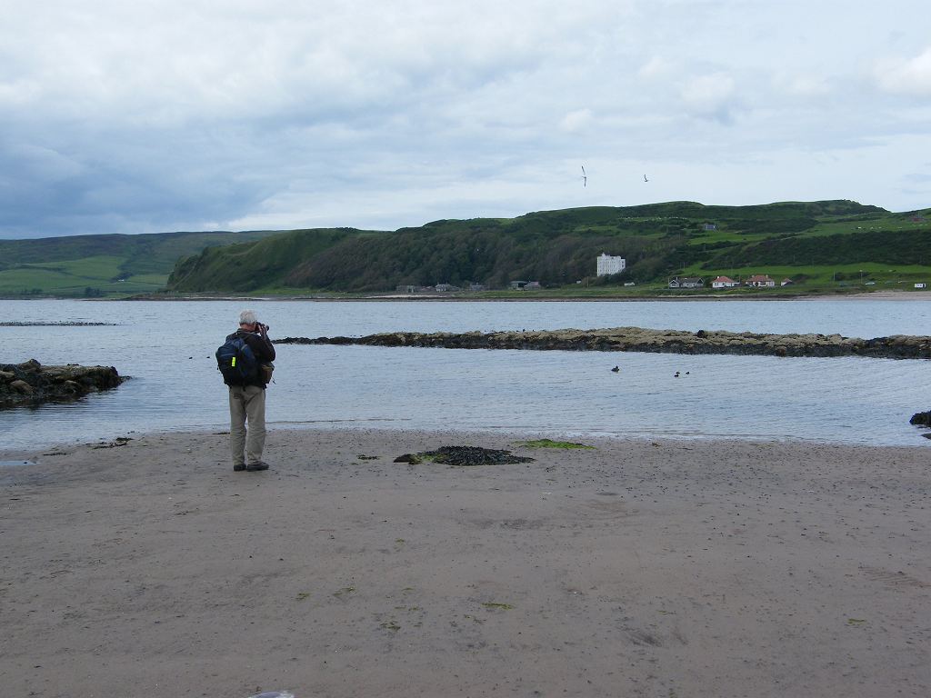
There were a number of birds on the beach (we were the only people) and Colin noticed that there were some eider duck chicks with their Mum. Gorgeous little balls of feathers! He stopped to photograph them.


We were a little higher now, and had good views over to Ireland which looked very near. To the east we could see Ailsa Craig in the far distance — a volcanic plug between Kintyre and the mainland. It is uninhabited. Granite from Ailsa Craig has been used to make curling stones for many years, but nowadays it is just a bird sanctuary.


It is always difficult to find something to sit on when eating our lunch — I can’t sit on the ground because of my back problem. So today I sat on a milepost which told us we were ten miles from Campbeltown. Since this Walk is fifteen miles long, that should have meant we had already walked five miles. We knew we hadn’t, we’d walked three at the most. I never believe these mileposts!


At least three miles after the ten mile post we passed a milepost telling us we were nine miles from Campbeltown! We reckon this nine-mile post was more accurately placed.


We ‘route-marched’ the last three miles to our car, parked in Campbeltown.
That ended Walk no.272, we shall pick up Walk no.273 next time on the waterfront in Campbeltown. It was eight o’clock, so the Walk had taken us seven and a half hours. Since we were only about four miles from the caravan site in Machrihanish, and since it was still raining, we drove back to our caravan as quickly as we could to have our tea in comfort.
This morning, when the sun had been shining, we visited another place of interest in Campbeltown — the Linda McCartney memorial garden. Paul McCartney, of Beatle fame, bought a remote farm in the area as a retreat away from his fans. He loved this part of the world so much that in the late 1970s he composed the song ‘The Mull of Kintyre’. Local people, especially a pipe band, helped him make a video in order to market the song. This brought the tourists in their droves, which was very good for the local economy. Campbeltown is a long way from anywhere, and notoriously difficult to get to. It is 132 miles by road from Glasgow, or you have to take an expensive ferry from Ardrossan. There is only one road, and this goes over an infamous mountain pass called ‘Rest and be Thankful’ where there are frequent landslips. Whenever a landslide closes this part of the road, the detour is a further sixty miles!!


No comments:
Post a Comment