Weather: Torrential showers interspersed with fleeting
sunny intervals. Fine this afternoon, it
even got too hot for a while. Later rain
started, gently at first but it had become torrential by the time we finished
the Walk. We were very wet!
Location: Walney Island to Ulverston.
Distance: 16 miles.
Total distance: 3216 miles.
Terrain: A lot of concrete. Some road-walking. Beach, both soggy sand and shingle with rocks. Some extremely muddy fields. Mostly flat.
Tide: In, going out.
Rivers: No.388, Devonshire Dock, Barrow-in-Furness.
Ferries: None.
Piers: None.
Kissing gates: No.393 towards the end of the Walk. It cheered us up when we were feeling like drowned rats!
Pubs: None.
‘English Heritage’ properties: No.47, Furness Abbey which we visited on a different day and found it was closed! No.48, Bow Bridge which we missed because it was behind a hedge! No.49, Piel Castle which we visited last month when the weather was better.
Ferris wheels: None.
Diversions: None.
How we got there and back: Yesterday we towed our caravan from home to Grange-over-Sands. This morning we drove to Ulverston and parked at Canal Foot. We had to walk nearly two miles into town in order to catch a bus to Barrow-in-Furness. We alighted near the Town Hall and walked to the bridge where we finished the last Walk.
At the end we came to the car in the pouring rain and fading light. We drove straight back to the caravan, it was too wet to do anything else.

 We visited Furness Abbey the next day because it is over a mile inland
and we didn’t actually pass it on the Walk.
What we didn’t realise was that, as from 1st October, it was
only open at weekends — so when we got
there it was closed! It is a magnificent
Cistercian Abbey built in the 12th & 13th centuries
using red sandstone.
We visited Furness Abbey the next day because it is over a mile inland
and we didn’t actually pass it on the Walk.
What we didn’t realise was that, as from 1st October, it was
only open at weekends — so when we got
there it was closed! It is a magnificent
Cistercian Abbey built in the 12th & 13th centuries
using red sandstone.
 It is vast, and in
its time it was second only to Fountains Abbey in Yorkshire. It looked remarkably well preserved, what we
could see of it from the road, and it was a great pity that we couldn’t get
inside.
It is vast, and in
its time it was second only to Fountains Abbey in Yorkshire. It looked remarkably well preserved, what we
could see of it from the road, and it was a great pity that we couldn’t get
inside.

 We drove off to find Bow
Bridge, a packhorse
bridge nearby which is also owned by English Heritage. But we missed it because it was behind a
hedge. Then we realised we were supposed
to walk from the Furness Abbey car park along the river bank for about a mile
in order to get to it. We couldn’t be
bothered by then as we had driven well past it and we had other things to do.
We drove off to find Bow
Bridge, a packhorse
bridge nearby which is also owned by English Heritage. But we missed it because it was behind a
hedge. Then we realised we were supposed
to walk from the Furness Abbey car park along the river bank for about a mile
in order to get to it. We couldn’t be
bothered by then as we had driven well past it and we had other things to do.
We didn’t do very well with our ‘cultural interludes’ today!
 This morning we set the alarm for six, and as if on a
signal the rain thundered on the roof of the caravan so hard it completely
drowned out the radio! That set the
scene for most of the day — pelting showers interspersed with sunshine. It was ‘elevenses’ time before we got to
the bridge ready to start today’s Walk.
So we sat in the adjacent gardens out of the wind and ate our pies. We had so much rain while we were walking we
didn’t take nearly as many photos as we would have liked.
This morning we set the alarm for six, and as if on a
signal the rain thundered on the roof of the caravan so hard it completely
drowned out the radio! That set the
scene for most of the day — pelting showers interspersed with sunshine. It was ‘elevenses’ time before we got to
the bridge ready to start today’s Walk.
So we sat in the adjacent gardens out of the wind and ate our pies. We had so much rain while we were walking we
didn’t take nearly as many photos as we would have liked.
 We missed out the dock area because it was
industrial. We followed a road which
took us round to cross over the dock on a high-level bridge. We came to a Morrison’s store where we took
the steps down to the car park so we could pop in and use their toilet!
We missed out the dock area because it was
industrial. We followed a road which
took us round to cross over the dock on a high-level bridge. We came to a Morrison’s store where we took
the steps down to the car park so we could pop in and use their toilet!
We then walked alongside a busy road for half
a mile, but there was a pavement so it wasn’t too bad.
 We went under a railway bridge and
immediately turned right on to a quieter road lined by terraced houses. At the end of that we turned on to a potholed
road which led back under the railway.
The footpath was at a higher level going under the bridge, but despite
the rain the lowest bit of the track wasn’t flooded.
We went under a railway bridge and
immediately turned right on to a quieter road lined by terraced houses. At the end of that we turned on to a potholed
road which led back under the railway.
The footpath was at a higher level going under the bridge, but despite
the rain the lowest bit of the track wasn’t flooded.
We emerged out in the open the other side of the dock area, and it was very blowy. We realised we were not on the path marked on the map, but the other side of a rectangle.
 We seemed to be going towards
the locked gates of an industrial complex, then the path slanted away towards
the left. This was completely the wrong
direction, we needed to go right. A man
was coming towards us walking his dog, so we asked him the way — he told us
there was a path alongside the fence of the industrial complex going right
towards Piel Island.
And so it was, hidden behind the bushes so we couldn’t see it until we
were right up to it.
We seemed to be going towards
the locked gates of an industrial complex, then the path slanted away towards
the left. This was completely the wrong
direction, we needed to go right. A man
was coming towards us walking his dog, so we asked him the way — he told us
there was a path alongside the fence of the industrial complex going right
towards Piel Island.
And so it was, hidden behind the bushes so we couldn’t see it until we
were right up to it.

 It was a long straight path on unforgiving concrete,
we strongly suspected that it was the track of an old railway. Colin said it was boring. We passed a gas flare, and we had views
across to Barrow and Walney
Island. Part way along, Piel Island
came into view. We came out at the end
of the road to Roa
Island, but we didn’t go
down it because it is dead end. From the
further end of Roa Island runs the short ferry to Piel Island.
It was a long straight path on unforgiving concrete,
we strongly suspected that it was the track of an old railway. Colin said it was boring. We passed a gas flare, and we had views
across to Barrow and Walney
Island. Part way along, Piel Island
came into view. We came out at the end
of the road to Roa
Island, but we didn’t go
down it because it is dead end. From the
further end of Roa Island runs the short ferry to Piel Island.
 We visited Piel Island
back in September when the weather was kinder.
We had to drive out to Roa Island on a causeway, then catch a ferry which took
us half a mile across to Piel
Island. On this rock there is a pub and a ruined
castle — not enough room for much else.
Yet it has a KING! (Currently the
pub landlord). And a THRONE for him to
sit on! This throne is an old wooden
chair in the bar of the pub which has the following notice by it:
We visited Piel Island
back in September when the weather was kinder.
We had to drive out to Roa Island on a causeway, then catch a ferry which took
us half a mile across to Piel
Island. On this rock there is a pub and a ruined
castle — not enough room for much else.
Yet it has a KING! (Currently the
pub landlord). And a THRONE for him to
sit on! This throne is an old wooden
chair in the bar of the pub which has the following notice by it:
 “Be it known
that who so
ever not being
of the order,
sits on this
fine ancient chair
of Piel, shall
by tradition furnish
refreshments for all
those present.”
“Be it known
that who so
ever not being
of the order,
sits on this
fine ancient chair
of Piel, shall
by tradition furnish
refreshments for all
those present.”
So we didn’t — sit on it, that is. There were crowds of people there, and it would have cost us several hundred pounds to ‘refresh’ them all! It is a tradition which dates back to the 15th century when one Lambert Simnel attempted unsuccessfully to usurp the throne of England. The present ‘King of Piel’ (Steve Chattaway, the pub landlord) was ‘crowned’ in 2007 by sitting in the chair wearing a helmet and holding a sword while alcohol was poured over him. The ‘King’ is expected to be “a free drinker and smoker and lover of the female sex”. Quite a coronation!

 We refreshed ourselves at the bar, then we went out to
explore the castle. It was built
originally as a fort, and was involved in the smuggling trade for several
hundred years. It is not very big, more
like a tower really. There wasn’t much else
to do on this tiny island, so we took the ferry back to Roa Island
where we were reunited with our car.
We refreshed ourselves at the bar, then we went out to
explore the castle. It was built
originally as a fort, and was involved in the smuggling trade for several
hundred years. It is not very big, more
like a tower really. There wasn’t much else
to do on this tiny island, so we took the ferry back to Roa Island
where we were reunited with our car.
 Back to the Walk. We decided against visiting the pub we were
just passing — this was Colin, should I
be worried? — and found a seat further along where we sat and ate our
sarnies. There were nice views, but it
was very cold and blowy there. I was
still wearing my cape for warmth, and the wind caught in the hood inflating me
like a balloon!
Back to the Walk. We decided against visiting the pub we were
just passing — this was Colin, should I
be worried? — and found a seat further along where we sat and ate our
sarnies. There were nice views, but it
was very cold and blowy there. I was
still wearing my cape for warmth, and the wind caught in the hood inflating me
like a balloon!

 It began to rain before
we’d finished our lunch. As we got up to
leave, I stood on the pavement behind the hedge. There was no wind there and it was much
warmer, but there was also nothing to sit on so we could only stand. We were cold, wet and miserable. We thought about visiting another pub along
the road, but it was a posh hotel so we didn’t.
We felt like drowned rats.
It began to rain before
we’d finished our lunch. As we got up to
leave, I stood on the pavement behind the hedge. There was no wind there and it was much
warmer, but there was also nothing to sit on so we could only stand. We were cold, wet and miserable. We thought about visiting another pub along
the road, but it was a posh hotel so we didn’t.
We felt like drowned rats.
 We walked away from Piel
and Roa Islands, and passed a strange tall slim
tower on the beach. The infamous
mudflats of Morecambe
Bay stretched away to our
right. At the next road junction we came
across a broken Cumbrian Coastal
Way signpost.
It was the only one we saw all day even though we were (supposedly)
following this waymarked footpath for the entire Walk. And then the rain stopped and the sun came
out — it was unbelievably pleasant. What
a difference in a few moments!
We walked away from Piel
and Roa Islands, and passed a strange tall slim
tower on the beach. The infamous
mudflats of Morecambe
Bay stretched away to our
right. At the next road junction we came
across a broken Cumbrian Coastal
Way signpost.
It was the only one we saw all day even though we were (supposedly)
following this waymarked footpath for the entire Walk. And then the rain stopped and the sun came
out — it was unbelievably pleasant. What
a difference in a few moments!
We thought the next few miles would be a traffic-dodging nightmare, but it wasn’t like that at all. There was a track between the road and the sea wall at first, then a crude concrete prom. We were unable to walk along this prom because the tide was right in, the sea choppy and waves were breaking over it. But we could walk up higher along a pavement, and the road wasn’t very busy. It was quite bracing — this was the most enjoyable part of today’s Walk.

 At the far end of the prom
we came to a bus shelter where we could sit out of the wind. So we went in there to eat our first
chocolate. Sure enough, a bus came along
and slowed down thinking we were passengers.
Only about three buses a day — typical!
We passed warning notices about incoming tides, quicksands and deep
gullies — Morecambe
Bay is a notoriously
dangerous place, not to be taken lightly by those who don’t know it.
At the far end of the prom
we came to a bus shelter where we could sit out of the wind. So we went in there to eat our first
chocolate. Sure enough, a bus came along
and slowed down thinking we were passengers.
Only about three buses a day — typical!
We passed warning notices about incoming tides, quicksands and deep
gullies — Morecambe
Bay is a notoriously
dangerous place, not to be taken lightly by those who don’t know it.
After about two miles the road turned inland. We took a track which went straight on, and said “Hello!” to a couple coming out of a caravan park. They went on to the beach, vast areas of muddy sand which were being revealed as the tide receded. Our track turned into a footpath, then through a gate and down some steps into a field. The path followed a hedge up a hill to a corner, and then……nothing. No way on.
We looked at the map. There was a parallel public footpath marked further across the field, perhaps we were supposed to be on that. We rounded some soggy weeds and followed the hedge inland. Suddenly we came across a stile hidden in the hedge — we couldn’t see it until we were right up to it. I find stiles very difficult these days, I can’t lift my feet high enough and my back is stiff. Colin said, “You’ve lost your nimbleness!” Certainly have!
 The next field had a path
enclosed between two parallel barbed wire fences across the centre of it, yet
it was only a scrabby grass field with no livestock in it. In fact, the grass on the path looked more
lush than the grass in the field either side.
We came to another stile — not easy.
Then we couldn’t see where to go, the grass was boggy and uneven with no
sign of a path.
The next field had a path
enclosed between two parallel barbed wire fences across the centre of it, yet
it was only a scrabby grass field with no livestock in it. In fact, the grass on the path looked more
lush than the grass in the field either side.
We came to another stile — not easy.
Then we couldn’t see where to go, the grass was boggy and uneven with no
sign of a path.
 We eventually found a
stile right in the bottom corner, but it was impossible to get to it because of
the deep pond in front of it! There were
single-strand barbed wire fences everywhere to make it the only possible way
out of the field — we got the impression the landowner didn’t like hikers! We had to crawl under the barbed wire, then
scrabble over a wooden fence. I’m
getting too old for this!
We eventually found a
stile right in the bottom corner, but it was impossible to get to it because of
the deep pond in front of it! There were
single-strand barbed wire fences everywhere to make it the only possible way
out of the field — we got the impression the landowner didn’t like hikers! We had to crawl under the barbed wire, then
scrabble over a wooden fence. I’m
getting too old for this!
We emerged on to a twisty A-road, and the next half mile was a traffic-dodging nightmare — horrid! We turned off at Aldingham, a hamlet that consisted of little more than a manor house and a church.
 We could see the couple we’d met earlier
walking on newly uncovered sand which looked liquid but wasn’t. In view of our experiences, we wished we’d
followed them down there. Aldingham may
be tiny, but it has a public toilet which is free. It is maintained voluntarily by the local
community. Against all my principles I
put some coins in their box — after all they did ask very nicely!
We could see the couple we’d met earlier
walking on newly uncovered sand which looked liquid but wasn’t. In view of our experiences, we wished we’d
followed them down there. Aldingham may
be tiny, but it has a public toilet which is free. It is maintained voluntarily by the local
community. Against all my principles I
put some coins in their box — after all they did ask very nicely!
We went down to the beach, we’d had enough of the road. The sand was fairly firm but sticky, and we kept unexpectedly treading on soft places. So this is the famous Morecambe Bay — it’s vast!
 We had passed several “No Cockling” notices
because they have been overfished and stocks are now dangerously low. This is such a pity for the local fishing
families who have made a mean living by cockling on a small-scale for
generations. Outsiders have greedily
come in and scooped up the lot. In 2004,
twenty-one Chinese illegal immigrants were drowned in Morecambe Bay
whilst cockling for one of these big criminal organisations. They had no idea how dangerous the incoming
tide can be — faster than a man can run — when they were taken out on to the
sands and left to their fate. They were
being paid a pittance anyway, slaves really.
One of the bodies wasn’t found until 2010!
We had passed several “No Cockling” notices
because they have been overfished and stocks are now dangerously low. This is such a pity for the local fishing
families who have made a mean living by cockling on a small-scale for
generations. Outsiders have greedily
come in and scooped up the lot. In 2004,
twenty-one Chinese illegal immigrants were drowned in Morecambe Bay
whilst cockling for one of these big criminal organisations. They had no idea how dangerous the incoming
tide can be — faster than a man can run — when they were taken out on to the
sands and left to their fate. They were
being paid a pittance anyway, slaves really.
One of the bodies wasn’t found until 2010!
 We didn’t like walking on
the sand. It was more mud really, and
sometimes it was actually under water.
It was too slippery to feel safe, so we came up on to the beach
proper. Sometimes this was OK and
sometimes it got a bit stony and rocky.
We put up with it because it was better than the road.
We didn’t like walking on
the sand. It was more mud really, and
sometimes it was actually under water.
It was too slippery to feel safe, so we came up on to the beach
proper. Sometimes this was OK and
sometimes it got a bit stony and rocky.
We put up with it because it was better than the road.
 We rounded a corner and
came across a man with a digger collecting shingle and filling a trailer with
it. He was taking up the whole width of
the available beach, and seemed reluctant to stop to let us get past. So we ‘ran the gauntlet’ and he had to pause
momentarily to avoid scooping us up. He
certainly had made a great big hole in the shingle bank. Further on we suddenly heard a woman behind
us shouting hysterically — so loud we thought she would burst a blood
vessel. She was almost screaming……….“Farmer
Thwaites……….!” (we couldn’t quite make
out the rest). The man on the digger
was, by now, taking his stolen shingle along a track past her house at the top
of the beach. He shouted something back
to her, but she just kept on repeating the phrase and screaming.
We rounded a corner and
came across a man with a digger collecting shingle and filling a trailer with
it. He was taking up the whole width of
the available beach, and seemed reluctant to stop to let us get past. So we ‘ran the gauntlet’ and he had to pause
momentarily to avoid scooping us up. He
certainly had made a great big hole in the shingle bank. Further on we suddenly heard a woman behind
us shouting hysterically — so loud we thought she would burst a blood
vessel. She was almost screaming……….“Farmer
Thwaites……….!” (we couldn’t quite make
out the rest). The man on the digger
was, by now, taking his stolen shingle along a track past her house at the top
of the beach. He shouted something back
to her, but she just kept on repeating the phrase and screaming.
A couple walking their dog a little behind us turned round and said, “Oh dear!” We allowed them to catch us up so we could ask them what the kafuffle was about. They answered, “That’s our local farmer, he’s a law unto himself. He shouldn’t be taking the stones off the beach and she’s afraid that the tide will reach her chalet.” They spoke as if the whole village was afraid of this Farmer Thwaites who, apparently, has influence on the local Council as well as being a big local landowner. The age of inequality is by no means past, bullies like him are still getting away with it. How we felt for the lady in the chalet!
We chatted with this couple until we reached a boggy bit of the beach where they turned round and went back. Further on we sat on a rock under trees to eat apples. We chose to sit under the trees because it started to rain — gently at first, but it gradually got harder and harder. This was no simple shower.
We came to a picnic area where people were still walking their dogs despite the rain — the dogs didn’t seem to mind. We chatted with one woman who had a playful dog which was positively revelling in it. They all had cars nearby, but we still had a couple of miles to go.
From there on the path was above the beach and led through woods for some of the time. It was raining very hard and we were fast losing light, especially under the trees. We walked for over a mile like this with the rain pelting ever harder and harder. We hadn’t seen anybody for a while, until a dog appeared in front of us from the direction of the beach closely followed by its owner. Apart from a grunt, he barely acknowledged our presence as we walked along almost together. Eventually we all turned inland to a car park where he got into the only car with his dog and drove off. He didn’t offer us a lift though the rain was pelting down by then and he could see we hadn’t got a car. (We wouldn’t have accepted it because we were determined to finish the Walk, but it would have been nice to have been asked, considering the weather.)
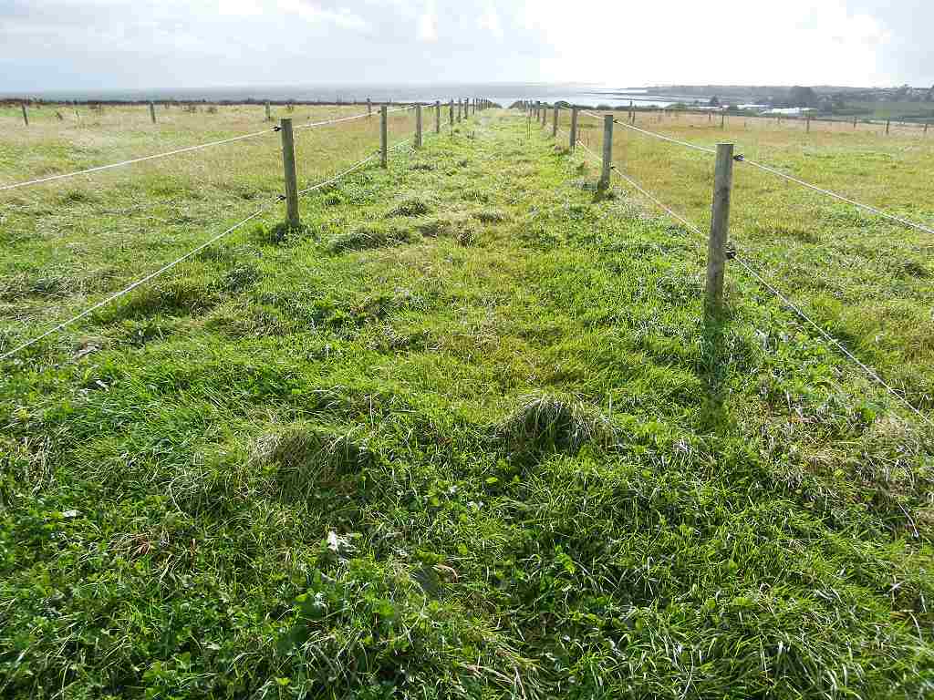
The next bit of the Walk was along a quiet road, which was OK. Then we had to go through a farmyard past some horses and across several fields. They were very boggy with standing water in most of them. We had to zigzag which wasn’t easy in the half-light. Colin got a bootful of water in one gateway, so I clung to the fence and leapt across. I remained dry — in my boots, that is. It was raining so hard by now it hurt! We could barely see to read the map, but Colin said he could make out where the gate was on the far side of the last field — I couldn’t see it. Colin strode out towards it and I followed. Sure enough, we came to a kissing gate which led out on to a lane. How glad we were to be out of those soggy fields before it got pitch dark!
The lane led past factories and we had street lights, all of which we recognised from when we walked from the car to the bus this morning. The rain was now torrential, it was unbelievable! We had to walk through a playing field which had a concrete path, but that was a river, quite deep, so we had to squidge over the grass. By the time we arrived at the car parked at Canal Foot, it was quite dark. And we were wet right through, despite our fancy wet-weather gear.


Location: Walney Island to Ulverston.
Distance: 16 miles.
Total distance: 3216 miles.
Terrain: A lot of concrete. Some road-walking. Beach, both soggy sand and shingle with rocks. Some extremely muddy fields. Mostly flat.
Tide: In, going out.
Rivers: No.388, Devonshire Dock, Barrow-in-Furness.
Ferries: None.
Piers: None.
Kissing gates: No.393 towards the end of the Walk. It cheered us up when we were feeling like drowned rats!
Pubs: None.
‘English Heritage’ properties: No.47, Furness Abbey which we visited on a different day and found it was closed! No.48, Bow Bridge which we missed because it was behind a hedge! No.49, Piel Castle which we visited last month when the weather was better.
Ferris wheels: None.
Diversions: None.
How we got there and back: Yesterday we towed our caravan from home to Grange-over-Sands. This morning we drove to Ulverston and parked at Canal Foot. We had to walk nearly two miles into town in order to catch a bus to Barrow-in-Furness. We alighted near the Town Hall and walked to the bridge where we finished the last Walk.
At the end we came to the car in the pouring rain and fading light. We drove straight back to the caravan, it was too wet to do anything else.
Furness Abbey
and Bow Bridge


We didn’t do very well with our ‘cultural interludes’ today!


We emerged out in the open the other side of the dock area, and it was very blowy. We realised we were not on the path marked on the map, but the other side of a rectangle.


Piel Island


So we didn’t — sit on it, that is. There were crowds of people there, and it would have cost us several hundred pounds to ‘refresh’ them all! It is a tradition which dates back to the 15th century when one Lambert Simnel attempted unsuccessfully to usurp the throne of England. The present ‘King of Piel’ (Steve Chattaway, the pub landlord) was ‘crowned’ in 2007 by sitting in the chair wearing a helmet and holding a sword while alcohol was poured over him. The ‘King’ is expected to be “a free drinker and smoker and lover of the female sex”. Quite a coronation!


We thought the next few miles would be a traffic-dodging nightmare, but it wasn’t like that at all. There was a track between the road and the sea wall at first, then a crude concrete prom. We were unable to walk along this prom because the tide was right in, the sea choppy and waves were breaking over it. But we could walk up higher along a pavement, and the road wasn’t very busy. It was quite bracing — this was the most enjoyable part of today’s Walk.


After about two miles the road turned inland. We took a track which went straight on, and said “Hello!” to a couple coming out of a caravan park. They went on to the beach, vast areas of muddy sand which were being revealed as the tide receded. Our track turned into a footpath, then through a gate and down some steps into a field. The path followed a hedge up a hill to a corner, and then……nothing. No way on.
We looked at the map. There was a parallel public footpath marked further across the field, perhaps we were supposed to be on that. We rounded some soggy weeds and followed the hedge inland. Suddenly we came across a stile hidden in the hedge — we couldn’t see it until we were right up to it. I find stiles very difficult these days, I can’t lift my feet high enough and my back is stiff. Colin said, “You’ve lost your nimbleness!” Certainly have!

We emerged on to a twisty A-road, and the next half mile was a traffic-dodging nightmare — horrid! We turned off at Aldingham, a hamlet that consisted of little more than a manor house and a church.

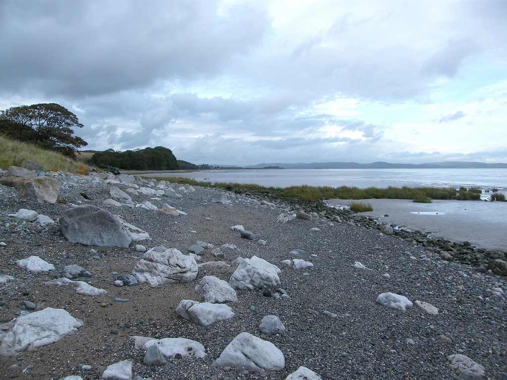
We went down to the beach, we’d had enough of the road. The sand was fairly firm but sticky, and we kept unexpectedly treading on soft places. So this is the famous Morecambe Bay — it’s vast!


A couple walking their dog a little behind us turned round and said, “Oh dear!” We allowed them to catch us up so we could ask them what the kafuffle was about. They answered, “That’s our local farmer, he’s a law unto himself. He shouldn’t be taking the stones off the beach and she’s afraid that the tide will reach her chalet.” They spoke as if the whole village was afraid of this Farmer Thwaites who, apparently, has influence on the local Council as well as being a big local landowner. The age of inequality is by no means past, bullies like him are still getting away with it. How we felt for the lady in the chalet!
We chatted with this couple until we reached a boggy bit of the beach where they turned round and went back. Further on we sat on a rock under trees to eat apples. We chose to sit under the trees because it started to rain — gently at first, but it gradually got harder and harder. This was no simple shower.
We came to a picnic area where people were still walking their dogs despite the rain — the dogs didn’t seem to mind. We chatted with one woman who had a playful dog which was positively revelling in it. They all had cars nearby, but we still had a couple of miles to go.
From there on the path was above the beach and led through woods for some of the time. It was raining very hard and we were fast losing light, especially under the trees. We walked for over a mile like this with the rain pelting ever harder and harder. We hadn’t seen anybody for a while, until a dog appeared in front of us from the direction of the beach closely followed by its owner. Apart from a grunt, he barely acknowledged our presence as we walked along almost together. Eventually we all turned inland to a car park where he got into the only car with his dog and drove off. He didn’t offer us a lift though the rain was pelting down by then and he could see we hadn’t got a car. (We wouldn’t have accepted it because we were determined to finish the Walk, but it would have been nice to have been asked, considering the weather.)
The next bit of the Walk was along a quiet road, which was OK. Then we had to go through a farmyard past some horses and across several fields. They were very boggy with standing water in most of them. We had to zigzag which wasn’t easy in the half-light. Colin got a bootful of water in one gateway, so I clung to the fence and leapt across. I remained dry — in my boots, that is. It was raining so hard by now it hurt! We could barely see to read the map, but Colin said he could make out where the gate was on the far side of the last field — I couldn’t see it. Colin strode out towards it and I followed. Sure enough, we came to a kissing gate which led out on to a lane. How glad we were to be out of those soggy fields before it got pitch dark!
The lane led past factories and we had street lights, all of which we recognised from when we walked from the car to the bus this morning. The rain was now torrential, it was unbelievable! We had to walk through a playing field which had a concrete path, but that was a river, quite deep, so we had to squidge over the grass. By the time we arrived at the car parked at Canal Foot, it was quite dark. And we were wet right through, despite our fancy wet-weather gear.
That ended Walk no.315, we shall pick up Walk no.316 in the village of Cark, across the estuary from
Ulverston. A BOAT (Byway Open to All
Traffic) leads from the canal end at Ulverston across the treacherous sands of Morecambe Bay to Cark, so we decided to count such
BOATs as redundant ferries or railway viaducts and made up a new rule to
accommodate this. It was seven o’clock
(it seemed like midnight!) so the Walk had taken us eight hours and ten minutes.
We immediately started to drive back to
our caravan. The journey was a nightmare
— standing water across the road in numerous places, and sheeting rain across
our headlights bringing visibility down to almost nil. How Colin kept the car on the road I don’t
know, and it was with great relief that we arrived back safely at our caravan.

The next day we returned to Ulverston to
photograph the end of our Walk — we’d kept the cameras firmly wrapped in
polythene ever since the beach where the farmer was stealing the shingle. We also visited Furness Abbey, but couldn’t
get in.


No comments:
Post a Comment