Ages: Colin was 75 years and 93 days. Rosemary was 72 years and 235 days.
Weather: Mostly sunny with a stiff breeze.
Location: Solva to Nolton Haven.
Distance: 8 miles.
Total
distance: 3893½ miles.
Terrain:
Challenging! Mostly undulating
cliff paths with numerous deep clefts accessed by lots of steps. A good stretch of beautiful sandy beach, and
a little road.
Tide: Out when
it mattered!
Rivers: None.
Ferries: None.
Piers: None.
Kissing gates: Nos.917, 918, 919, 920, 921, 922, 923 and 924
near the start of the Walk, no.925 nearer the end.
Pubs: None.
‘Cadw’ properties: None.
Ferris wheels: None.
Diversions: None.
How
we got there and back: We were
caravanning near Whitesands
Beach. This morning we drove to Nolton Haven where
we parked in the free car park. We
caught a bus to Solva.
At
the end we came to the car park in Nolton Haven. We drove straight back to the caravan where
we had tea and cream cakes.
We started today’s Walk near the lime kilns where the coast path rises up
on the south side of the Solva inlet. We
came to a stone telling us that this little headland was donated to the
National Trust in 1937 by the former landowner in memory of his father and
grandfather.
When we got to the top we realised
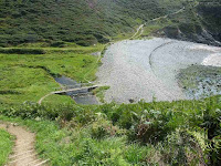
that almost immediately there was a deep cleft which we had to descend all the
way to sea level again. I found this
very difficult with my new knees, especially the right one which is only a few
months old. All those steps! But I managed it. There was a wooden footbridge to cross the stream at the bottom and a
shingle beach, but I was pleased to find that the actual path was on grass
behind it. Then we had to climb all the
way up to the top of the cliff again. I
didn’t find this nearly so difficult as coming down even though it was tiring. There were a lot of people walking the coast
path today in both directions — Pembrokeshire coast path is very well known and
popular with walkers from all over the world.
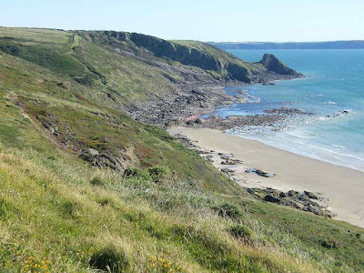
We had spectacular views of the cliffs and rocks all the way along. A lot has happened over geological time to
these twisted rocks. It was OK walking
in the wind but it was too cold to sit in it.
So when we came across a bank sheltered by gorse bushes we made use of
it and sat there to eat our pasties (not on the gorse bushes, silly, on the
grass bank in front of them!)
Colin
saw a bird of prey on the cliffs, he thought it might be a peregrine. It was too far away to photograph. The path was more ‘undulating’ than it appeared on the map — at least it
seemed so to me. We kept coming to deep
clefts, and each one I found more difficult to get down to the bottom. Some of the steps were huge — I tried to avoid
them by stepping down the side but this was not always possible.
We sat on a low bank to eat our bananas. Colin had to pull me up when it was time to
go because I cannot kneel on my new knees and I haven’t yet the strength in my
legs to pull myself up unaided. But I am
getting stronger and it is getting easier.
From where we were sitting we could see the tide was out on Newgale Beach.
We discussed the possibility of accessing the beach from one of the deep
clefts and missing out the last couple of hills. (This
gave me hope) We chatted with a
family who were passing — they said they were hoping to do the same. But they went on much faster than us, so we
never knew how they got on.
 The first cleft we came to didn’t go down to beach level, so we had to
climb out of it again. The second one
had a path of sorts, not the official coast path, which led right down.
The first cleft we came to didn’t go down to beach level, so we had to
climb out of it again. The second one
had a path of sorts, not the official coast path, which led right down.It was a bit dodgy at the bottom — the stream
fell down in a lovely little waterfall — but I sat down (not in the stream!) and Colin helped me negotiate the last step
which was about eighteen inches high. At
last we were on a flat beach of firm sand!
It was wonderful to look up at the last couple of hills on the coast path
and smugly realise we didn’t have to climb them.
We marvelled at the twisted rocks we were
passing at the bottom of the cliffs we didn’t have to climb.
I looked them up later — it turned out they
are Cambrian, very old. A lot has
happened to them over the past hundreds of millions of years.
Soon we were out beyond Newgale with its stones along the top of the
beach. We had been so lucky with the
tide — we had not planned particularly to walk at low tide today — because we
would have been up there on the stones or on the road had the tide been
in. As it was, we walked nearly two
miles on flat sand — fabulous! It was quite breezy, but that made it all the
more pleasant for it wasn’t at all cold.
The tide was well out and lots of people were enjoying this fantastic
beach. Many were kite flying, and we
were passed by a sand yacht at one point — it was going very fast. Loose sand was blowing in waves along the
beach, but it was only at ankle level so it was not a nuisance.
We made for a flag which was at the place where the road goes
uphill. The beach continued a little
further than that but we didn’t know if there would be a way up the cliff at
the far end, so we thought we’d better make for the road exit. There we walked up a narrow boardwalk to the
lifeguard shed and sat on a low wall to eat our chocolate.
From there it was two miles to Nolton Haven where our car was parked, but
what a two miles! It took us a whole
hour longer than it should have done because the path was like a roller-coaster
— up and down, up and down with huge steps to negotiate. My knees were screaming! First we had to walk about a hundred yards up
the road, then we turned off on a path which immediately went down again — with
lots of steps — almost to sea level.
That was when we discovered we could have easily come off the flat beach
at that point! Then it was up and down,
up and down far more than was indicated on the map.
About half way to Nolton Haven we were sent down loads of steps to an
area which was once mined. It took me ages
to get down. Only a single chimney and
bits of coal dust scattered on the steps remained to tell us coal was once
mined here. The geology map informed us
that this part of the coast is formed of rocks from the Carboniferous period
labelled “Productive Coal Measures”.
The beach came to an end about there, and from far back we had wondered
whether we could access the path we were walking on from the beach at this
point. But we hadn’t dared risk it
because we didn’t want to have to retrace our steps when we found we
couldn’t. We could see a sort-of path
going down. Colin followed it, but came
back to say the end was far too steep for me to have managed. That was a little comfort, but not much.
On we went, up and down, up and down — I really don’t know how my knees
managed, especially the right one. But
the surgeon had told me my knees were so secure I couldn’t damage them no
matter what I did, but that didn’t stop them from aching horribly!
We had to go down a particularly long flight
of steps to a vertical rock which was stuck up as if it was a standing
stone. But I’m pretty sure it was
natural. It was difficult to photograph
it because the sun was directly above it, but I had a go.
There was a family sitting there
resting. A bit later they passed us on
the path, and I noticed that one of the teenage girls was struggling along in
high-heeled shoes!!
We saw some more large toadstools, beautiful! We had been seeing them all along this path.
At last we came within sight of Nolton Haven, a lovely little beach
tucked away in the cliffs. Quite a few
families were enjoying themselves there even though it was, by now, early
evening when most families had departed.
We were relieved to get to the bottom of the steps knowing that our car
was only a few yards away in the free car park. That ended Walk no.380, we shall pick up Walk no.381
next time on Nolton Haven beach. It was twenty-five
to seven, so the Walk had taken us six hours and fifty minutes. We drove straight back to the caravan
where we had tea and cream cakes.


1 comment:
I don't think you post comments any more but just to say I am enjoying your latest write ups and hope you will be able to get back to the coast soon.
Post a Comment