Friday, September 17, 2010

Walk 263 -- Kilmelford to A Bheinn

Ages:  Colin was 68 years and 132 days.  Rosemary was 65 years and 274 days.
Weather:  Mostly sunny.  Remaining dry despite occasional threatening clouds.  A cool wind.
Location:  Kilmelford to Á Bheinn.
Distance:  14 miles.
Total distance:  2495½ miles.
Terrain:  Mostly roads, a lot were “dodge-the-traffic” main roads.  But some were minor roads and we found the connecting track between Craobh Haven and Ardfern to be an excellent thoroughfare which was well maintained.
Tide:  In.  (There are neap tides this week, so it hardly makes a difference in the lochs.)
Rivers:  No.299, Barbreck River.
Ferries:  None.
Piers: None.
Kissing gates:  None.
Pubs:  The ‘Lord of the Isles’ at Craobh Haven, but it isn’t a ‘real ale’ pub so it didn’t really count!  (They did have two pumps with the clips turned round, and said they hadn’t had a delivery.)
‘Historic Scotland’ properties:  None.
Ferris wheels:  None.
Diversions:  None.
How we got there and back:  We were staying in our caravan in Lochgilphead.  This morning we drove to the middle of nowhere and parked our car in the entrance to a disused quarry where it was off the main road and out of everyone’s way.  (I took the name ‘Á Bheinn’ from the nearest mountain!)  We hailed a passing bus, and alighted at the exact spot where we finished yesterday’s Walk — where the minor road from Melfort met the main road.
At the end, we finished our Walk at the car.  We had tea and caramel shortcake, then returned to our caravan in Lochgilphead. 

The first eight miles of today’s Walk was along a “dodge-the-traffic” main road.  So we put on our bright yellow waistcoats and attached flashing reflective straps — which we had bought only yesterday — to our rucksacks.  Then we just got on with it.  On the ‘up’ side the weather was good, the traffic was sparse, we ate blackberries along the way and the views were fantastic — as ever.


We started at the road junction just south of Kilmelford where we finished the last Walk.  Most of the first eight miles was alongside Loch Melfort, so there were things of interest all the way.  We just had to keep a look-out for traffic speeding towards us, that’s all.
We could see where we had walked two days ago, including the path with the mica rocks.  It was only at a distance that we could appreciate how high we had climbed from the Seil Bridge before descending to Degnish.

There were birds on the shore, we passed a salmon farm, and we enjoyed the wild flowers.  We came to a ‘works’ and there was what looked like a large empty box near its entrance.  It turned out to be an empty tank, but it made a good seat so we sat on it to eat our pies.  Then we walked on for another one and a half hours.

More fish-farming, and a rocky knoll out in the loch.
We came to a strange house, a new-build.  Part of the house jutted out about six-foot high over nothing!  That room seemed to have no visible means of support — I wouldn’t have liked to live there, especially as it was right next to the loch where storms could engulf it.  It was an ugly house anyway.  There was a small concrete jetty protruding over the stony beach there, but no boats in sight.

We came to a layby where there was a picnic table overlooking the loch, so we immediately decided it was lunchtime!
It was very pleasant sitting in the sunshine, though the wind was getting up and the blue water of the loch was becoming a little choppy.  Colin found a peacock butterfly in the undergrowth, and managed to take a gorgeous picture of it.

At last we were able to turn off the main road on to a lane leading to Craobh Haven.  No sooner had we done so than a man stopped his car and offered us a lift!  We explained what we were doing and gave him a blog card, but he looked a bit bemused — I don’t think he really understood.

We walked through the village to the marina and came to the pub.  Before we went in Colin said, “If they have no real ales I’ll drink keg!!”  You could have knocked me down with a feather — I couldn’t believe he had really said that!  They did have the proper pumps, two of them, but the clips were turned round.  The barmaid explained that they’d had no delivery, but they had bottled beer so Colin was ‘saved’ from the awfulness of keg.  It was so nice to relax with a drink for about twenty minutes — it recharged the batteries.

We stood by the yacht marina for a while, watching the swans and listening to the clattering of the masts.  Then we made our way along the shore.  It wasn’t clear from the map which way we had to go in order to get on the track to Ardfern, but the barmaid back at the pub had told us how to find it.  I was relieved that there was actually a way through, I don’t trust OS maps in Scotland anymore!
I was tempted to find a footpath along the shore to a jetty — clearly marked on the map —  and go up from there, but there was no real path in actual fact so my scepticism was justified.  OK, a vestige of a path disappeared under bushes, but it was so overgrown we both immediately decided it was no-go.  It obviously hadn’t been walked for years.

 
So we followed the good track which led round a big house up on a hill, past a wire statue of a boy looking out to sea, and up to some riding stables.  There was the recycling bin we’d been told to look out for — with a freezer and washing machine dumped next to it.  We knew we were on the right track!

It was a nice wide track leading over the hill to Ardfern, almost a road.  A woman on a trail bike passed us when we were part way up, and later she returned with a child riding pillion.  (It was school turning-out time, and the local primary school is in Ardfern.)  It wasn’t much of a hill, but from the top we could see a couple of small freshwater lochans, and over the tops of trees to the next sea loch, Loch Craignish.  We came out in Ardfern where a notice told us “Twenty’s Plenty” as we passed Craignish School.

Our way led on along the waterfront past numerous luxury yachts — there is certainly a lot of money about these days despite the so-called recession.  We were on a minor road leading along the shoreline.  We watched a heron fishing in the shallows as we sat on a rock eating our chocolate.

"Which way do we go?"
At the junction with the main road is a most extraordinary sculpture.  Standing more than six feet tall, a wooden arm rises out of the ground pointing a finger along the road we had just walked!  We wondered what was the ‘deep’ meaning behind such a structure.

We had three more miles on the “dodge-the-traffic” main road before we reached the car.  So we donned the bright yellow gear again, and set off.  We crossed Barbreck River on an ordinary straightforward bridge, but further on we crossed a burn on a curve in the road over a pretty stone bridge.  Colin was ahead of me and didn’t look back, so he didn’t see the following incident.
I decided to take a photo of this bridge after I had walked over it, so I leant on the stone wall to get a better view.  Unknown to me, a sheep was sitting down, possibly asleep, against the wall on the other side.  She woke up, completely spooked by me.  She leapt up, lost her balance, and rolled roly-poly roly-poly all the way down the steep grass bank!  It was so unexpected and funny, I burst out laughing.  But I was also relieved when she got up on her feet looking slightly bemused, and trotted away apparently none the worse for her adventure.  Pity I didn’t have my camera switched on in time to take a video!

A little further on we passed the remains of an ancient stone circle, so we diverted for a few minutes to look at it.  The standing stone in the middle was very phallic-like.  It also had a face carved in it — we wondered who it was!  Looking at the map, there are standing stones everywhere in this area.  And ‘cup & saucer’ rings.  And ancient cairns.

After that it was a slog uphill inland for a further two miles on the main road.  We were very tired by then, so we route-marched that last bit, looking neither to right nor left, until we reached the disused quarry entrance where our car was parked.

 That ended Walk no.263, we shall pick up Walk no.264 next time at the at the entrance to the disused quarry at the foot of Á Bheinn. It was twenty-five past six, so the Walk had taken us eight hours and twenty minutes.  We had our tea and caramel shortcake, then we returned to our caravan in Lochgilphead.

Wednesday, September 15, 2010

Walk 262 -- Kilninver to Kilmelford

Ages:  Colin was 68 years and 130 days.  Rosemary was 65 years and 272 days.
Weather:  Torrential rain which suddenly cleared up as the Walk started.  We then had blue skies for most of the way!  A few light showers near the end.  Very windy.
Location:  Kilninver to Kilmelford.
Distance:  14 miles.
Total distance:  2481½ miles.
Terrain:  Mostly minor roads.  An excellent 3 mile track across Bealach Gaoithe, it was well maintained and signposted.  We were quite relieved about that!
Tide:  Going out.
Rivers:  No.297, River Euchar.  No.298, River Oude.
Ferries:  None.
Piers: None.
Kissing gates:  None.
Pubs:  None.
‘Historic Scotland’ properties:  None.
Ferris wheels:  None.
Diversions:  None.
How we got there and back:  We were staying in our caravan in Lochgilphead.  This morning we drove to Kilmelford and parked in a car park next to a bus stop.  We then caught a bus to Kilninver, alighting at the exact spot where we finished yesterday’s Walk.
At the end, we finished our Walk where the minor road from Melfort met the main road.  We then walked about 200 yards northwards to our car parked by the bus stop.  We had tea and caramel shortcake, then returned to our caravan in Lochgilphead.

        When we woke this morning the rain was teeming down making a lot of noise on our caravan roof.  It was also very windy.  This weather was so bad we considered cancelling the Walk.  I just wanted to go home!  But we got up, set up the Walk, and as we got off the bus the rain stopped.  The sky cleared as if by magic, and very soon we had to peel off our wet weather gear because we were too hot.  We did most of the Walk in brilliant sunshine, well off the main road, and it proved to be a very enjoyable day indeed!
From the road junction we walked down the link road to Kilninver.  We were right next to the loch at first, and it was quite blue because the sky had already cleared.  We watched a heron fishing for a while, before moving on.  We also saw some geese in a field.
In Kilninver, which is half a dozen houses at most, we crossed the river on an attractive stone bridge and took the road towards Seil.  This road is quite narrow and twisty, and it was a lot busier than we’d thought it would be.  We were passed by several coaches and a double-decker bus full of ‘wrinklies’!  We could only assume they were all making for the island of Seil, but we wondered how these big vehicles coped with the bridge which is narrow and humped.
When not dodging the traffic we had time to look at the autumnal wild flowers on the roadside, and marvel at the number of rose hips there seem to be this year.
We passed Loch Seil on our left hand side, a small sausage-shaped loch.  We noticed that there was a piece of blue string stretching along the road.  We hadn’t seen it start, and couldn’t make out what it was for.  We must have followed it for more than a mile!  We said we would see where it ended, it might give us some clue.
But we were speculating so animatedly as to its purpose that we didn’t see where it went — we suddenly noticed it wasn’t there any more.  We couldn’t be bothered to walk back, so it remains a mystery.
We bypassed the road down to Seil because it is a dead end.  But we did visit the island last July because there is a rather nice ‘real ale’ pub just across the bridge.  We had a pub lunch there back then, followed by a tour of the island by car.

The Islands of Seil and Easdale
Seil is separated from the mainland by a very narrow strait, in fact we have crossed wider rivers.  There is just one bridge across to the island, and that is narrow and humped.  In actual fact it is a very attractive bridge.  The ‘Tigh an Truish’ pub lies just on the other side.
Across the island, several miles away from the bridge, is the pretty little harbour of Ellenabeich.  This is the spot the tourist buses were making for, and it now boasts a Craft Centre and a Heritage Centre.  There is also a little ferry across to a rock called Easdale where there is a pub and a museum, according to my map.  (There is hardly room on this rock for anything else!)
Easdale was once the centre of the British slate industry, and slates from this tiny island can still be found on rooftops all over the world.  There were several quarries, some of which extended — by the use of pumping machinery — up to three hundred feet below sea level. Hundreds of men were employed in this dangerous work of cutting out the slates.  They were poorly paid and lived in hovels on the island.  The company which owned the island made a fine profit, meanwhile.  But times change, and the quarries stopped producing on a commercial scale in 1911.  The last slate was cut on Easdale in the 1950s.
Nowadays the flooded quarries form deep rectangular pools on Easdale and round Ellenabeich.  The slates are still there, and they make excellent skimming stones!  So each September the World Stone-Skimming Championships are held on Easdale — and the experts are the local children who can practise all the year.

At the bend we continued straight on down a farm road, passing some Highland cows lurking in the undergrowth.  We were followed by a van with a smelly trailer which passed us several times, going backwards and forwards transferring animals to a field lower down.  (Why the farmer didn’t herd the cattle I don’t know, I would have thought that would have been a much easier option.  But then I don’t know anything about farming.)  We sat on a wall to eat our sarnies, then continued until the tarmacked road ran out.
There the way forked, and we took the left-hand branch because the one leading down to the shore was a dead end.  Our track led across the moors to Kilchoan Bay in Loch Melfort, and we were relieved to find it was a good track, well drained, well maintained and well signposted!  We thought the track must be used as an unofficial road by the local people, though we didn’t meet anybody on it throughout its length.  Telegraph wires on poles were beside us all the way.
We crossed a stream at a ford which was so narrow we could jump it, but Colin balanced across on a piece of guttering just to be different.  Then we began to climb.
The sun was shining.  The scenery was lovely, we had wonderful views across the strait to Seil.  The track was good, and it was very clear which way we were supposed to go.  We were really enjoying ourselves, and thought it couldn’t get any better.  But it did!  We saw a red squirrel!
Colin hadn’t brought his camera because of the rain this morning, so he grabbed mine and crept out on to a bluff hoping to get a better view.  I stayed quietly on the track.  Colin couldn’t see the squirrel when he got out there, but I did.
Somehow it had got round behind him, and I saw it skitter away into some trees quite near me.  But I didn’t have my camera because it was in Colin’s hand over there!  The only picture we got was of some sheep peeping over a ridge.
We continued to climb.  At the top we came across a dead tree which was stuffed with coins — not old coins, you understand, but modern 10p pieces mostly.  Why do people hammer coins into trees like this?  Is it for good luck, like throwing money into a wishing well?
The only other coin tree we have come across on our travels is on the ‘Waterfalls Walk’ in Ingleton on the Yorkshire Dales, but apparently there are a number of them scattered about the countryside in England, Scotland and Wales.  We were quite surprised to come across one in such a remote spot, I shouldn’t think many tourists come up here.  So who are the people who do this?
Not far past the coin tree we came upon a very interesting rock.  It was an outcrop of basalt — the hexagonal columns turned on their sides so we could only see their ends.  It was a bit like Ireland’s famous ‘Giant’s Causeway’, only tipped sideways.
The track began to descend, and the views ahead of us were stupendous!  They quite took our breath away.  The track went on, down and down.  We hadn’t realised we had climbed so high.
Then we saw some rocks which had such a high percentage of mica in them they shone in the sun!
From the distance they looked like mirrors — my photos don’t do them justice.
We couldn’t get over how beautiful they were, and that they were completely natural.
I took dozens of photos of them.
Further down we came across a mica rock that had been wrinkled — amazing!
As were the continuing views across the loch far below.
The track we were on was coming down to meet the road at a sharp angle, facing in the wrong direction like two prongs of a fork.  Colin insisted we cut off the corner, but he had to help me down as I found it a bit steep.  We were on a tarmacked lane again.  There was a car parked down there overlooking the loch, and the driver asked us if we had enjoyed our walk.  So we stopped to chat for a bit.  Further on we sat on a bank to eat our apples.
The lane we were on was undulating, narrow and twisting — but there was so little traffic it didn’t really matter.  It was very pretty, and we kept getting wonderful views over the loch.  A couple of miles further on we sat by the roadside to eat our chocolate.  The man we had chatted to earlier drove past, stopped and offered us a lift.  When we tried to explain that we “must” walk it all even though we were very tired by now, he kept asking, “Are you sure?”  So I gave him one of my blog cards — I wonder if he is still reading it. (“Hello!” if you are!)
As we neared the end of our Walk, we passed through the hamlet of Melfort.  The ground between the lane and the loch was quite swampy there, even the trees seemed to be growing in water.
In front of a row of houses we came across an interesting post.  It recorded the high water mark of 22nd November 1881. (I think that was the date, it was difficult to make out.)  It was about four feet off the ground up by the fence, yet the present day tide level is well below the road.  All the houses along there must have been flooded that day.  But today the water in the loch was much lower, and looking very picturesque with yachts moored in the shallows.
As we neared the end of our Walk, the blue skies clouded over and we had a couple of showers — but nothing like the downpours this morning.  At last we came out on to the main road.

That ended Walk no.262, we shall pick up Walk no.263 next time at the road junction just south of Kilmelford. It was twenty-five past six, so the Walk had taken us eight hours.  We walked about 200 yards northwards on the main road to the bus stop next to where our car was parked.  We had our tea and caramel shortcake, then returned to our caravan in Lochgilphead.

Tuesday, September 14, 2010

Walk 261 -- Oban to Kilninver

Ages:  Colin was 68 years and 129 days.  Rosemary was 65 years and 271 days.
Weather:  Very heavy showers interspersed with bright sunny intervals.  Very windy but not cold.
Location:  Oban to Kilninver.
Distance:  11½ miles.
Total distance:  2467½ miles.
Terrain:  99% roads.  Undulating.
Tide:  Going out.
Rivers:  No.296, Feochan Bheag.
Ferries:  None.
Piers: None.
Kissing gates:  None.
Pubs:  The Lorne Bar in Oban which we visited twice on our rest days for lunch.  Colin drank Oban Bay ‘Fair Puggled’ and Caledonian ‘Deuchars IPA’.  I had a shandy the first time and Strongbow cider the second.
‘Historic Scotland’ properties:  None.
Ferris wheels:  None.
Diversions:  None.
How we got there and back:  We took two days to drive up from Malvern towing our caravan, and based ourselves in Lochgilphead yesterday.  This morning we drove to Kilninver and parked on a grass verge at the junction of the road off to Seil and Easdale Island.  We had intended catching the bus into Oban from there, but Colin insisted we try to thumb a lift instead.  A retired couple stopped because they thought we had broken down!  I don’t know how pleased they were when they discovered we were hitching a free ride, but they took us into Oban and dropped us at the bus station, close to where we finished the last Walk.
At the end, we finished our Walk by the car parked on the main road.  We had tea and caramel shortcake, then returned to our caravan in Lochgilphead.

      We started our Walk in the bus station area of Oban.  We had good views across the harbour towards the entrance and the town.
        We walked past the ferries to the Isles which were loading up, it was very busy there.
      

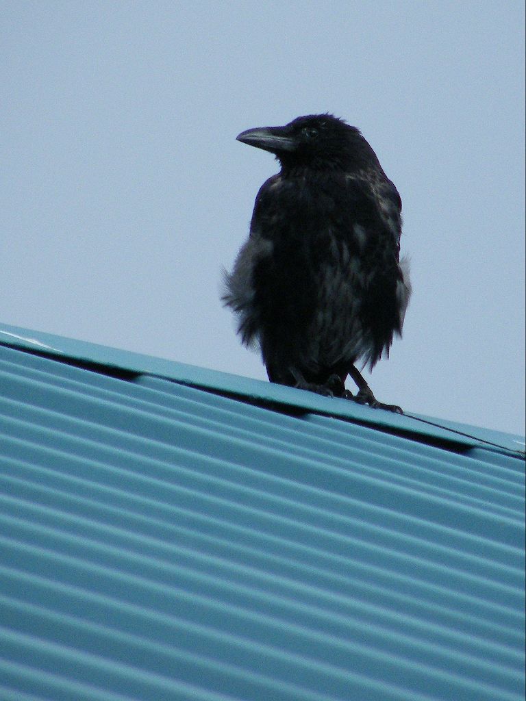
      We started to take photographs (Colin saw a raven on a roof) but it kept raining — torrential showers so we had to keep putting the cameras away.  When the sun came out between the showers, it got too hot — it was a crazy sort of day!
        
      We followed the road which led along the lochside.  It told us “Twenty’s Plenty” which is a speed sign we’ve seen all over this part of Scotland.  Quite right too, in these residential areas.  Why is everyone in such a hurry these days?  It was quieter along there, with yachts moored in the loch.
We went through an alleyway to the road in front of the houses so that we could see the view.  Since it wasn’t raining at that precise moment, we sat on a wall to eat our pies.  But we had to finish hurriedly because the heavens opened again.
Further on we came to the smaller ferry across to the island of Kerrera.  On our map it was marked as a passenger ferry only, but when we passed it they were loading up cars as well.  Round the next corner we had to turn inland, because the road continuing was a dead end.  We walked back along the other side of the hill almost into Oban again!
We came to an area that appeared to be an open-cast coal mine which was finished with.  We were amazed and horrified to see that a new housing estate had been built on top of and just below what looked like a tip!  There was even a stream running down the middle of it.  Haven’t they heard of Aberfan?  And the terrible disaster which happened there in the autumn of 1966?  (I was a newly qualified teacher at the time, teaching a reception class in a primary school in Worcester.  When I heard what had happened at Aberfan, I kept looking at the windows of my bright new classroom wondering what I would do if tons of slimy coal-waste suddenly crashed through them, suffocating me and all the children.  It spooked me for weeks even though I wasn’t anywhere near a coal mine!)  We couldn’t believe that houses had been built in what looked like a very unstable situation.  I wouldn’t have a wink of sleep if I had to stay in such a house, especially during a rainstorm.
Because of these new houses which weren’t marked on our map, we had a bit of trouble working out exactly where we were.  But we eventually found the track which connected us to the main road without having to go right back into Oban.  It led us over a swamp, but there were concrete blocks set in the ground like stepping stones so it was a dry path and easy to walk.  A small bridge took us over a stream. Then it was up the road and out by the hospital.
We sat on the wall of a hotel entrance to eat our sarnies, then we continued.  There was a pavement for a little way, after which it was ‘dodge-the-traffic’ once more.  On with the high-vis vests and constant leaping into the undergrowth — not much fun!  We climbed a big hill, then down the other side.  The road was very twisty, and it kept raining.
We crossed a river and came to Loch Feochan — once more we were by the water.  A narrow loch, but that was our ‘sea’ for the moment.  The water in the river was well up, we have had a lot of rain recently, especially in this area.
We came to a stony beach, so we sat on rocks to eat our chocolate.
The rest of the Walk was really a bit dull.  We were still traffic-dodging on the main road and we were alongside the loch, according to the map.  We did have the occasional nice view, but mostly it was behind trees.
We passed a sheep in a field with unbelievably curly horns, but that was just about the only thing of interest.  Colin collected hazelnuts and I ate blackberries as we walked along, a bonus at this time of year.
Eventually we came to our car parked at the road junction down into Kilninver.  There was a notice about the stone-skimming championships to be held fairly soon on the nearby island of Easdale — more about that on the next Walk.

       That ended Walk no.261, we shall pick up Walk no.262 next time at the road junction leading into Kilninver.  It was just gone half past four, so the Walk had taken us five hours fifty minutes. We had our tea and caramel shortcake, then returned to our caravan in Lochgilphead.