Monday, September 06, 2021

Walk 395 -- Freshwater East to Manorbier

 Ages: Colin was 79 years and 121 days. Rosemary was 76 years and 263 days. 
Weather: Hot and muggy. A negligible breeze. 
Location: Freshwater East to Manorbier. 
Distance: 4 miles. 
Total distance: 3985 miles. 
Terrain: Some beach. Mostly clifftop paths. Very undulating. 
Tide: Out. 
Rivers: None. 
Ferries: None. 
Piers: None. 
Kissing gates: None. 
Pubs: None. 
‘Cadw’ properties: No.13, Lamphey Palace. 
Ferris wheels: None. 
Diversions: None. 
How we got there and back: Yesterday we towed our caravan from home to Freshwater East. The caravan site is a 5 minute walk from the beach, so that is where we started the Walk. 
At the end we came to Manorbier beach. We intended ringing for a taxi to take us back to the caravan site but I couldn't get a signal on my phone. I was all in at the end of the Walk, the terrain had been challenging, the weather was hot and I had been very slow. But after a rest and an ice cream I felt a lot better. So we decided to walk back along the local lanes which wouldn't be so challenging – after all it was only four miles. I got about halfway, and sank exhausted on to a roadside bank. Fortunately a couple of Good Samaritans caught us up, namely Richard and Margaret. Seeing the state I was in, they fetched their car and drove us the rest of the way. We were deeply grateful to them. 
We realised we are going to have to rethink the way we do the rest of our Round-Britain-Walk. We still have about a thousand miles to go and we are not up to it any more — especially me. Old age has caught us up. 
 
Lamphey Palace 
Lamphey Palace is a medieval ruin situated a couple of miles north of Freshwater East. It was mostly built in the the 14
th century by Henry de Gower, Bishop of St David's. It was used by high-ranking clergy until the dissolution of the monasteries in 1546. It was damaged in the English Civil War, and subsequently used as farm buildings until it fell into complete ruin. It is now owned and maintained by Cadw.
 
We started today's Walk at the bridge over the stream at Freshwater East beach. First we followed a tarmacked path up into the dunes until we reached a kind of platform with seats all round — an ideal place for disabled people to overlook the beach. There were lots of wild flowers blooming in the dunes. 
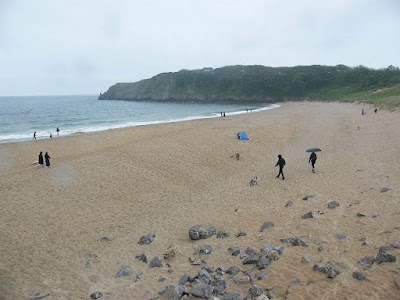
From there the path was loose and undulating across the dunes, so we decided that we would prefer the firm sand of the beach as the tide was out. We made our way down there and really enjoyed walking along by the lapping waves. We came to the end of the beach but we hadn't seen a way up to the path on the cliffs.
The rocks at that end of the beach looked interesting, but I'm afraid I've forgotten most of the geology I learned in the 1980s when I got my degree with the Open University. It's too long ago.
 
The two ways up we thought we had seen as we were walking along both involved a scramble up a vertical cliff — we are too old for that! So we had to backtrack, which is something we never like doing. I was making for the end of the dunes, but Colin noticed some steps before that. Sure enough, they led up to the Coast Path. The path up was quite steep, but by no means vertical. 
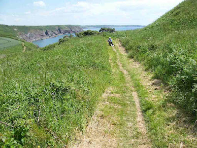
The Coast Path at that point was great! It was smooth, almost flat and had recently been strimmed for ease of access. But soon it started to undulate, quite steeply in places. There were lots of steps which my knees were not totally happy with.
 
We left Freshwater East behind and climbed West Moor Cliff. The views were fantastic, but the visibility was poor because of the mugginess. It got very hot and there was hardly a breath of wind. 
 
 
We rounded a corner and got a lovely view of Swanlake Bay. I was feeling hot and tired by then, so we sat on a bank and ate our cereal bars. That was the only food we had brought with us because we intended having lunch in a cafĂ© in Manorbier — after all, we had reasoned, it is only four miles from Freshwater East. Little did we guess how difficult we would find it to get there. 
We could see how undulating the path was from that point on. The downhills were very steep with few steps — I found them particularly difficult despite using my poles. I had completely lost my confidence

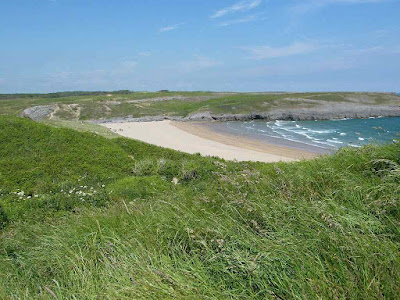
The views and the wild flowers were a great compensation. We rounded Swanlake Bay, a lovely beach with few people on it because you can only get to it by walking.
 
We climbed East Moor Cliff the other side and got our first view of Manorbier in the distance
By then the sweat was pouring off me in a constant stream and dripping from the end of my nose! And I kept getting cramp in my calves. I mistakenly thought that once we had climbed East Moor Cliff it would only be a short hop to Manorbier where we planned to have lunch. But it was at least another mile of steep and difficult terrain and the heat from the sun was immense! There was hardly a breath of wind, especially where the path zigzagged inland to get up a hill.
 
At last we came out on to the lane where there was a small car park. Just past it was a bench that overlooked the beach which was about a hundred yards away. We sat on it and called it the end of the Walk.
 
 
That ended Walk 395. At that point we intended starting Walk 396 at that bench next time. It was quarter to three and we hadn't had any lunch. The Walk had taken us four hours, ten minutes and it was only four miles! We were both dog-tired and overheated. When we had rested a little we didn't go down to the beach. Instead we walked down the lane to the main car park because we wanted to use the toilets. I took a photo of Manorbier Castle which was over a hedge opposite, but it was a pretty poor photo.
Then we bought an ice cream each and I tried to ring for a taxi to take us back to the caravan. But I couldn't get a signal on my phone. What to do?
 
We didn't want to walk even further away into the village which was up a hill. We felt a fraction refreshed after a short rest and the ice creams, so we decided to walk back along the road. It should be far easier walking than the cliff path and they were back lanes so there shouldn't be much traffic to buzz us. And what's four miles of easy walking anyway? We've always been able to do that and more, no matter how tired we've been. 
Old Age — that's what stymied us! 
We managed up a steep hill at the beginning, after that it was more or less flat. It was deadly boring and I soon began to seriously tire in the oppressive heat. After about three miles I sank down on to a roadside bank because I felt I couldn't go on any further. A lady in a car stopped to ask if I was alright. She offered us a lift, but she was going the wrong way. Just then a couple (Richard and Margaret) walked up from behind us. They said they were staying at a cottage just two hundred yards further on, and if we could get there they would drive us all the way to the caravan site which they reckoned was two more miles distant. We accepted their offer — I really couldn't walk another two miles in that heat. Richard drove us to the entrance of the caravan site at Freshwater East. After a rest, a drink and a bite to eat I felt fine. 
 
:: – :: – :: – :: – :: – :: – :: – :: – :: – :: – :: – :: – :: – :: – :: – :: – ::
 
We really are going to have to rethink the rest of the Round Britain Walk. We still have about a thousand miles to go and I'm just not up to it anymore. We've had so many setbacks in recent years (my knees, financial worries, no car, no caravan, Covid and I've had a lot of back trouble). Colin is amazingly fit physically, but the isolation of the pandemic restrictions has taken a big toll on his mental health. 
I am bitterly disappointed. Colin is disappointed too, but not as much as me because it has always been very much my project. But we' re not giving up completely, I am making plans!
 
 
:: – :: – :: – :: – :: – :: – :: – :: – :: – :: – :: – :: – :: – :: – :: – :: – ::
 

Difficult Decisions


We are very disappointed. After 23 years and 3985 miles we are going to have to throw in the towel! This is a project I have wanted to do ever since I was a child, but old age has caught up with us before we have been able to finish. We have had a lot of bad luck. Since we started in 1998 I have had five operations on my legs and Colin has had three on his bladder. Right at the beginning our walking was curtailed for about six months because the countryside was 'closed' due to the foot and mouth crisis. The weather has often put the kibosh on our Walks, especially in Scotland, and we have come home earlier than we intended. We had to take two years out because of my arthritic knees. Then we had financial problems over a mortgage and had to take another two years out. During that time both the car and the caravan packed up and we couldn't afford to replace them until the mortgage was finally paid off. The Covid pandemic was the last straw, when we were unable to leave our homes for nigh on two years over a series of lockdowns.
I had seen the fact that I might have to give up coming for quite some time, but I was always in denial. With grim determination I wanted to finish and say, “We walked every inch of the way!” But I can no longer walk the distances I used to. I need to rest a lot more often. I am very slow. I cannot cope with big steps or steep downhills, and the coast path is full of these. It has become an impossibility. After the incident on the way back from this last Walk I have had to accept defeat.
But we have done much to be proud of. We have walked nearly four thousand miles of the British coastline. We have walked all round the Scottish coast. We have walked in every kind of weather it is possible to experience in the British Isles. We walked to Cape Wrath from the ferry and out via Sandwood Bay in one day!! I entered the story of that epic Walk into a competition and got it published in a book by Hilary Bradt called “To Oldly Go” — the only piece of writing I have ever had published!
And we are not giving up entirely. We plan to continue from Manorbier, visiting every access point on the coast and doing a bit of walking here and there where it is not too undulating. We will get back to Bognor one day, even though we don't live there anymore.

Monday, June 21, 2021

Walk 394 -- Stackpole Quay to Freshwater East

(The bus times were so awkward today we decided to do this Walk in two parts instead.)
Ages: (a) Colin was 79 years and 44 days. Rosemary was 76 years and 186 days. (b) Colin was 79 years and 45 days. Rosemary was 76 years and 187 days.
Weather: (a) Fair-weather cloud. Breezy but warm. (b) Hot and sunny with a cooling breeze when we could get it.
Location: Stackpole Quay to Freshwater East.
Distance: 3 miles.
Total distance: 3981 miles.
Terrain: Grassy cliff paths. Undulating but steps at the beginning where needed, not at the end. 
Tide: (a) Coming in. (b) Out.
Rivers: None.
Ferries: None.
Piers: None.
Kissing gates: None. 
Pubs: None.
‘Cadw’ properties: None.
Ferris wheels: None.
Diversions: None.
How we got there and back: We were caravanning at Freshwater East. (a) We drove to Stackpole Quay and parked in the National Trust car park. (b) We didn't use the car at all today. We walked from our caravan down to the beach and picked up the cliff path towards Stackpole Quay. When we reached the halfway point, Greenala Fort, we turned back.
At the end (a) we came to what we considered to be the halfway point, Greenala Fort. We turned round and walked back to Stackpole Quay. After consuming a takeaway lunch at the cafe we tried to drive back to Freshwater East. But the road was closed due to roadworks and we had to go a long way round via Pembroke and Lamphey. A truck was stuck on the bridge at Lamphey which held us up for about half an hour. (b) We walked back to our caravan and had lunch there.
The next day we towed our caravan home to Malvern. 


I can't believe we have a grandson of 32!! Jamie was born on the 21st June 1989, and we had a lot to do with him as he was growing up. We were very close at the time. But now he lives in Atlanta, USA, and we haven't seen him for three years. That's the way of the world! (The picture is of him, left, with his partner, Matt)


(a) We left Stackpole Quay on a steep cliff path, but at least it had steps cut into it. As soon as we got up high we went down almost to sea level again, but that seemed to be the order of the day.
There was a large rock on the rocky beach at that point which showed how the layers of rock had been wrinkled up and then eroded — a true piece of naked geology!
The views were wonderful for the whole Walk. We met a lot of other hikers on this Walk, the Pembrokeshire Coast Path is very popular.
 
We passed a sinkhole and could hear the sea gurgling at the bottom of it. We inched as near as we dared to the edge, and could actually see the water at the bottom of the pit. 
There were a huge variety of wild flowers along the route with loads of insects buzzing around them.
A true wildflower meadow, but only for a narrow strip along the coast.
 
We walked as far as Greenala Point which we reckoned was halfway between Stackpole Quay and Freshwater East. It is a rocky headland with the remains of an ancient fort on it. There we turned back.
 
(b) We started at Greenala Point at the exact spot behind the fort where we had turned round yesterday. The views were spectacular and it was very clear.
At the top of one hill we climbed was a notice on a gate saying “
Lundy View”. Sure enough, very faint on the horizon we could just make out Lundy Island which is in North Devon! Looking back we could see Barafundle Bay, in the sunshine today!
The slopes seemed even more steep on this half of the Walk, both up and down. But we coped — taking it very slowly. We saw a lot of rock falls and wondered how recent they were.
 
At the top of Trewent Point we walked to the end instead of just cutting across like we had earlier on the way out. It was rather overgrown and underwhelming. I had hoped there would be a seat at the end so we could sit and soak in the view — but there wasn't so we couldn't.
 
Freshwater East beach looked great from up there. We had to negotiate a long and steep path coming down to the beach, which was a great strain on my knees. There were no steps. But my knees coped with it, as did I.
 
I took a photo of flowering succulents on a garden wall — a dazzling picture! We crossed the stream at the bottom, and that was the end of the Walk.
 
 
That ended Walk no.394, we shall pick up Walk no.395 next time where the stream crosses the road at Freshwater East. It was twenty-five to two, so the Walk had taken us two hours forty-five minutes. We walked back to our caravan and had lunch there. 
The next day we towed our caravan home to Malvern.

Sunday, June 20, 2021

Walk 393 -- Bosherston Lily Ponds to Stackpole Quay

 Ages: Colin was 79 years and 43 days. Rosemary was 76 years and 185 days. 
Weather: Drizzle which kept coming and going. 
Location: Bosherston Lily Ponds to Stackpole Quay. 
Distance: 3 miles. 
Total distance: 3978 miles. 
Terrain: A steep and difficult start over soft sand. Otherwise gently undulating grassy cliff paths. 
Tide: In. 
Rivers: None. 
Ferries: None. 
Piers: None. 
Kissing gates: Nos.958, 959 and 960. 
Pubs: None. 
‘Cadw’ properties: None. 
Ferris wheels: None. 
Diversions: None. 
How we got there and back: We were caravanning at Freshwater East. This morning we drove to Stackpole Quay and parked in the National Trust car park. The bus times were too awkward to use today, so we walked to Eight Arch Bridge, then alongside one of the lily ponds to the bench overlooking Broad Haven South beach. 
At the end we came to Stackpole Quay and drove back to our caravan at Freshwater East. 
 
We started today's Walk by sitting on the bench at the end of the lily ponds overlooking Broad Haven Beach where we finished the last Walk. We had just completed a lovely saunter from Stackpole Quay via Eight Arch Bridge, so we rested there and ate our lunch. The coast path almost immediately left the lily ponds, which we have very much enjoyed walking round over the past few days, and took us up an almost vertical slope of very soft sand. Every time we put a foot forward it slipped down again almost to where it had started — it was a real struggle to get up to the top of the cliffs. But it was well worth it for the views over Broad Haven Beach and the lily ponds. 
It was a relief to get on to a firm grassy path. We were both wearing our kags already, but when the drizzle intensified we struggled into our overtrousers. Then the rain practically stopped, of course! I took my overtrousers off pretty soon because I find them too hot and I'd rather have wet trouser legs.
We walked round several inlets and a huge sinkhole looking at the rocks. But when we got to Stackpole Head the wind and rain intensified. It was really quite nasty out there, so we cut across the 'neck' and missed it out.
 
We were surprised at the number of people out walking the cliff paths on this rainy day — not what we're used to. But we Brits have come to appreciate the natural world a lot more since Covid struck. Most of us have to holiday at home this year because foreign travel is so difficult with all the new rules and regulations which seem to change on a daily basis.
If you manage to get to your foreign resort for a holiday, you never know whether you'll be able to get home without having to spend over £1000 to isolate in a hotel for ten days. So all British resorts are crowded out this year.
 
As we descended to Barafundle Bay the rain eased off, and we felt nothing under the trees. Barafundle has been my favourite beach ever since I first discovered it back in the 1970s. I had really been looking forward to getting there on our Grand Coastal Trek, and I was mildly annoyed that it was raining on the very day we passed through. The trouble is that nowadays this remote and lovely beach, which is completely undeveloped and can only be reached by walking across the cliff tops, has been discovered by far too many other people. I was counting the discarded plastic bottles, and Colin saw at least half a dozen throwaway barbecues strewn on the sand. So sad. But the beach is still beautiful!
 
We walked across the sand, then climbed the steep steps out of it. At the top we sat down just to gaze at this amazing strip of sand to really appreciate it. (If only we were there on our own, not having to share it with about a hundred other people!)
 
Eventually we tore our selves away and walked a mile over the hill to Stackpole Quay which is a tiny rocky harbour built in the 19th century for the limeworks nearby.
 
That ended Walk no.393, we shall pick up Walk no.394 next time at the entrance to Stackpole Quay. It was twenty to three, so the Walk had taken us two hours ten minutes. We walked up to the car park and drove back our caravan at Freshwater East.

Saturday, June 19, 2021

Walk 392 -- Merrion to Bosherston Lily Ponds

Ages: Colin was 79 years and 42 days. Rosemary was 76 years and 184 days. 
Weather: Mostly sunny with quite a cool breeze. 
Location: Merrion to Bosherston Lily Ponds. 
Distance: 7 miles. 
Total distance: 3975 miles. 
Terrain: The first two miles were along a concrete road across the ranges. Mostly a clifftop track, sometimes stony and sometimes grassy. Slightly undulating but there was one deep cleft. We also descended the cliffs to a chapel. Deep sand beach at the end. 
Tide: In, going out. 
Rivers: None. 
Ferries: None. 
Piers: None. 
Kissing gates: None. 
Pubs: None. 
‘Cadw’ properties: None. 
Ferris wheels: None. 
Diversions: None. 
How we got there and back: We were caravanning at Freshwater East. This morning we drove to Bosherston and parked in the National Trust car park. We caught the bus to Merrion and were dropped off at the gate which leads across the ranges. This gate was open today, and the red flag had been taken down. 
At the end we came to a bench overlooking Broad Haven South beach. It is situated at the end of Bosherston Lily Ponds. After a rest, we walked alongside one of the lily ponds back to the car park. Then we drove back to our caravan at Freshwater East. 
 
My injured thumb is still a little bit sore, but it is nearly back to normal now. The gate to the ranges was open, so we were able to do today's planned Walk. The first couple of miles were boring, we walked an almost straight concrete road leading from the crossroads, where we got off the bus, to the sea.
About halfway along we came to another crossroads where range traffic could go across. A young soldier was standing there all day making sure that the general public didn't stray off course. What a job! We felt sorry for him. We heard skylarks as we walked down, lots of them. And we noted a few bent trees and bushes — it must get very windy there at times.
 
On arrival at the car park at the top of the cliffs, we veered a little to the right to look at the natural rock arch called “The Green Bridge of Wales”. It is quite spectacular. Next to it is a rock stack which was covered in squawking guillemots — we had heard them from well down the road as we were approaching.
 
While we were watching them, I happened to notice that a couple of cyclists had lifted their bikes over a gate to the west and were cycling off over Castlemartin Ranges! Now, I was under the impression that those ranges are permanently out of bounds because of all the ordnance that has been left there. I walked over to the gate to read the notices which were the usual “Keep Out” variety, but the one on the gate talked about “permit holders”.
Then two hikers came up and climbed over the padlocked gate. So I asked them, and they said you could get a permit by filling in a form online and handing it in to the soldier we had passed further back at the crossroads. I was miffed at this because I knew nothing about it. We had discounted Castlemartin Ranges as a dead loss and did that last Walk on a deadly inland route round them. Ah well, it's done now.


We continued eastwards along the track, passing more guillemots squabbling on stack rocks on the way. We saw lots of wild flowers, especially lovely were the wild orchids we found.
The track went in a much straighter line than the actual coast, and at times seemed to veer away from it. But we discovered, when we went to look for a suitable bush to “water”, that there wasn't really any other path, and that it was very difficult trying to walk over rough ground. So we stuck to the track.
 
After passing Bullslaughter Bay — what a lovely name! — the track turned a corner in order to follow the coast. It divided into two — the shorter one went through a deep dip and the longer one went through a shallower dip. We chose the longer one. We looked around for somewhere to eat our lunch. Colin chose some rocks next to an old World War II pill-box. It was perfect! We were out of the wind and had a lovely view back across Bullslaughter Bay.
 
We hoofed on. It was a bit boring because we continued to follow the track a little bit inland from the cliff edge. But at least there were no clefts! We passed the occasional rusty tank, just to remind us we were on Army land.
 
Eventually we came to some spectacular inlets, one of which is called “Huntsman's Leap”. The story goes that a huntsman was being chased along the clifftop by some pirates. In desperation he leapt, on his horse, across the narrow cutting. Had the horse missed, they both would have plunged to their deaths on the rocks below. They made it safely across, but then the huntsman looked back at what he had just done and died of shock!
 
At last we came to the car park at St Govan's. The tiny chapel in the cleft of the cliff has intrigued me since the 1970s when I first discovered it. A few years ago I wrote a poem about the story in the form of a villanelle. I entered it into our local U3A Welsh group's Eisteddfod, but it didn't win me the Bard's Chair! However, here it is: 
 
The Chapel in the Cliff
Where to hide ? Where to hide ? Just cliffs and sea !
The pirates tried to kidnap me . Oh God !
A fissure opens up ! God is with me !

Govan is my name . From across the sea
To visit Wales to preach, this path I trod .
Where to hide ? Where to hide ? Just cliffs and sea !

A ransom they will ask, to release me .
I am a holy monk, a man of God !
A fissure opens up ! God is with me !

Rocks close above my head . They cannot see
Nor know the fear which is beneath the sod .
Where to hide ? Where to hide ? Just cliffs and sea !

They’ve gone away, back to sea . I am free !
The fissure opens up . Thank you, my God !
The fissure opens up ! God is with me !

But a coward I’ve been ! Shame engulfs me .
I’ll stay, I’ll build a chapel to my God.
Where to hide ? Where to hide ? Just cliffs and sea !
A fissure opens up ! God is with me !
We went down the steps into the chapel which
is empty. We went out the other side where we found some rocks to sit on and eat the second half of our lunches. There were lots of people coming and going, most with a mobile phone in hand as people do these days.
I carefully counted the steps coming down, and again when we went up. Legend has it that it is never the same coming down as it is going up, and I wanted to disprove this ancient story. I was so careful to count correctly. I made it 76 steps coming down, and 77 going up — Aaaaaaaaaahh!
As I emerged, a man standing there with an ice cream in his hand said, “That looks hard! But the ice creams are good, I can recommend them!” What a good idea! So we went over and bought one each.
We were feeling tired by then, and we are getting old. We intended missing out on walking round St Govan's Head, instead cutting straight across. But the mistake we made was not looking at the map, we thought it would be obvious. We followed a tarmac track from the car park, but that took us to the end of St Govan's Head and we didn't realise this until we got there. So we walked back along the other side, round what looked like a tumulus, and were presented with a deep cleft. Oh no! We hadn't been expecting one of those today. It didn't look too bad, but we found a few tricky bits going down. Luckily I had my poles, and Colin's steady hand to help me. Climbing up the other side was steep with no steps, but we managed it okay. We joined the track we should have been on, a track which came out of a different corner of St Govan's car park and which didn't have a cleft to negotiate.
We climbed over another hill and there we exited the ranges through a gate. We were relieved that they were now behind us. We were in Broad Haven South car park.
We soon found a very sandy path leading down to the beach. Part way down was a path leading off through the bushes to the left. A notice said “START” with an arrow. Start what? Colin thought it might be our path leading behind the dunes to the lily ponds, but I thought it went off too high up. So we continued down and found there were no other paths leading off before we hit the beach. For once I should have listened to my better half!
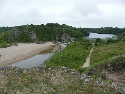
The beach was deep soft sand of a lovely golden colour — a beautiful beach but terrible for walking on. So we went down to the water's edge and walked along there where the wet sand was a tad firmer. On reaching the other side, we walked back up the beach on wet sand next to a pool. We came to a bench which overlooked the beach at the end of the lily ponds.
That ended Walk no.392, we shall pick up Walk no.393 next time at the end of Bosherston Lily Ponds overlooking Broad Haven South beach. It was ten to four, so the Walk had taken us six and a half hours. After resting on the bench for a while, we walked alongside one of the lily ponds back to the car park. Then we drove back to our caravan at Freshwater East.