Ages: Colin was 64 years and 61 days. Rosemary was 61 years and 203 days.
Weather: Cloudy and breezy. Rain later.
Location: Seaham to Seaburn, via Sunderland.
Distance: 12 miles.
Total distance: 1098½ miles.
Terrain: ‘Unstable’ cliff paths — some overgrown — with deep clefts. Disused railway line. Concrete in Sunderland. Little bit of sandy beach towards the end which was a bit sinky.
Tide: In.
Rivers: No.58, the Wear at Sunderland.
Ferries: None.
Piers: None.
Kissing gates: None.
Pubs: ‘The Clarendon’ in Sunderland — a brew-pub. I enjoyed ‘Peelwall’s’, a Scottish pineapple cider, whereas Colin quaffed ‘Nowsta Matta’, ‘Amber’, and ‘Bull Terrier’ all from the Bull’s Head Brewery.
‘English Heritage’ properties: None.
Ferris wheels: None.
Diversions: No.39 just out of Seaham tried to divert us along the beach, no.40 was about a mile further on and offered no alternative. Both used the excuse of ‘unstable cliffs’, ‘erosion’ and ‘no path’ but we reckoned the local Council were just using that as an excuse not to maintain the public rights of way. We ignored both!
How we got there and back: We were camping at Hinderwell. We drove to Seaburn and parked in a free car park near the seafront. We walked about a mile to the nearest metro station and caught a metro train to Sunderland. There, on the same platform, we caught an ordinary train to Seaham. Then we walked down to the seafront to where we finished yesterday’s Walk.
At the end we walked from the seafront to the car park. After a cup of tea we drove back to our campsite at Hinderwell.
 We had a look round Seaham before starting our Walk, mainly to buy some pasties and find the toilets. It is not much of a place — a very depressed area with a lot of unemployment since the coal mines are all closed and the fishing industry is in the doldrums. We saw many signs of neglect and vandalism, but also indications that the town is starting to pull itself up.
  The seats and cycle racks in the shopping precinct were ironwork sculptures which were quite jolly — and, unlike Hartlepool, the toilets were open and free!
We took our pasties down to the seafront green where we had finished the last Walk, and sat on a seat to consume them. A fat man with two even fatter children arrived at an adjacent seat and proceeded to tuck into fish and chips. In later months we read that this area of the North-East has the worst obesity in the whole of England — What! Even worse than Skegness? We came across a memorial stone to a lifeboat crew who had lost their lives in 1962.
 The inscription read:
 We walked northwards, and when we were well away from the harbour we found a path down to a promenade along the top of the beach. We followed this until it came to an end about half a mile north of the town centre. So we climbed up to the cliff-top again as the beach looked none too friendly.

 Almost
  immediately we came to a deep cleft. According to the map we should have been able to cross this cleft on a footbridge and continue along the next bit of cliff-top. There was no footbridge, and a notice told us that the next bit of cliff-top footpath was closed and to use the beach. We had no choice but to slither down to the beach, but we found the going there was soft sand and shingle — not good. Besides, the tide was in and we didn’t know if we could get through.
  Neither
  of us fancied the road, about two hundred yards inland, so we took the third option.
We noticed that there was a bit of a path up the steep slope on the northern side of the cleft. Colin hauled me up and, despite the local Council’s notices about ‘UNSTABLE CLIFFS’ and ‘NO CLIFF PATH’ we found a perfectly stable path that was just a bit overgrown through lack of use. We felt that the Council had reneged on their responsibilities — in this age of litigation they must have felt it was cheaper to ‘close’ a public right-of-way rather than keep it up to standard. We have walked on far worse paths than those on the cliff-tops between Seaham and Sunderland. In fact, the wild flowers grew in profusion up there and were beautiful, especially the poppies.
 We sat down to eat the main part of our lunch overlooking rock stacks. But I had a bad attack of heartburn and could hardly eat anything — in fact I felt pretty gruesome for the next half-hour or so. Too much hard fat in those wretched pasties we had bought, I think!
 We continued towards the next cleft which was wooded, and the path deteriorated. We formed the impression that local people went up there, perhaps to walk their dogs, and returned the way they had come. At the cleft the ‘path’ disappeared altogether. There was no way we could clamber down the steep sides of the cleft — too many brambles — so we fought our way westwards along the edge of a cornfield to the road.
  We crossed a bridge, then immediately turned on to a track which led us back to the cliff-top. Colin stopped to remove his boots, and impatiently pulled dozens of grass seeds out of his socks! He shouldn’t wear shorts — with my trousers coming well down to my boots, I hadn’t picked up any.
 On returning to the cliff-top we came across yet more council notices about ‘UNSTABLE CLIFFS’ and ‘PATH CLOSED’. It was utter nonsense! The path between there and Sunderland was obviously very well walked and there was nothing unstable about it at all as far as we could see. Aren’t the Councils supposed to be encouraging us to get out and walk? No wonder the area is the obesity capital of England!
We continued all the way to Sunderland on a well-marked mostly flat open path along the cliff-tops without any feeling that we were in danger of falling over the edge on loose rocks. We passed two more clefts which were not nearly so deep or steep, so we were able to clamber through them — in fact the second one was a mere dip in the landscape. They were both plastered with ‘UNSTABLE CLIFFS’ and ‘PATH CLOSED’ notices. We ignored them all, and in complete safety we admired the views out to sea and the profusion of wild flowers.
 The way became more and more industrial with an increasing amount of rubbish strewn about.
  We descended into a car park by a rocky beach where we came across a ‘shrine’, if you like, to the English World Cup team.
  Whoever had made it had really gone to town, with flowers and flags tied to the railings. Unfortunately, England were knocked out of the competition yesterday — dashing all hopes of repeating their victory of 1966. The whole country has sunk into doom & gloom — except Colin and I on our Round-Britain-Walk as we don’t really follow football at all.
  There is more to life! There were quite a few people about, and we stopped and chatted to a woman with a barking dog.
The way on was blocked by a power station surrounded by barbed wire fences and notices telling us it was a ’RESTRICTED AREA’. A quick glance at the map showed ‘WORKS’ and yet more ‘WORKS’ for the next mile followed by docks for another mile leading to Sunderland Harbour. We were reluctant to go under the railway bridge (the car park exit) and walk these two miles along a road between factories. Then Colin saw a man walking his dog up on the ‘railway line’, which proved to be disused and merely a bank. So we elected to walk up there — at least we would be on a level with the factory roofs and hoped to get the occasional glance of the sea.
 The big question was:— could we get out the other end? The old railway embankment — long since abandoned and growing high with weeds — led us right into the industrial / dockland area. The man with his dog had disappeared by the time we had scrambled up there, and so did a group of youths who were walking ahead of us. The embankment widened out when we were above the docks, and we started to look round the tall weeds and piles of slag for a way out. Then two men on quad-bikes came zipping up, passed us, and came back. They, too, were looking for an exit, and they found one — a set of broken steps! They each rode their quad-bikes down the fairly steep flight, and seemed to survive.
  We followed them and found ourselves on a road which was completely blocked to traffic with rubbish of all descriptions. Graffiti adorned the walls and derelict buildings all around us, even the old railway bridge — what a dump! Since the blocked road under the abandoned railway was the main entrance to the docks (according to our map),
  we assumed that the whole dock area — including all the piers on the south side of Sunderland Harbour — were derelict too.
We turned our backs on it all, and followed the nearest road to the sea, past an abandoned boys’ orphanage, all the way round to the banks of the River Wear. There we came across ‘The Clarendon’ pub, a ‘brew’ pub that had been acting as a carrot to Colin ever since we started the Walk this morning. Joy of joys — it was OPEN and had three real ales and a real cider to try!
  To tell the truth, I was glad of a sit-down and a drink as well.
 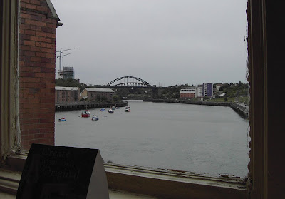 We had good views of the Wearmouth Bridge from the window.
 It was raining when we came out, so I donned my cape and Colin got out his umbrella. A thin drizzle persisted for the rest of the Walk.
  We walked along to the Wearmouth Bridge, an impressive structure built in 1927 — replacing a bridge built in 1857 which in turn replaced the first bridge built in 1796.

 We crossed the River Wear and descended some steps to the riverside, ignoring a notice telling us not to light fires.

The next part of the Walk was really pleasant, despite the greyness of the sky and the dampness of the weather. The path led us along the waterside past the University which was opened by the Queen in 1992 — not so long ago. The way was littered with quirky sculptures!
 We sat on a bench to eat our chocolate and survey them. Some were worked in iron and some carved in stone.
  We could come to terms with the birds and the pile of books, but what were the nuts and screws about?
  They were fun, anyway.

 We
We  passed through some gardens, circled a marina, but couldn’t get on to the short North Pier because notices warned us it was dangerous, an unsafe structure and that access was prohibited. That was good enough for us. However we could walk on the much longer Roker Pier which we found to be lined with fisherman right up to the lighthouse at the end. So many men and boys had come out to spend the evening fishing on the north side of this pier, there was hardly room left at the railings.
We were very tired by the time we had walked along to the lighthouse and back. So we walked the next bit on the beach to save us climbing a bit of a hill. We found the sand to be a little too sinky for comfort, but it wasn’t long before we regained a concrete walking surface without having to change altitude — much. We could see a Ferris wheel ahead, but it wasn’t going. Officially it was in the next Walk, so we hoped it would be running in two days time when we planned to return. We soon came to the road leading to our car park behind a leisure centre.
That ended Walk no.136, we shall pick up Walk no.137 next time by the leisure centre on the seafront at Seaburn. It was already ten to eight in the evening. We had a cup of tea from flasks in our car, then drove straight back to Hinderwell — a long way.
Location: Seaham to Seaburn, via Sunderland.
Distance: 12 miles.
Total distance: 1098½ miles.
Terrain: ‘Unstable’ cliff paths — some overgrown — with deep clefts. Disused railway line. Concrete in Sunderland. Little bit of sandy beach towards the end which was a bit sinky.
Tide: In.
Rivers: No.58, the Wear at Sunderland.
Ferries: None.
Piers: None.
Kissing gates: None.
Pubs: ‘The Clarendon’ in Sunderland — a brew-pub. I enjoyed ‘Peelwall’s’, a Scottish pineapple cider, whereas Colin quaffed ‘Nowsta Matta’, ‘Amber’, and ‘Bull Terrier’ all from the Bull’s Head Brewery.
‘English Heritage’ properties: None.
Ferris wheels: None.
Diversions: No.39 just out of Seaham tried to divert us along the beach, no.40 was about a mile further on and offered no alternative. Both used the excuse of ‘unstable cliffs’, ‘erosion’ and ‘no path’ but we reckoned the local Council were just using that as an excuse not to maintain the public rights of way. We ignored both!
How we got there and back: We were camping at Hinderwell. We drove to Seaburn and parked in a free car park near the seafront. We walked about a mile to the nearest metro station and caught a metro train to Sunderland. There, on the same platform, we caught an ordinary train to Seaham. Then we walked down to the seafront to where we finished yesterday’s Walk.
At the end we walked from the seafront to the car park. After a cup of tea we drove back to our campsite at Hinderwell.
 We had a look round Seaham before starting our Walk, mainly to buy some pasties and find the toilets. It is not much of a place — a very depressed area with a lot of unemployment since the coal mines are all closed and the fishing industry is in the doldrums. We saw many signs of neglect and vandalism, but also indications that the town is starting to pull itself up.
  The seats and cycle racks in the shopping precinct were ironwork sculptures which were quite jolly — and, unlike Hartlepool, the toilets were open and free!
We took our pasties down to the seafront green where we had finished the last Walk, and sat on a seat to consume them. A fat man with two even fatter children arrived at an adjacent seat and proceeded to tuck into fish and chips. In later months we read that this area of the North-East has the worst obesity in the whole of England — What! Even worse than Skegness?
 We came across a memorial stone to a lifeboat crew who had lost their lives in 1962.
 The inscription read:
REMEMBER THE HEROES
This memorial is to commemorate the bravery of the five lifeboat men
who lost their lives when, in the stormy seas of November 17th 1962,
the Seaham lifeboat George Elmy capsized with the loss of its crew:
John T. Miller (coxswain)
Fred Gippert (second coxswain)
Arthur Brown
James Farrington
 and all but one of the crew of the fishing coble Economy,
to whose aid the courageous men had gone:
Gordon Burrell, George Firth, Joseph Kennedy, David Burrell (aged 9)
“Greater love hath no man than this, that a man lay down his life for his friends” (John, 15:13)
This memorial was unveiled by the Chairman of Easington
District Council on 17th November, 1994.
So why had it taken them thirty-two years to erect a memorial to these brave men and a little boy? Colin was most interested to see that the stone itself was stashed with fossils.This memorial is to commemorate the bravery of the five lifeboat men
who lost their lives when, in the stormy seas of November 17th 1962,
the Seaham lifeboat George Elmy capsized with the loss of its crew:
John T. Miller (coxswain)
Fred Gippert (second coxswain)
Arthur Brown
James Farrington
 and all but one of the crew of the fishing coble Economy,
to whose aid the courageous men had gone:
Gordon Burrell, George Firth, Joseph Kennedy, David Burrell (aged 9)
“Greater love hath no man than this, that a man lay down his life for his friends” (John, 15:13)
This memorial was unveiled by the Chairman of Easington
District Council on 17th November, 1994.
 We walked northwards, and when we were well away from the harbour we found a path down to a promenade along the top of the beach. We followed this until it came to an end about half a mile north of the town centre. So we climbed up to the cliff-top again as the beach looked none too friendly.

 Almost
  immediately we came to a deep cleft. According to the map we should have been able to cross this cleft on a footbridge and continue along the next bit of cliff-top. There was no footbridge, and a notice told us that the next bit of cliff-top footpath was closed and to use the beach. We had no choice but to slither down to the beach, but we found the going there was soft sand and shingle — not good. Besides, the tide was in and we didn’t know if we could get through.
  Neither
  of us fancied the road, about two hundred yards inland, so we took the third option.
We noticed that there was a bit of a path up the steep slope on the northern side of the cleft. Colin hauled me up and, despite the local Council’s notices about ‘UNSTABLE CLIFFS’ and ‘NO CLIFF PATH’ we found a perfectly stable path that was just a bit overgrown through lack of use. We felt that the Council had reneged on their responsibilities — in this age of litigation they must have felt it was cheaper to ‘close’ a public right-of-way rather than keep it up to standard. We have walked on far worse paths than those on the cliff-tops between Seaham and Sunderland.
 In fact, the wild flowers grew in profusion up there and were beautiful, especially the poppies.
 We sat down to eat the main part of our lunch overlooking rock stacks. But I had a bad attack of heartburn and could hardly eat anything — in fact I felt pretty gruesome for the next half-hour or so. Too much hard fat in those wretched pasties we had bought, I think!
 We continued towards the next cleft which was wooded, and the path deteriorated. We formed the impression that local people went up there, perhaps to walk their dogs, and returned the way they had come. At the cleft the ‘path’ disappeared altogether. There was no way we could clamber down the steep sides of the cleft — too many brambles — so we fought our way westwards along the edge of a cornfield to the road.
  We crossed a bridge, then immediately turned on to a track which led us back to the cliff-top. Colin stopped to remove his boots, and impatiently pulled dozens of grass seeds out of his socks! He shouldn’t wear shorts — with my trousers coming well down to my boots, I hadn’t picked up any.
 On returning to the cliff-top we came across yet more council notices about ‘UNSTABLE CLIFFS’ and ‘PATH CLOSED’. It was utter nonsense! The path between there and Sunderland was obviously very well walked and there was nothing unstable about it at all as far as we could see. Aren’t the Councils supposed to be encouraging us to get out and walk? No wonder the area is the obesity capital of England!
We continued all the way to Sunderland on a well-marked mostly flat open path along the cliff-tops without any feeling that we were in danger of falling over the edge on loose rocks. We passed two more clefts which were not nearly so deep or steep, so we were able to clamber through them — in fact the second one was a mere dip in the landscape. They were both plastered with ‘UNSTABLE CLIFFS’ and ‘PATH CLOSED’ notices. We ignored them all, and in complete safety we admired the views out to sea and the profusion of wild flowers.

 The way became more and more industrial with an increasing amount of rubbish strewn about.
  We descended into a car park by a rocky beach where we came across a ‘shrine’, if you like, to the English World Cup team.
  Whoever had made it had really gone to town, with flowers and flags tied to the railings. Unfortunately, England were knocked out of the competition yesterday — dashing all hopes of repeating their victory of 1966. The whole country has sunk into doom & gloom — except Colin and I on our Round-Britain-Walk as we don’t really follow football at all.
  There is more to life! There were quite a few people about, and we stopped and chatted to a woman with a barking dog.
The way on was blocked by a power station surrounded by barbed wire fences and notices telling us it was a ’RESTRICTED AREA’. A quick glance at the map showed ‘WORKS’ and yet more ‘WORKS’ for the next mile followed by docks for another mile leading to Sunderland Harbour. We were reluctant to go under the railway bridge (the car park exit) and walk these two miles along a road between factories. Then Colin saw a man walking his dog up on the ‘railway line’, which proved to be disused and merely a bank. So we elected to walk up there — at least we would be on a level with the factory roofs and hoped to get the occasional glance of the sea.
 The big question was:— could we get out the other end? The old railway embankment — long since abandoned and growing high with weeds — led us right into the industrial / dockland area. The man with his dog had disappeared by the time we had scrambled up there, and so did a group of youths who were walking ahead of us. The embankment widened out when we were above the docks, and we started to look round the tall weeds and piles of slag for a way out. Then two men on quad-bikes came zipping up, passed us, and came back. They, too, were looking for an exit, and they found one — a set of broken steps! They each rode their quad-bikes down the fairly steep flight, and seemed to survive.
  We followed them and found ourselves on a road which was completely blocked to traffic with rubbish of all descriptions. Graffiti adorned the walls and derelict buildings all around us, even the old railway bridge — what a dump! Since the blocked road under the abandoned railway was the main entrance to the docks (according to our map),
  we assumed that the whole dock area — including all the piers on the south side of Sunderland Harbour — were derelict too.
We turned our backs on it all, and followed the nearest road to the sea, past an abandoned boys’ orphanage, all the way round to the banks of the River Wear. There we came across ‘The Clarendon’ pub, a ‘brew’ pub that had been acting as a carrot to Colin ever since we started the Walk this morning.
 Joy of joys — it was OPEN and had three real ales and a real cider to try!
  To tell the truth, I was glad of a sit-down and a drink as well.
  We had good views of the Wearmouth Bridge from the window.
 It was raining when we came out, so I donned my cape and Colin got out his umbrella. A thin drizzle persisted for the rest of the Walk.
  We walked along to the Wearmouth Bridge, an impressive structure built in 1927 — replacing a bridge built in 1857 which in turn replaced the first bridge built in 1796.
 We crossed the River Wear and descended some steps to the riverside, ignoring a notice telling us not to light fires.

The next part of the Walk was really pleasant, despite the greyness of the sky and the dampness of the weather. The path led us along the waterside past the University which was opened by the Queen in 1992 — not so long ago. The way was littered with quirky sculptures!

 We sat on a bench to eat our chocolate and survey them. Some were worked in iron and some carved in stone.
  We could come to terms with the birds and the pile of books, but what were the nuts and screws about?
  They were fun, anyway.
 We
We  passed through some gardens, circled a marina, but couldn’t get on to the short North Pier because notices warned us it was dangerous, an unsafe structure and that access was prohibited. That was good enough for us. However we could walk on the much longer Roker Pier which we found to be lined with fisherman right up to the lighthouse at the end. So many men and boys had come out to spend the evening fishing on the north side of this pier, there was hardly room left at the railings.
We were very tired by the time we had walked along to the lighthouse and back. So we walked the next bit on the beach to save us climbing a bit of a hill. We found the sand to be a little too sinky for comfort,
 but it wasn’t long before we regained a concrete walking surface without having to change altitude — much. We could see a Ferris wheel ahead, but it wasn’t going. Officially it was in the next Walk, so we hoped it would be running in two days time when we planned to return. We soon came to the road leading to our car park behind a leisure centre.
That ended Walk no.136, we shall pick up Walk no.137 next time by the leisure centre on the seafront at Seaburn. It was already ten to eight in the evening. We had a cup of tea from flasks in our car, then drove straight back to Hinderwell — a long way.

No comments:
Post a Comment