Ages: Colin was 64 years and 345 days. Rosemary was 62 years and 122 days.
Weather: Sunny intervals, but a cold wind. Very clear.
Location: Dowlaw to Cove.
Distance: 8 miles.
Total distance: 1245 miles.
Terrain: Grassy cliff paths, sheep’s paths, and sometimes no paths at all!
Tide: Coming in.
Rivers: No.70, Littlecleugh Burn at Red Heugh. No.71, Pease Burn, at Pealands Banks — this one was a ford.
Ferries: None.
Piers: None.
Kissing gates: No.128 at Siccar Point. No.129 at Pealands Banks. No. 130 at Cove.
Pubs: None.
‘Historic Scotland’ properties: None.
Ferris wheels: None.
Diversions: None.
How we got there and back: We were staying in a holiday cottage at Grantshouse. With one bike on the back of the car, we drove part of the way to Dowlaw where Colin dropped me off. I walked the last mile and a half to keep warm as there was nothing to do at Dowlaw itself, but I arrived a good half hour before Colin and had to sit behind an earth heap to shelter from the cold wind. Meanwhile Colin drove to Cove where he parked the car. With map securely in hand this time, he cycled to Dowlaw without mishap. It was all on roads, but rather hilly so he took longer than expected. He padlocked his bike to a fence.
At the end we walked to our car in Cove. We had a cup of tea from our flask and dumped our rucksacks in the boot. Then we walked down to Cove Harbour and back. We picked up the bike on our way back to the cottage.
 While I was waiting for Colin to cycle back to Dowlaw, I had a look at the Soay sheep in the field opposite the car park. They are wild, and didn’t like me any more today than they did two days ago! A notice told me:
“Soays are a Scottish breed, indigenous to the island of St Kilda. Thousands of years of natural selection have resulted in a sheep well able to look after itself. They have self shedding fleeces, are amazingly agile and survive on coastal grasses and seaweed. This made them the ideal breed to be introduced to Dowlaw in 2000 as part of a conservation grazing project.
The conditions here are wild and as near to Soay native habitat as they can get. They thrive with no supplementary feeding, or other usual husbandry practises. In fact the lambs for sale have never been handled except for gathering prior to marketing.”
I could have bought a box of frozen lamb at the farm, and was tempted to try it as something different. But we had no freezer at the cottage, and by the time we departed for home nearly two weeks later I had forgotten all about it.
I was getting quite cold waiting around for Colin. I asked him to drop me a mile and a half short of Dowlaw so that I could walk to keep warm, but I still had another half an hour to kill before he turned up. There was nothing to look at after I had watched the sheep, so I hid behind a little knoll in an attempt to get out of the wind. This didn’t work very well as I had to practically lie down, so I tried jogging up and down our starting track. This didn’t work either, and I was absolutely frozen by the time Colin arrived. He took longer than anticipated because the wind was against him, and he was too hot when he arrived after all his effort! But we started the Walk at 10.40, which wasn’t too bad.
 It
It was very clear, we could see for miles. The views were magnificent, and again we were struck by the brightness of the gorse flowers. We passed a bank of little white flowers — don’t know what they were, but they were very pretty.
It was impossible to get out of the North wind which was blowing in directly from the sea, so very soon we were both cold.
We MET NOBODY until we were almost at the end of the Walk, we seemed to be the only people in the world!

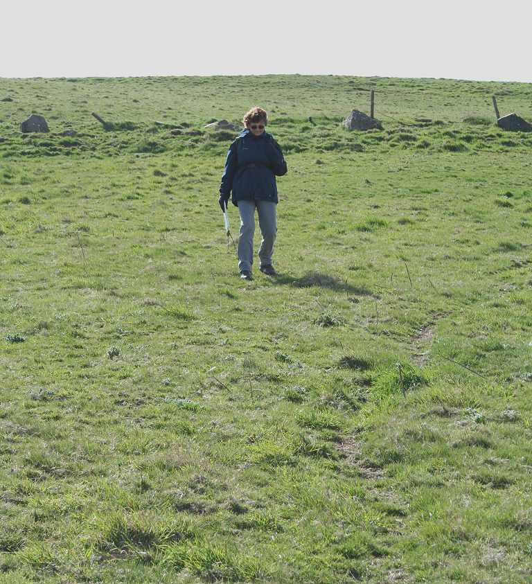
 We started on a faint track which became more evident after a few yards. This was marked on the map as coming to a dead end in a field after about a mile. We were hoping it would continue in fact and join up with another track further on. It didn’t. Like the last Walk, we had to make our way across fields and clamber over fences or walls without a path in sight.
 We descended to the clifftop and walked along the perimeter wall/fence, sometimes inside it and sometimes outside teetering on the edge. It was okay where it was grassy, but hard going where arable fields were sown right to the edge.
  We tried not to trample on any crops, but occasionally it was the only way we could get by. I think we did minimal damage, it was certainly not our intention to destroy anything.
  If only they would put a path along this magnificent bit of coast — it wouldn’t have to be very wide, just enough for hikers to walk by in single file.
 The cliff was not vertical but sloped down in grassy ridges a little further on. We walked down a little from the top to sit down and eat our pies, but we got even colder as soon as we stopped moving. So we ate up quickly and carried on.
  Soon we picked up the second track that was marked on the map, but then we deliberately lost it because it went too far inland. We wanted to walk on the clifftop, so we managed without any path.
  The cliffs are heavily indented and we caught up with the track again at the remains of a derelict cottage, then immediately left it a second time.

 We came to a burn in a little gully, which we decided to descend despite the new rule made up only on the last Walk. It would have been a long way round behind some cottages (don’t know if they were occupied) to stay on the flat, and the gully wasn’t very deep. It was lined with bright yellow eye-scorching gorse flowers, and we managed to find a place to jump over the narrow burn. Having
  done that, we realised we were OUT OF THE WIND for the first time since we had left the cottage at Grantshouse that morning! It was really quite warm in the sun, so we immediately sat down and got out our lunch. While we were quietly munching away, we noticed two roe deer just across the gully where we had come from — a magic moment!
We were reluctant to leave our sunny spot, but we had to tear ourselves away and return to the windy clifftop. Where it was possible, we walked below the ridge of the cliff because it was slightly more sheltered. There were a lot of animal paths so we didn’t have to walk on a slope. We tried not to go where it got too steep, unlike some sheep we saw further over which seemed to be grazing on an almost vertical slope — I don’t know how they kept their balance! The views were breathtaking, and we were amazed with the clarity of the day allowing us to see so many miles in each direction.
We came to Siccar Point, made famous because of the unconformity noticed in the cliffs by the 18th century Geologist, James Hutton. He is regarded as the ‘Father’ of modern Geology, because he claimed the unconformity at Siccar Point to be conclusive proof of his theory of ‘uniformity’, the basis of geological theory today. He asserted that the world was a good deal older than the few thousand years claimed in 1654 by a certain Archbishop Usher who, after reading a number of holy books, declared that the world was created 4004 years before the birth of Christ, on the 26th of October at 9 o’clock in the morning! Hutton, after many years studying chemistry and rock processes, came to the conclusion that the earth was probably several million years old. Even he didn’t envisage the 4.6 billion years that is believed to be nearer the truth today. A notice at Siccar Point told us: “Hutton realised that earth processes are cyclical, and that geological time is virtually unlimited. What we see today is very much what he would have seen 200 years ago — but a moment in geological time!”
  Incidentally, when I was about eight — this was circa 1953 — I asked one of the nuns at my convent school how old the earth was. (See, I was a Geologist even at that age!) The answer I received was Usher’s theory! In 1966 I was taking the final exams for my Teacher’s Certificate qualification. I had been studying Geography for three years and had written a short thesis on the South Downs. At my Geography ‘Viva’ exam I was expounding on the formation of the Downs using the theory of Continental Drift which seemed to be very new at the time.
  I shall never forget the glum faces and the silence from the three examiners sitting in a row behind a table as I spoke. When I had finished, one of them remarked, “Yes, that’s what some people think!” and not one question about it was asked of me. (I still passed!) The opposition and prejudice Hutton was up against two hundred years earlier must have been phenomenal.
The notice at Siccar Point explained the unconformity thus: “The underlying vertical rock layers are greyish in colour and called Greywackes. The overlying gently dipping rock layers are reddish in colour and called Old Red Sandstone and Conglomerates. The gap between them represents 55 million years. During this time the underlying rocks formed from layers of sediment deposited on the floor of an ancient ocean, had been folded, uplifted and eroded.
  This produced an uneven land surface on to which the overlying rocks were then deposited as sand and gravel. The irregular dipping surface between the vertical and the gently dipping rock layers is known as an UNCONFORMITY.”
We didn’t clamber part-way down the cliffs to look at this geological marvel because we didn’t think it was safe to do so in our state of tiredness. (Apparently, Hutton and his friends looked at it from a boat.) We have seen unconformities in other places — there is one at High Force in Teesdale and another at Thornton Force near Ingleton in the Yorkshire Dales. So we thought we’d better leave this one, we were so remote that if anything had happened to either of us there was no one to call for help. The notice warned us that the way down to see it was steep and dangerous, and the photograph of it on the notice board didn’t make it look very spectacular — it is just that it plays a significant part in our geological history.
Next to the notice about Siccar Point was a kissing gate leading from the inland field to the triangle of grass we were standing on. It made it look as if people were really supposed to get there, though I don’t know how as there were no paths. We had scaled quite a few walls and fences coming in from the East, and had several more to go leaving to the West. Through the gate was a hill and a quarry. The OS map is devoid of any sort of path leading to Siccar Point. We had been lucky to get there!
 A little further on we came to a ruined chapel which had no roof and only a couple of its walls.
  The graveyard was a complete jumble too, so we assumed it had been derelict for a good many years. We couldn’t find anything out about its history,
  and while we were exploring it we were looked on in idle curiosity by a flock of lambs and a herd of cows. The cows were edging closer and closer, so I went all-out to prevent a stampede to no avail — they continued to edge closer. In the end we thought it prudent just to walk away sharpish and scale another wall. As soon as we had done so the cows lost interest.

 Very soon we came to yet another gully, and in walking round it we came upon a road. I’d had enough of rough ground by then, and announced I was no longer following every indentation of the coast but staying on the road to descend the steep hill to Pease Sands. Colin didn’t need much persuasion to join me! Despite the ford we had to cross (we could have used a foot bridge if we’d wanted to) we felt we were at last getting back to civilisation. For there was a large static caravan park back from the road. This is April, the beginning of the holiday season, but no one seemed to be about except a man gathering sticks upstream.
 We
We  wondered what portion of the year the caravans are used. We sat on a fence and ate our chocolate to celebrate being on a real footpath once again — for the rest of today’s Walk, all of a mile, was on the way-marked Southern
  Upland Way.
This led us up a steep hill past little waterfalls and through the yellowest of yellow gorse bushes. As we climbed Colin turned round and said, “Look at that!” He had spotted a derelict cottage with tiles sliding off the roof leaving great holes, but it had a brand new front door! I think I would have started renovations with the roof — get the rain out first. At the top we had sweeping views of the coast in both directions, and a bird’s-eye view of Cove Harbour as we approached it.


 Towards the end we met the one and only person on the whole Walk, a local woman out exercising her dog. We finished our Walk in the car park at the tiny hamlet of Cove, next to a barometer which had been donated to the fisherman of Cove circa. 1861 through the ‘munificence’ (don’t the Victorians love that word!) of Sir John Hall, Bart. It had been relocated in a local stone weighing three tons in 1995.
 That ended Walk no.151, we shall pick up Walk no.152 next time in the car park at Cove. It was twenty past four, so the Walk had taken us five hours, forty minutes. We had our tea from the flask, then walked down to look at the harbour. I was born and brought up in Cove, but a horrible little village which is situated at the nether end of Farnborough in Hampshire, not this Cove. I couldn’t help being struck by the contrast. This Cove may have been poor, but at least they had fresh air, magnificent views and the sea. My Cove, on its smelly clay soil, was damp and foggy in the Winter, suffocatingly hot in the Summer, and the air was polluted all the year round by the experimental aircraft from the Royal Aircraft Establishment (RAE)
 — and I haven’t even mentioned the noise! The water we drank used to turn our tea grey if it boiled for longer than ten seconds! I would rather die than have to go back there to live!! I moved away as soon as I was able, and that is how we first came to live in Malvern. When I married Colin it was on condition we didn’t live anywhere near Cove or Farnborough. So he got a transfer to the Royal Radar Establishment (RRE) in Malvern, and the rest is history as they say.
 There were several notices charting the history of this tiny Scottish hamlet, and several old photographs to illustrate the tales. There was always a natural harbour here, and it is recorded as being utilised as early as the beginning of the 17th century. The main problem was lack of access from the cliffs above. In the 18th century several largely unsuccessful attempts were made to clear the basin and build an access road. A tunnel with cellars leading off it was hacked out at the bottom of the cliff. The cellars were officially used for storing fresh salmon and herring, also cured and barrelled white fish. But it is also believed that smuggled brandy, whisky, gin and rum was stowed away there and in local disused mineshafts and natural caves only accessible at low tide. The present harbour was built in 1831.
 In 1794 there were sixteen Cove fishermen, and this increased to twenty when the new harbour was built. They remained for nigh on a hundred years because the markets for white fish brought prosperity to the area. The curing station employed no less than 55 men and women. They split and smoked white fish and red herrings, they salted white herrings and made cod liver oil. In addition Victorian artists, including ‘The Glasgow Boys’ were attracted to this picturesque fishing village. Four fishing boats were wrecked in the Great Storm of 1881. At noon that day, so we were told, “the sky took on an inky blackness…and within a few minutes a hurricane raged”. Eleven Cove fisherman never came back. But the prosperity of the fishing industry at the time meant they could ride the disaster and carry on.
 It began to decline after the First World War. By 1946 the last occupants of the harbour cottages moved up to the main village on the cliff, and ever since the buildings have been used for storage only. Just two boats operate from the harbour nowadays, these set creels for lobster and crab. The cellars were used by bathers as changing rooms for years, but were closed off in 1981 for safety reasons. The tunnel is still maintained as it is the only access to the beach if you haven’t got a boat. The picturesque harbour is still attractive to film-makers — scenes for ‘A Tour of the Western Isles’ and ‘Mrs Brown’ were filmed here.
We explored the harbour and the tunnel to the beach, and met no one — we were completely on our own. The cutting for the road reveals the rock in all its glory. It includes a range of the carboniferous series, rich in marine fossil fauna and fossil spores from tropical plants. We were only sorry we didn’t have time to look at it properly. We climbed the hill back to our car, drove to Dowlaw to pick up the bike, and returned to our cottage in Grantshouse.
Location: Dowlaw to Cove.
Distance: 8 miles.
Total distance: 1245 miles.
Terrain: Grassy cliff paths, sheep’s paths, and sometimes no paths at all!
Tide: Coming in.
Rivers: No.70, Littlecleugh Burn at Red Heugh. No.71, Pease Burn, at Pealands Banks — this one was a ford.
Ferries: None.
Piers: None.
Kissing gates: No.128 at Siccar Point. No.129 at Pealands Banks. No. 130 at Cove.
Pubs: None.
‘Historic Scotland’ properties: None.
Ferris wheels: None.
Diversions: None.
How we got there and back: We were staying in a holiday cottage at Grantshouse. With one bike on the back of the car, we drove part of the way to Dowlaw where Colin dropped me off. I walked the last mile and a half to keep warm as there was nothing to do at Dowlaw itself, but I arrived a good half hour before Colin and had to sit behind an earth heap to shelter from the cold wind. Meanwhile Colin drove to Cove where he parked the car. With map securely in hand this time, he cycled to Dowlaw without mishap. It was all on roads, but rather hilly so he took longer than expected. He padlocked his bike to a fence.
At the end we walked to our car in Cove. We had a cup of tea from our flask and dumped our rucksacks in the boot. Then we walked down to Cove Harbour and back. We picked up the bike on our way back to the cottage.
 While I was waiting for Colin to cycle back to Dowlaw, I had a look at the Soay sheep in the field opposite the car park. They are wild, and didn’t like me any more today than they did two days ago! A notice told me:
“Soays are a Scottish breed, indigenous to the island of St Kilda. Thousands of years of natural selection have resulted in a sheep well able to look after itself.
 They have self shedding fleeces, are amazingly agile and survive on coastal grasses and seaweed. This made them the ideal breed to be introduced to Dowlaw in 2000 as part of a conservation grazing project.
The conditions here are wild and as near to Soay native habitat as they can get. They thrive with no supplementary feeding, or other usual husbandry practises. In fact the lambs for sale have never been handled except for gathering prior to marketing.”
I could have bought a box of frozen lamb at the farm, and was tempted to try it as something different. But we had no freezer at the cottage, and by the time we departed for home nearly two weeks later I had forgotten all about it.
I was getting quite cold waiting around for Colin. I asked him to drop me a mile and a half short of Dowlaw so that I could walk to keep warm, but I still had another half an hour to kill before he turned up. There was nothing to look at after I had watched the sheep, so I hid behind a little knoll in an attempt to get out of the wind. This didn’t work very well as I had to practically lie down, so I tried jogging up and down our starting track. This didn’t work either, and I was absolutely frozen by the time Colin arrived. He took longer than anticipated because the wind was against him, and he was too hot when he arrived after all his effort! But we started the Walk at 10.40, which wasn’t too bad.

 It
It was very clear, we could see for miles. The views were magnificent, and again we were struck by the brightness of the gorse flowers. We passed a bank of little white flowers — don’t know what they were, but they were very pretty.
It was impossible to get out of the North wind which was blowing in directly from the sea, so very soon we were both cold.
We MET NOBODY until we were almost at the end of the Walk, we seemed to be the only people in the world!

 We started on a faint track which became more evident after a few yards. This was marked on the map as coming to a dead end in a field after about a mile. We were hoping it would continue in fact and join up with another track further on. It didn’t. Like the last Walk, we had to make our way across fields and clamber over fences or walls without a path in sight.
 We descended to the clifftop and walked along the perimeter wall/fence, sometimes inside it and sometimes outside teetering on the edge. It was okay where it was grassy, but hard going where arable fields were sown right to the edge.
  We tried not to trample on any crops, but occasionally it was the only way we could get by. I think we did minimal damage, it was certainly not our intention to destroy anything.
  If only they would put a path along this magnificent bit of coast — it wouldn’t have to be very wide, just enough for hikers to walk by in single file.
 The cliff was not vertical but sloped down in grassy ridges a little further on. We walked down a little from the top to sit down and eat our pies, but we got even colder as soon as we stopped moving. So we ate up quickly and carried on.
  Soon we picked up the second track that was marked on the map, but then we deliberately lost it because it went too far inland. We wanted to walk on the clifftop, so we managed without any path.
  The cliffs are heavily indented and we caught up with the track again at the remains of a derelict cottage, then immediately left it a second time.
 We came to a burn in a little gully, which we decided to descend despite the new rule made up only on the last Walk. It would have been a long way round behind some cottages (don’t know if they were occupied) to stay on the flat, and the gully wasn’t very deep. It was lined with bright yellow eye-scorching gorse flowers, and we managed to find a place to jump over the narrow burn. Having
  done that, we realised we were OUT OF THE WIND for the first time since we had left the cottage at Grantshouse that morning! It was really quite warm in the sun, so we immediately sat down and got out our lunch. While we were quietly munching away, we noticed two roe deer just across the gully where we had come from — a magic moment!
We were reluctant to leave our sunny spot, but we had to tear ourselves away and return to the windy clifftop. Where it was possible, we walked below the ridge of the cliff because it was slightly more sheltered. There were a lot of animal paths so we didn’t have to walk on a slope. We tried not to go where it got too steep, unlike some sheep we saw further over which seemed to be grazing on an almost vertical slope —
 I don’t know how they kept their balance! The views were breathtaking, and we were amazed with the clarity of the day allowing us to see so many miles in each direction.
We came to Siccar Point, made famous because of the unconformity noticed in the cliffs by the 18th century Geologist, James Hutton. He is regarded as the ‘Father’ of modern Geology, because he claimed the unconformity at Siccar Point to be conclusive proof of his theory of ‘uniformity’, the basis of geological theory today. He asserted that the world was a good deal older than the few thousand years claimed in 1654 by a certain Archbishop Usher who, after reading a number of holy books, declared that the world was created 4004 years before the birth of Christ, on the 26th of October at 9 o’clock in the morning!
 Hutton, after many years studying chemistry and rock processes, came to the conclusion that the earth was probably several million years old. Even he didn’t envisage the 4.6 billion years that is believed to be nearer the truth today. A notice at Siccar Point told us: “Hutton realised that earth processes are cyclical, and that geological time is virtually unlimited. What we see today is very much what he would have seen 200 years ago — but a moment in geological time!”
  Incidentally, when I was about eight — this was circa 1953 — I asked one of the nuns at my convent school how old the earth was. (See, I was a Geologist even at that age!) The answer I received was Usher’s theory! In 1966 I was taking the final exams for my Teacher’s Certificate qualification. I had been studying Geography for three years and had written a short thesis on the South Downs. At my Geography ‘Viva’ exam I was expounding on the formation of the Downs using the theory of Continental Drift which seemed to be very new at the time.
  I shall never forget the glum faces and the silence from the three examiners sitting in a row behind a table as I spoke. When I had finished, one of them remarked, “Yes, that’s what some people think!” and not one question about it was asked of me. (I still passed!) The opposition and prejudice Hutton was up against two hundred years earlier must have been phenomenal.
The notice at Siccar Point explained the unconformity thus:
 “The underlying vertical rock layers are greyish in colour and called Greywackes. The overlying gently dipping rock layers are reddish in colour and called Old Red Sandstone and Conglomerates. The gap between them represents 55 million years. During this time the underlying rocks formed from layers of sediment deposited on the floor of an ancient ocean, had been folded, uplifted and eroded.
  This produced an uneven land surface on to which the overlying rocks were then deposited as sand and gravel. The irregular dipping surface between the vertical and the gently dipping rock layers is known as an UNCONFORMITY.”
We didn’t clamber part-way down the cliffs to look at this geological marvel because we didn’t think it was safe to do so in our state of tiredness. (Apparently, Hutton and his friends looked at it from a boat.) We have seen unconformities in other places — there is one at High Force in Teesdale and another at Thornton Force near Ingleton in the Yorkshire Dales. So we thought we’d better leave this one, we were so remote that if anything had happened to either of us there was no one to call for help.
 The notice warned us that the way down to see it was steep and dangerous, and the photograph of it on the notice board didn’t make it look very spectacular — it is just that it plays a significant part in our geological history.
Next to the notice about Siccar Point was a kissing gate leading from the inland field to the triangle of grass we were standing on. It made it look as if people were really supposed to get there, though I don’t know how as there were no paths. We had scaled quite a few walls and fences coming in from the East, and had several more to go leaving to the West. Through the gate was a hill and a quarry. The OS map is devoid of any sort of path leading to Siccar Point. We had been lucky to get there!

 A little further on we came to a ruined chapel which had no roof and only a couple of its walls.
  The graveyard was a complete jumble too, so we assumed it had been derelict for a good many years. We couldn’t find anything out about its history,
  and while we were exploring it we were looked on in idle curiosity by a flock of lambs and a herd of cows. The cows were edging closer and closer, so I went all-out to prevent a stampede to no avail — they continued to edge closer. In the end we thought it prudent just to walk away sharpish and scale another wall. As soon as we had done so the cows lost interest.
 Very soon we came to yet another gully, and in walking round it we came upon a road. I’d had enough of rough ground by then, and announced I was no longer following every indentation of the coast but staying on the road to descend the steep hill to Pease Sands. Colin didn’t need much persuasion to join me! Despite the ford we had to cross (we could have used a foot bridge if we’d wanted to) we felt we were at last getting back to civilisation. For there was a large static caravan park back from the road. This is April, the beginning of the holiday season, but no one seemed to be about except a man gathering sticks upstream.
 We
We  wondered what portion of the year the caravans are used. We sat on a fence and ate our chocolate to celebrate being on a real footpath once again — for the rest of today’s Walk, all of a mile, was on the way-marked Southern
  Upland Way.
This led us up a steep hill past little waterfalls and through the yellowest of yellow gorse bushes. As we climbed Colin turned round and said, “Look at that!” He had spotted a derelict cottage with tiles sliding off the roof leaving great holes, but it had a brand new front door! I think I would have started renovations with the roof — get the rain out first.
 At the top we had sweeping views of the coast in both directions, and a bird’s-eye view of Cove Harbour as we approached it.


 Towards the end we met the one and only person on the whole Walk, a local woman out exercising her dog. We finished our Walk in the car park at the tiny hamlet of Cove, next to a barometer which had been donated to the fisherman of Cove circa. 1861 through the ‘munificence’ (don’t the Victorians love that word!) of Sir John Hall, Bart. It had been relocated in a local stone weighing three tons in 1995.
 That ended Walk no.151, we shall pick up Walk no.152 next time in the car park at Cove. It was twenty past four, so the Walk had taken us five hours, forty minutes. We had our tea from the flask, then walked down to look at the harbour. I was born and brought up in Cove, but a horrible little village which is situated at the nether end of Farnborough in Hampshire, not this Cove. I couldn’t help being struck by the contrast. This Cove may have been poor, but at least they had fresh air, magnificent views and the sea. My Cove, on its smelly clay soil, was damp and foggy in the Winter, suffocatingly hot in the Summer, and the air was polluted all the year round by the experimental aircraft from the Royal Aircraft Establishment (RAE)
 — and I haven’t even mentioned the noise! The water we drank used to turn our tea grey if it boiled for longer than ten seconds! I would rather die than have to go back there to live!! I moved away as soon as I was able, and that is how we first came to live in Malvern. When I married Colin it was on condition we didn’t live anywhere near Cove or Farnborough. So he got a transfer to the Royal Radar Establishment (RRE) in Malvern, and the rest is history as they say.
 There were several notices charting the history of this tiny Scottish hamlet, and several old photographs to illustrate the tales. There was always a natural harbour here, and it is recorded as being utilised as early as the beginning of the 17th century. The main problem was lack of access from the cliffs above. In the 18th century several largely unsuccessful attempts were made to clear the basin and build an access road. A tunnel with cellars leading off it was hacked out at the bottom of the cliff. The cellars were officially used for storing fresh salmon and herring, also cured and barrelled white fish. But it is also believed that smuggled brandy, whisky, gin and rum was stowed away there and in local disused mineshafts and natural caves only accessible at low tide. The present harbour was built in 1831.
 In 1794 there were sixteen Cove fishermen, and this increased to twenty when the new harbour was built. They remained for nigh on a hundred years because the markets for white fish brought prosperity to the area. The curing station employed no less than 55 men and women. They split and smoked white fish and red herrings, they salted white herrings and made cod liver oil. In addition Victorian artists, including ‘The Glasgow Boys’ were attracted to this picturesque fishing village. Four fishing boats were wrecked in the Great Storm of 1881. At noon that day, so we were told, “the sky took on an inky blackness…and within a few minutes a hurricane raged”. Eleven Cove fisherman never came back. But the prosperity of the fishing industry at the time meant they could ride the disaster and carry on.
 It began to decline after the First World War. By 1946 the last occupants of the harbour cottages moved up to the main village on the cliff, and ever since the buildings have been used for storage only. Just two boats operate from the harbour nowadays, these set creels for lobster and crab. The cellars were used by bathers as changing rooms for years, but were closed off in 1981 for safety reasons. The tunnel is still maintained as it is the only access to the beach if you haven’t got a boat. The picturesque harbour is still attractive to film-makers — scenes for ‘A Tour of the Western Isles’ and ‘Mrs Brown’ were filmed here.
We explored the harbour and the tunnel to the beach, and met no one — we were completely on our own. The cutting for the road reveals the rock in all its glory. It includes a range of the carboniferous series, rich in marine fossil fauna and fossil spores from tropical plants. We were only sorry we didn’t have time to look at it properly. We climbed the hill back to our car, drove to Dowlaw to pick up the bike, and returned to our cottage in Grantshouse.


No comments:
Post a Comment