Ages: Colin was 66 years and 87 days. Rosemary was 63 years and 230 days.
Weather: Mostly hot and sunny, some breeze but too little. (There were dark clouds over the Black Isle across the water!)
Location: Hopeman, via Burghead, to Findhorn.
Distance: 10½ miles.
Total distance: 1650 miles.
Terrain: Disused railway line to Burghead. Then beach all the way to Findhorn, except where we diverted into the adjacent forest to avoid shingle.
Tide: In, started to go out later.
Rivers: None.
Ferries: None.
Piers: None.
Kissing gates: No.155 as we entered the forest at Burghead.
Pubs: The ‘Crown & Anchor’ at Findhorn where we drank Deuchars IPA because that was all they had — and Colin nearly fainted at the price!
‘Historic Scotland’ properties: None.
Ferris wheels: None.
Diversions: No.54 — Colin insisted on diverting into the forest to avoid a shingle beach. I wasn’t keen, especially when the ‘path’ veered away from the coast. I insisted we return to the beach, which we did to find the shingle situation better.
How we got there and back: We were staying in a holiday cottage in Gardenstown. With Colin’s bike on the back of the car, we drove to Hopeman where Colin dropped me off to amuse myself for an hour and a half. He drove on to Findhorn where he parked behind the dunes near a toilet block. Then he cycled back to Hopeman.
At the end, we finished the Walk at the car. After drinking tea from our flask, we drove into Findhorn where we went to the pub because it is a rare commodity in this part of Scotland — a ‘real ale’ pub! It was very disappointing, only one beer on and very expensive. There was a fish’n’chip shop nearby so we bought some, drove to Hopeman and ate them by the harbour. (They were excellent!) The clouds over the Black Isle area were amazing! Then we strapped the bike to the car and drove back to our cottage in Gardenstown.
It was a beautiful day, and I had a lot of time to kill in Hopeman whilst waiting for Colin to park the car and cycle back. The public conveniences (clean, open and free!) were nicely decorated on the outside with murals and hanging baskets. The shop called ‘Harbour Brooms’, with brightly painted flowers on its doors, was closed because it was Sunday.
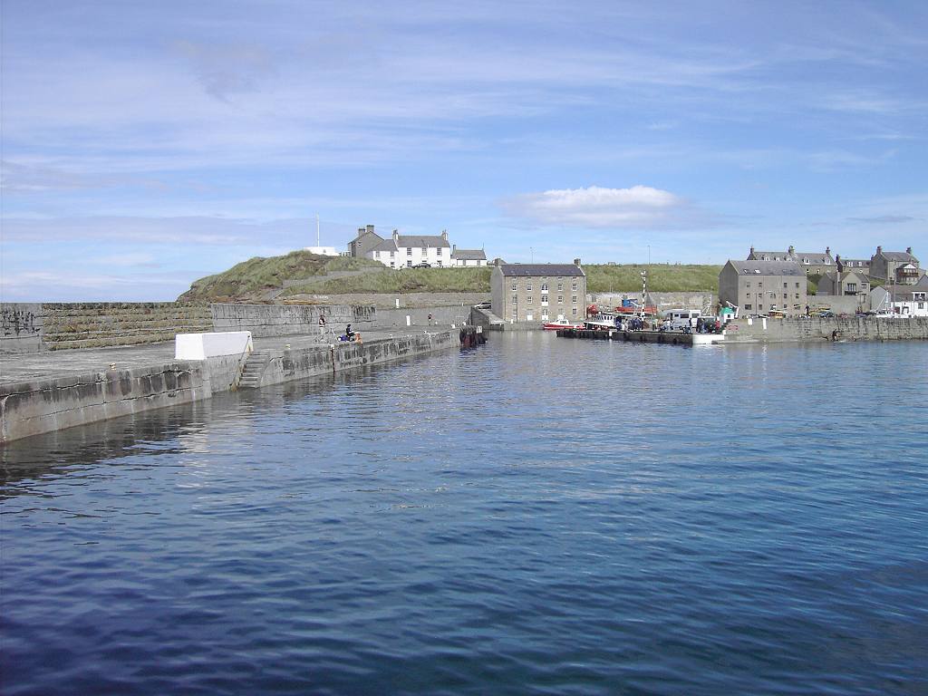
Next to it was a building with ‘Gordonstoun Seamanship Department’ written on the door, so probably some of the boats in the harbour belong to this prestigious school. There was an old crane near the quay, obviously a museum piece now.
I strolled around the harbour walls. No fishing boats or the paraphernalia associated with a working harbour. Hopeman seems to be more of a marina for the leisure industry these days. I was amused by a sign saying “No cranes beyond this point”. I hadn’t actually intended taking my crane out with me today! I was relieved there were no children jumping off the high walls into the harbour. There were a few people about, altogether it was a very peaceful scene.
Then I noticed a jellyfish in the water, and another. And another! There were scores of them, they were everywhere! (Perhaps that was why there were no children jumping in the water.) It was fascinating to watch them pulsating away or swimming along with their long tentacles trailing behind them. They were beautiful colours, almost luminous pinks and purples. Amazing animals!
When Colin arrived, he was equally fascinated and spent half an hour walking round the harbour walls photographing them. I was getting quite hungry by then, so we sat at a picnic table and ate our pasties. Come on, Colin! We’ve got a ten mile Walk ahead of us and we haven’t even started yet!
At last we got going. We made our way behind a lovely sandy beach and through a pleasant caravan site — one day I’d like to buy us a caravan to replace our tent which we haven’t used for two years. It wasn’t obvious where the path went. We made for an old bridge which took us over a disused railway, then down on to the redundant line. It is now a pleasant cycle track which made the first two miles of our Walk, as far as Burghead, very easy hiking.
The shoreline below us became rocky. So we were glad we were up where we were. We could see the waves breaking down below, and looked at some very interesting rocks. It was good to be out walking in such a lovely place in the sunshine!
Then an eyesore loomed on the horizon, on our left hand side. It was a massive concrete building, and there was a fine dust in the air which plagued us the rest of the way to Burghead. We couldn’t tell what it was, and there was no indication as to its purpose on the map. We were glad to get past it.
As we entered Burghead, we left the disused railway and walked along to the Pictish fort on the Head. The Picts were the Celtic tribes who lived in northern Scotland for about a thousand years, until they merged with the Gaels around the 10
th to 11
th centuries. This headland was the site of the largest Pictish fortification in Scotland.
There we found a picnic table outside the Visitor Centre where we had glorious views almost all round. So we sat there and ate our lunch. Entrance to the Visitor Centre was by donation, so we didn’t bother — hadn’t got time anyway, but would have had a glance around if it had been free. The building itself was a 19
th century Storm Signal Station which was later used as a coastguard lookout.
We walked down to the harbour which had very few boats in it. And this one was full of jellyfish too!
Colin got out his camera again to take even more pictures, and I started chatting to a one-eyed retired fisherman who was sitting on the quay in the sun. He was bemoaning the fact that all the old fishing harbours were becoming marinas for “dry-land yachtsmen” (his words) to moor their boats. I don’t know what he was whingeing about really, because he reckoned he makes a packet splicing ropes for them because they don’t know how to do it! There were wet-suited youths jumping in the harbour from the walls. These were big lads, not children., and there was a little too much of the f... word being bandied about. So we moved on.
We walked along the front and through a caravan park to the forest, following Moray Coast Path signs which had suddenly sprung up. (There was no sign of a coast path on my supposedly up-to-date OS Explorer Map for which I had paid nearly £8!) It was lovely in the forest with good clear sandy paths, but we lost the signs (inevitable) and I wanted to be down on the beach because it looked really nice down there.
So we turned right and came out on a beautiful sandy beach stretching for miles. It is almost perfect, shelving very gently into the sea — ideal for families.
And a lot of families were using it this hot August day, at least a lot for such an out-of-the-way place. But we were reminded of less tranquil times by the numerous concrete posts and frequent Second World War pill boxes in varying states of decay.
We walked along for miles, enjoying the sunshine and the seaside.
The people thinned out as we got further from the caravan site, then there was a bunch of people again. I looked at the map, and found there was a car park in the forest near that point.
The tide was right in by then, and the beach narrowed. It began to get stony, but it wasn’t too bad to walk on. Colin thought it was and kept moaning about finding a “better path” in the forest, but I wasn’t keen. I gave in when I couldn’t stand his whingeing any longer, but I shouldn’t have.
We climbed up the bank into the trees. It was very pretty in the forest, but the ‘paths’ we followed were a bit of a myth. They didn’t really exist, and kept petering out. We had started on what looked like an ‘official’ path, but it was veering further and further away from the coast until we could no longer see the sea. Colin ploughed on, sometimes he seems to lose all sense of direction, but he is
never wrong!
In the end I had to insist we went back to the beach. It had got very rough underfoot with roots and holes in the undergrowth to trip the unwary. A shingle beach would be much easier than this! We turned right — we could just about see the sea through the trees so we knew which way to go. The bank at the edge of the forest was very steep at that point, and Colin had to help me down. I was so relieved we were back on the beach, I’d had visions of us walking round in circles in the forest and getting nowhere. By then the tide had just started to go out, and sandy patches were appearing between the stones. So the beach wasn’t so bad after all.Now there was no one on the beach except us, but we’re quite used to that. So many miles of Britain’s beaches are deserted, even on a sunny Sunday in August. The reason? People are loathe to walk anywhere. They don’t know what they’re missing!
We did see a lone man swimming — I thought he was a seal when I first saw him! But otherwise, just us.
More and more concrete. One pill box had slipped down the dunes and was being pounded by waves in a spectacular fashion. Don’t suppose it will last long now.
We also heard and then saw a small aeroplane buzzing about. I expect it was from RAF Kinloss which was just behind the dunes. We could see one of their masts from the beach.
As we approached Findhorn we began to meet people again. The beach did get quite shingly, but it was packed solid and not difficult to walk on at all. Colin was still in a mood, and grumpily said he was going to walk on the dunes where it was sandy. I ignored him this time, and continued marching. He was soon back on the beach and way behind me.
As I had suspected, he had found the sand too soft to walk on. But I couldn’t have told him that, it would have been like a red rag to a bull! I didn’t say anything when he caught me up, he always gets grumpy in the heat. I had thoroughly enjoyed this Walk, the sun was hot but it was tempered by a slight breeze from the sea.
Colin couldn’t quite remember how far along he had parked the car. At least, he couldn’t recognise the spot from the beach. So we had to walk along the top of the bank. It was parked a lot further along than he had thought when looking from the beach, but we came to it in the end. A set of steps led down to it.
The sand spit at the end of the beach, almost cutting off the entrance to Findhorn Bay, reminded us of the northernmost point of Denmark where the two seas meet. We went there in 1994 soon after my Dad died — Wow! That was fourteen years ago!
That ended Walk no.189, we shall pick up Walk no.190 next time near the sand spit at Findhorn. It was ten past six, so the Walk had taken just over six hours. After drinking tea from our flask, we drove into Findhorn where we went to the Crown & Anchor because a ‘real ale’ pub is a rare commodity in this part of Scotland! It was very disappointing, only one beer on and very expensive. There was a fish’n’chip shop nearby so we thought about buying some to save me cooking when we eventually got back to the cottage. After that expensive beer we were not sure if we had enough cash. We asked the chip shop manager if there was a cash machine in the village, but there was only one where you have to pay to take your money out. Now I object very strongly to having to pay to take my own money out of my own bank account, so we stood there counting every last penny each of us had in our purses. The chip shop manager was very amused by this, and said, “You can stand outside and sing if you like!” I think we were about a penny short, but he generously let us off this and we bought some haddock‘n’chips. We drove straight to Hopeman and ate them by the harbour. (They were excellent!)
The clouds over the Black Isle area were amazing! There was a sunbeam which came down through them like a sign from heaven! When that disappeared, we strapped the bike to the car and drove back to our cottage in Gardenstown.


1 comment:
I've just discovered your blog and am enjoying reading it very much.
The eye-sore building in Burghead is a maltings, supplying lots of the Speyside distilleries with malted barley. My husband says that it produces enough malt to make 250 million bottles of whisky every year. I'm not sure how he knows this, but hey-ho...
Post a Comment