Ages: Colin was 66 years and 137 days. Rosemary was 63 years and 280 days.
Weather: Sunny — a brilliant day!
Location: Hilton of Cadboll to Portmahomack.
Distance: 12 miles.
Total distance: 1745 miles.
Terrain: A rough path between the cliffs and the beach — uneven, but mostly flat. Road for the last three miles into Portmahomack.
Tide: Out, coming in.
Rivers: None.
Ferries: None.
Piers: None.
Kissing gates: Nos.162 & 163 at the sculpture and remains in Hilton, no.164 just outside Hilton and no.165 at Rockfield.
Pubs: None.
‘Historic Scotland’ properties: None.
Ferris wheels: None.
Diversions: None.
How we got there and back: We were staying in a holiday flat in the countryside about three miles from Dingwall. This morning we got up early, put Colin’s bike on the back of the car, and drove to Hilton of Cadboll where Colin dropped me off. I had a look at a sculpture of a Pictish stone and wandered round Pictish remains while Colin drove on to Portmahomack and cycled back.
At the end, we finished at the car. Portmahomack is such a pretty village, especially in the evening sun. We had our tea and mouth-watering caramel squares, and returned to Hilton of Cadboll to pick up the bike. We drove back to Dingwall, such a long way now and we were exhausted. I suggested fish’n’chips again, but the shop was shut. So we returned to the flat and I had to cook after all.
We went down to Edinburgh for a couple of nights to attend my nephew’s ordination into the priesthood. Bruno was born and brought up in Arundel, West Sussex, where his parents still live. He is 30 years old, and has joined the Dominican Friars, the Order of Preachers. For some years he has been studying in various Dominican houses around the country, latterly in Edinburgh where he has been working at the University as a chaplain. His ordination, a deeply moving ceremony, took place in Edinburgh last Saturday. We had been invited, and also to his First Mass in Arundel Cathedral followed by a reception in Arundel Castle (no less!) which is to take place next Friday. Since we planned to be walking the coast of Scotland at this time, we decided to attend the ordination in Edinburgh, and then return north to continue our trek. We would forego the celebrations in Arundel for the sake of the Round-Britain-Walk! We wish Bruno well in his chosen vocation.
It was great to catch up with various family members in Edinburgh. It was also nice to have a real shower in the B&B in which we stayed! It was with reluctance that we returned to our grotty ‘cottage’ in the roof yesterday.
But the weather has improved enormously, and we looked forward to a great Walk with light hearts! While waiting for Colin to park the car in Portmahomack and cycle back, I had a look at the sculpture of a Pictish stone slab — a modern copy of the original Pictish slab which once stood in a chapel on this site. Very little of the chapel remains, merely a few turf-covered humps. And very little is known about it. The broken and defaced remains of the original stone slab are in a museum in Edinburgh, and this reconstruction was completed only six years ago.
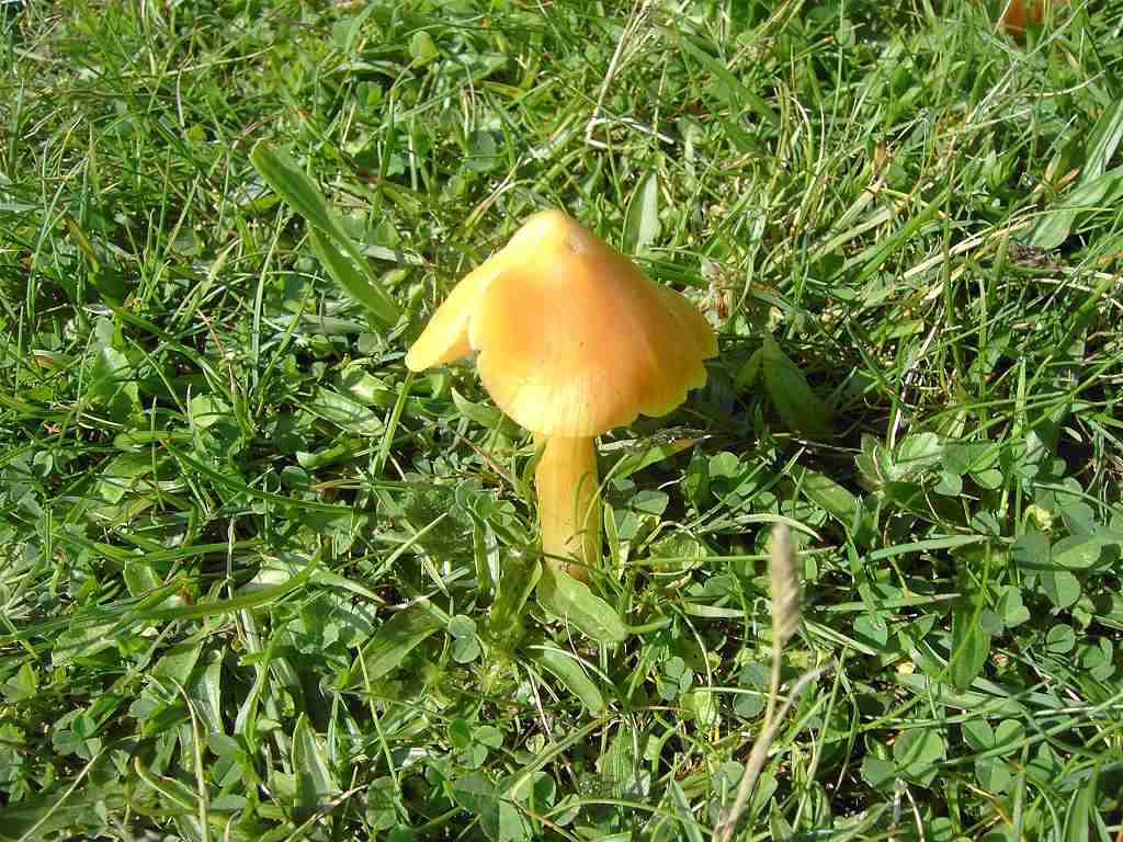
I descended across the grass, past a bright orange toadstool, to the little car park where we had finished the last Walk in the pouring rain. Very near to it — facing the sea — was a bench, so I sat down in the sun with my puzzle book until Colin arrived. What a difference to last Thursday! Colin enjoyed his cycle ride today, and when he got back to Hilton we sat together and ate our quiches.
But the Walk had to be walked, so we soon got started. There was a good path above the beach along the bottom of the cliffs, on what I suspect is a raised beach. Occasionally it was a trifle rough, but mostly we were striding along a pleasant grassy track which was easy to walk. Especially in the sunshine! In fact the sun was so bright that it made photography difficult at times.
We passed some poles that we recognised as the type that are used for drying fishing nets. We also passed a winch at the top of the beach, but there was no sign of any boats. We passed a bothy which had big ‘picture’ windows, but it looked too flimsy to provide adequate shelter during a storm, so we wondered what it was really used for. We met no one.
We saw very little in the way of wildlife, which was disappointing. We kept looking out to sea for dolphins and seals, but there was nothing. We saw a kestrel being mobbed by crows, but it was all over in a few moments. There were a few oystercatchers on the beach, and later on we saw a couple of rabbits. Nearer Tarbat Ness we came across some cormorants resting on a rock. Occasionally we ‘herded’ sheep along the track, but only ever for a few yards before they went off at a tangent and got behind us.
The rocks were interesting, though not nearly so spectacular as the Walk before last. Eroded sandstone peeped through the vegetation covering the cliff and it looked quite pretty.
The rocks on the beach were different, possibly a limestone and they were dipping sharply. Signs of an unconformity here?
Further on they were different again, more globular. It all added interest to a very pleasant Walk. We sat on a rock and ate our sarnies.
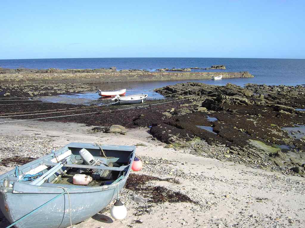
We came to the hamlet of Rockfield where, after looking at the map, there were more houses than we had expected. It looked very pretty in the sunshine, with its manicured lawns and village green right by the sea.
There were a few small rowing boats in the tiny harbour which was almost all natural, made out of rocks.
We thought we would have to walk up the road and find a way along the top of the cliffs from there on — at least that is what we had gathered through studying the map. We stopped to chat to a lady who was tending her garden, and asked her if the path did actually continue along the bottom of the cliffs — for that is what it looked like from where we were standing. She said she doesn’t walk it herself as she “isn’t a walker”, but her husband sometimes walks to Tarbat Ness along the bottom of the cliffs. So we carried on, hopefully.
We climbed over a ladder-stile and found the path was still there but a lot rougher. However, we have faced worse paths than that, and we didn’t find it too difficult despite the weeds and the lumps. Again we met no one.
We passed Ballone Castle which was up on the cliff above us. Right on the edge too — I wonder how safe it is! It says (restored) on the map, but there was still a crane up there. But it looked as if that was to build a modern extension. I looked the castle up on the internet, and found that it had been restored from an absolute ruin to a habitable residence over the last decade. Well done, the owners — must have cost them a bomb!
We continued along the beach until we were within sight of the lighthouse at Tarbat Ness. Colin’s knee began to give him trouble, which it has done spasmodically over the last decade. (Ever since he wrenched it trying to pull a metal post out of the garden in Bognor.) The path was uneven in places, but mostly it was quite good. Eventually we came to the end of a beach that looked as if it was walkable. Colin was not keen to carry on “in case we find the way is blocked, forcing us to turn back”. Hooray! At last he understands my reluctance to go uncertain routes at times. (I think his knee was talking to him, actually!) We climbed a sloping path and had a good view of the lighthouse from the top.
We followed a grassy path along the top for a while (none of these paths are marked on our OS map) but there was a gully ahead. We could have got round it, but decided to go down a zigzag path to the beach again.
There we saw cormorants and oystercatchers perched on a rock. We also noted that the rock formation on the edge of the cliff looked like a grotesque face! Colin took a lovely picture of a heron flying past.
Round another corner, and we came to a tiny ‘harbour’ which was only a slipway really. There was no way we could get past that on the beach, so we had to go up for the final time. There we walked along until we were standing by the lighthouse — though we didn’t have to as it was a dead end. Tarbat Ness Lighthouse was built in 1830, and heightened in 1892 to make it the second tallest lighthouse in Britain (after Skerryvore which is on a remote reef off the west coast of Scotland). We sat down and ate our chocolate, then we said “Goodbye” to the Moray Firth. We were at the northernmost end of the Black Isle.
We had toyed with the idea of walking close to the north-west coast to get back to Portmahomack, but we were tired. So far we’d had a good day, and we didn’t want to spoil it by clambering across fields on ‘iffy’ paths, climbing barbed wire fences, and then finding we couldn’t get through anyhow. Besides, Colin’s knee was still giving him grief. So we started walking back along the road.
We passed a yard full of sheep, and stopped to chat to the lady farmer. We have found most farmers we have met in Scotland to be very helpful, friendly, and almost eager to chat. (Wish I could say the same about English farmers.) For five minutes we put the world to rights with this lady, and discussed the merits of mutton over lamb. Then we yomped on the three miles to Portmahomack.
We said “hello” to a cow (or was it a bull?) in a field, and observed some starlings making a heck of a noise on some telephone wires.
Above Portmahomack they have built a new estate, so we asked a young mother, who had just come out of one of the houses, whether we could get to the harbour through the estate. She directed us the best way down.
We came out just beyond the harbour, but we were too tired to walk it this evening. We did think that the little town looked very pretty in the evening sun. We stopped to admire a cast iron fountain, a lovely Victorian sculpture. It was made in 1877 to commemorate the introduction of piped water to the town.
A notice also told us that the harbour was built by Thomas Telford in 1816, possibly incorporating an earlier structure. This was the period when the herring industry in Portmahomack was thriving, unlike today.
We walked along the seafront until we reached our car. We did think Portmahomack looked lovely in the evening sun, and despite our fatigue we felt happy because it had been such an enjoyable Walk.
That ended Walk no.198, we shall pick up Walk no.199 next time on the seafront at Portmahomack. It was ten to six, so the Walk had taken six hours forty minutes. We had our tea and caramel squares, then returned to Hilton of Cadboll to pick up the bike. We drove back to Dingwall, such a long way now and we were exhausted. I suggested fish’n’chips again, but being a Monday the shop was shut. So we returned to the flat and I had to cook after all.


1 comment:
Enjoyed your blog very much, and loved your photos. Are you still doing walks?
Alison MacRae
Post a Comment