Weather: Cloudy, brightening up. Then it turned to a constant drizzle which eventually stopped after a couple of hours.
Location: Polly More to Achiltibuie.
Distance: 11 miles.
Total distance: 2095 miles.
Terrain: All road-walking, since the path over the rocks which is marked on the map didn’t exist!
Tide: Out.
Rivers: No.210, River Polly at the smelly fish farm. No.211, the outlet of Loch Osgaig.
Ferries: None.
Piers: No.27, Achiltibuie.
Kissing gates: No.196 to get into the loo at the very end of the Walk.
Pubs: None.
‘Historic Scotland’ properties: None.
Ferris wheels: None.
Diversions: No.56 at the beginning of the Walk. Colin managed to get across the stepping stones with difficulty, but could find no vestige of the two-mile footpath which, according to our up-to-date OS map, leads from there to Strath Polly. The ground was too rough to make our way through without a path to follow, so he slipped his way back across the stones and we walked the five miles by road.
How we got there and back: We were staying in our caravan at Achmelvich, and we have hired a car so we have two for a week. This morning we drove both cars to Achiltibuie where we left our own car parked next to the public loo. Then we drove the hire-car back to Polly More and managed to find a space to park it just off this very narrow road.
At the end, we had our tea and biscuits (and went through the kissing gate to use the loo!). Then we drove back to Polly More, picked up the hire-car and drove both cars back to our caravan at Achmelvich.
Yesterday’s amazing weather was a one-day wonder — it was drizzling this morning when we got up and this continued off and on all day. Terrible light for photography!
 The tide was further out when we got to Polly More this morning, revealing a lot more rocks that could have been a stepping-stones crossing once upon a time. But it had been washed away (or deliberately vandalised) and didn’t look as if it had been used for years. Colin was determined to get across, and he managed it with difficulty.
 He then took himself up the opposite bank and into the adjoining woods to look for the footpath which is so clearly marked on the OS map. He couldn’t find any vestige of it! Then he had to get himself back across the river, and very nearly slid off the slippery stones in doing so. I would never have got myself across there without getting a bootful of water at least, so in a way I was secretly a little bit glad that he couldn’t find the path.
 The going is far too inhospitable in these parts to attempt to walk over rough ground, so we resigned ourselves to walking the long way round by road.
While Colin was exploring the nether bank, I was watching a seal on a far rock, flexing its head and tail. It looked like an overgrown jelly-bean!
 Before we started walking, we sat on a rock and ate our pies. We wondered if the Inverpolly Estate had anything to do with the vandalising of the stepping stones so that the footpath would fall into disuse and become overgrown. They own most of the land in this area, and with the liberal open access laws in Scotland they can’t stop people walking where they like — unless they make it impossible for them to do so. Their fishing permit notices were everywhere, there is no way you can catch a fish around here without paying for the privilege.
 The sun came out while we were sitting there and we thought it was going to get hot like yesterday. But it didn’t, in fact that bit of sunshine lasted all of two minutes before it became dull and cold again. We set off, following the road next to the river we couldn’t cross. And we never did actually cross it, for the road looped round following the valley until we passed the source, then it looped back again towards the fish farm — that it why we had to walk five miles as opposed to two if we could have gone in a straight line.

We gradually climbed all the while. It was picturesque walking along next to the river, especially where the rowan trees were showing off their bright red berries.
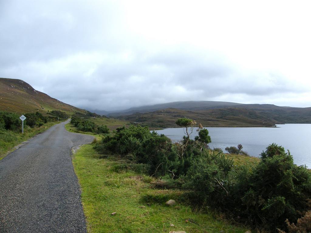
 After the turn in the road, we found we were following another drainage system — consisting of rivers, streams, cliffs and lochs — which was far below us.
 Eventually it all drained into Loch Osgaig, and so to the sea. This whole area of Scotland is just one big bog!
 We sat on a rock high above a loch, with magnificent views, to eat our lunch. We wanted to enjoy our food before we reached the fish farm because we knew it would be smelly there. It started to drizzle just as we finished, so it was a bit miserable walking down.
 A “Private Road” came out from Inverpolly Lodge at the fish farm — that is the way we would have come down and rejoined the road, had we been able to use the path. There were notices about fishing permits pointing up towards the Lodge, that is where you have to go to buy them.

 We put on our overtrousers because the drizzle was getting more intense. Colin was wearing his complete new hiking gear — boots, kag and overtrousers. He looked really smart, but above all he was dry without being overheated. He is pleased, now, that he spent out on the quality gear!
We climbed a very steep hill and out on to the open moor, which wasn’t very nice in the rain. We sheltered in the lee of a rock to eat our apples — we could hardly believe that only yesterday we were in a heatwave! We descended to the ‘main’ road between Ullapool and Achiltibuie — a narrow road with passing places, but the only road to Achiltibuie and other isolated communities.


After that it got a bit boring. The road was straight, so was the adjoining loch. “Even the trees are in a straight line!” observed Colin. At least the drizzle stopped for a while, though it remained quite overcast. The tedium was relieved a little by the find of a big and unusual toadstool growing by the side of the road.

 We came to a bridge over the short river which drains Loch Osgaig into the sea about half a mile away. A number of other lochs, rivers and burns drain into Loch Osgaig, so there is a huge amount of water there which has finally found its way into the ocean. This end of Loch Osgaig is very shallow.
 We crossed another bit of open moor, and after mile or so came to the top end of an estuary which drains another set of lochs into the sea. This whole area is very open and wild, bet it is often windy. I wouldn’t like to live in such a place.
 We stopped at a road junction, and ate our chocolate whilst hiding behind a stone information block in an effort to get out of the cold wind. We soon moved on. We should really have turned right and taken the road round the headland, but we didn’t want to. The left turn was a much more direct route to our car parked three miles away. So we took this option because we were fed up and tired.
 We discussed, as we were walking along, all sorts of ‘excuses’ for not taking the longer, more coastal route. We even thought of making up a new rule, but we didn’t in the end because we couldn’t even be bothered to do that. We thought a combination of additional rules 11, 14 and 15 would suffice. This morning we had driven the longer route, and satisfied ourselves that the road was mostly inland and barely touched the coast — additional rule no.11. The weather wasn’t good (rule 14) and we were tired (rule 15) so there you are!
 The road we were on was boring too, wild and lonely. I thought the grassy reeds growing in a nearby loch made a good picture, and the heather on the moor was nice — though past its best for this season. I was trying to be positive, but the sky got duller and darker as we progressed. We were a mere quarter of a mile from the car when it started to drizzle again. Why couldn’t it have waited?
 We had a cup of tea, and the drizzle stopped. We felt a lot more refreshed, so we salved our consciences a little by walking half a mile down the road we should have come up because this bit was along the shore.
 There is a greensward along the top of the beach, with a notice prohibiting camping. Nevertheless, a couple were pitching their tent right in the middle of it. So much for Council notices!


Further along were some simple fishing boats hauled up, and then a row of rusty anchors. The road then went uphill away from the shore, but we went down a dead-end road to a little wooden pier. From there we saw cormorants on a rock drying their wings, and a couple of fishermen on the jetty.
 The wood was pretty rotten, but they still run cruises from here to the Summer Isles which are just offshore to the south-west.
 We then retraced our steps to the car, looking South towards Ardmair Point and Ullapool — our next couple of Walks.
That ended Walk no.228, we shall pick up Walk no.229 next time by the public loo at Achiltibuie. It was six o’clock, so the Walk had taken seven hours and ten minutes. We had another cup of tea, then we drove back to Polly More where Colin transferred to the hire car. We then drove both cars back to our caravan at Achmelvich.
The next day we moved both cars and the caravan to a site at Ardmair Point.
Location: Polly More to Achiltibuie.
Distance: 11 miles.
Total distance: 2095 miles.
Terrain: All road-walking, since the path over the rocks which is marked on the map didn’t exist!
Tide: Out.
Rivers: No.210, River Polly at the smelly fish farm. No.211, the outlet of Loch Osgaig.
Ferries: None.
Piers: No.27, Achiltibuie.
Kissing gates: No.196 to get into the loo at the very end of the Walk.
Pubs: None.
‘Historic Scotland’ properties: None.
Ferris wheels: None.
Diversions: No.56 at the beginning of the Walk. Colin managed to get across the stepping stones with difficulty, but could find no vestige of the two-mile footpath which, according to our up-to-date OS map, leads from there to Strath Polly. The ground was too rough to make our way through without a path to follow, so he slipped his way back across the stones and we walked the five miles by road.
How we got there and back: We were staying in our caravan at Achmelvich, and we have hired a car so we have two for a week. This morning we drove both cars to Achiltibuie where we left our own car parked next to the public loo. Then we drove the hire-car back to Polly More and managed to find a space to park it just off this very narrow road.
At the end, we had our tea and biscuits (and went through the kissing gate to use the loo!). Then we drove back to Polly More, picked up the hire-car and drove both cars back to our caravan at Achmelvich.
Yesterday’s amazing weather was a one-day wonder — it was drizzling this morning when we got up and this continued off and on all day. Terrible light for photography!
 The tide was further out when we got to Polly More this morning, revealing a lot more rocks that could have been a stepping-stones crossing once upon a time. But it had been washed away (or deliberately vandalised) and didn’t look as if it had been used for years. Colin was determined to get across, and he managed it with difficulty.
 He then took himself up the opposite bank and into the adjoining woods to look for the footpath which is so clearly marked on the OS map. He couldn’t find any vestige of it! Then he had to get himself back across the river, and very nearly slid off the slippery stones in doing so. I would never have got myself across there without getting a bootful of water at least, so in a way I was secretly a little bit glad that he couldn’t find the path.
  The going is far too inhospitable in these parts to attempt to walk over rough ground, so we resigned ourselves to walking the long way round by road.
While Colin was exploring the nether bank, I was watching a seal on a far rock, flexing its head and tail. It looked like an overgrown jelly-bean!
 Before we started walking, we sat on a rock and ate our pies. We wondered if the Inverpolly Estate had anything to do with the vandalising of the stepping stones so that the footpath would fall into disuse and become overgrown. They own most of the land in this area, and with the liberal open access laws in Scotland they can’t stop people walking where they like — unless they make it impossible for them to do so. Their fishing permit notices were everywhere, there is no way you can catch a fish around here without paying for the privilege.
 The sun came out while we were sitting there and we thought it was going to get hot like yesterday. But it didn’t, in fact that bit of sunshine lasted all of two minutes before it became dull and cold again. We set off, following the road next to the river we couldn’t cross. And we never did actually cross it, for the road looped round following the valley until we passed the source, then it looped back again towards the fish farm — that it why we had to walk five miles as opposed to two if we could have gone in a straight line.
We gradually climbed all the while. It was picturesque walking along next to the river, especially where the rowan trees were showing off their bright red berries.
 After the turn in the road, we found we were following another drainage system — consisting of rivers, streams, cliffs and lochs — which was far below us.
 Eventually it all drained into Loch Osgaig, and so to the sea. This whole area of Scotland is just one big bog!
 We sat on a rock high above a loch, with magnificent views, to eat our lunch. We wanted to enjoy our food before we reached the fish farm because we knew it would be smelly there. It started to drizzle just as we finished, so it was a bit miserable walking down.
 A “Private Road” came out from Inverpolly Lodge at the fish farm — that is the way we would have come down and rejoined the road, had we been able to use the path. There were notices about fishing permits pointing up towards the Lodge, that is where you have to go to buy them.
 We put on our overtrousers because the drizzle was getting more intense. Colin was wearing his complete new hiking gear — boots, kag and overtrousers. He looked really smart, but above all he was dry without being overheated. He is pleased, now, that he spent out on the quality gear!
We climbed a very steep hill and out on to the open moor, which wasn’t very nice in the rain. We sheltered in the lee of a rock to eat our apples — we could hardly believe that only yesterday we were in a heatwave! We descended to the ‘main’ road between Ullapool and Achiltibuie — a narrow road with passing places, but the only road to Achiltibuie and other isolated communities.

After that it got a bit boring. The road was straight, so was the adjoining loch. “Even the trees are in a straight line!” observed Colin. At least the drizzle stopped for a while, though it remained quite overcast. The tedium was relieved a little by the find of a big and unusual toadstool growing by the side of the road.

 We came to a bridge over the short river which drains Loch Osgaig into the sea about half a mile away. A number of other lochs, rivers and burns drain into Loch Osgaig, so there is a huge amount of water there which has finally found its way into the ocean. This end of Loch Osgaig is very shallow.
 We crossed another bit of open moor, and after mile or so came to the top end of an estuary which drains another set of lochs into the sea. This whole area is very open and wild, bet it is often windy. I wouldn’t like to live in such a place.
 We stopped at a road junction, and ate our chocolate whilst hiding behind a stone information block in an effort to get out of the cold wind. We soon moved on. We should really have turned right and taken the road round the headland, but we didn’t want to. The left turn was a much more direct route to our car parked three miles away. So we took this option because we were fed up and tired.
 We discussed, as we were walking along, all sorts of ‘excuses’ for not taking the longer, more coastal route. We even thought of making up a new rule, but we didn’t in the end because we couldn’t even be bothered to do that. We thought a combination of additional rules 11, 14 and 15 would suffice. This morning we had driven the longer route, and satisfied ourselves that the road was mostly inland and barely touched the coast — additional rule no.11. The weather wasn’t good (rule 14) and we were tired (rule 15) so there you are!
 The road we were on was boring too, wild and lonely. I thought the grassy reeds growing in a nearby loch made a good picture, and the heather on the moor was nice — though past its best for this season. I was trying to be positive, but the sky got duller and darker as we progressed. We were a mere quarter of a mile from the car when it started to drizzle again. Why couldn’t it have waited?
 We had a cup of tea, and the drizzle stopped. We felt a lot more refreshed, so we salved our consciences a little by walking half a mile down the road we should have come up because this bit was along the shore.
  There is a greensward along the top of the beach, with a notice prohibiting camping. Nevertheless, a couple were pitching their tent right in the middle of it. So much for Council notices!

Further along were some simple fishing boats hauled up, and then a row of rusty anchors. The road then went uphill away from the shore, but we went down a dead-end road to a little wooden pier. From there we saw cormorants on a rock drying their wings, and a couple of fishermen on the jetty.
 The wood was pretty rotten, but they still run cruises from here to the Summer Isles which are just offshore to the south-west.
 We then retraced our steps to the car, looking South towards Ardmair Point and Ullapool — our next couple of Walks.
That ended Walk no.228, we shall pick up Walk no.229 next time by the public loo at Achiltibuie. It was six o’clock, so the Walk had taken seven hours and ten minutes. We had another cup of tea, then we drove back to Polly More where Colin transferred to the hire car. We then drove both cars back to our caravan at Achmelvich.
The next day we moved both cars and the caravan to a site at Ardmair Point.

No comments:
Post a Comment