Weather: Steady light rain all day.
Location: Kirkcudbright to Dundrennan.
Distance: 16 miles.
Total distance: 2964 miles.
Terrain: Some very muddy paths and tracks. Some stony tracks. A lot of concrete roads and lanes.
Tide: (Didn’t get near the sea!)
Rivers: No.356, Abbey Burn.
Ferries: None.
Piers: None.
Kissing gates: None.
Pubs: None on the Walk. But we did visit the Sulwath Brew Pub in Castle Douglas several times while we were in the area.
‘Historic Scotland’ properties: No.40, Dundrennan Abbey (which we visited on a different day).
Ferris wheels: None.
Diversions: None.
How we got there and back: We were staying in our caravan in Dalbeattie. This morning we drove to Dundrennan, parked the car, then caught a bus into Kirkcudbright. (We had to pay our fares today!)
At the end we walked a mile along a lane from Fagra Farm to Dundrennan where our car was parked. We drove back to Dalbeattie for tea, biscuits and a lie-down.
No free bus fares today! Unlike two days ago, we had to pay for our
bus ride this morning. It rained
practically all day, so we embarked on a pretty soggy Walk. We didn’t take many photos because we didn’t want
to risk the cameras getting wet. Those
we did manage to take, we were huddled under Colin’s umbrella trying to face
away from the wind so they aren’t very good.
They were bunched in groups, and occasionally we got drips on the lens.
 We walked alongside the river in Kirkcudbright until
we had passed the harbour, then we had to go inland a little because buildings
blocked our way. We came out at the
marina. From there we walked through a
park — all this in the rain. At the
other end we merged into a housing estate, trying to keep as close to the river
as we could. We wondered if we would be
able to get out at the other end because we have been ‘trapped’ in housing
estates before. But we found an
unofficial path, obviously much used by the locals, which led round the end of
the perimeter fence into a marsh. It was
a bit boggy underfoot, but we coped. We
carried on along the edge of what was once a wood of fir trees but was now cut
down. We came out on a track which led
all round St Mary’s Isle — only it isn’t actually an island, just a long thin
peninsula.
We walked alongside the river in Kirkcudbright until
we had passed the harbour, then we had to go inland a little because buildings
blocked our way. We came out at the
marina. From there we walked through a
park — all this in the rain. At the
other end we merged into a housing estate, trying to keep as close to the river
as we could. We wondered if we would be
able to get out at the other end because we have been ‘trapped’ in housing
estates before. But we found an
unofficial path, obviously much used by the locals, which led round the end of
the perimeter fence into a marsh. It was
a bit boggy underfoot, but we coped. We
carried on along the edge of what was once a wood of fir trees but was now cut
down. We came out on a track which led
all round St Mary’s Isle — only it isn’t actually an island, just a long thin
peninsula.

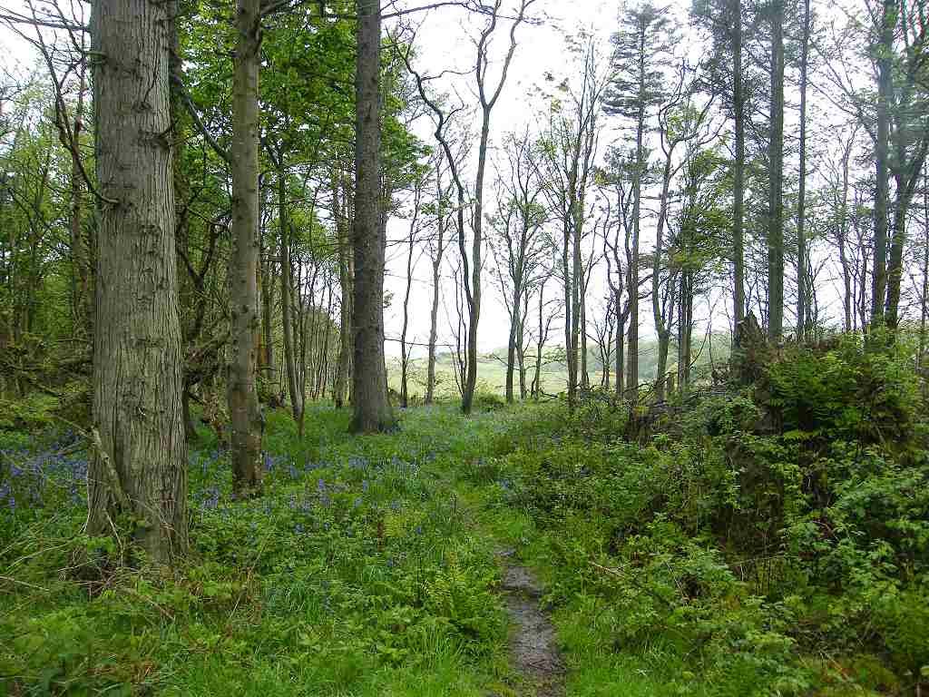
 Now if it had been a sunny day with the sunlight
dappling through the trees, the next part of our Walk would have been truly
beautiful. But it was a grey, drippy and
gloomy day — despite that it was still beautiful!
Now if it had been a sunny day with the sunlight
dappling through the trees, the next part of our Walk would have been truly
beautiful. But it was a grey, drippy and
gloomy day — despite that it was still beautiful!
 I love trees, I love woods in the springtime
with their pale green new leaves and the assortment of wild flowers on the
woodland floor. Added to that, we had
glimpses of the river, now an estuary, through the trees on our right. It was boggy in places, but we didn’t let
that spoil our enjoyment.
I love trees, I love woods in the springtime
with their pale green new leaves and the assortment of wild flowers on the
woodland floor. Added to that, we had
glimpses of the river, now an estuary, through the trees on our right. It was boggy in places, but we didn’t let
that spoil our enjoyment.

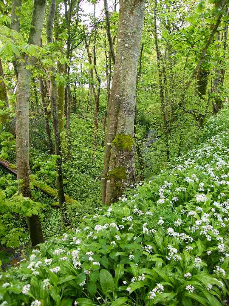
 There was the all-pervading scent of wild garlic
which was prolific in the woods. As a
child, Colin used to call them “stinking nans”, it was a local name in
Derbyshire. We recalled the time when
our own children were young and we took them for a picnic in woods at this time
of year. Maria was about six at the
time. She came trotting back to me and
said, “I’ve just been running through the smelly grandmas!” Ever since then, these lovely Spring flowers
have been known as “smelly grandmas” in our family!
There was the all-pervading scent of wild garlic
which was prolific in the woods. As a
child, Colin used to call them “stinking nans”, it was a local name in
Derbyshire. We recalled the time when
our own children were young and we took them for a picnic in woods at this time
of year. Maria was about six at the
time. She came trotting back to me and
said, “I’ve just been running through the smelly grandmas!” Ever since then, these lovely Spring flowers
have been known as “smelly grandmas” in our family!
 We came to the end of the ‘island’ where we could
see an extra bit of land, detached, through the trees. Near there we found a log where we could sit
without getting too wet, so we stopped to eat our pies — in the rain! The path curved round and followed the other
side of the peninsula, almost back to where we had started.
We came to the end of the ‘island’ where we could
see an extra bit of land, detached, through the trees. Near there we found a log where we could sit
without getting too wet, so we stopped to eat our pies — in the rain! The path curved round and followed the other
side of the peninsula, almost back to where we had started.
 We merged on to a potholed road, and further on some
workmen were filling the potholes with stones.
Eventually we came out on to the proper road which had recently been
retarmacked with those horrible little stones which are not properly embedded
in the tar. We thought we were going to
get splattered with tarry grit, but we didn’t because the traffic was
light. A sweeping lorry came along,
supposedly picking up the surplus stones, but it was quite inefficient. The road looked just as bad after it had
passed by. There was a pavement for the
mile we had to walk this road, so we didn’t need our bright yellow waistcoats.
We merged on to a potholed road, and further on some
workmen were filling the potholes with stones.
Eventually we came out on to the proper road which had recently been
retarmacked with those horrible little stones which are not properly embedded
in the tar. We thought we were going to
get splattered with tarry grit, but we didn’t because the traffic was
light. A sweeping lorry came along,
supposedly picking up the surplus stones, but it was quite inefficient. The road looked just as bad after it had
passed by. There was a pavement for the
mile we had to walk this road, so we didn’t need our bright yellow waistcoats.
The road went inland so we turned off along a
lane. Further on the lane went inland so
we turned off along a track. It was a
well made-up track as far as the turnoff to the lifeboat station. After that it
was a bit muddy.
 We were alongside the
estuary, and had glorious views of it through the trees — at least they would
have been glorious if they hadn’t been so uniformly grey. But we remained in good spirits because we
were surrounded by wild flowers and trees with their new leaves, a lovely green
even in that dull light.
We were alongside the
estuary, and had glorious views of it through the trees — at least they would
have been glorious if they hadn’t been so uniformly grey. But we remained in good spirits because we
were surrounded by wild flowers and trees with their new leaves, a lovely green
even in that dull light.
 We also found
an unusual coloured snail sliding across the track. We sat on a log to eat our sarnies — in the
rain!
We also found
an unusual coloured snail sliding across the track. We sat on a log to eat our sarnies — in the
rain!
Further on we passed a car stuck in the mud. Two men had given up trying the drive it out, they had only got themselves stuck in deeper with their efforts. The track had narrowed to footpath width long since, so we don’t know why they were there. We could only conclude that they drove on too far after the track had deteriorated into a muddy footpath — but where did they think they were they going? They had tried to turn round by driving off the side, and got themselves into even deeper mud. They seemed to be quite cheerful about their situation, they said they had phoned for help and a Landrover was on its way to haul them out.
 The path emerged from the trees at Torrs Point, and
there it became a narrow cliff path around the Point. At last we were at the mouth of the estuary
and should have had views across the Solway Firth
— but not on a rainy day like today, we could barely see back across the mouth
to the peninsula we were on during the last Walk.
The path emerged from the trees at Torrs Point, and
there it became a narrow cliff path around the Point. At last we were at the mouth of the estuary
and should have had views across the Solway Firth
— but not on a rainy day like today, we could barely see back across the mouth
to the peninsula we were on during the last Walk.

 However we did have views ahead along the
next bit of rocky coast. Little did we
realise that it would be the last view of the coast on this Walk, of which we
had so far completed less than half.
There were several stiles to get over, one of which presented me with a
lot of difficulty because the steps were much too high. Or is it that I’m getting old? These days I find I have to look at a stile
and plan how I’m going to climb over it before starting to climb up. My back problem limits my flexibility in
twisting over a stile, and my thigh muscles are not strong enough to haul
myself up huge steps nor to lift my legs very high to get over the top. Far better to have a kissing gate!
However we did have views ahead along the
next bit of rocky coast. Little did we
realise that it would be the last view of the coast on this Walk, of which we
had so far completed less than half.
There were several stiles to get over, one of which presented me with a
lot of difficulty because the steps were much too high. Or is it that I’m getting old? These days I find I have to look at a stile
and plan how I’m going to climb over it before starting to climb up. My back problem limits my flexibility in
twisting over a stile, and my thigh muscles are not strong enough to haul
myself up huge steps nor to lift my legs very high to get over the top. Far better to have a kissing gate!
We climbed up to an entrance to the military ranges. Way back on our last Walk we had stopped to chat to a local man who was sitting on his garden wall. He gave us lots of tips as to how we should proceed, and had asked if we knew that the MOD had now opened a footpath through Kirkcudbright ranges. He told us that if we wanted to walk there (we did because it is nearer the sea) we should ring up beforehand to make sure they were not shooting on the day we wanted to walk through. So yesterday we had called in at Kirkcudbright Tourist Information Centre where they furnished us with a leaflet. So we had a sketchmap of the open paths through the ranges and I rang the number on the leaflet to be assured we could walk through today quite safely because they had no plans to shoot.
 Once inside, the paths were well waymarked and we
were warned not to wander off them on pain of death! (I don’t think they know themselves how much
unexploded ordnance lurks in the undergrowth, they have been shooting there for
so many decades.) We walked through
woods at first which was very pleasant, and we admired the many wild flowers we
passed.
Once inside, the paths were well waymarked and we
were warned not to wander off them on pain of death! (I don’t think they know themselves how much
unexploded ordnance lurks in the undergrowth, they have been shooting there for
so many decades.) We walked through
woods at first which was very pleasant, and we admired the many wild flowers we
passed.
 We came to a building with
toilets, but it was completely locked up.
Colin needed to change his pad — yes, he still has to wear small ones,
and on wet days like today his artificial sphincter does not work as well as it
might. There was no one about, so he did
it outside!
We came to a building with
toilets, but it was completely locked up.
Colin needed to change his pad — yes, he still has to wear small ones,
and on wet days like today his artificial sphincter does not work as well as it
might. There was no one about, so he did
it outside!
 From there the route across the ranges was quite
zigzag and rather like a roller-coaster.
We were disappointed that it was not footpaths, but unforgiving concrete
roads for miles and miles. And
warning notices were everywhere about the dangers of wandering off these
roads. We only saw the sea from a
distance, we never got up close.
Altogether it was quite tedious, especially in the rain. There was nothing much to look at, except the
odd rusty tank. We sat on the wall of a
bridge to eat our apples — in the rain!
From there the route across the ranges was quite
zigzag and rather like a roller-coaster.
We were disappointed that it was not footpaths, but unforgiving concrete
roads for miles and miles. And
warning notices were everywhere about the dangers of wandering off these
roads. We only saw the sea from a
distance, we never got up close.
Altogether it was quite tedious, especially in the rain. There was nothing much to look at, except the
odd rusty tank. We sat on the wall of a
bridge to eat our apples — in the rain!
 A white van was buzzing about and passed us twice on
our journey through. It didn’t seem to
be going anywhere in particular and I’m positive they were keeping an eye on
us, making sure we were genuine hikers sticking to the route and not up to any
mischief. I expect they had us on their
radar — I felt a little spooked. (We
have experienced this before when walking across military land, both at
Shoeburyness in Essex and Thorney Island in West Sussex.) There were warning notices everywhere about
the dangers of wandering off the concrete roads. But sheep and cattle were grazing all over
the place, don’t they ever get blown up?
A white van was buzzing about and passed us twice on
our journey through. It didn’t seem to
be going anywhere in particular and I’m positive they were keeping an eye on
us, making sure we were genuine hikers sticking to the route and not up to any
mischief. I expect they had us on their
radar — I felt a little spooked. (We
have experienced this before when walking across military land, both at
Shoeburyness in Essex and Thorney Island in West Sussex.) There were warning notices everywhere about
the dangers of wandering off the concrete roads. But sheep and cattle were grazing all over
the place, don’t they ever get blown up?
 Colin worked here for a few weeks back in the
1970s. He was working for Plessey at the
time, and most of their contracts were for the MOD — he often worked alongside
the Army. All these years later he
couldn’t remember much about the work he did here, but when he saw the
Sergeants’ Mess in the distance he exclaimed, “That is where I was introduced
to Glayva!” (Of course, it is only the
important things in life that stick in the memory!)
Colin worked here for a few weeks back in the
1970s. He was working for Plessey at the
time, and most of their contracts were for the MOD — he often worked alongside
the Army. All these years later he
couldn’t remember much about the work he did here, but when he saw the
Sergeants’ Mess in the distance he exclaimed, “That is where I was introduced
to Glayva!” (Of course, it is only the
important things in life that stick in the memory!)
 Soon after the bridge where we ate our apples, there
was a fork in the road with no waymarks.
Help! Are we going to be blown to
smithereens? We made an educated guess
as to which way we should proceed — and got it right, thank goodness. A bit further on the concrete road turned
into an ordinary track which was much easier on the feet.
Soon after the bridge where we ate our apples, there
was a fork in the road with no waymarks.
Help! Are we going to be blown to
smithereens? We made an educated guess
as to which way we should proceed — and got it right, thank goodness. A bit further on the concrete road turned
into an ordinary track which was much easier on the feet.
We passed a ‘Portaloo’ which was not locked, but it was dirty and didn’t flush. But there were fresh tissues and toilet paper in there, so it was obviously intended to be used. We didn’t — I’d rather hide behind a bush than use toilets in such a state.
 The track led us on to a tarmacked road which turned
down a stream valley. It was very
pretty, there were carpets of smelly grandmas….er, sorry — wild garlic! This was the best bit of the whole ranges walk.
The track led us on to a tarmacked road which turned
down a stream valley. It was very
pretty, there were carpets of smelly grandmas….er, sorry — wild garlic! This was the best bit of the whole ranges walk.
 We came to an exit gate to the ranges where we sat
on the wall of a bridge to eat our chocolate — in the rain! Then it was uphill, uphill, uphill, higher
than we’d been all day — a real sting in the tail when we were so tired. At least the rain ceased and gave us a
break. We were amused by the cows
rushing along next to us in adjacent fields — this happened in several
fields. At last we emerged on to a lane
near a farm called Fagra. The way on was
to turn right, but we didn’t do that today.
We came to an exit gate to the ranges where we sat
on the wall of a bridge to eat our chocolate — in the rain! Then it was uphill, uphill, uphill, higher
than we’d been all day — a real sting in the tail when we were so tired. At least the rain ceased and gave us a
break. We were amused by the cows
rushing along next to us in adjacent fields — this happened in several
fields. At last we emerged on to a lane
near a farm called Fagra. The way on was
to turn right, but we didn’t do that today.
That ended Walk no.294, we shall pick up Walk no.295 next time in the lane by the farm called Fagra. It was five to six, so the Walk had taken us nine hours exactly. We turned left and walked down into Dundrennan where our car was parked. We drove straight back to Dalbeattie where we had our tea and biscuits in the caravan.


Further on we passed a car stuck in the mud. Two men had given up trying the drive it out, they had only got themselves stuck in deeper with their efforts. The track had narrowed to footpath width long since, so we don’t know why they were there. We could only conclude that they drove on too far after the track had deteriorated into a muddy footpath — but where did they think they were they going? They had tried to turn round by driving off the side, and got themselves into even deeper mud. They seemed to be quite cheerful about their situation, they said they had phoned for help and a Landrover was on its way to haul them out.
We climbed up to an entrance to the military ranges. Way back on our last Walk we had stopped to chat to a local man who was sitting on his garden wall. He gave us lots of tips as to how we should proceed, and had asked if we knew that the MOD had now opened a footpath through Kirkcudbright ranges. He told us that if we wanted to walk there (we did because it is nearer the sea) we should ring up beforehand to make sure they were not shooting on the day we wanted to walk through. So yesterday we had called in at Kirkcudbright Tourist Information Centre where they furnished us with a leaflet. So we had a sketchmap of the open paths through the ranges and I rang the number on the leaflet to be assured we could walk through today quite safely because they had no plans to shoot.

We passed a ‘Portaloo’ which was not locked, but it was dirty and didn’t flush. But there were fresh tissues and toilet paper in there, so it was obviously intended to be used. We didn’t — I’d rather hide behind a bush than use toilets in such a state.
That ended Walk no.294, we shall pick up Walk no.295 next time in the lane by the farm called Fagra. It was five to six, so the Walk had taken us nine hours exactly. We turned left and walked down into Dundrennan where our car was parked. We drove straight back to Dalbeattie where we had our tea and biscuits in the caravan.
Dundrennan Abbey


The abbey was founded in the 12th century by Cistercian monks from Rievaulx Abbey in Yorkshire. It was connected to Glenluce Abbey, which we have already visited, and Sweetheart Abbey, which we shall pass by soon, because they were all founded by the same monks. Also this abbey was where the tragic Mary Queen of Scots spent her last night in Scotland, the land of her birth, before she fled to England where she mistakenly believed Elizabeth I would protect her from her enemies.


No comments:
Post a Comment