Weather: Heavy rain for the first 3 to 4 hours. It eventually eased to clear skies with scudding
clouds. A cold breeze.
Location: Foxfield to Barrow-in-Furness.
Distance: 13½ miles.
Total
distance: 3198½ miles.
Terrain:
Lanes. Grassy paths. Muddy paths.
Tracks, some muddy. Top of
estuary beach. Flat.
Tide: Out when it
mattered.
Rivers: None.
Ferries: None.
Piers: None.
Kissing gates: Nos 390, 391 and 392 when crossing back and
forth across the railway.
Pubs: None.
‘English Heritage’
properties: None.
Ferris wheels: None.
Diversions: None.
How we got there and
back: We were staying in our caravan
near Grange-over-Sands. This morning we
drove to Barrow-in-Furness and parked about
half a mile from the station. We caught
a train to Foxfield, and started the Walk from the station as it is situated
directly across the estuary from where we finished the last Walk.
At the end we
finished the Walk on the main road into Barrow, about a mile from where we had
parked the car. So we walked down the
cycleway-cum-pavement to where it was parked.
After tea and biscuits we returned to our caravan.
After alighting from the train, we crammed ourselves
into the tiny wooden waiting room at Foxfield Station to put on our wet-weather
gear. Colin noticed a swallows’ nest in
the roof with three chicks in it and a fourth perched on a rafter. They looked almost mature enough to fledge,
and there was lots of chirping because we were there. Colin was worried that this late brood had
been abandoned, but then a parent flew in with food, quite unfazed that we were
sitting below.

The lane zigzagged through the countryside, up a
little hill and down, until we turned off at a farm. We crossed a small river and took a footpath
across some fields. We did wonder how
deep we were going to sink into the mud considering the amount of rain we’ve
had recently, but to our surprise it was not muddy — only a trifle
squelchy. There were a few ditches to
cross, but all of them had footbridges so we got across with dry feet.
We came out on to a road and walked down to
Kirkby-in-Furness Station. There we sat
in the waiting room on the first platform we came to so we could get out of the
rain to eat our pies. But this shelter
was fairly open and very draughty, so we crossed over to the other platform
where the shelter was more substantial. There
was a man inside painting it, but he didn’t mind us sitting there. He told us he used to work in an office and
hated it. Now he paints railway stations
for less money, but he is much happier!
The path continued alongside the railway on the
estuary side. The wind was strong here
and blowing rain into our faces. It was
not nice! The path was uneven and
muddy. At one point it had eroded away
completely, the railway having been built up with big rocks. We had to go down on to the ‘beach’ which was
slippery. I hated it, and had difficulty
getting up the other side — I can’t do big steps any more.
We were very unhappy because of the rain in our
faces, and the wind was so strong. We
decided to go inland at the next railway crossing and follow a parallel path
across fields. So we did this at
Soutergate. As soon as we got off the
beach the wind was considerably reduced though the rain was just as
intense. The paths across the fields
were not well way-marked which made navigation problematic. It was muddy in places, and we found it
difficult to negotiate our way round the gooey patches. There were lots of stiles which I find
increasingly tricky to climb over as I get older and my back gets stiffer. In the wet the wood is slippery and the steps
are usually too big. We made very slow
progress.
Colin was grumpy and I was dead miserable, ready to
throw in the towel there and then. We
got to a field in which there seemed to be no way out. We walked along the hedge looking for a gap,
but we couldn’t see one. Suddenly the
rain stopped, the wind dropped and the sky cleared. The sun came out, it was a different world! We couldn’t believe how quickly the situation
changed — from the depths of despair our mood rose to dizzying heights.


 We walked towards the strange Askham “Pier”, a huge
construction of rocks leading out to a deeper channel in the estuary. It was apparently built from slag, a waste
product of the 19th century iron ore furnaces. We were relieved to find a bridge had been
put in so we could walk under it at the top of the beach — no climbing
involved.
We walked towards the strange Askham “Pier”, a huge
construction of rocks leading out to a deeper channel in the estuary. It was apparently built from slag, a waste
product of the 19th century iron ore furnaces. We were relieved to find a bridge had been
put in so we could walk under it at the top of the beach — no climbing
involved.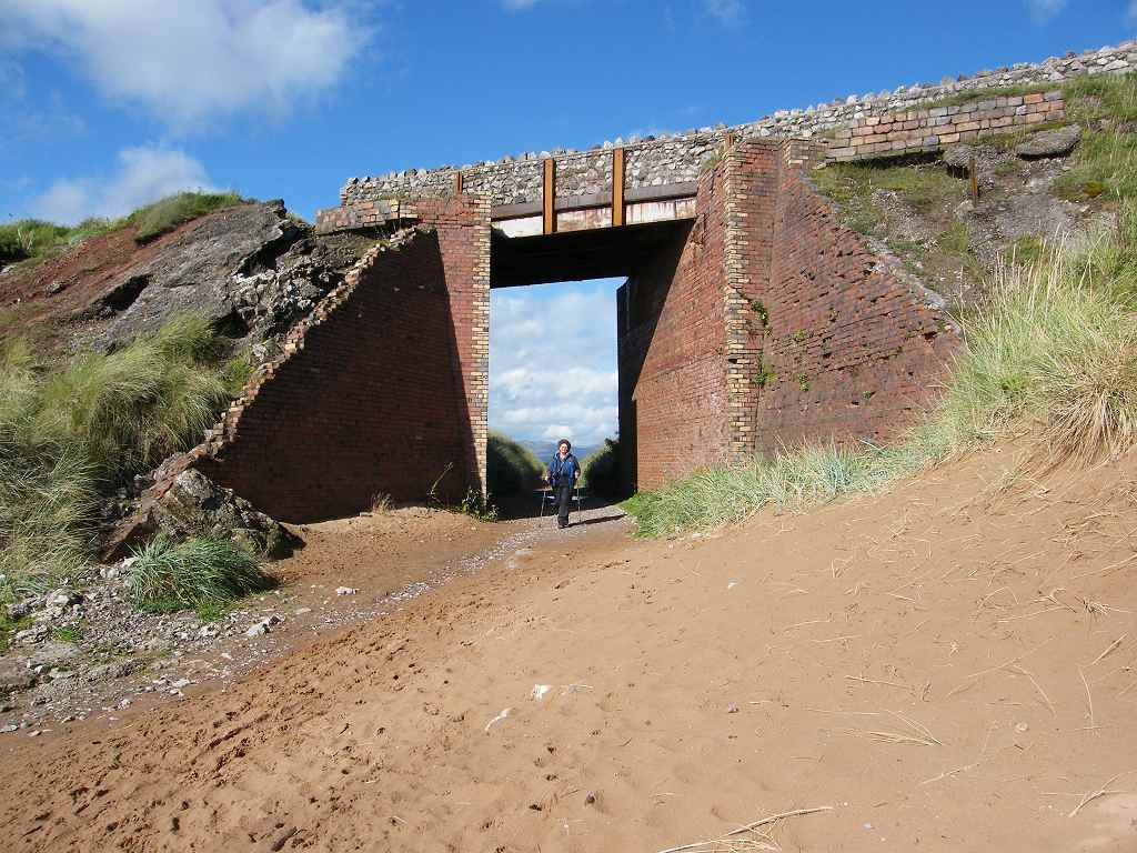


I’d had enough by then, I was too tired to go any
further in the wrong direction, or argue any more with such unreasonableness. I snatched the map from him, made him carry
my sticks because I couldn’t carry both, and insisted we did the
inland route because I was now the navigator.
He complained that the field path would be muddy and difficult to
navigate, but it wasn’t. It turned out
to be a good track, mostly concrete and it was waymarked very clearly. We made good time across it, but even then
Colin wouldn’t concede that it had been a good route. What can you do with such obstinacy?
We passed some farmers mending a fence. Then the
track turned inland and would have taken us to a road which is what we didn’t
want to do. We sat on a stile to eat our
apples. Colin was in a much calmer mood
by now, and we were able to discuss in a reasonable manner how we should
proceed. We decided to continue along
the beach even though it looked a bit wild and uggy. This was always going to be the most dodgy
part of the Walk. We couldn’t make up
our minds whether the next mile or so of beach was an unofficial path or the
neglected Cumbrian Coastal Way.


We knew we had to cut in somewhere before we reached
the end of the beach and walk out to the road.
This was because the beach deteriorated and eventually got swallowed up
into a disused industrial sandpit. It
was difficult to see where the gap was since everything was so horribly
overgrown, but two people out on the beach with a dog gave us a clue — they
must have come through the gap. We found
it — overgrown with lots of stinging nettles which we had to battle our way
through.
We came out by some industrial buildings and turned
right along a concrete track. A signpost
pointed the public footpath the way we were going, but we came to a gate with
an awkward fastening. Colin negotiated
it, and we carried on. We were alongside
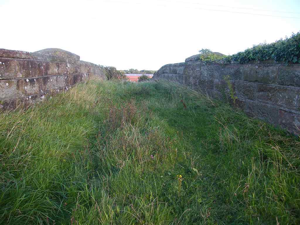
the railway once again. Colin looked up
and said we should be up on that bridge over the railway that we had just passed. We couldn’t see any way up to it, just
fences, brambles and stinging nettles.
We decided to carry on, but soon we came to a locked gate — leading to a
waste water plant!
We had no choice but to turn back, negotiating the
gate with the awkward fastening again. Next
to it, almost completely hidden by overgrown bushes, was another gate which was
leaning awkwardly. This, apparently, was
the public footpath. But this gate could
not be opened at all because there was a haystack leaning against it on the
other side!
 There was also a notice
warning us to keep off the newly sown grass seed’s! Where?
And what did the grass seed possess that was so precious we must keep
off it?
There was also a notice
warning us to keep off the newly sown grass seed’s! Where?
And what did the grass seed possess that was so precious we must keep
off it?


That ended Walk no.313, we shall pick up Walk no.314
at the small car park on the A590 just to the north of Barrow-in-Furness. It was quarter to eight, so the Walk had
taken us nine hours. We walked about a
mile down the cycleway-cum-pavement to where our car was parked in a back
street. After tea and biscuits we
returned to our caravan near Grange-over-Sands.

No comments:
Post a Comment