Ages: Colin was 71 years and 128 days. Rosemary was 68 years and 270 days.
Weather: No wind and not cold. Grey skies turning to light rain.
Location: Trearddur Bay to Four Mile Bridge.
Distance: 10 miles.
Total distance: 3545 miles.
Terrain: Moorland-type cliff paths. Some beach. Forest paths. Slightly undulating.
Tide: Coming in.
Rivers: No.420, Cymyran Strait.
Ferries: None.
Piers: None.
Kissing gates: Nos.607 to 621 mainly in the first half of the Walk (15 in all!)
Pubs: The ‘White Eagle’ at Rhoscolyn which we visited on a different day for a pub lunch, and found it rather expensive. Colin drank Milestone’s ‘Shine On’ and White Horse’s ‘Village Idiot’. I drank Strongbow cider.
‘Cadw’ properties: None.
Ferris wheels: None.
Diversions: None.
How we got there and back: We were staying in our caravan on a remote farm in the middle of Anglesey. This morning we drove to Four Mile Bridge where we parked in a layby. From there we caught a bus to Trearddur Bay, then walked up the road to the spot where we finished the last Walk.
At the end we finished the Walk at the car. It was twenty-five past five, so the Walk had taken us 7 hours and 35 minutes. We had our tea and chocolate biscuits before driving back to our caravan.
 We walked down the road towards Trearddur Bay,
but took little detours off to the right when they presented themselves so that
we followed the edge of the low cliff.
We walked down the road towards Trearddur Bay,
but took little detours off to the right when they presented themselves so that
we followed the edge of the low cliff.

 We noticed a big house on a rock and wondered if it was actually an
hotel, but it had an air of neglect about it.
We didn’t go close enough to look properly, and perhaps it was derelict. The wild roses were lovely — I enjoyed their
scent but Colin is beginning to lose his sense of smell and couldn’t detect it.
We noticed a big house on a rock and wondered if it was actually an
hotel, but it had an air of neglect about it.
We didn’t go close enough to look properly, and perhaps it was derelict. The wild roses were lovely — I enjoyed their
scent but Colin is beginning to lose his sense of smell and couldn’t detect it.
 We walked across the beautiful sand of Trearddur Bay,
then had to backtrack a little to find the toilet block. We sat on a wall and ate our pasties.
We walked across the beautiful sand of Trearddur Bay,
then had to backtrack a little to find the toilet block. We sat on a wall and ate our pasties.

 We walked up the road and came across a blue plaque to Thomas Telford,
the Scottish engineer. In both Welsh and
English it said: “THOMAS TELFORD World renowned civil engineer, known as ‘the
Colossus of Roads’, lived in Towyn Lodge and worked here during the design and
construction of the Anglesey section (circa 1819/22) of the London to Holyhead road”
We walked up the road and came across a blue plaque to Thomas Telford,
the Scottish engineer. In both Welsh and
English it said: “THOMAS TELFORD World renowned civil engineer, known as ‘the
Colossus of Roads’, lived in Towyn Lodge and worked here during the design and
construction of the Anglesey section (circa 1819/22) of the London to Holyhead road”

 We continued. There were lots of
nice little beaches between rocky sections.
We were walking across one when a boat trailer had to wait for us to
clear the slipway.
We continued. There were lots of
nice little beaches between rocky sections.
We were walking across one when a boat trailer had to wait for us to
clear the slipway.
 At the end of the
houses we entered a caravan site, according to the notices on the gate. But we couldn’t see any caravans. The path led to the top of the cliffs well
away from the tarmacked roads — then there came into sight a load of static
caravans half hidden in a hollow in the cliffs.
At the end of the
houses we entered a caravan site, according to the notices on the gate. But we couldn’t see any caravans. The path led to the top of the cliffs well
away from the tarmacked roads — then there came into sight a load of static
caravans half hidden in a hollow in the cliffs.
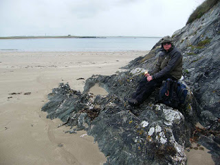
 We were walking along a spectacular coast, far more dramatic than we had
been expecting.
We were walking along a spectacular coast, far more dramatic than we had
been expecting.
 There were caves, rock
arches, twisty and zigzag patterns in the cliffs, different coloured rocks
including a deep rose pink which made the cliff look as if it was blushing!
There were caves, rock
arches, twisty and zigzag patterns in the cliffs, different coloured rocks
including a deep rose pink which made the cliff look as if it was blushing!
 There were deep clefts, some of which we came
across unexpectedly — dangerous!
There were deep clefts, some of which we came
across unexpectedly — dangerous!
 There were also wild flowers, rabbits and
goats.
There were also wild flowers, rabbits and
goats.
 We did enjoy this part of the Walk.
 But it was by no means quiet. The
RAF were doing exercises over the sea, and we couldn’t hear ourselves speak
when they went over.
But it was by no means quiet. The
RAF were doing exercises over the sea, and we couldn’t hear ourselves speak
when they went over.

 Twice a big and
noisy propeller plane passed us overhead to drop a number of parachutists into
the sea. They were so far out we could
only just see them, though we could see a ship out there. A number of RIBS were buzzing about picking
up men from the water. Later helicopters
were picking up equipment loads from the ship and carrying them back to the
airfield. All very noisy.
Twice a big and
noisy propeller plane passed us overhead to drop a number of parachutists into
the sea. They were so far out we could
only just see them, though we could see a ship out there. A number of RIBS were buzzing about picking
up men from the water. Later helicopters
were picking up equipment loads from the ship and carrying them back to the
airfield. All very noisy.
 We climbed a down where Colin saw choughs and got very excited. He managed to photograph them, and so did I
from a distance using my telephoto lens.
We climbed a down where Colin saw choughs and got very excited. He managed to photograph them, and so did I
from a distance using my telephoto lens.
 Meanwhile I noticed stones round part of a swampy stream, damming it
slightly to form a well. We couldn’t
make up our minds whether it was an ancient holy well, which are scattered all
over the remote parts of Wales, or whether the local farmer had rearranged the
stones so his animals had somewhere to drink.
Later I looked it up on the internet — it was an ancient well dedicated to St Gwenfaen. A gift of two white quartz pebbles thrown
into the well is said to cure mental problems, but we didn’t know that when we
passed so we are still loopy!
Meanwhile I noticed stones round part of a swampy stream, damming it
slightly to form a well. We couldn’t
make up our minds whether it was an ancient holy well, which are scattered all
over the remote parts of Wales, or whether the local farmer had rearranged the
stones so his animals had somewhere to drink.
Later I looked it up on the internet — it was an ancient well dedicated to St Gwenfaen. A gift of two white quartz pebbles thrown
into the well is said to cure mental problems, but we didn’t know that when we
passed so we are still loopy!
 We walked up to the top of a hill where there was a lookout post. A man inside was monitoring the RAF exercises
out at sea. As we came down from there
towards Rhoscolyn
Bay it started to rain — not again! The rest of the Walk was wet — BUMMER!
We walked up to the top of a hill where there was a lookout post. A man inside was monitoring the RAF exercises
out at sea. As we came down from there
towards Rhoscolyn
Bay it started to rain — not again! The rest of the Walk was wet — BUMMER!

 We read a curious notice on a gate — it told us that the walk-map was
wrong and to follow the blue arrows. We
only had the OS map and didn’t think they were referring to that. We were following the blue arrows anyway. So when we came to an opening where two blue arrows,
one on each side, were pointing towards each other, we assumed they meant us to
follow the path through the opening. But
when we did so, we came to a swampy field with no way out! We retraced our steps, and this time asked a
white-van-man, who was working on a house nearby, if he knew which way was the
coastal path. He told us to walk over
what looked like someone’s private front lawn, then turn left on to the
beach. And so it was.
We read a curious notice on a gate — it told us that the walk-map was
wrong and to follow the blue arrows. We
only had the OS map and didn’t think they were referring to that. We were following the blue arrows anyway. So when we came to an opening where two blue arrows,
one on each side, were pointing towards each other, we assumed they meant us to
follow the path through the opening. But
when we did so, we came to a swampy field with no way out! We retraced our steps, and this time asked a
white-van-man, who was working on a house nearby, if he knew which way was the
coastal path. He told us to walk over
what looked like someone’s private front lawn, then turn left on to the
beach. And so it was.
 We started walking along the top of the beach when Colin noticed a large
tree overhanging a low wall, and the wall was dry where it was under the
tree. So we sat there and ate our
sarnies. As we were doing so we watched
in amazement as the white-van-man we had just spoken to drove his van across
the beach between seaweed covered rocks, even going through the waves at one
point because the tide was coming in fast, so that he could exit through the
beach car park. We realised that the only way the half dozen or so properties
behind us could be accessed by vehicles was across the beach at low tide! (We hope they never need a fire engine or an
ambulance at high tide!)
We started walking along the top of the beach when Colin noticed a large
tree overhanging a low wall, and the wall was dry where it was under the
tree. So we sat there and ate our
sarnies. As we were doing so we watched
in amazement as the white-van-man we had just spoken to drove his van across
the beach between seaweed covered rocks, even going through the waves at one
point because the tide was coming in fast, so that he could exit through the
beach car park. We realised that the only way the half dozen or so properties
behind us could be accessed by vehicles was across the beach at low tide! (We hope they never need a fire engine or an
ambulance at high tide!)
 We used the loos in the car park, then we walked along the back of the
beach behind the dunes. We came to a junction
and should have gone straight on, according to the map. But there were only arrows to left and right,
not for the straight-on path which went through a blue gate. We tried the path to the right, but it only
took us down to the beach which was a dead end.
We returned to the junction and went through the blue gate. It was
the right way! We reckon the landowner had removed the signs — there were lots
of PRIVATE and KEEP OUT notices on all the
other blue gates we passed.
We used the loos in the car park, then we walked along the back of the
beach behind the dunes. We came to a junction
and should have gone straight on, according to the map. But there were only arrows to left and right,
not for the straight-on path which went through a blue gate. We tried the path to the right, but it only
took us down to the beach which was a dead end.
We returned to the junction and went through the blue gate. It was
the right way! We reckon the landowner had removed the signs — there were lots
of PRIVATE and KEEP OUT notices on all the
other blue gates we passed.
 We came out on
to moorland. The scenery was not quite
so dramatic there but it was still good — pity the rain had to spoil it.
We came out on
to moorland. The scenery was not quite
so dramatic there but it was still good — pity the rain had to spoil it.

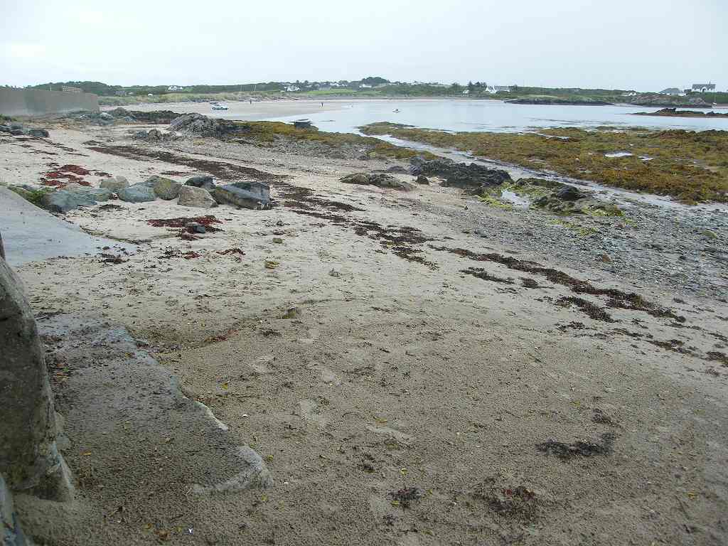
 We came to Silver Bay,
a lovely stretch of sand, where we sat miserably on a bank of rock to eat our
apples. As we crossed this beautiful bay
we met a lady who asked us sarcastically (for the rain was pelting down by
then) if we were enjoying our walk.
We came to Silver Bay,
a lovely stretch of sand, where we sat miserably on a bank of rock to eat our
apples. As we crossed this beautiful bay
we met a lady who asked us sarcastically (for the rain was pelting down by
then) if we were enjoying our walk.
 She
was obviously a local, and told us that the path up through the forest was “a
lovely walk”. And it was, at least it
would have been if it wasn’t for the rain.
It took us through a conifer wood, then uphill through fields and along
a long track.
She
was obviously a local, and told us that the path up through the forest was “a
lovely walk”. And it was, at least it
would have been if it wasn’t for the rain.
It took us through a conifer wood, then uphill through fields and along
a long track.
 We were on a quiet lane
for a while, then we turned off on a ‘permissive’ path through woods. It was a lovely path, well maintained. It seemed to go on forever, but that could
have been because of the rain!
We were on a quiet lane
for a while, then we turned off on a ‘permissive’ path through woods. It was a lovely path, well maintained. It seemed to go on forever, but that could
have been because of the rain!
 At last it spat
us out on to the road. A notice informed
us that the permissive path ahead was closed from 1st October to 31st
January each year — Colin said, “Shooting season!” Luckily we were still in September, so we
were allowed to use it. Following that
there was a little bit of road before turning off again on a path which led us
down to a swamp! There were some
boardwalks to help us over, but not nearly enough.
At last it spat
us out on to the road. A notice informed
us that the permissive path ahead was closed from 1st October to 31st
January each year — Colin said, “Shooting season!” Luckily we were still in September, so we
were allowed to use it. Following that
there was a little bit of road before turning off again on a path which led us
down to a swamp! There were some
boardwalks to help us over, but not nearly enough.
We met a group of teenage girls doing their Duke of Edinburgh award. They were carrying all their kit, and looked wet, cold and fed up. We didn’t envy them, at least we were only carrying a day-pack each. Further on we met another group of girls, we think they came from the same school.
 We came out at Four-Mile Bridge, so called because it is four
miles by road from Holyhead. There has
been a bridge there since the early 16th century — before that
people could only get to Holyhead by boat.
Four Mile Bridge was the only land route to Holyhead
for three hundred years, then the Stanley Embankment was built by Thomas
Telford. We crossed the bridge and came
to our car parked in a layby.
We came out at Four-Mile Bridge, so called because it is four
miles by road from Holyhead. There has
been a bridge there since the early 16th century — before that
people could only get to Holyhead by boat.
Four Mile Bridge was the only land route to Holyhead
for three hundred years, then the Stanley Embankment was built by Thomas
Telford. We crossed the bridge and came
to our car parked in a layby.
That ended Walk no.343, we shall pick up Walk no.344 next time on the Anglesey side of Four Mile Bridge. It was twenty-five past five, so the Walk had taken us seven hours thirty-five minutes. We had our tea and chocolate biscuits before driving back to our caravan.
Location: Trearddur Bay to Four Mile Bridge.
Distance: 10 miles.
Total distance: 3545 miles.
Terrain: Moorland-type cliff paths. Some beach. Forest paths. Slightly undulating.
Tide: Coming in.
Rivers: No.420, Cymyran Strait.
Ferries: None.
Piers: None.
Kissing gates: Nos.607 to 621 mainly in the first half of the Walk (15 in all!)
Pubs: The ‘White Eagle’ at Rhoscolyn which we visited on a different day for a pub lunch, and found it rather expensive. Colin drank Milestone’s ‘Shine On’ and White Horse’s ‘Village Idiot’. I drank Strongbow cider.
‘Cadw’ properties: None.
Ferris wheels: None.
Diversions: None.
How we got there and back: We were staying in our caravan on a remote farm in the middle of Anglesey. This morning we drove to Four Mile Bridge where we parked in a layby. From there we caught a bus to Trearddur Bay, then walked up the road to the spot where we finished the last Walk.
At the end we finished the Walk at the car. It was twenty-five past five, so the Walk had taken us 7 hours and 35 minutes. We had our tea and chocolate biscuits before driving back to our caravan.


We met a group of teenage girls doing their Duke of Edinburgh award. They were carrying all their kit, and looked wet, cold and fed up. We didn’t envy them, at least we were only carrying a day-pack each. Further on we met another group of girls, we think they came from the same school.

That ended Walk no.343, we shall pick up Walk no.344 next time on the Anglesey side of Four Mile Bridge. It was twenty-five past five, so the Walk had taken us seven hours thirty-five minutes. We had our tea and chocolate biscuits before driving back to our caravan.
I WISH
IT WOULD STOP
RAINING !!

No comments:
Post a Comment