Weather: A cold start but it was mostly sunny. The breeze was not quite so cold as it has
been. There were threatening clouds at
the end, but the rain missed us.
Location: Glenluce to Monreith.
Distance: 17 miles.
Total distance: 2870 miles.
Terrain: Mostly road-walking. There was infrequent traffic, but it was fast when it came. At one place we took a grassy path down to the beach, walked across a bit of sand (bliss!) and ‘escaped’ over rocks and up a steep field back to that wretched road.
Tide: Coming in.
Rivers: No.346, Lady Burn.
Ferries: None.
Piers: None.
Kissing gates: No.273 at Finian Chapel.
Pubs: None.
‘Historic Scotland’ properties: No.32, Finian Chapel. No.33, Barsalloch Fort.
Ferris wheels: None.
Diversions: None.
How we got there and back: We were staying in our caravan on a site in Garlieston. This morning we drove to Monreith and parked at the top of the beach steps. We hailed the bus as it passed, and that took us to Glenluce. We walked down to the road junction where we finished the last Walk.
At the end we were at the car. It was covered in gull s**t! So we wiped that off and drove back to our caravan for tea and biscuits.
Once more we are walking on my grandmother’s birthday — she was born in East London 134 years ago today!

 There is a cycle track leading through a tunnel
under the main road at the staggered crossroads just south of Glenluce where we
finished the last Walk — so we made use of it.
It brought us out on a quiet road leading south along the river and then
the shore. We crossed over a smaller
river that flows from the centre of Glenluce, then we could see the two rivers
flowing side by side until they joined further along. There were gorgeous reflections of the trees
in both the rivers on this bright sunny day.
We could see the path we had walked along at the end of the last Walk on
the other side of the larger river.
There is a cycle track leading through a tunnel
under the main road at the staggered crossroads just south of Glenluce where we
finished the last Walk — so we made use of it.
It brought us out on a quiet road leading south along the river and then
the shore. We crossed over a smaller
river that flows from the centre of Glenluce, then we could see the two rivers
flowing side by side until they joined further along. There were gorgeous reflections of the trees
in both the rivers on this bright sunny day.
We could see the path we had walked along at the end of the last Walk on
the other side of the larger river.
 The road veered away from the river a little, but
then we came to a pleasant woodland track which led off to the right. A notice told us to “clean up after your dogs,
otherwise this path will no longer be maintained for health and safety reasons.” Quite right too!
The road veered away from the river a little, but
then we came to a pleasant woodland track which led off to the right. A notice told us to “clean up after your dogs,
otherwise this path will no longer be maintained for health and safety reasons.” Quite right too!

 It was a lovely path which led through trees to a beautiful
sandy beach. Fortunately the tide was
out, if it had been in we couldn’t have got much further. As it was we were only able to walk about two
hundred yards before the sands ran out.
We scrambled over a few rocks, climbed up a steep field watched by the
resident cows and exited via a gate to the road where it dipped slightly.
It was a lovely path which led through trees to a beautiful
sandy beach. Fortunately the tide was
out, if it had been in we couldn’t have got much further. As it was we were only able to walk about two
hundred yards before the sands ran out.
We scrambled over a few rocks, climbed up a steep field watched by the
resident cows and exited via a gate to the road where it dipped slightly.
 From there it was about a mile to Stairhaven. It was a quiet road, and we had magnificent
views across Luce Bay to South Rhins.
From there it was about a mile to Stairhaven. It was a quiet road, and we had magnificent
views across Luce Bay to South Rhins.

 We could see the caravan site at New England Bay
where we had been staying until yesterday, and we could see South Rhins
lighthouse on the southernmost tip of Scotland. (We had visited there during the hurricane
last September, and were amazed that we were still allowed to climb up to the
light in such weather!)
We could see the caravan site at New England Bay
where we had been staying until yesterday, and we could see South Rhins
lighthouse on the southernmost tip of Scotland. (We had visited there during the hurricane
last September, and were amazed that we were still allowed to climb up to the
light in such weather!)

 Above the beach at Stairhaven there were
semi-circles of walls which were fairly new. On investigation we discovered
that some of them had picnic benches inside, but some did not — it looked like
a project that was not quite finished.
So we sat inside one with benches and ate our pie / pizza shielded from
the wind by the walls. Brilliant!
Above the beach at Stairhaven there were
semi-circles of walls which were fairly new. On investigation we discovered
that some of them had picnic benches inside, but some did not — it looked like
a project that was not quite finished.
So we sat inside one with benches and ate our pie / pizza shielded from
the wind by the walls. Brilliant!

 Then we looked for the coastal path which, according
to our map, followed the top of the cliffs to Auchenmalg Bay.
We thought it led off from the end of
the beach, but it didn’t. We looked
more carefully at the map, then we saw a sign just up the road past a
cottage. It was very steeply uphill at
first, almost hands and knees! But it
was arrowed sufficiently except at one place where we went wrong because we
took the easier path. We soon ended in a
gorse bush, so we backtracked and continued very steeply uphill.
Then we looked for the coastal path which, according
to our map, followed the top of the cliffs to Auchenmalg Bay.
We thought it led off from the end of
the beach, but it didn’t. We looked
more carefully at the map, then we saw a sign just up the road past a
cottage. It was very steeply uphill at
first, almost hands and knees! But it
was arrowed sufficiently except at one place where we went wrong because we
took the easier path. We soon ended in a
gorse bush, so we backtracked and continued very steeply uphill.
 Eventually it levelled out into a fairly good path,
if a little undulating. There were lots
of stiles along the way, some of which were of the ladder-type. We had glorious views all along. There were primroses and celandines
everywhere looking very pretty, but all the photographs I took of them were
rubbish so I dumped them. It is very
difficult to recreate the grandeur of a place in a photograph — sometimes I
wish I was an artist!
Eventually it levelled out into a fairly good path,
if a little undulating. There were lots
of stiles along the way, some of which were of the ladder-type. We had glorious views all along. There were primroses and celandines
everywhere looking very pretty, but all the photographs I took of them were
rubbish so I dumped them. It is very
difficult to recreate the grandeur of a place in a photograph — sometimes I
wish I was an artist!

 We crossed a stile into a large field, and an arrow
on a post indicated we should walk round the edge of the field, not straight
across it. That was OK, but there was
nothing to tell us where we should leave the field. In the end we found the sign — it was up a
hill and out of sight — but meanwhile we had got a bit confused and wondered if
this was one more Scottish footpath about to let us down. Back on the path we met a man walking towards
us. He greeted Colin with the words, “Hello!
You’re the second person I’ve met on this path in the last ten years!” He said he lives locally and regularly walks
to Glenluce, catching the bus back. He
reckoned that no one else ever walks the path — until he met us.
We crossed a stile into a large field, and an arrow
on a post indicated we should walk round the edge of the field, not straight
across it. That was OK, but there was
nothing to tell us where we should leave the field. In the end we found the sign — it was up a
hill and out of sight — but meanwhile we had got a bit confused and wondered if
this was one more Scottish footpath about to let us down. Back on the path we met a man walking towards
us. He greeted Colin with the words, “Hello!
You’re the second person I’ve met on this path in the last ten years!” He said he lives locally and regularly walks
to Glenluce, catching the bus back. He
reckoned that no one else ever walks the path — until he met us.

 Further on there was another confusion — do we take
the path up to a field? Or down to some
stepping stones? We guessed it was the
latter, and this time we were right! As
we walked along we enjoyed the bright gorse flowers, the rocky strata and
watching cormorants on a rock.
Further on there was another confusion — do we take
the path up to a field? Or down to some
stepping stones? We guessed it was the
latter, and this time we were right! As
we walked along we enjoyed the bright gorse flowers, the rocky strata and
watching cormorants on a rock.
We came to a lovely view overlooking Auchenmalg. Knowing that after we had got down there we would be on a road for miles and miles, we sat down on a bank to eat our sandwiches. A woman with two small boys came up the path and passed us, so there were other people using the path today. (Mind you, I don’t know if they walked all the way to Stairhaven.)

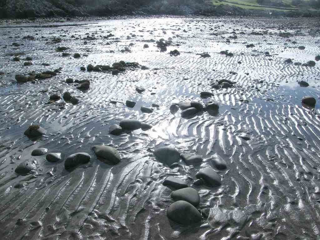
 We descended to the beach, but found it was too
stony to walk on comfortably so we came back to the wretched main road. We passed a pub, not a real ale one but a
notice outside said it did hot drinks. I
fancied a cup of tea, and a notice with times on the door indicated that it
should be open. We tried the door — it
was locked! Were we to be thwarted again? We started to walk off, but I looked back and
saw another door round the corner. This
one was open! It led into a bar, not the
café end which said it did hot drinks, but the barman said he would make tea
for us. It was a bit of a dive, but the
tea was good and really revived us.
We descended to the beach, but found it was too
stony to walk on comfortably so we came back to the wretched main road. We passed a pub, not a real ale one but a
notice outside said it did hot drinks. I
fancied a cup of tea, and a notice with times on the door indicated that it
should be open. We tried the door — it
was locked! Were we to be thwarted again? We started to walk off, but I looked back and
saw another door round the corner. This
one was open! It led into a bar, not the
café end which said it did hot drinks, but the barman said he would make tea
for us. It was a bit of a dive, but the
tea was good and really revived us.
 There was a very small area fenced off at the top of
the beach which puzzled us. A notice
told us it was “Ministry of Defence (P.E.) property, keep out” and all that was
inside it was a pole with a red disc on top.
Strange!
There was a very small area fenced off at the top of
the beach which puzzled us. A notice
told us it was “Ministry of Defence (P.E.) property, keep out” and all that was
inside it was a pole with a red disc on top.
Strange!
 We also came across a
couple of stones on which someone had scrawled in marker pen, “Welcome
to Monreith Bay”. But we have
miles and miles of road to walk before we reach Monreith, and I would hardly
call this a bay. The map calls this part
of the sea Luce Bay, but that is the whole area between us and South Rhins.
We also came across a
couple of stones on which someone had scrawled in marker pen, “Welcome
to Monreith Bay”. But we have
miles and miles of road to walk before we reach Monreith, and I would hardly
call this a bay. The map calls this part
of the sea Luce Bay, but that is the whole area between us and South Rhins.

 We set off along the road. Sometimes there was a greensward, which was
nice, but more often there was not. We
kept looking down at the beach, but it remained rocky and generally unwalkable. There was not much traffic although this was
an A-road, but what there was came fast because it was pretty straight. We had to keep our wits about us!
We set off along the road. Sometimes there was a greensward, which was
nice, but more often there was not. We
kept looking down at the beach, but it remained rocky and generally unwalkable. There was not much traffic although this was
an A-road, but what there was came fast because it was pretty straight. We had to keep our wits about us!
We met a runner who was raising money for the charity ‘Help for Heroes’. Actually, when he passed us he wasn’t running, he was walking and jabbering non-stop into his mobile phone. He didn’t even notice we were there, thank goodness! He was being followed at a very slow speed by a 4x4 vehicle in which we could see at least three people. Now, how much did his back-up vehicle cost, in fuel alone never mind everything else? This modern-day fashion for ‘sponsored’ walking / running / climbing / sitting in a bath of baked beans / marching to the South Pole / or whatever has gone too far! There are too many charities for a start. And how much of the money raised goes into setting up these crazy schemes? Who are the people who pay out this sponsorship money? There must be an awful lot of spare cash around, but none of it is in our pockets — that’s for sure! And is the money raised spent wisely? How much of it actually gets to the people who really need it? And do they really need it? Who regulates it and checks against fraud? So many questions need to be asked. As I have said before, we helped several charities by volunteering, not fund-raising, when we were in our twenties and thirties (the Catholic Church, the Samaritans, the Scout Association, Children’s Country Holiday Fund, Southwark Catholic Children’s Society, etc) and set many many young people on their way to a happy and fulfilling adult life. Now that we are pensioners on a restricted income it is “ME” time for both of us! If that sounds selfish, so be it.
We passed our first orchid this season, on the roadside. Such a beautiful ‘showy’ flower! Unfortunately the photo I took of it was rubbish again — I can’t seem to get the focus right today.
 After about three miles we came to Chapel Finian,
the remains of an 11th century pilgrim’s chapel. It is believed that it was used as a refuge
by pilgrims from Ireland
who landed here on their way to the shrine of St Ninian at Whithorn. It was always a very simple building, and
it’s associated well still survives. We
sat on the wall there and ate our apples.
After about three miles we came to Chapel Finian,
the remains of an 11th century pilgrim’s chapel. It is believed that it was used as a refuge
by pilgrims from Ireland
who landed here on their way to the shrine of St Ninian at Whithorn. It was always a very simple building, and
it’s associated well still survives. We
sat on the wall there and ate our apples.

 We continued on our road above the rocky beach,
watching the bird life on the shore. We
also saw belted Galloway cattle on the bank
landside. Not surprising really, since
we were in Galloway! We are familiar with this type of cattle
because they are grazed on the Malvern Hills
above our house in a bid to keep the scrub down. They are a hardy breed.
We continued on our road above the rocky beach,
watching the bird life on the shore. We
also saw belted Galloway cattle on the bank
landside. Not surprising really, since
we were in Galloway! We are familiar with this type of cattle
because they are grazed on the Malvern Hills
above our house in a bid to keep the scrub down. They are a hardy breed.


We passed a number of milestones — don’t know if they are original (all but a few were destroyed during the Second World War) but we didn’t believe the mileages on them. We felt they had sited them a mile too near Port William. A modern-day cycle route notice didn’t agree with them either — it said we were 1¼ miles to Port William when a nearby milestone said we were 2½.

 At last we reached Port William, we had seen the
little town from a long way off and watched it getting bigger as we
approached. The sky was threatening but
the rain missed us — we could see it pouring down both fore and aft. We sat at a picnic table by the harbour to
eat our chocolate.
At last we reached Port William, we had seen the
little town from a long way off and watched it getting bigger as we
approached. The sky was threatening but
the rain missed us — we could see it pouring down both fore and aft. We sat at a picnic table by the harbour to
eat our chocolate.
 We walked the first arm of the harbour, then along
the main street where we passed flowering tulips in boxes outside a row of
houses.
We walked the first arm of the harbour, then along
the main street where we passed flowering tulips in boxes outside a row of
houses.
We walked the second arm of the harbour, then out on to a green. There were two items of interest here:

 (1) Beneath a granite stone had been buried a cask
containing “tales and tokens of our lives and past”. It had been buried at the Millennium, and the
idea is that it will be dug up in 2100, a hundred years later. Above it was a signpost pointing to lots of
different places around the British Isles. We have walked here from John O’Groats, but
not by the quickest route of 310 miles — more like 1011 miles!
(1) Beneath a granite stone had been buried a cask
containing “tales and tokens of our lives and past”. It had been buried at the Millennium, and the
idea is that it will be dug up in 2100, a hundred years later. Above it was a signpost pointing to lots of
different places around the British Isles. We have walked here from John O’Groats, but
not by the quickest route of 310 miles — more like 1011 miles!

Just as we know that it will be a lot more than 356 miles to Land’s End by the coastal route which we will take.
 (2) Near a
sculpture by Andrew Brown was inscribed the first two lines of my favourite
poem in all the world —“What is this life if, full of care, / We
have no time to stop and stare?…..”
The sculpture was of a fisherman leaning on a fence staring out to
sea. So I joined him, I leant on the
fence next to him and stared out to sea!
(2) Near a
sculpture by Andrew Brown was inscribed the first two lines of my favourite
poem in all the world —“What is this life if, full of care, / We
have no time to stop and stare?…..”
The sculpture was of a fisherman leaning on a fence staring out to
sea. So I joined him, I leant on the
fence next to him and stared out to sea!
 After that bit of nonsense we moved on. Only two more miles to go! Sometimes there was a path along the
greensward between us and the sea, and sometimes there wasn’t.
After that bit of nonsense we moved on. Only two more miles to go! Sometimes there was a path along the
greensward between us and the sea, and sometimes there wasn’t.
 At the entrance to one of these paths was a
notice warning us about the presence of adders.
We don’t need to be warned about adders, we love snakes! They are beautiful animals, and very
shy. They are only likely to lash out
with their venom if they are surprised or attacked, they are much more likely
to slither away at the first sign of the presence of a human. They are more terrified of us than we are of
them. Anyway, people don’t die of adder
stings — not unless they are very frail or very young. The Malvern Hills is the best place in
Worcestershire to see these lovely creatures — not that we’ve ever seen one on
our walks as we didn’t at Port William on today’s Walk. (Though we have seen them in Sussex,
when we lived there.)
At the entrance to one of these paths was a
notice warning us about the presence of adders.
We don’t need to be warned about adders, we love snakes! They are beautiful animals, and very
shy. They are only likely to lash out
with their venom if they are surprised or attacked, they are much more likely
to slither away at the first sign of the presence of a human. They are more terrified of us than we are of
them. Anyway, people don’t die of adder
stings — not unless they are very frail or very young. The Malvern Hills is the best place in
Worcestershire to see these lovely creatures — not that we’ve ever seen one on
our walks as we didn’t at Port William on today’s Walk. (Though we have seen them in Sussex,
when we lived there.)
 Traffic was light.
We were passed by a man on his bike ‘walking’ his Alsatian, which I
believe is called a German shepherd dog these days. He was pulling the dog along on a lead as he
rode by. When he came back about ten
minutes later, the dog was pulling him on his bike!
Traffic was light.
We were passed by a man on his bike ‘walking’ his Alsatian, which I
believe is called a German shepherd dog these days. He was pulling the dog along on a lead as he
rode by. When he came back about ten
minutes later, the dog was pulling him on his bike!
The road gradually rose uphill, and there was a bit of a cliff between us and the sea.
 We
passed a notice pointing to Barsalloch Fort.
Because it was an ‘Historic Scotland’ site we thought perhaps we ought
to divert and visit it — that is until we saw the flight of steps leading up
the mound. Considering we had just
walked sixteen miles, we made our excuses and carried on up the road!
We
passed a notice pointing to Barsalloch Fort.
Because it was an ‘Historic Scotland’ site we thought perhaps we ought
to divert and visit it — that is until we saw the flight of steps leading up
the mound. Considering we had just
walked sixteen miles, we made our excuses and carried on up the road!
 Apparently it is the site of an Iron Age
farmstead, and the highlight is the view from the top. Well, we were content with the view from the
road where we were — the sun was shining on the hills over there, but not here!
Apparently it is the site of an Iron Age
farmstead, and the highlight is the view from the top. Well, we were content with the view from the
road where we were — the sun was shining on the hills over there, but not here!


That ended Walk no.289, we shall pick up Walk no.290 next time at the bend in the road just north of Monreith. It was twenty-five to seven, so the Walk had taken us nine hours and fifty minutes. The public toilet was on the beach at the bottom of 128 steps — I know, I counted them!
 Colin cleaned the car,
then we drove back to our caravan for tea and biscuits.
Colin cleaned the car,
then we drove back to our caravan for tea and biscuits.
Location: Glenluce to Monreith.
Distance: 17 miles.
Total distance: 2870 miles.
Terrain: Mostly road-walking. There was infrequent traffic, but it was fast when it came. At one place we took a grassy path down to the beach, walked across a bit of sand (bliss!) and ‘escaped’ over rocks and up a steep field back to that wretched road.
Tide: Coming in.
Rivers: No.346, Lady Burn.
Ferries: None.
Piers: None.
Kissing gates: No.273 at Finian Chapel.
Pubs: None.
‘Historic Scotland’ properties: No.32, Finian Chapel. No.33, Barsalloch Fort.
Ferris wheels: None.
Diversions: None.
How we got there and back: We were staying in our caravan on a site in Garlieston. This morning we drove to Monreith and parked at the top of the beach steps. We hailed the bus as it passed, and that took us to Glenluce. We walked down to the road junction where we finished the last Walk.
At the end we were at the car. It was covered in gull s**t! So we wiped that off and drove back to our caravan for tea and biscuits.
Once more we are walking on my grandmother’s birthday — she was born in East London 134 years ago today!
We came to a lovely view overlooking Auchenmalg. Knowing that after we had got down there we would be on a road for miles and miles, we sat down on a bank to eat our sandwiches. A woman with two small boys came up the path and passed us, so there were other people using the path today. (Mind you, I don’t know if they walked all the way to Stairhaven.)
We met a runner who was raising money for the charity ‘Help for Heroes’. Actually, when he passed us he wasn’t running, he was walking and jabbering non-stop into his mobile phone. He didn’t even notice we were there, thank goodness! He was being followed at a very slow speed by a 4x4 vehicle in which we could see at least three people. Now, how much did his back-up vehicle cost, in fuel alone never mind everything else? This modern-day fashion for ‘sponsored’ walking / running / climbing / sitting in a bath of baked beans / marching to the South Pole / or whatever has gone too far! There are too many charities for a start. And how much of the money raised goes into setting up these crazy schemes? Who are the people who pay out this sponsorship money? There must be an awful lot of spare cash around, but none of it is in our pockets — that’s for sure! And is the money raised spent wisely? How much of it actually gets to the people who really need it? And do they really need it? Who regulates it and checks against fraud? So many questions need to be asked. As I have said before, we helped several charities by volunteering, not fund-raising, when we were in our twenties and thirties (the Catholic Church, the Samaritans, the Scout Association, Children’s Country Holiday Fund, Southwark Catholic Children’s Society, etc) and set many many young people on their way to a happy and fulfilling adult life. Now that we are pensioners on a restricted income it is “ME” time for both of us! If that sounds selfish, so be it.
We passed our first orchid this season, on the roadside. Such a beautiful ‘showy’ flower! Unfortunately the photo I took of it was rubbish again — I can’t seem to get the focus right today.
We passed a number of milestones — don’t know if they are original (all but a few were destroyed during the Second World War) but we didn’t believe the mileages on them. We felt they had sited them a mile too near Port William. A modern-day cycle route notice didn’t agree with them either — it said we were 1¼ miles to Port William when a nearby milestone said we were 2½.
We walked the second arm of the harbour, then out on to a green. There were two items of interest here:

Just as we know that it will be a lot more than 356 miles to Land’s End by the coastal route which we will take.
The road gradually rose uphill, and there was a bit of a cliff between us and the sea.
We passed a
‘Toblerone’ house — such buildings were toilets when we were travelling in Iceland! Soon we were at the kink in the road where
our car was parked. We were miffed to
find it was covered in seagull s**t which Colin had to clean off before we
could drive away.
That ended Walk no.289, we shall pick up Walk no.290 next time at the bend in the road just north of Monreith. It was twenty-five to seven, so the Walk had taken us nine hours and fifty minutes. The public toilet was on the beach at the bottom of 128 steps — I know, I counted them!

No comments:
Post a Comment